Trip from Bethlehem, PA to Aliquippa, PA

Drive Time

6h 16m

Distance

318.6 mi

513 km

Drive Score

9/10

Great drive

Same Day?

Yes, doable

Fuel Cost

$53

one way

EV Charging

None

0 DC fast

Best Time to Leave

Save up to 38 min
4 AM
6h 3m ★
6 AM
6h 16m
8 AM
6h 41m
10 AM
6h 25m
12 PM
6h 22m
3 PM
6h 26m
5 PM
6h 40m
8 PM
6h 8m

Estimated drive times based on typical traffic patterns. Actual times may vary with weather, construction, and real-time conditions.

Downtown Bethlehem, PA, PA

Bethlehem, PA

Phuc Tran

Downtown Aliquippa, PA, PA

Aliquippa, PA

Haneul Trac

Trip Overview

The drive from Bethlehem, PA to Aliquippa, PA covers 318.6 miles and takes about 6h 16m behind the wheel. This route is realistic as a one-day drive if you keep your stops efficient.

The route leans on Pennsylvania Turnpike, William Penn Highway, I 81 for much of the mileage, and the overall profile is highway-focused drive. The longest uninterrupted segment is about 198.4 miles on Pennsylvania Turnpike. At current regular gas prices, budget about $52.72 one way before food or hotel costs.

Trip Pace

Same-day drive is realistic

A same-day return is possible, but it will make for a full day on the road.

Break Rhythm

1 planned break

Plan on a short reset every 3 to 4 hours to stay fresh behind the wheel.

Midpoint

159.3 miles from Bethlehem, PA

A natural place for your longest stop of the day , about 3h 11m into the drive .

Drive Character

This is a 6h 16m highway drive covering 318.6 miles, with most of the trip on Pennsylvania Turnpike and William Penn Highway. The longest continuous stretch is about 198.4 miles on Pennsylvania Turnpike.

Most of the miles stay on highways, which makes pacing and fuel planning easier than turn-by-turn city driving.
There are about 36 navigation steps in the underlying route data, so the final approach matters more than the middle miles.
Pennsylvania Turnpike is the longest continuous segment at about 198.4 miles.

How Hard Is This Drive?

This is a straightforward highway drive that stays mostly on Pennsylvania Turnpike and William Penn Highway. This route has several spots where lane changes, forks, or exits need your full attention. The trickiest moment comes around 3.4 miles in.

Route Complexity 10/10

High effort - long or complex enough to need steady focus all day

This is a demanding drive. With 26 significant decision points across 318.6 miles, you will need to stay alert — especially through interchange areas and urban stretches. Consider splitting it into segments if you are not comfortable with fast highway navigation.

Where does it get tricky?

The main spots that need attention: at 3.4 miles: Highway fork - watch signs carefully. Lane positioning matters here; at 102.1 miles: Exit ramp - move to the correct lane early. Lane positioning matters here. Multiple destination signs - pick the right one; at 102.3 miles: Highway fork - watch signs carefully. Lane positioning matters here.

Critical Maneuvers

5 of 26 key points

These are the spots where you need to pay the most attention. Preview them before you drive.

7
3.4 mi into trip | ~5m in

Keep slight left at fork toward US 22 West: Allentown

Highway fork - watch signs carefully. Lane positioning matters here

Use the slight left lane. Toward US 22 West: Allentown
8
102.1 mi into trip | ~2h 6m in

Take the exit toward US 11: New Kingstown, Middlesex

Exit ramp - move to the correct lane early. Lane positioning matters here. Multiple destination signs - pick the right one

Use the slight right lane. Exit 52 Toward US 11: New Kingstown, Middlesex
8
102.3 mi into trip | ~2h 7m in

Keep slight right at fork toward US 11 South

Highway fork - watch signs carefully. Lane positioning matters here

Use the right lane. Toward US 11 South
7
103.8 mi into trip | ~2h 10m in

Keep slight right at fork toward I 76 West: Pittsburgh

Highway fork - watch signs carefully. Lane positioning matters here

Use the slight right lane. Toward I 76 West: Pittsburgh
8
302.4 mi into trip | ~5h 48m in

Take the exit toward I 79, US 19: Erie, Pittsburgh, Warrendale, Cranberry

Exit ramp - move to the correct lane early. Lane positioning matters here. Multiple destination signs - pick the right one

Use the slight right lane. Exit 28 Toward I 79, US 19: Erie, Pittsburgh, Warrendal...

Towns Along This Route

Between Bethlehem, PA and Aliquippa, PA, road signs point toward Middlesex, Patp, Pittsburgh, Warrendale and Cranberry.

Middlesex

102.1 mi in | ~2h 6m

Patp

103.3 mi in | ~2h 9m

Pittsburgh

302.4 mi in | ~5h 48m

Warrendale

302.4 mi in | ~5h 48m

Cranberry

302.4 mi in | ~5h 48m

Main Roads

Road Distance Duration
Pennsylvania Turnpike 198.4 mi 3h 37m
William Penn Highway 43.1 mi 51m
I 81 36.6 mi 44m
Lehigh Valley Thruway 9.8 mi 13m
78th Division Highway 7.6 mi 8m
Freedom Crider Road 4.4 mi 6m
Constitution Boulevard 3.2 mi 5m
Freedom Road 2.6 mi 4m
Longest stretch: Pennsylvania Turnpike — 198.4 mi, about 3h 37m

Turn-by-Turn Driving Directions

Step-by-step road directions between Bethlehem, PA and Aliquippa, PA.

1

Start on Linden Street

367 ft · 13 sec · Linden Street
2

Turn right onto East Union Boulevard

0.8 mi · 1 min · East Union Boulevard
3

Take the ramp

0.2 mi · 30 sec
4

Merge onto PA 378

2.3 mi · 3 min · Bethlehem Spur Route
5

Keep slight left at fork

0.8 mi · 1 min
Toward US 22 West: Allentown Use the slight left lane.
6

Merge onto US 22

9.8 mi · 13 min · Lehigh Valley Thruway
Use the straight / slight right lanes.
7

Merge onto I 78; US 22

43 mi · 51 min · William Penn Highway
Use the straight lane.
8

Continue on I 78; US 22

7.6 mi · 8 min · 78th Division Highway
9

Keep slight left at fork

0.7 mi · 49 sec
Exit 1B Toward I 81 South: Harrisburg
10

Merge onto I 81

37 mi · 44 min · I 81
11

Take the exit

0.3 mi · 48 sec
Exit 52 Toward US 11: New Kingstown, Middlesex Use the slight right lane.
12

Keep slight right at fork

201 ft · 7 sec
Toward US 11 South Use the right lane.
13

Merge onto US 11

1.0 mi · 2 min · Harrisburg Pike
Use the straight / right lanes.
14

Take the exit

0.5 mi · 1 min
Toward I 76, PATP
15

Keep slight right at fork

0.2 mi · 37 sec
Toward I 76 West: Pittsburgh Use the slight right lane.
16

Merge onto I 76; PATP

198 mi · 3 hr 37 min · Pennsylvania Turnpike
17

Take the exit

0.2 mi · 26 sec
Exit 28 Toward I 79, US 19: Erie, Pittsburgh, Warrendale, Cranberry Use the slight right lane.
18

Keep slight right at fork

0.2 mi · 34 sec
Toward US 19: Warrendale, Cranberry
19

Turn slight left

149 ft · 5 sec
Use the left lane.
20

Turn left onto US 19

0.5 mi · 1 min · Perry Highway
Use the left / straight / right lanes.
21

Turn left onto Freedom Road

2.6 mi · 4 min · Freedom Road
Use the left lane.
22

Continue on Freedom Crider Road

2.4 mi · 3 min · Freedom Crider Road
23

Enter roundabout onto Freedom Crider Road

98 ft · 1 sec · Freedom Crider Road
24

Continue on Freedom Crider Road

2.0 mi · 2 min · Freedom Crider Road
25

Turn straight onto Crows Run Road

1.5 mi · 2 min · Crows Run Road
26

Turn right onto PA 65

2.1 mi · 2 min · Ohio River Boulevard
27

Turn left onto PA 51

0.5 mi · 44 sec · Monaca-East Rochester Bridge
28

Continue on PA 51

0.1 mi · 10 sec · 17th Street
29

Continue on PA 51

309 ft · 5 sec · 17th Street
30

Turn left onto PA 51

0.4 mi · 1 min · Pennsylvania Avenue
31

Continue on PA 51

3.2 mi · 5 min · Constitution Boulevard
32

Turn left onto Bridge Street

0.2 mi · 46 sec · Bridge Street
33

Turn right onto River Avenue

0.2 mi · 59 sec · River Avenue
34

Turn right onto 4th Street

41 ft · 7 sec · 4th Street
35

Turn left

24 ft · 1 sec
36

Arrive at destination

Trip Plan

Morning Departure

Start early — leave by 6-7 AM to arrive at a reasonable hour.

Evening Departure

This is a long drive — plan for a morning departure or consider splitting it into two days.

You can normally do this drive in one day.
Plan roughly 1 meaningful break for fuel, food, and rest.
The halfway point lands around 159.3 miles from Bethlehem, PA, or about 3h 11m into the drive.
The longest continuous stretch on this route runs about 198.4 miles.

This is a comfortable same-day trip.

Departure

Before you leave

Start with fuel, water, and navigation already sorted so the first hour feels easy.

First stop

Around 80 miles or 1h 39m in

Use this first pause for coffee, a restroom break, and a quick traffic check ahead.

Halfway reset

Around 159.3 miles or 3h 11m in

This is the best place for your longest stop, a real meal, and a full fuel check.

Final approach

Final hour starts around 5h 3m

Traffic, exits, and arrival timing usually matter more near Aliquippa, PA than in the middle of the route.

Before You Leave

+

Open the route before leaving Bethlehem, PA so your first major turns are already loaded.

+

Leave with enough water and a charging cable within reach, not packed away.

+

Check your fuel range against the first long segment, especially if you are starting outside city service areas.

Day 1

Settle into the route from Bethlehem, PA

This is one driving day of about 318.6 miles and 6h 16m.

Your first comfortable stop window is around 80 miles from Bethlehem, PA.
This route can stay practical as a one-day drive if traffic stays reasonable.
Plan about 1 real break rather than only quick fuel stops.
The longest stretch is on Pennsylvania Turnpike for about 198.4 miles.

Where to Stop

Rest stops, refuel points, and overnight suggestions along this route.

Halfway Point

Midpoint

About 159.3 mi from Bethlehem, PA · 3h 11m into the drive

Downtown Jamestown, NY, NY

Mid-route town

Meal stop

Jamestown, NY

159 mi into the route

Best for: Lunch, fuel, and a longer reset

This sits close to the middle of the route, so it works well for the longest stop of the day.

Pacing Suggestions

Union, NY

Fuel and coffee

A short stop after about 80 miles helps settle the day before fatigue starts building.

Cuba, NY

Meal break

The midpoint is around 159.3 miles from Bethlehem, PA, which is a good place for a longer meal and fuel stop.

Before the longest stretch

Fuel check

Top up before Pennsylvania Turnpike if your tank is already low. That segment runs about 198.4 miles.

Arriving in Aliquippa, PA

The final approach into Aliquippa, PA usually feels slower than the middle of the drive, so avoid planning your tightest schedule at the very end.

Try to arrive with enough fuel left to skip an immediate station stop unless you already know the area around Aliquippa, PA.

After long uninterrupted mileage, take five minutes before the last urban segment to reset and refocus on exits, merges, and city traffic.

These stop ideas are pacing suggestions — the exact town or exit can change with traffic, hotel plans, and fuel range.

National Parks Near This Route

Worth a detour if your schedule allows.

Appalachian National Scenic Trail

Appalachian National Scenic Trail

National Scenic Trail

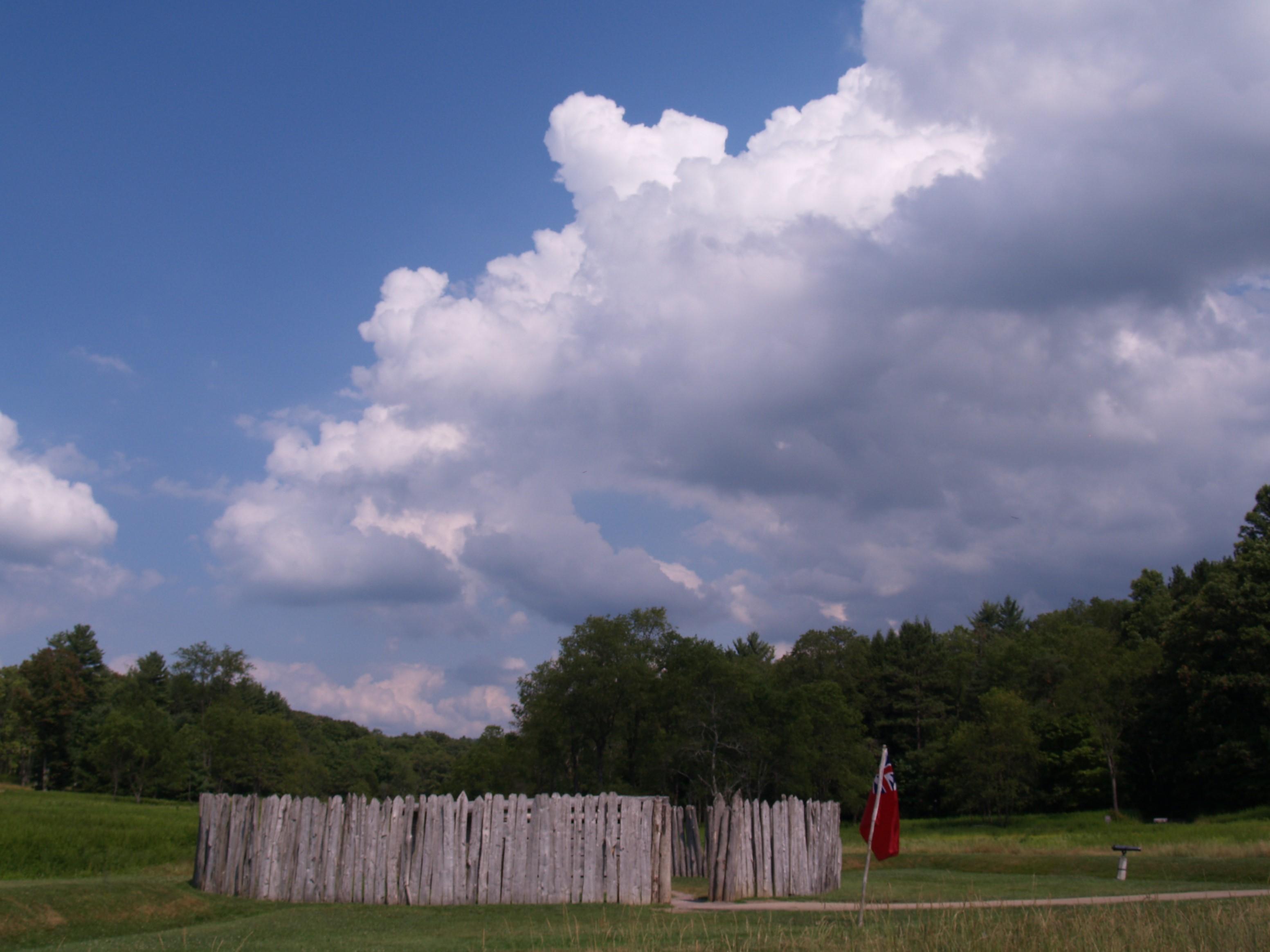
The Appalachian Trail is a 2,190+ mile long public footpath that traverses the scenic, wooded, pastoral, wild, and culturally resonant lands of the Appalachian Mountains. Conceived in 1921, built by p...

5 mi from route ~13 min detour Free near mile 65.9
Park Closure: List of trail closures post-Hurricane Helene
Caution: Black Bears Frequenting the McAfee Knob Area in Virginia
View on nps.gov
Carlisle Federal Indian Boarding School National Monument

Carlisle Federal Indian Boarding School National Monument

National Monument

More than 7,800 children from 140 Tribes went to the Carlisle School from 1879 to 1918. The National Park Service will collaborate with families, affiliated Tribal Nations, the US Army, historians, an...

5 mi from route ~11 min detour Free near mile 109.9
View on nps.gov
Flight 93 National Memorial

Flight 93 National Memorial

National Memorial

On Tuesday morning, September 11, 2001, the U.S. came under attack when four commercial airliners were hijacked and used to strike targets on the ground. Nearly 3,000 people tragically lost their live...

7 mi from route ~16 min detour Free near mile 208.8
View on nps.gov
Fort Necessity National Battlefield

Fort Necessity National Battlefield

National Battlefield

The battle at Fort Necessity in the summer of 1754 was the opening action of the French and Indian War. This war was a clash of British, French and American Indian cultures. It ended with the removal...

23 mi from route ~59 min detour Free near mile 241.7
View on nps.gov
Johnstown Flood National Memorial

Johnstown Flood National Memorial

National Memorial

The South Fork Dam failed on Friday, May 31, 1889, and unleashed 20,000,000 tons of water that devastated Johnstown, PA. The flood killed 2,209 people but it brought the nation and the world together...

24 mi from route ~60 min detour Free near mile 186.8
View on nps.gov

Park data from the National Park Service API. Alerts update every 2 hours.

Fuel & Cost

Regular Gas

$52.72 one way

$105.44 round trip

$4.20/gal 25.4 MPG avg 112 kg CO2
Fuel Type $/gal One Way Round Trip
midgrade $4.60 $57.69 $115.37
premium $4.92 $61.74 $123.48
diesel $5.64 $70.78 $141.56

Estimated Tolls: $26.48

Pennsylvania Turnpike (198.4 mi) $25.79
Lehigh Valley Thruway (9.8 mi) $0.69

Toll estimates based on average 2024-2025 rates. EZ-Pass/SunPass discounts may lower the actual cost.

Estimated Trip Cost (one way, 1 person)

Fuel

$53

Tolls

$26

Meals

$25–$50

Total

$104–$129

Rough estimate based on US averages. Hotel $80–$140/night, meals $25–$50/day.

Estimated CO2 emission: 111.5 kg one way. Prices: EIA weekly data, 2026-04-06.

Driving Electric?

About $33 in charging · 1 stop · 67% less CO2

Vehicle Type kWh Stops DC Fast Home Charge
Average EV 95.6 1 $33.45 $15.29
Efficient EV 79.7 0 $27.88 $12.74
EV Truck/SUV 127.4 1 $44.60 $20.39

Gas CO2

111 kg

EV CO2

37 kg (67% less)

Plan for 1 charging stop. A 30-minute DC fast charge mid-route should be enough to complete the trip comfortably.

DC fast charging avg $0.35/kWh. Home charging avg $0.16/kWh. US grid CO2: 0.39 kg/kWh.

Travel Intel

Current conditions at both ends of the drive.

Forecast data refreshed 3 days ago

Origin

Bethlehem, PA

Late night in Bethlehem on Monday

Local time

3:58 AM

EDT

Current temp

60°F

Unavailable

Live forecast

Destination

Aliquippa, PA

Late night in Aliquippa on Monday

Local time

3:58 AM

EDT

Current temp

60°F

Unavailable

Live forecast

Seasonal Notes

Summer travel usually means heavier construction, hotter rest stops, and busier weekend traffic around major cities.

Winter travel shortens daylight, so a route that looks manageable on paper can feel much longer after dark.

Holiday weekends tend to make both departure and arrival windows slower than the raw route time suggests.

Time zone

Same local time

Origin and destination are on the same clock, so arrival timing is easier to judge at a glance.

Temperature spread

Very similar conditions

Both ends of the route are sitting at about the same temperature right now.

Road read

6h 16m on the road

Start early — leave by 6-7 AM to arrive at a reasonable hour.

Weather data from the National Weather Service. Conditions may change; check closer to your travel date.

Frequently Asked Questions

The drive from Bethlehem, PA to Aliquippa, PA covers 318.6 miles and takes about 6h 16m without stops. Add 15-30 minutes for a fuel or rest stop on longer drives.
The main roads are Pennsylvania Turnpike, William Penn Highway, I 81. Most of the drive stays on highways, so watch for ramps and exits.
This is a comfortable same-day trip.
The midpoint is about 159.3 miles from Bethlehem, PA. Look for rest areas, gas stations, or food options near the halfway mark.
At current regular gas prices, expect to spend about $52.72 one way. This estimate uses 25.4 MPG — your actual cost will vary with your vehicle's fuel efficiency and current gas prices.
Start early — leave by 6-7 AM to arrive at a reasonable hour. This is a long drive — plan for a morning departure or consider splitting it into two days.
Plan about 1 meaningful break for fuel, food, or rest. Plan on a short reset every 3 to 4 hours to stay fresh behind the wheel.
This is a demanding drive. With 26 significant decision points across 318.6 miles, you will need to stay alert — especially through interchange areas and urban stretches. Consider splitting it into segments if you are not comfortable with fast highway navigation.
The main spots that need attention: at 3.4 miles: Highway fork - watch signs carefully. Lane positioning matters here; at 102.1 miles: Exit ramp - move to the correct lane early. Lane positioning matters here. Multiple destination signs - pick the right one; at 102.3 miles: Highway fork - watch signs carefully. Lane positioning matters here.
Between Bethlehem, PA and Aliquippa, PA, road signs point toward Middlesex, Patp, Pittsburgh, Warrendale and Cranberry.

Was this route helpful?

Thanks for your feedback!

Your tip has been submitted. Thanks!

/500

Explore More

Explore more options from Bethlehem, PA or browse trips ending in Aliquippa, PA.

Looking for more statewide routes? Browse PA road trips.

Explore maps for Bethlehem, PA or Aliquippa, PA on MapSof.net.