Trip from Borger, TX to Rhode Island, TX

Drive Time

8h 27m

Distance

457.4 mi

736 km

Drive Score

7/10

Good drive

Same Day?

2-day trip

Fuel Cost

$70

one way

EV Charging

None

0 DC fast

Best Time to Leave

Save up to 22 min
4 AM
8h 20m ★
6 AM
8h 27m
8 AM
8h 42m
10 AM
8h 33m
12 PM
8h 31m
3 PM
8h 33m
5 PM
8h 42m
8 PM
8h 23m

Estimated drive times based on typical traffic patterns. Actual times may vary with weather, construction, and real-time conditions.

Downtown Borger, TX, TX

Borger, TX

Jeff Stapleton

Downtown Rhode Island, TX, TX

Rhode Island, TX

Beth Fitzpatrick

Trip Overview

The drive from Borger, TX to Rhode Island, TX covers 457.4 miles and takes about 8h 27m behind the wheel. It usually feels better as a 2-day road trip than as one long push.

The route leans on US Highway 287, Central East Freeway, Julius Schepps Freeway for much of the mileage, and the overall profile is highway-focused drive. The longest uninterrupted segment is about 110.2 miles on US Highway 287. At current regular gas prices, budget about $69.87 one way before food or hotel costs.

Trip Pace

Best split across 2 days

Treat the return leg as its own travel day rather than an afterthought.

Break Rhythm

2 planned breaks

Plan on a short reset every 3 to 4 hours to stay fresh behind the wheel.

Midpoint

228.7 miles from Borger, TX

A natural place for your longest stop of the day , about 4h 20m into the drive .

Drive Character

This is a 8h 27m highway drive covering 457.4 miles, with most of the trip on US Highway 287 and Central East Freeway. The longest continuous stretch is about 110.2 miles on US Highway 287.

Most of the miles stay on highways, which makes pacing and fuel planning easier than turn-by-turn city driving.
There are about 55 navigation steps in the underlying route data, so the final approach matters more than the middle miles.
US Highway 287 is the longest continuous segment at about 110.2 miles.

How Hard Is This Drive?

This is a straightforward highway drive that stays mostly on US Highway 287 and Central East Freeway. This route has several spots where lane changes, forks, or exits need your full attention. The trickiest moment comes around 342 miles in.

Route Complexity 10/10

High effort - long or complex enough to need steady focus all day

This is a demanding drive. With 33 significant decision points across 457.4 miles, you will need to stay alert — especially through interchange areas and urban stretches. Consider splitting it into segments if you are not comfortable with fast highway navigation.

Where does it get tricky?

The main spots that need attention: at 342 miles: Exit ramp - move to the correct lane early. Lane positioning matters here; at 342.4 miles: Highway fork - watch signs carefully. Lane positioning matters here; at 373.5 miles: Exit ramp - move to the correct lane early. Lane positioning matters here. Multiple destination signs - pick the right one.

Critical Maneuvers

5 of 33 key points

These are the spots where you need to pay the most attention. Preview them before you drive.

7
342 mi into trip | ~6h 23m in

Take the exit toward I 820

Exit ramp - move to the correct lane early. Lane positioning matters here

Use the slight right lane. Exit 57 Toward I 820
7
342.4 mi into trip | ~6h 23m in

Keep slight left at fork toward I 820 East

Highway fork - watch signs carefully. Lane positioning matters here

Use the slight left / slight right lanes. Toward I 820 East
8
373.5 mi into trip | ~6h 56m in

Take the exit toward Continental Avenue, Commerce Street West

Exit ramp - move to the correct lane early. Lane positioning matters here. Multiple destination signs - pick the right one

Use the slight right lane. Exit 429B Toward Continental Avenue, Commerce Street West
7
374.9 mi into trip | ~6h 59m in

Keep slight right at fork toward I 45 South: Houston

Highway fork - watch signs carefully. Lane positioning matters here

Use the slight right lane. Toward I 45 South: Houston
7
454.8 mi into trip | ~8h 22m in

Take the exit toward FM 833

Exit ramp - move to the correct lane early. Lane positioning matters here

Use the straight / slight right lanes. Exit 206 Toward FM 833

Towns Along This Route

On the drive from Borger, TX to Rhode Island, TX, road signs begin pointing toward Commerce Street West along the way.

Commerce Street West

373.5 mi in | ~6h 56m

Main Roads

Road Distance Duration
US Highway 287 110.2 mi 1h 56m
Central East Freeway 99.2 mi 1h 46m
Julius Schepps Freeway 79.4 mi 1h 21m
US Highway 287 East 40.5 mi 42m
West 2nd Street 27.8 mi 30m
North Cedar Street 22.2 mi 33m
SH 183 TEXpress 15 mi 14m
TX 207 9.6 mi 14m
Longest stretch: US Highway 287 — 110.2 mi, about 1h 56m

Turn-by-Turn Driving Directions

Step-by-step road directions between Borger, TX and Rhode Island, TX.

1

Start on this road

201 ft · 14 sec · this road
2

Turn sharp left onto TX 152

276 ft · 12 sec · West 3rd Street
3

Turn left onto TX 136; TX 207

22 mi · 33 min · North Cedar Street
4

Continue on TX 207; FM 293

0.3 mi · 25 sec · TX 207; FM 293
5

Continue on TX 207; FM 293

0.5 mi · 46 sec · Elsie Avenue
6

Turn right onto TX 207; FM 293

0.2 mi · 19 sec · East Broadway Street
7

Turn straight onto TX 207; FM 293

9.3 mi · 13 min · TX 207; FM 293
8

Continue on TX 207; US 66 Hist

1.0 mi · 1 min · Original U.S. Route 66
9

Turn right onto TX 207

6.1 mi · 9 min · State Highway 207
10

Continue on TX 207

0.5 mi · 49 sec · North Hurley Avenue
11

Turn left onto US 287

1.1 mi · 2 min · West 1st Street
12

Continue on US 287; FM 1151

28 mi · 28 min · US Highway 287
13

Continue on US 287; TX 70

28 mi · 30 min · West 2nd Street
14

Turn slight right onto US 287

14 mi · 13 min · US Highway 287
15

Continue on US 287

0.7 mi · 58 sec · Burnett Street
16

Continue on US 287

14 mi · 14 min · US Highway 287
17

Continue on US 287

2.8 mi · 3 min · Avenue F Northwest
18

Continue on US 287

54 mi · 58 min · US Highway 287
19

Continue on US 287

4.1 mi · 4 min · Martin Luther King Jr Memorial Highway
Use the straight / slight right lanes.
20

Continue on US 70; US 183; US 287

41 mi · 42 min · US Highway 287 East
Use the straight / slight right lanes.
21

Continue on US 287

4.6 mi · 4 min · Northwest Freeway
22

Keep slight right at fork onto US 287

0.6 mi · 42 sec · Northwest Freeway
Toward I 44 West, US 277 South, US 281 South, US 287 South: Wichita Falls
23

Merge onto I 44; US 277; US 281; US 287

2.5 mi · 3 min · Central Freeway
Use the straight / slight right lanes.
24

Continue on US 277; US 281; US 287

0.9 mi · 1 min · Lloyd Ruby Overpass
Use the straight lane.
25

Continue on US 281; US 287

0.9 mi · 1 min · Central East Freeway
26

Keep slight right at fork onto US 82; US 287

1.8 mi · 1 min · Central East Freeway
27

Keep slight right at fork onto US 82; US 287

97 mi · 1 hr 43 min · Central East Freeway
Use the straight / slight right lanes.
28

Continue on US 81; US 287

4.6 mi · 4 min · US 81; US 287
Use the straight / slight right lanes.
29

Merge onto I 35W; US 287

2.3 mi · 2 min · North Freeway
Use the straight / slight right lanes.
30

Take the exit

0.4 mi · 24 sec
Exit 57 Toward I 820 Use the slight right lane.
31

Keep slight left at fork

1.0 mi · 1 min
Toward I 820 East Use the slight left / slight right lanes.
32

Merge onto I 820

0.4 mi · 24 sec · Northeast Loop
33

Take the exit

0.1 mi · 7 sec
Toward I 820 Express East Toll
34

Merge onto I 820 TEXpress

5.5 mi · 5 min · I 820 TEXpress
Use the straight / slight right lanes.
35

Continue on TX 121 TEXpress; TX 183 TEXpress

4.4 mi · 4 min · SH 121/183 TEXpress
Use the straight / slight right lanes.
36

Continue on TX 183 TEXpress

12 mi · 11 min · SH 183 TEXpress
Toward TX 183 Express East Use the straight / slight right lanes.
37

Keep slight right at fork onto TX 183 TEXpress

3.3 mi · 3 min · SH 183 TEXpress
38

Merge onto TX 183

0.8 mi · 50 sec · John W Carpenter Freeway
39

Merge onto I 35E

3.9 mi · 4 min · North Stemmons Freeway
Use the straight / slight right lanes.
40

Take the exit

0.1 mi · 22 sec
Exit 429B Toward Continental Avenue, Commerce Street West Use the slight right lane.
41

Turn straight onto North Stemmons Freeway

0.1 mi · 18 sec · North Stemmons Freeway
42

Turn left onto Continental Avenue

0.3 mi · 49 sec · Continental Avenue
Use the left / straight lanes.
43

Turn left onto McKinney Avenue

0.2 mi · 24 sec · McKinney Avenue
44

Take the ramp

0.2 mi · 29 sec
Toward US 75 North
45

Merge onto Spur 366

0.4 mi · 37 sec · Woodall Rodgers Freeway
46

Keep slight right at fork

0.5 mi · 49 sec
Toward I 45 South: Houston Use the slight right lane.
47

Merge onto I 45

3.1 mi · 3 min · Julius Schepps Freeway
Use the straight / right lanes.
48

Keep slight left at fork onto I 45

76 mi · 1 hr 18 min · Julius Schepps Freeway
Use the straight / slight right lanes.
49

Take the exit

0.3 mi · 41 sec
Exit 206 Toward FM 833 Use the straight / slight right lanes.
50

Turn left onto North Interstate 45

307 ft · 10 sec · North Interstate 45
51

Turn left onto FM 833

1.3 mi · 3 min · FM 833
52

At end of road, turn right onto TX 75; FM 833

52 ft · 1 sec · North State Highway 75
53

Turn left onto FM 833

0.9 mi · 1 min · East FM 833
54

Turn right onto County Road 161

10 ft · 0 sec · County Road 161
55

Arrive at destination

County Road 161

Trip Plan

Morning Departure

Start early — leave by 6-7 AM to arrive at a reasonable hour.

Evening Departure

This is a long drive — plan for a morning departure or consider splitting it into two days.

This drive is better paced as a 2-day trip.
Plan roughly 2 meaningful breaks for fuel, food, and rest.
The halfway point lands around 228.7 miles from Borger, TX, or about 4h 20m into the drive.
The longest continuous stretch on this route runs about 110.2 miles.

Consider an overnight stop or starting very early.

Departure

Before you leave

Start with fuel, water, and navigation already sorted so the first hour feels easy.

First stop

Around 101 miles or 2h 4m in

Use this first pause for coffee, a restroom break, and a quick traffic check ahead.

Halfway reset

Around 228.7 miles or 4h 20m in

This is the best place for your longest stop, a real meal, and a full fuel check.

Overnight split

Day 1 wrap after about 228.7 miles or 4h 20m

Stop before fatigue turns the last few hours into a grind. You want day two to start fresh, not just resumed.

Final approach

Final hour starts around 7h 23m

Traffic, exits, and arrival timing usually matter more near Rhode Island, TX than in the middle of the route.

Before You Leave

+

Open the route before leaving Borger, TX so your first major turns are already loaded.

+

Leave with enough water and a charging cable within reach, not packed away.

+

Check your fuel range against the first long segment, especially if you are starting outside city service areas.

+

Pick one backup stop option before the midpoint in case traffic changes your pacing.

+

Treat this as a 2-day road trip and book the overnight stop before the busiest arrival window.

Day 1

Settle into the route from Borger, TX

Aim for roughly 229 miles and 4.2 hours of wheel time on this day.

Day 2

Finish the approach into Rhode Island, TX

Aim for roughly 229 miles and 4.2 hours of wheel time on this day.

Your first comfortable stop window is around 101 miles from Borger, TX.
This route usually feels better as a 2-day drive than as one long push.
Plan about 2 real breaks rather than only quick fuel stops.
The longest stretch is on US Highway 287 for about 110.2 miles.

Where to Stop

Rest stops, refuel points, and overnight suggestions along this route.

Halfway Point

Midpoint

About 228.7 mi from Borger, TX · 4h 20m into the drive

Downtown Wichita Falls, TX, TX

Mid-route town

Overnight candidate

Wichita Falls, TX

229 mi into the route

Best for: Hotel check-in, dinner, and a fresh start

This lines up well with a realistic day-end stop if you are breaking the drive into stages.

Find hotels in Wichita Falls, TX

Overnight Options

Night 1

Wichita Falls, TX

229 mi · about 4.2h in

A practical overnight split lands near Wichita Falls, TX after about 229 miles or 4.2 hours of driving.

Find hotels

Pacing Suggestions

Wellington, TX

Fuel and coffee

A short stop after about 101 miles helps settle the day before fatigue starts building.

Wichita Falls, TX

Meal break

The midpoint is around 228.7 miles from Borger, TX, which is a good place for a longer meal and fuel stop.

Before the longest stretch

Fuel check

Top up before US Highway 287 if your tank is already low. That segment runs about 110.2 miles.

Overnight split

Hotel stop

For a steadier pace, wrap day one after about 229 miles or 4.2 hours on the road.

Arriving in Rhode Island, TX

The final approach into Rhode Island, TX usually feels slower than the middle of the drive, so avoid planning your tightest schedule at the very end.

Try to arrive with enough fuel left to skip an immediate station stop unless you already know the area around Rhode Island, TX.

On a multi-day trip, keep the last day a little lighter so you reach Rhode Island, TX with some flexibility left in the schedule.

After long uninterrupted mileage, take five minutes before the last urban segment to reset and refocus on exits, merges, and city traffic.

These stop ideas are pacing suggestions — the exact town or exit can change with traffic, hotel plans, and fuel range.

National Parks Near This Route

Worth a detour if your schedule allows.

Lake Meredith National Recreation Area

Lake Meredith National Recreation Area

National Recreation Area

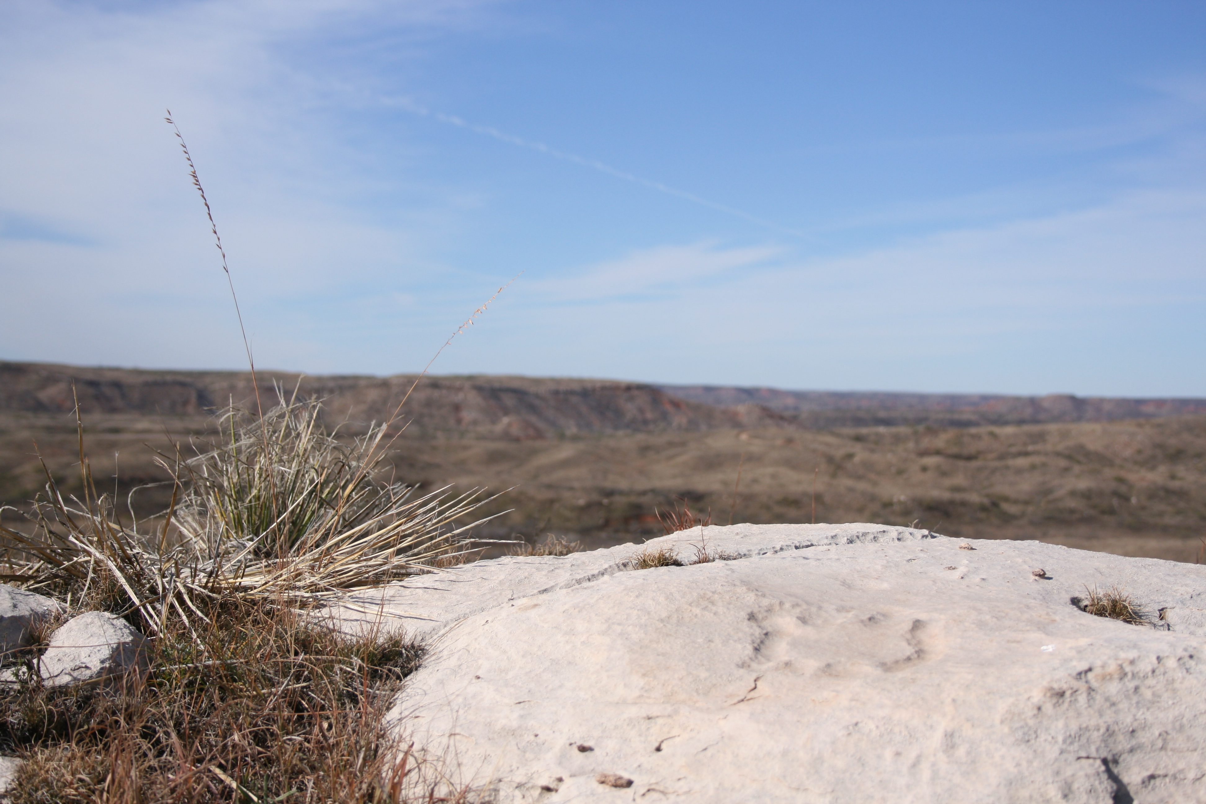
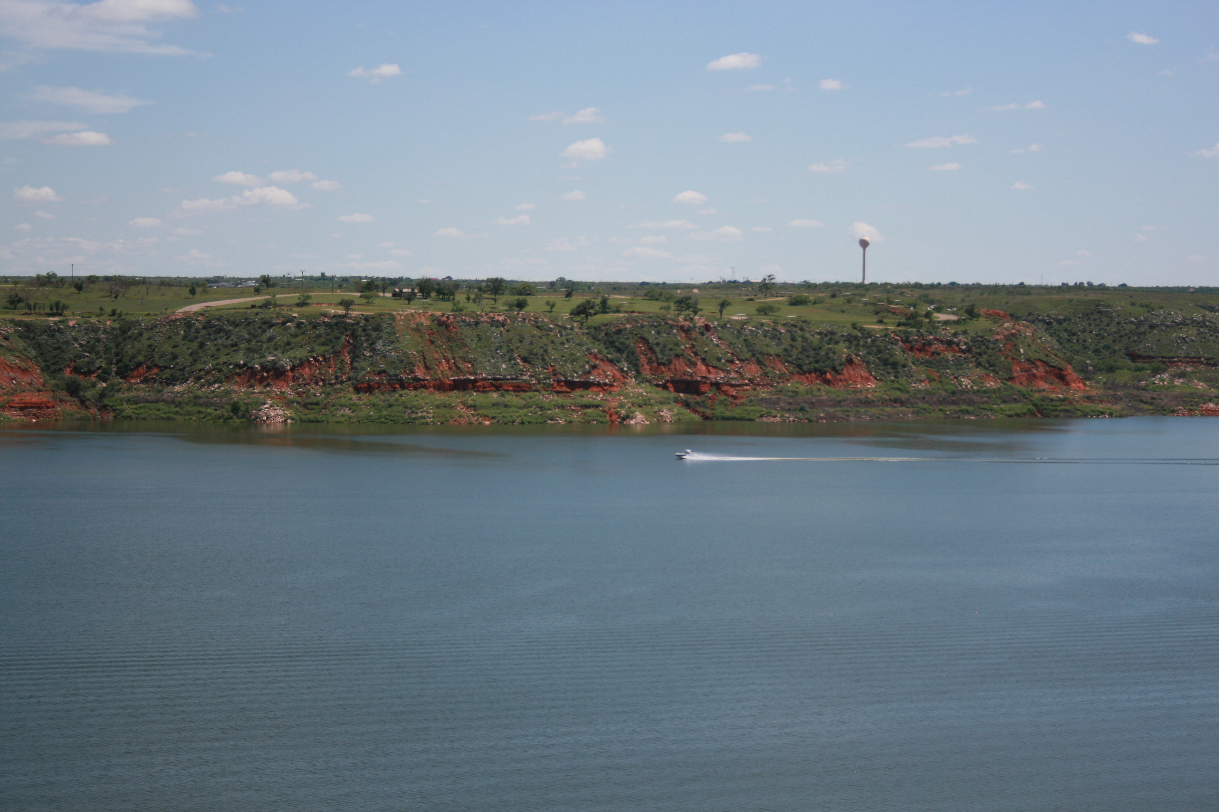
Set within the wide‑open Texas Plains, Lake Meredith National Recreation Area offers a peaceful retreat in the heart of rugged grasslands. Over thousands of years, the Canadian River carved dramatic 2...

16 mi from route ~41 min detour Free
View on nps.gov
Alibates Flint Quarries National Monument

Alibates Flint Quarries National Monument

National Monument

13,000 years ago, Alibates Flint was used by mammoth hunters as a source of flint for tools. Learn how important this site was to the survival, commerce, and culture of the people of the High Plains.

17 mi from route ~41 min detour Free
View on nps.gov

Park data from the National Park Service API. Alerts update every 2 hours.

Fuel & Cost

Regular Gas

$69.87 one way

$139.74 round trip

$3.88/gal 25.4 MPG avg 160 kg CO2
Fuel Type $/gal One Way Round Trip
midgrade $4.25 $76.57 $153.14
premium $4.59 $82.67 $165.35
diesel $5.64 $101.62 $203.24

No toll roads detected on this route.

Estimated Trip Cost (one way, 1 person)

Fuel

$70

Hotel (1n)

$80–$140

Meals

$50–$100

Total

$200–$310

Rough estimate based on US averages. Hotel $80–$140/night, meals $25–$50/day.

Estimated CO2 emission: 160 kg one way. Prices: EIA weekly data, 2026-04-06.

Driving Electric?

About $48 in charging · 1 stop · 66% less CO2

Vehicle Type kWh Stops DC Fast Home Charge
Average EV 137.2 1 $48.03 $21.96
Efficient EV 114.4 1 $40.02 $18.30
EV Truck/SUV 183 2 $64.04 $29.27

Gas CO2

160 kg

EV CO2

54 kg (66% less)

Plan for 1 charging stop. A 30-minute DC fast charge mid-route should be enough to complete the trip comfortably.

DC fast charging avg $0.35/kWh. Home charging avg $0.16/kWh. US grid CO2: 0.39 kg/kWh.

Travel Intel

Current conditions at both ends of the drive.

Forecast data refreshed 13 minutes ago

Origin

Borger, TX

Morning in Borger on Monday

Local time

10:25 AM

CDT

Current temp

89°F

Sunny

WSW 20 to 25 mph 1% chance Live forecast

Red Flag Warning

Red Flag Warning issued April 13 at 7:52AM CDT until April 13 at 8:00PM CDT by NWS Lubbock TX

Fire Weather Watch

Fire Weather Watch issued April 13 at 7:52AM CDT until April 14 at 8:00PM CDT by NWS Lubbock TX

Destination

Rhode Island, TX

Morning in Rhode Island on Monday

Local time

10:25 AM

CDT

Current temp

82°F

Partly Sunny then Slight Chance Showers And Thunderstorms

S 10 mph 24% chance Live forecast

Red Flag Warning

Red Flag Warning issued April 13 at 7:52AM CDT until April 13 at 8:00PM CDT by NWS Lubbock TX

Fire Weather Watch

Fire Weather Watch issued April 13 at 7:52AM CDT until April 14 at 8:00PM CDT by NWS Lubbock TX

Seasonal Notes

Summer travel usually means heavier construction, hotter rest stops, and busier weekend traffic around major cities.

Winter travel shortens daylight, so a route that looks manageable on paper can feel much longer after dark.

Holiday weekends tend to make both departure and arrival windows slower than the raw route time suggests.

For long drives, weather on day two can matter just as much as conditions at departure, so check the whole travel window rather than only the first day.

Time zone

Same local time

Origin and destination are on the same clock, so arrival timing is easier to judge at a glance.

Temperature spread

7 degrees cooler at arrival

A meaningful temperature swing is a good cue to rethink layers, water, and how soon you want to arrive.

Road read

8h 27m on the road

This is long enough that the arrival forecast matters almost as much as departure conditions. Recheck both ends before you roll.

Weather data from the National Weather Service. Conditions may change; check closer to your travel date.

Frequently Asked Questions

The drive from Borger, TX to Rhode Island, TX covers 457.4 miles and takes about 8h 27m without stops. Add 15-30 minutes for a fuel or rest stop on longer drives.
The main roads are US Highway 287, Central East Freeway, Julius Schepps Freeway. Most of the drive stays on highways, so watch for ramps and exits.
Consider an overnight stop or starting very early.
Yes. This route is usually more comfortable as a 2-day drive. A sensible stopping point is after roughly 229 miles on day one.
The midpoint is about 228.7 miles from Borger, TX. Look for rest areas, gas stations, or food options near the halfway mark.
At current regular gas prices, expect to spend about $69.87 one way. This estimate uses 25.4 MPG — your actual cost will vary with your vehicle's fuel efficiency and current gas prices.
Start early — leave by 6-7 AM to arrive at a reasonable hour. This is a long drive — plan for a morning departure or consider splitting it into two days.
Plan about 2 meaningful breaks for fuel, food, or rest. Plan on a short reset every 3 to 4 hours to stay fresh behind the wheel.
This is a demanding drive. With 33 significant decision points across 457.4 miles, you will need to stay alert — especially through interchange areas and urban stretches. Consider splitting it into segments if you are not comfortable with fast highway navigation.
The main spots that need attention: at 342 miles: Exit ramp - move to the correct lane early. Lane positioning matters here; at 342.4 miles: Highway fork - watch signs carefully. Lane positioning matters here; at 373.5 miles: Exit ramp - move to the correct lane early. Lane positioning matters here. Multiple destination signs - pick the right one.
On the drive from Borger, TX to Rhode Island, TX, road signs begin pointing toward Commerce Street West along the way.

Was this route helpful?

Thanks for your feedback!

Your tip has been submitted. Thanks!

/500

Explore More

Explore more options from Borger, TX or browse trips ending in Rhode Island, TX.

Looking for more statewide routes? Browse TX road trips.

Explore maps for Borger, TX or Rhode Island, TX on MapSof.net.