Trip from Brodhead, KY to Hopkinsville, KY

Drive Time

3h 58m

Distance

207.2 mi

333 km

Drive Score

8/10

Great drive

Same Day?

Yes, doable

Fuel Cost

$31

one way

EV Charging

Excellent

17 DC fast

Best Time to Leave

Save up to 39 min
4 AM
3h 45m ★
6 AM
3h 58m
8 AM
4h 24m
10 AM
4h 7m
12 PM
4h 5m
3 PM
4h 9m
5 PM
4h 23m
8 PM
3h 50m

Estimated drive times based on typical traffic patterns. Actual times may vary with weather, construction, and real-time conditions.

Downtown Brodhead, KY, KY

Brodhead, KY

Vietnam Hidden Light

Downtown Hopkinsville, KY, KY

Hopkinsville, KY

Vietnam Hidden Light

Trip Overview

The drive from Brodhead, KY to Hopkinsville, KY covers 207.2 miles and takes about 3h 58m behind the wheel. This route is realistic as a one-day drive if you keep your stops efficient.

The route leans on Cumberland Parkway, US 68, I 65 for much of the mileage, and the overall profile is highway-focused drive. The longest uninterrupted segment is about 86.2 miles on Cumberland Parkway. At current regular gas prices, budget about $31.47 one way before food or hotel costs.

Trip Pace

Same-day drive is realistic

A same-day return is realistic if you keep stops short.

Break Rhythm

1 planned break

A short stop every 2 to 3 hours is enough for this drive.

Midpoint

103.6 miles from Brodhead, KY

A natural place for your longest stop of the day , about 1h 58m into the drive .

Drive Character

This is a 3h 58m highway drive covering 207.2 miles, with most of the trip on Cumberland Parkway and US 68. The longest continuous stretch is about 86.2 miles on Cumberland Parkway.

Most of the miles stay on highways, which makes pacing and fuel planning easier than turn-by-turn city driving.
There are about 32 navigation steps in the underlying route data, so the final approach matters more than the middle miles.
Cumberland Parkway is the longest continuous segment at about 86.2 miles.

How Hard Is This Drive?

This is a straightforward highway drive that stays mostly on Cumberland Parkway and US 68. This route has several spots where lane changes, forks, or exits need your full attention. The trickiest moment comes around 0.1 miles in near KY 1505 / Boone Way.

Route Complexity 7/10

Demanding - plan breaks and stay ahead of the key maneuvers

This is a demanding drive. With 17 significant decision points across 207.2 miles, you will need to stay alert — especially through interchange areas and urban stretches. Consider splitting it into segments if you are not comfortable with fast highway navigation.

Where does it get tricky?

The main spots that need attention: at 0.1 miles (KY 1505 / Boone Way): Navigation decision point; at 21.3 miles (KY 80 / Hal Rogers Parkway): Merge point - match speed before joining. Lane positioning matters here; at 141.6 miles: Exit ramp - move to the correct lane early. Lane positioning matters here. Multiple destination signs - pick the right one.

Critical Maneuvers

5 of 17 key points

These are the spots where you need to pay the most attention. Preview them before you drive.

5
0.1 mi into trip | ~0m in | KY 1505 / Boone Way

At end of road, turn right onto KY 1505 / Boone Way

Navigation decision point

5
21.3 mi into trip | ~26m in | KY 80 / Hal Rogers Parkway

Merge onto KY 80 / Hal Rogers Parkway

Merge point - match speed before joining. Lane positioning matters here

Use the straight lane.
8
141.6 mi into trip | ~2h 39m in

Take the exit toward I 165, KY 9007: Owensboro, Scottsville

Exit ramp - move to the correct lane early. Lane positioning matters here. Multiple destination signs - pick the right one

Use the slight right lane. Exit 20A-B Toward I 165, KY 9007: Owensboro, Scottsville
6
141.8 mi into trip | ~2h 40m in

Keep slight right at fork toward I 165: Owensboro

Highway fork - watch signs carefully

Exit 20B Toward I 165: Owensboro
6
146.7 mi into trip | ~2h 45m in

Take the exit toward US 68, KY 80: Russellville, Bowling Green

Exit ramp - move to the correct lane early. Multiple destination signs - pick the right one

Exit 5 Toward US 68, KY 80: Russellville, Bowling Gree...

Towns Along This Route

Between Brodhead, KY and Hopkinsville, KY, road signs point toward Bowling Green and Scottsville.

Bowling Green

32.6 mi in | ~41m

Scottsville

141.6 mi in | ~2h 39m

Main Roads

Road Distance Duration
Cumberland Parkway 86.2 mi 1h 32m
US 68 26.4 mi 31m
I 65 21.4 mi 22m
Cumberland Lake Parkway 15.6 mi 18m
Bowling Green Road 12.4 mi 14m
Hal Rogers Parkway 10.9 mi 14m
Russellville Road 8.2 mi 9m
Hopkinsville Road 7.9 mi 9m
Longest stretch: Cumberland Parkway — 86.2 mi, about 1h 32m

Turn-by-Turn Driving Directions

Step-by-step road directions between Brodhead, KY and Hopkinsville, KY.

1

Start on Sycamore Street

0.1 mi · 26 sec · Sycamore Street
2

At end of road, turn right onto KY 1505

0.1 mi · 16 sec · Boone Way
3

Turn left onto KY 2250

1.0 mi · 1 min · South Main Street
4

Turn left onto US 150

4.5 mi · 5 min · US 150
5

Turn right onto KY 461

16 mi · 18 min · Cumberland Lake Parkway
6

Merge onto KY 80

11 mi · 14 min · Hal Rogers Parkway
Use the straight lane.
7

Turn right onto KY 914

0.4 mi · 34 sec · KY 914
8

Keep slight left at fork

0.6 mi · 1 min
Toward Bowling Green
9

Merge onto Cumberland Parkway

86 mi · 1 hr 32 min · Cumberland Parkway
10

Continue on Cumberland Parkway

0.3 mi · 19 sec · Cumberland Parkway
Exit 1B Toward I 65 South: Bowling Green
11

Continue on Cumberland Expressway

0.7 mi · 1 min · Cumberland Expressway
12

Merge onto I 65

21 mi · 22 min · I 65
13

Take the exit

0.2 mi · 21 sec
Exit 20A-B Toward I 165, KY 9007: Owensboro, Scottsville Use the slight right lane.
14

Keep slight right at fork

0.6 mi · 50 sec
Exit 20B Toward I 165: Owensboro
15

Merge onto I 165

4.3 mi · 4 min · I 165
16

Take the exit

0.3 mi · 45 sec
Exit 5 Toward US 68, KY 80: Russellville, Bowling Green
17

Turn left onto US 68; KY 80

8.2 mi · 9 min · Russellville Road
Use the straight / right lanes.
18

Continue on US 68; KY 80

12 mi · 13 min · Bowling Green Road
19

Continue on US 68; KY 80

3.2 mi · 3 min · East Jefferson Davis Highway
20

Continue on US 68; KY 80

0.6 mi · 51 sec · Bowling Green Road
21

Continue on US 68 Business

0.1 mi · 12 sec · Franklin Street
22

Continue on US 68 Business

0.2 mi · 19 sec · Franklin Road
23

Continue on US 68 Business

373 ft · 6 sec · Franklin Street
24

Continue on US 68 Business

0.6 mi · 54 sec · East 4th Street
25

Turn right onto US 68 Business; KY 3519

129 ft · 5 sec · North Main Street
26

Turn left onto US 68 Business; KY 3519

227 ft · 5 sec · West 4th Street
27

Continue on US 68 Business

0.3 mi · 23 sec · West 4th Street
28

Continue on US 68 Business

7.9 mi · 9 min · Hopkinsville Road
29

Continue on US 68; KY 80

26 mi · 31 min · US 68; KY 80
30

Turn right onto US 41; KY 109

0.7 mi · 1 min · East 9th Street
31

Turn left onto Bethel Street

301 ft · 13 sec · Bethel Street
32

Arrive at destination

Bethel Street

Trip Plan

Morning Departure

An early start around 7-8 AM gets you there with plenty of daylight left.

Evening Departure

A late afternoon start means arriving after dark. Morning is better.

You can normally do this drive in one day.
Plan roughly 1 meaningful break for fuel, food, and rest.
The halfway point lands around 103.6 miles from Brodhead, KY, or about 1h 58m into the drive.
The longest continuous stretch on this route runs about 86.2 miles.

This is a comfortable same-day trip.

Departure

Before you leave

Start with fuel, water, and navigation already sorted so the first hour feels easy.

First stop

Around 80 miles or 1h 33m in

Use this first pause for coffee, a restroom break, and a quick traffic check ahead.

Halfway reset

Around 103.6 miles or 1h 58m in

This is the best place for your longest stop, a real meal, and a full fuel check.

Final approach

Final hour starts around 3h 12m

Traffic, exits, and arrival timing usually matter more near Hopkinsville, KY than in the middle of the route.

Before You Leave

+

Open the route before leaving Brodhead, KY so your first major turns are already loaded.

+

Leave with enough water and a charging cable within reach, not packed away.

+

Check your fuel range against the first long segment, especially if you are starting outside city service areas.

Day 1

Settle into the route from Brodhead, KY

This is one driving day of about 207.2 miles and 3h 58m.

Your first comfortable stop window is around 80 miles from Brodhead, KY.
This route can stay practical as a one-day drive if traffic stays reasonable.
Plan about 1 real break rather than only quick fuel stops.
The longest stretch is on Cumberland Parkway for about 86.2 miles.

Where to Stop

Rest stops, refuel points, and overnight suggestions along this route.

Halfway Point

Midpoint

About 103.6 mi from Brodhead, KY · 1h 58m into the drive

Downtown Oklahoma, KY, KY

Mid-route town

Meal stop

Oklahoma, KY

104 mi into the route

Best for: Lunch, fuel, and a longer reset

This sits close to the middle of the route, so it works well for the longest stop of the day.

Pacing Suggestions

Louisville, KY

Fuel and coffee

A short stop after about 80 miles helps settle the day before fatigue starts building.

Oklahoma, KY

Meal break

The midpoint is around 103.6 miles from Brodhead, KY, which is a good place for a longer meal and fuel stop.

Before the longest stretch

Fuel check

Top up before Cumberland Parkway if your tank is already low. That segment runs about 86.2 miles.

Arriving in Hopkinsville, KY

The final approach into Hopkinsville, KY usually feels slower than the middle of the drive, so avoid planning your tightest schedule at the very end.

Try to arrive with enough fuel left to skip an immediate station stop unless you already know the area around Hopkinsville, KY.

These stop ideas are pacing suggestions — the exact town or exit can change with traffic, hotel plans, and fuel range.

National Parks Near This Route

Worth a detour if your schedule allows.

Mill Springs Battlefield National Monument

Mill Springs Battlefield National Monument

National Monument

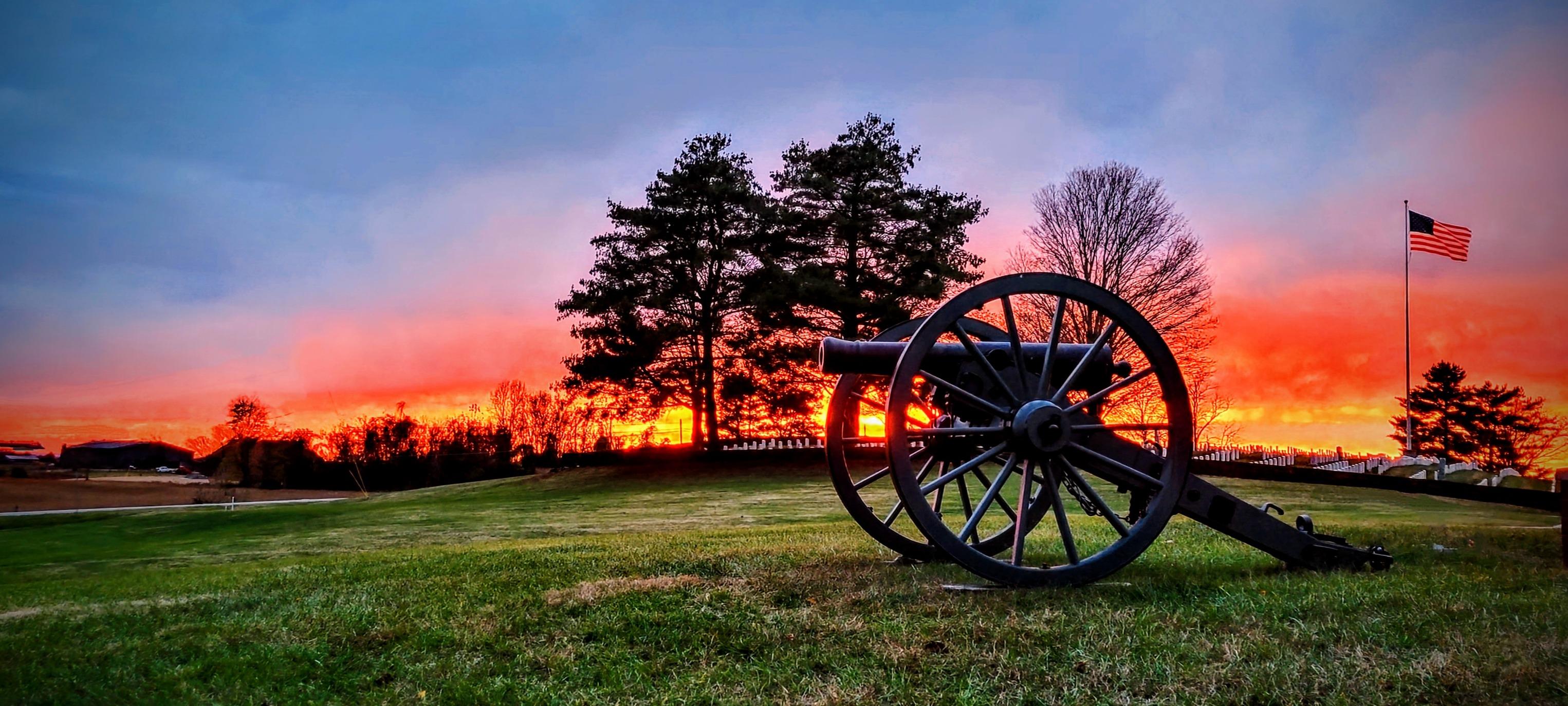
The US won a significant victory early in the Civil War at the Battle of Mill Springs. Explore the rolling fields of Kentucky where the battle took place and learn about that state's strategic importa...

3 mi from route ~7 min detour Free near mile 35.7
View on nps.gov
Mammoth Cave National Park

Mammoth Cave National Park

National Park

Rolling hills, deep river valleys, and the world's longest known cave system. Mammoth Cave National Park is home to thousands of years of human history and a rich diversity of plant and animal life, e...

10 mi from route ~25 min detour Free near mile 121.5
View on nps.gov
Camp Nelson National Monument

Camp Nelson National Monument

National Monument

The US Army established Camp Nelson as a fortified supply depot in April 1863. Over the next 3 years, the site evolved into a massive recruitment and training center for United States Colored Troops a...

29 mi from route ~72 min detour Free
View on nps.gov

Park data from the National Park Service API. Alerts update every 2 hours.

Fuel & Cost

Regular Gas

$31.47 one way

$62.94 round trip

$3.86/gal 25.4 MPG avg 73 kg CO2
Fuel Type $/gal One Way Round Trip
midgrade $4.25 $34.69 $69.39
premium $4.80 $39.12 $78.23
diesel $5.64 $46.03 $92.07

No toll roads detected on this route.

Estimated Trip Cost (one way, 1 person)

Fuel

$31

Meals

$25–$50

Total

$56–$81

Rough estimate based on US averages. Hotel $80–$140/night, meals $25–$50/day.

Estimated CO2 emission: 72.5 kg one way. Prices: EIA weekly data, 2026-04-06.

EV Charging Along Route

17 DC fast chargers · Coverage: excellent

Buc-ee's - Tesla Supercharger

Smiths Grove, KY

Tesla

16 DCFC

Meijer - Tesla Supercharger

Bowling Green, KY

Tesla

8 DCFC

Gillie Hyde Ford L3

Glasgow, KY

Blink Network

4 DCFC

Casey's #4433 - Glasgow

Glasgow, KY

FCN

4 DCFC

National Corvette Museum (Bowling Green, KY)

Bowling Green, KY

Electrify America

4 DCFC

Greenwood Ford Lincoln

Bowling Green, KY

FORD_CHARGE

4 DCFC

Russell County Tourist Center

Russell Springs, KY

Non-Networked

2 DCFC

Don Franklin Ford Lincoln

Fairplay, KY

FORD_CHARGE

2 DCFC

ChargePoint Network: 4 Non-Networked: 3 FORD_CHARGE: 2 Blink Network: 2 EV Connect: 2 Tesla: 2 FCN: 1 Electrify America: 1

Station data from NREL Alternative Fuel Stations database.

Driving Electric?

About $22 in charging · 0 stops · 67% less CO2

Vehicle Type kWh Stops DC Fast Home Charge
Average EV 62.2 0 $21.76 $9.95
Efficient EV 51.8 0 $18.13 $8.29
EV Truck/SUV 82.9 1 $29.01 $13.26

Gas CO2

72 kg

EV CO2

24 kg (67% less)

This trip is well within single-charge range for most EVs. No charging stops needed if you start fully charged.

DC fast charging avg $0.35/kWh. Home charging avg $0.16/kWh. US grid CO2: 0.39 kg/kWh.

Travel Intel

Current conditions at both ends of the drive.

Forecast data refreshed 2 days ago

Origin

Brodhead, KY

Evening in Brodhead on Sunday

Local time

7:51 PM

EDT

Current temp

81°F

Unavailable

Live forecast

Destination

Hopkinsville, KY

Evening in Hopkinsville on Sunday

Local time

6:51 PM

CDT

Current temp

61°F

Unavailable

Live forecast

Along the Route

63°F

Oklahoma, KY

104 mi in

Seasonal Notes

Summer travel usually means heavier construction, hotter rest stops, and busier weekend traffic around major cities.

Winter travel shortens daylight, so a route that looks manageable on paper can feel much longer after dark.

Holiday weekends tend to make both departure and arrival windows slower than the raw route time suggests.

Time zone

1 hour earlier

The destination clock does not match departure time, so double-check hotel check-in windows and late arrival plans.

Temperature spread

20 degrees cooler at arrival

A meaningful temperature swing is a good cue to rethink layers, water, and how soon you want to arrive.

Road read

3h 58m on the road

Use the two city cards together: check the sky where you start, then compare it with the local time and temperature at arrival.

Weather data from the National Weather Service. Conditions may change; check closer to your travel date.

Frequently Asked Questions

The drive from Brodhead, KY to Hopkinsville, KY covers 207.2 miles and takes about 3h 58m without stops. Add 15-30 minutes for a fuel or rest stop on longer drives.
The main roads are Cumberland Parkway, US 68, I 65. Most of the drive stays on highways, so watch for ramps and exits.
This is a comfortable same-day trip.
The midpoint is about 103.6 miles from Brodhead, KY. Look for rest areas, gas stations, or food options near the halfway mark.
At current regular gas prices, expect to spend about $31.47 one way. This estimate uses 25.4 MPG — your actual cost will vary with your vehicle's fuel efficiency and current gas prices.
An early start around 7-8 AM gets you there with plenty of daylight left. A late afternoon start means arriving after dark. Morning is better.
Plan about 1 meaningful break for fuel, food, or rest. A short stop every 2 to 3 hours is enough for this drive.
This is a demanding drive. With 17 significant decision points across 207.2 miles, you will need to stay alert — especially through interchange areas and urban stretches. Consider splitting it into segments if you are not comfortable with fast highway navigation.
The main spots that need attention: at 0.1 miles (KY 1505 / Boone Way): Navigation decision point; at 21.3 miles (KY 80 / Hal Rogers Parkway): Merge point - match speed before joining. Lane positioning matters here; at 141.6 miles: Exit ramp - move to the correct lane early. Lane positioning matters here. Multiple destination signs - pick the right one.
Between Brodhead, KY and Hopkinsville, KY, road signs point toward Bowling Green and Scottsville.

Was this route helpful?

Thanks for your feedback!

Your tip has been submitted. Thanks!

/500

Explore More

Return Trip

Hopkinsville, KY to Brodhead, KY

Plan the drive back the other way.

206.8 mi 3h 57m

Explore more options from Brodhead, KY or browse trips ending in Hopkinsville, KY.

Looking for more statewide routes? Browse KY road trips.

Explore maps for Brodhead, KY or Hopkinsville, KY on MapSof.net.