The drive from Burney, CA to Fresno, CA covers 381.7 miles and takes about 7h 21m behind the wheel.
This route is realistic as a one-day drive if you keep your stops efficient.
The route leans on Westside Freeway, CA 99, South Sacramento Freeway for much of the mileage,
and the overall profile is highway-focused drive.
The longest uninterrupted segment is about 127.4 miles on Westside Freeway.
At current regular gas prices, budget about $87.73 one way before food or hotel costs.
Trip Pace
Same-day drive is realistic
A same-day return is possible, but it will make for a full day on the road.
Break Rhythm
2 planned breaks
Plan on a short reset every 3 to 4 hours to stay fresh behind the wheel.
Midpoint
190.9 miles from Burney, CA
A natural place for your longest stop of the day
, about 3h 39m into the drive
.
Who Is This Route For?
Weekend Trip
Doable as a same-day drive at 7h 21m. Total distance: 381.7 miles.
Family Friendly
Moderate complexity with 2 natural rest stops along the way.
Solo Traveler
7h 21m drive, plan rest stops for pacing.
Drive Character
This is a 7h 21m highway drive covering 381.7 miles, with most of the trip on Westside Freeway and CA 99. The longest continuous stretch is about 127.4 miles on Westside Freeway.
Most of the miles stay on highways, which makes pacing and fuel planning easier than turn-by-turn city driving.
There are about 21 navigation steps in the underlying route data, so the final approach matters more than the middle miles.
Westside Freeway is the longest continuous segment at about 127.4 miles.
How Hard Is This Drive?
This is a straightforward highway drive that stays mostly on Westside Freeway and CA 99. This route has several spots where lane changes, forks, or exits need your full attention. The trickiest moment comes around 177.6 miles in near I 5 / Westside Freeway.
Driving Effort9/10
High effort - long or complex enough to need steady focus all day
Balances navigation complexity with total wheel time.
This is a demanding drive. With 17 significant decision points across 381.7 miles, you will need to stay alert - especially through interchange areas and urban stretches. Consider splitting it into segments if you are not comfortable with fast highway navigation.
Where does it get tricky?
The main spots that need attention: at 177.6 miles (I 5 / Westside Freeway): Highway fork - watch signs carefully. Lane positioning matters here; at 193.2 miles (I 5 / Westside Freeway): Highway fork - watch signs carefully. Lane positioning matters here; at 211.9 miles: Exit ramp - move to the correct lane early. Lane positioning matters here. Multiple destination signs - pick the right one.
Critical Maneuvers
5 of 17 key points
These are the spots where you need to pay the most attention. Preview them before you drive.
6
177.6 mi into trip|~3h 24m in|I 5 / Westside Freeway
Keep slight left at fork onto I 5 / Westside Freeway
Highway fork - watch signs carefully. Lane positioning matters here
Use the straight / slight right lanes.
6
193.2 mi into trip|~3h 41m in|I 5 / Westside Freeway
Keep slight left at fork onto I 5 / Westside Freeway
Highway fork - watch signs carefully. Lane positioning matters here
Use the straight / slight right lanes.
8
211.9 mi into trip|~4h 2m in
Take the exit toward US 50: South Lake Tahoe, San Francisco
Exit ramp - move to the correct lane early. Lane positioning matters here. Multiple destination signs - pick the right one
Use the slight right lane.
Exit 518
Toward US 50: South Lake Tahoe, San Francisco
8
214.4 mi into trip|~4h 6m in|I 80 Business / Capital City Freeway
Keep slight right at fork onto I 80 Business / Capital City Freeway toward I 80 Business East, CA 99 South: Reno, Fresno
Highway fork - watch signs carefully. Lane positioning matters here. Multiple destination signs - pick the right one
Use the slight right lane.
Toward I 80 Business East, CA 99 South: Reno, F...
7
378.3 mi into trip|~7h 14m in
Take the exit toward Belmont Avenue
Exit ramp - move to the correct lane early. Lane positioning matters here
Use the slight right lane.
Exit 134
Toward Belmont Avenue
Towns Mentioned on Route Signs
Based on OSRM destination-sign hints, not a full list of every settlement the road passes.
On the drive from Burney, CA to Fresno, CA, road signs begin pointing toward San Francisco along the way.
San Francisco
211.9 mi in|~4h 2m
Main Roads
Road
Distance
Duration
Westside Freeway
127.4 mi
2h 17m
CA 99
106.7 mi
2h 2m
South Sacramento Freeway
56.4 mi
1h 5m
Cascade Wonderland Highway
33.8 mi
36m
State Route 299
26.1 mi
35m
CA 299
23.1 mi
29m
West Belmont Avenue
2.9 mi
5m
Capital City Freeway
1.5 mi
1m
Longest stretch:
Westside Freeway
— 127.4 mi, about 2h 17m
Turn-by-Turn Driving Directions
Step-by-step road directions between Burney, CA and Fresno, CA.
1
Start on CA 299
1.3 mi·2 min·Main Street
2
Continue on CA 299
26 mi·35 min·State Route 299
3
Turn right onto CA 299
23 mi·29 min·CA 299
4
Turn left
0.3 mi·42 sec
5
Merge onto I 5
34 mi·36 min·Cascade Wonderland Highway
6
Continue on I 5
93 mi·1 hr 39 min·Westside Freeway
7
Keep slight left at fork onto I 5
16 mi·16 min·Westside Freeway
Use the straight / slight right lanes.
8
Keep slight left at fork onto I 5
19 mi·21 min·Westside Freeway
Use the straight / slight right lanes.
9
Take the exit
0.4 mi·27 sec
Exit 518Toward US 50: South Lake Tahoe, San FranciscoUse the slight right lane.
10
Keep slight left at fork
0.4 mi·32 sec
Exit 518Toward US 50 East: Fresno
11
Keep slight left at fork
0.6 mi·1 min
Exit 518Toward US 50 East: Fresno
12
Merge onto US 50; I 80 Business
1.2 mi·1 min·Capital City Freeway
13
Keep slight right at fork onto I 80 Business
0.3 mi·18 sec·Capital City Freeway
Toward I 80 Business East, CA 99 South: Reno, FresnoUse the slight right lane.
14
Take the exit
0.4 mi·34 sec
Toward CA 99 South: FresnoUse the straight / slight right lanes.
15
Merge onto CA 99
56 mi·1 hr 5 min·South Sacramento Freeway
Use the straight / slight right lanes.
16
Keep slight left at fork onto CA 99
107 mi·2 hr 2 min·CA 99
Use the straight / slight right lanes.
17
Take the exit
0.3 mi·40 sec
Exit 134Toward Belmont AvenueUse the slight right lane.
18
At end of road, turn left onto West Belmont Avenue
2.9 mi·5 min·West Belmont Avenue
Use the straight / right lanes.
19
Turn right onto North First Street
0.2 mi·26 sec·North First Street
20
Turn left onto East Washington Avenue
69 ft·3 sec·East Washington Avenue
21
Arrive at destination
East Washington Avenue
Trip Plan
Morning Departure
Start early — leave by 6-7 AM to arrive at a reasonable hour.
Evening Departure
This is a long drive — plan for a morning departure or consider splitting it into two days.
You can normally do this drive in one day.
Plan roughly 2 meaningful breaks for fuel, food, and rest.
The halfway point lands around 190.9 miles from Burney, CA, or about 3h 39m into the drive.
The longest continuous stretch on this route runs about 127.4 miles.
This is a comfortable same-day trip.
Departure
Before you leave
Start with fuel, water, and navigation already sorted so the first hour feels easy.
First stop
Around 84 miles or 1h 44m in
Use this first pause for coffee, a restroom break, and a quick traffic check ahead.
Halfway reset
Around 190.9 miles or 3h 39m in
This is the best place for your longest stop, a real meal, and a full fuel check.
Final approach
Final hour starts around 6h 9m
Traffic, exits, and arrival timing usually matter more near Fresno, CA than in the middle of the route.
Before You Leave
+
Open the route before leaving Burney, CA so your first major turns are already loaded.
+
Leave with enough water and a charging cable within reach, not packed away.
+
Check your fuel range against the first long segment, especially if you are starting outside city service areas.
+
Pick one backup stop option before the midpoint in case traffic changes your pacing.
Day 1
Settle into the route from Burney, CA
This is one driving day of about 381.7 miles and 7h 21m.
Your first comfortable stop window is around 84 miles from Burney, CA.
This route can stay practical as a one-day drive if traffic stays reasonable.
Plan about 2 real breaks rather than only quick fuel stops.
The longest stretch is on Westside Freeway for about 127.4 miles.
Where to Stop
Rest stops, refuel points, and overnight suggestions along this route.
Halfway Point
Midpoint
About 190.9 mi from Burney, CA
· 3h 39m into the drive
The midpoint is around 190.9 miles from Burney, CA, which is a good place for a longer meal and fuel stop.
Before the longest stretch
Fuel check
Top up before Westside Freeway if your tank is already low. That segment runs about 127.4 miles.
Arriving in Fresno, CA
The final approach into Fresno, CA usually feels slower than the middle of the drive, so avoid planning your tightest schedule at the very end.
Try to arrive with enough fuel left to skip an immediate station stop unless you already know the area around Fresno, CA.
After long uninterrupted mileage, take five minutes before the last urban segment to reset and refocus on exits, merges, and city traffic.
These stop ideas are pacing suggestions — the exact town or exit can change with traffic, hotel plans, and fuel range.
National Parks Near This Route
Worth a detour if your schedule allows.
Whiskeytown National Recreation Area
National Recreation Area
Whiskeytown Lake’s crystal-clear waters are iconic, but this 42,000-acre National Recreation Area offers much more. Explore waterfalls, hike rugged trails, uncover Gold Rush history, and witness the r...
13 mi from route
~32 min detour
$15
near mile 52.7
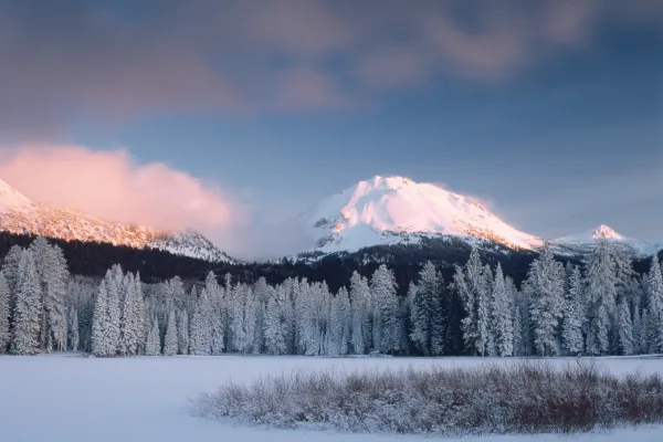
Lassen Volcanic National Park is home to steaming fumaroles, meadows freckled with wildflowers, clear mountain lakes, and numerous volcanoes. Jagged peaks tell the story of its eruptive past while hot...
Park data from the National Park Service API. Alerts update every 2 hours.
Fuel & Cost
Regular Gas
$87.73 one way
$175.46 round trip
$5.84/gal25.4 MPG avg134 kg CO2
Fuel Type
$/gal
One Way
Round Trip
midgrade
$6.02
$90.41
$180.81
premium
$6.18
$92.83
$185.65
diesel
$5.61
$84.27
$168.55
No toll roads detected on this route.
Estimated Trip Cost (one way, 1 person)
Fuel
$88
Meals
$25–$50
Total
$113–$138
Rough estimate based on US averages. Hotel $80–$140/night, meals $25–$50/day.
Estimated CO2 emission: 133.5 kg one way.
Prices: EIA weekly data, 2026-04-13.
Driving Electric?
About $40 in charging
· 1 stop
· 66% less CO2
Vehicle Type
kWh
Stops
DC Fast
Home Charge
Average EV
114.5
1
$40.08
$18.32
Efficient EV
95.4
1
$33.40
$15.27
EV Truck/SUV
152.7
1
$53.44
$24.43
Gas CO2
134 kg
EV CO2
45 kg (66% less)
Plan for 1 charging stop. A 30-minute DC fast charge mid-route should be enough to complete the trip comfortably.
DC fast charging avg $0.35/kWh. Home charging avg $0.16/kWh. US grid CO2: 0.39 kg/kWh.
Travel Intel
Current conditions at both ends of the drive.
Forecast as of Apr 16, 2026
Origin
Burney, CA
Morning
in Burney on Friday
Local time
6:30 AM
PDT
Current temp
57°F
Unavailable
Live forecast
Destination
Fresno, CA
Morning
in Fresno on Friday
Local time
6:30 AM
PDT
Current temp
73°F
Sunny
NW 5 to 15 mph0% chanceLive forecast
Seasonal Notes
Summer travel usually means heavier construction, hotter rest stops, and busier weekend traffic around major cities.
Winter travel shortens daylight, so a route that looks manageable on paper can feel much longer after dark.
Holiday weekends tend to make both departure and arrival windows slower than the raw route time suggests.
Time zone
Same local time
Origin and destination are on the same clock, so arrival timing is easier to judge at a glance.
Temperature spread
16 degrees warmer at arrival
A meaningful temperature swing is a good cue to rethink layers, water, and how soon you want to arrive.
Road read
7h 21m on the road
Start early — leave by 6-7 AM to arrive at a reasonable hour.
Weather data from the National Weather Service. Conditions may change; check closer to your travel date.
Frequently Asked Questions
The drive from Burney, CA to Fresno, CA covers 381.7 miles and takes about 7h 21m without stops. Add 15-30 minutes for a fuel or rest stop on longer drives.
The main roads are Westside Freeway, CA 99, South Sacramento Freeway. Most of the drive stays on highways, so watch for ramps and exits.
This is a comfortable same-day trip.
The midpoint is about 190.9 miles from Burney, CA. Look for rest areas, gas stations, or food options near the halfway mark.
At current regular gas prices, expect to spend about $87.73 one way. This estimate uses 25.4 MPG — your actual cost will vary with your vehicle's fuel efficiency and current gas prices.
Start early — leave by 6-7 AM to arrive at a reasonable hour. This is a long drive — plan for a morning departure or consider splitting it into two days.
Plan about 2 meaningful breaks for fuel, food, or rest. Plan on a short reset every 3 to 4 hours to stay fresh behind the wheel.
This is a demanding drive. With 17 significant decision points across 381.7 miles, you will need to stay alert - especially through interchange areas and urban stretches. Consider splitting it into segments if you are not comfortable with fast highway navigation.
The main spots that need attention: at 177.6 miles (I 5 / Westside Freeway): Highway fork - watch signs carefully. Lane positioning matters here; at 193.2 miles (I 5 / Westside Freeway): Highway fork - watch signs carefully. Lane positioning matters here; at 211.9 miles: Exit ramp - move to the correct lane early. Lane positioning matters here. Multiple destination signs - pick the right one.
On the drive from Burney, CA to Fresno, CA, road signs begin pointing toward San Francisco along the way.
Yes. Nearby national parks include Whiskeytown National Recreation Area and Lassen Volcanic National Park.
How this page is built
Compiled and maintained by the Trip.ovh planning team at COD Solutions Oy (Helsinki). Each route is built from authoritative open government and mapping datasets rather than crowdsourced reviews. Distances and geometry come from
OSRM
over
OpenStreetMap.
Fuel cost uses
EIA
weekly regional averages.
National park proximity is from the
NPS API.
Pages are published only after passing our data-quality checks; our
methodology page
documents refresh cadence, editorial standards, and known limitations.