The drive from Cannon Beach, OR to Terrebonne, OR covers 219.6 miles and takes about 5h 10m behind the wheel.
This route is realistic as a one-day drive if you keep your stops efficient.
The route leans on Warm Springs Highway, Mount Hood Highway, Sunset Highway for much of the mileage,
and the overall profile is turn-heavy local drive.
The longest uninterrupted segment is about 46.7 miles on Warm Springs Highway.
At current regular gas prices, budget about $43.75 one way before food or hotel costs.
Trip Pace
Same-day drive is realistic
A same-day return is possible, but it will make for a full day on the road.
Break Rhythm
1 planned break
Plan on a short reset every 3 to 4 hours to stay fresh behind the wheel.
Midpoint
109.8 miles from Cannon Beach, OR
A natural place for your longest stop of the day
, about 2h 33m into the drive
.
Who Is This Route For?
Weekend Trip
Doable as a same-day drive at 5h 10m. Total distance: 219.6 miles.
Family Friendly
Moderate complexity with 1 natural rest stops along the way.
Solo Traveler
5h 10m drive, comfortable solo distance.
Scenic Drive
Turn-heavy local drive route profile.
Drive Character
Expect a 5h 10m drive with frequent turns across 219.6 miles of local and secondary roads.
This route has more turning and local-road decision points than a simple highway run.
There are about 33 navigation steps in the underlying route data, so the final approach matters more than the middle miles.
Warm Springs Highway is the longest continuous segment at about 46.7 miles.
How Hard Is This Drive?
Expect a hands-on drive with frequent turns and local roads rather than long highway stretches. This route has several spots where lane changes, forks, or exits need your full attention. The trickiest moment comes around 78.2 miles in near US 26.
Driving Effort8/10
Demanding - plan breaks and stay ahead of the key maneuvers
Balances navigation complexity with total wheel time.
This is a demanding drive. With 15 significant decision points across 219.6 miles, you will need to stay alert - especially through interchange areas and urban stretches. Consider splitting it into segments if you are not comfortable with fast highway navigation.
Where does it get tricky?
The main spots that need attention: at 78.2 miles (US 26): Highway fork - watch signs carefully. Multiple destination signs - pick the right one; at 79.1 miles (Stadium Freeway): Exit ramp - move to the correct lane early. Lane positioning matters here. Multiple destination signs - pick the right one; at 80 miles: Exit ramp - move to the correct lane early. Lane positioning matters here. Multiple destination signs - pick the right one.
Critical Maneuvers
5 of 15 key points
These are the spots where you need to pay the most attention. Preview them before you drive.
6
78.2 mi into trip|~1h 44m in|US 26
Keep slight right at fork onto US 26 toward I 405 South, US 26 East: Salem
Highway fork - watch signs carefully. Multiple destination signs - pick the right one
Toward I 405 South, US 26 East: Salem
7
79.1 mi into trip|~1h 46m in|Stadium Freeway
Take the exit onto Stadium Freeway toward I 5 North, I 84 East: The Dalles, Seattle
Exit ramp - move to the correct lane early. Lane positioning matters here. Multiple destination signs - pick the right one
Use the slight right lane.
Toward I 5 North, I 84 East: The Dalles, Seattl...
8
80 mi into trip|~1h 47m in
Take the exit toward I 84 East, US 30 East: The Dalles, Portland Airport
Exit ramp - move to the correct lane early. Lane positioning matters here. Multiple destination signs - pick the right one
Use the straight / slight right lanes.
Exit 300
Toward I 84 East, US 30 East: The Dalles, Portl...
8
80.2 mi into trip|~1h 47m in
Keep slight left at fork toward I 84 East, US 30 East: Portland Airport, The Dalles
Highway fork - watch signs carefully. Lane positioning matters here. Multiple destination signs - pick the right one
Use the straight / slight right lanes.
Toward I 84 East, US 30 East: Portland Airport,...
8
94 mi into trip|~2h 6m in
Take the exit toward 238th Drive, Wood Village
Exit ramp - move to the correct lane early. Lane positioning matters here. Multiple destination signs - pick the right one
Use the straight / slight right lanes.
Exit 16
Toward 238th Drive, Wood Village
Towns Mentioned on Route Signs
Based on OSRM destination-sign hints, not a full list of every settlement the road passes.
Between Cannon Beach, OR and Terrebonne, OR, road signs point toward Seattle, Portland Airport, The Dalles and Wood Village.
The midpoint is around 109.8 miles from Cannon Beach, OR, which is a good place for a longer meal and fuel stop.
Arriving in Terrebonne, OR
The final approach into Terrebonne, OR usually feels slower than the middle of the drive, so avoid planning your tightest schedule at the very end.
Try to arrive with enough fuel left to skip an immediate station stop unless you already know the area around Terrebonne, OR.
These stop ideas are pacing suggestions — the exact town or exit can change with traffic, hotel plans, and fuel range.
National Parks Near This Route
Worth a detour if your schedule allows.
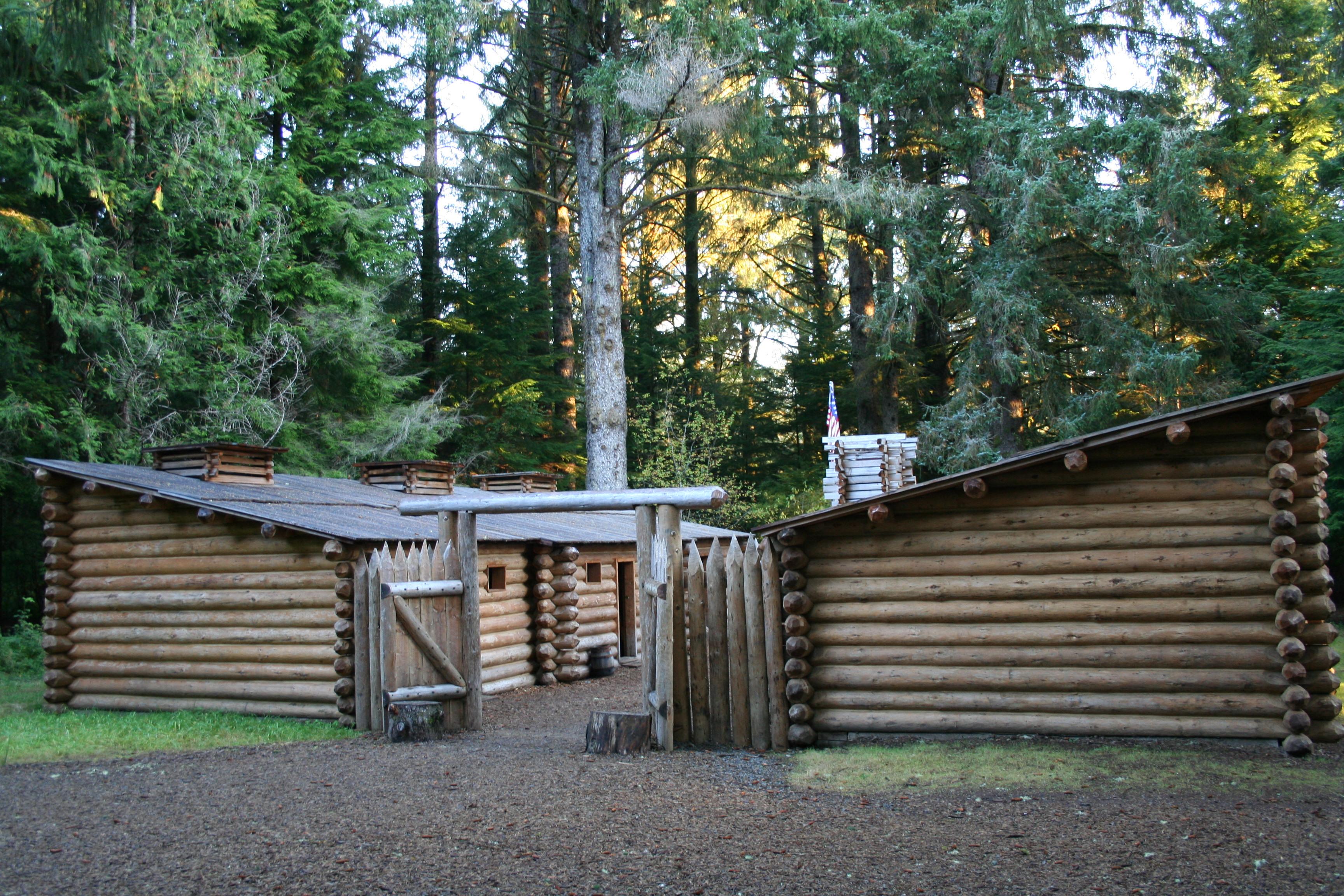
Lewis and Clark National Historical Park
National Historical Park
Explore the timeless rainforests and majestic coastal vistas. Discover the rich heritage of the native people. Unfold the dramatic stories of America's most famous explorers. The park encompasses site...
Station data from NREL Alternative Fuel Stations database.
Driving Electric?
About $23 in charging
· 0 stops
· 66% less CO2
Vehicle Type
kWh
Stops
DC Fast
Home Charge
Average EV
65.9
0
$23.06
$10.54
Efficient EV
54.9
0
$19.22
$8.78
EV Truck/SUV
87.8
1
$30.74
$14.05
Gas CO2
77 kg
EV CO2
26 kg (66% less)
Plan for 0 charging stops, roughly every 270 miles. Allow 25-40 minutes per stop at a DC fast charger.
DC fast charging avg $0.35/kWh. Home charging avg $0.16/kWh. US grid CO2: 0.39 kg/kWh.
Travel Intel
Current conditions at both ends of the drive.
Forecast as of Mar 4, 2022
Origin
Cannon Beach, OR
Morning
in Cannon Beach on Thursday
Local time
11:01 AM
PDT
Current temp
41°F
Unavailable
Live forecast
Destination
Terrebonne, OR
Morning
in Terrebonne on Thursday
Local time
11:01 AM
PDT
Current temp
34°F
Unavailable
Live forecast
Seasonal Notes
Summer travel usually means heavier construction, hotter rest stops, and busier weekend traffic around major cities.
Winter travel shortens daylight, so a route that looks manageable on paper can feel much longer after dark.
Holiday weekends tend to make both departure and arrival windows slower than the raw route time suggests.
Time zone
Same local time
Origin and destination are on the same clock, so arrival timing is easier to judge at a glance.
Temperature spread
7 degrees cooler at arrival
A meaningful temperature swing is a good cue to rethink layers, water, and how soon you want to arrive.
Road read
5h 10m on the road
An early start around 7-8 AM gets you there with plenty of daylight left.
Weather data from the National Weather Service. Conditions may change; check closer to your travel date.
Frequently Asked Questions
The drive from Cannon Beach, OR to Terrebonne, OR covers 219.6 miles and takes about 5h 10m without stops. Add 15-30 minutes for a fuel or rest stop on longer drives.
The main roads are Warm Springs Highway, Mount Hood Highway, Sunset Highway. Expect a mix of highway and local road driving.
This is a comfortable same-day trip.
The midpoint is about 109.8 miles from Cannon Beach, OR. Look for rest areas, gas stations, or food options near the halfway mark.
At current regular gas prices, expect to spend about $43.75 one way. This estimate uses 25.4 MPG — your actual cost will vary with your vehicle's fuel efficiency and current gas prices.
An early start around 7-8 AM gets you there with plenty of daylight left. A late afternoon start means arriving after dark. Morning is better.
Plan about 1 meaningful break for fuel, food, or rest. Plan on a short reset every 3 to 4 hours to stay fresh behind the wheel.
This is a demanding drive. With 15 significant decision points across 219.6 miles, you will need to stay alert - especially through interchange areas and urban stretches. Consider splitting it into segments if you are not comfortable with fast highway navigation.
The main spots that need attention: at 78.2 miles (US 26): Highway fork - watch signs carefully. Multiple destination signs - pick the right one; at 79.1 miles (Stadium Freeway): Exit ramp - move to the correct lane early. Lane positioning matters here. Multiple destination signs - pick the right one; at 80 miles: Exit ramp - move to the correct lane early. Lane positioning matters here. Multiple destination signs - pick the right one.
Between Cannon Beach, OR and Terrebonne, OR, road signs point toward Seattle, Portland Airport, The Dalles and Wood Village.