The drive from Cincinnati, OH to Spring Valley, OH covers 147.7 miles and takes about 3h 4m behind the wheel.
This route is realistic as a one-day drive if you keep your stops efficient.
The route leans on James A. Rhodes Appalachian Highway, US 35, Circle Freeway for much of the mileage,
and the overall profile is turn-heavy local drive.
The longest uninterrupted segment is about 99.7 miles on James A. Rhodes Appalachian Highway.
At current regular gas prices, budget about $22.92 one way before food or hotel costs.
Trip Pace
Same-day drive is realistic
A same-day return is realistic if you keep stops short.
Break Rhythm
1 planned break
A short stop every 2 to 3 hours is enough for this drive.
Midpoint
73.9 miles from Cincinnati, OH
A natural place for your longest stop of the day
, about 1h 32m into the drive
.
Loading map...
Drive Character
Expect a 3h 4m drive with frequent turns across 147.7 miles of local and secondary roads.
This route has more turning and local-road decision points than a simple highway run.
There are about 24 navigation steps in the underlying route data, so the final approach matters more than the middle miles.
James A. Rhodes Appalachian Highway is the longest continuous segment at about 99.7 miles.
How Hard Is This Drive?
Expect a hands-on drive with frequent turns and local roads rather than long highway stretches. This route has several spots where lane changes, forks, or exits need your full attention. The trickiest moment comes around 1.8 miles in.
Route Complexity9/10
High effort - long or complex enough to need steady focus all day
This is a demanding drive. With 20 significant decision points across 147.7 miles, you will need to stay alert — especially through interchange areas and urban stretches. Consider splitting it into segments if you are not comfortable with fast highway navigation.
Where does it get tricky?
The main spots that need attention: at 1.8 miles: Lane positioning matters here; at 7.4 miles: Exit ramp - move to the correct lane early. Lane positioning matters here. Multiple destination signs - pick the right one; at 19.1 miles: Exit ramp - move to the correct lane early. Lane positioning matters here. Multiple destination signs - pick the right one.
Critical Maneuvers
5 of 20 key points
These are the spots where you need to pay the most attention. Preview them before you drive.
7
1.8 mi into trip|~4m in
Take the ramp toward I 471 South: Newport
Lane positioning matters here
Use the left lane.
Toward I 471 South: Newport
8
7.4 mi into trip|~11m in
Take the exit toward I 275 East: Columbus, Ohio
Exit ramp - move to the correct lane early. Lane positioning matters here. Multiple destination signs - pick the right one
Use the slight left / straight lanes.
Exit 1A
Toward I 275 East: Columbus, Ohio
8
19.1 mi into trip|~25m in
Take the exit toward SR 32: Newtown, Eastgate Boulevard, Batavia
Exit ramp - move to the correct lane early. Lane positioning matters here. Multiple destination signs - pick the right one
Use the straight / slight right lanes.
Exit 63A-B
Toward SR 32: Newtown, Eastgate Boulevard, Bata...
9
19.4 mi into trip|~26m in
Keep slight left at fork toward SR 32 West: Eastgate Boulevard, Newtown
Highway fork - watch signs carefully. Lane positioning matters here. Multiple destination signs - pick the right one
Use the slight left lane.
Exit 63A
Toward SR 32 West: Eastgate Boulevard, Newtown
7
19.5 mi into trip|~26m in|SR 32 / James A. Rhodes Appalachian Highway
Turn right onto SR 32 / James A. Rhodes Appalachian Highway toward Eastgate Boulevard
Lane positioning matters here
Use the right lane.
Toward Eastgate Boulevard
Towns Mentioned on Route Signs
Based on OSRM destination-sign hints, not a full list of every settlement the road passes.
Between Cincinnati, OH and Spring Valley, OH, road signs point toward Ohio, Batavia, Newtown and Chillicothe.
Ohio
7.4 mi in|~11m
Batavia
19.1 mi in|~25m
Newtown
19.4 mi in|~26m
Chillicothe
119.2 mi in|~2h 27m
Main Roads
Road
Distance
Duration
James A. Rhodes Appalachian Highway
99.7 mi
2h 1m
US 35
26.1 mi
30m
Circle Freeway
9.5 mi
10m
I 471
5.3 mi
6m
Ronald Reagan Highway
1.6 mi
1m
Jackson Pike
1.2 mi
2m
Reading Road
1 mi
2m
East McMillan Street
0.4 mi
1m
Longest stretch:
James A. Rhodes Appalachian Highway
— 99.7 mi, about 2h 1m
Turn-by-Turn Driving Directions
Step-by-step road directions between Cincinnati, OH and Spring Valley, OH.
1
Start on Ohio Avenue
99 ft·6 sec·Ohio Avenue
2
Turn right onto West McMillan Avenue
0.2 mi·26 sec·West McMillan Avenue
3
Continue on East McMillan Street
0.4 mi·1 min·East McMillan Street
Use the straight lane.
4
Turn right onto Maplewood Avenue
0.1 mi·24 sec·Maplewood Avenue
5
Turn left onto Kinsey Avenue
0.2 mi·31 sec·Kinsey Avenue
6
Turn right onto US 42
1.0 mi·2 min·Reading Road
Use the straight lane.
7
Take the ramp
0.2 mi·32 sec
Toward I 471 South: NewportUse the left lane.
8
Merge onto I 471
5.3 mi·6 min·I 471
Use the straight / slight right lanes.
9
Take the exit
0.5 mi·1 min
Exit 1AToward I 275 East: Columbus, OhioUse the slight left / straight lanes.
10
Merge onto I 275
1.6 mi·1 min·Ronald Reagan Highway
11
Continue on I 275
9.5 mi·10 min·Circle Freeway
12
Take the exit
0.3 mi·41 sec
Exit 63A-BToward SR 32: Newtown, Eastgate Boulevard, BataviaUse the straight / slight right lanes.
13
Keep slight left at fork
0.2 mi·23 sec
Exit 63AToward SR 32 West: Eastgate Boulevard, NewtownUse the slight left lane.
14
Turn right onto SR 32
100 mi·2 hr 1 min·James A. Rhodes Appalachian Highway
Toward Eastgate BoulevardUse the right lane.
15
Take the exit
0.4 mi·54 sec
Toward US 35: Gallipolis, Chillicothe
16
Keep slight left at fork
419 ft·15 sec
17
Turn right onto US 35
26 mi·30 min·US 35
18
Take the exit
0.2 mi·31 sec
Toward SR 160: Vinton, Gallipolis
19
Turn right onto SR 160
0.3 mi·39 sec·State Route 160
20
Turn right onto CR 35
1.2 mi·2 min·Jackson Pike
21
Turn right
77 ft·11 sec
22
Turn left
304 ft·24 sec
23
Turn right
213 ft·15 sec
24
Arrive at destination
Trip Plan
Morning Departure
An early start around 7-8 AM gets you there with plenty of daylight left.
Evening Departure
A late afternoon start means arriving after dark. Morning is better.
You can normally do this drive in one day.
Plan roughly 1 meaningful break for fuel, food, and rest.
The halfway point lands around 73.9 miles from Cincinnati, OH, or about 1h 32m into the drive.
The longest continuous stretch on this route runs about 99.7 miles.
This is a comfortable same-day trip.
Departure
Before you leave
Start with fuel, water, and navigation already sorted so the first hour feels easy.
First stop
Around 80 miles or 1h 40m in
Use this first pause for coffee, a restroom break, and a quick traffic check ahead.
Halfway reset
Around 73.9 miles or 1h 32m in
This is the best place for your longest stop, a real meal, and a full fuel check.
Final approach
Final hour starts around 2h 30m
Traffic, exits, and arrival timing usually matter more near Spring Valley, OH than in the middle of the route.
Before You Leave
+
Open the route before leaving Cincinnati, OH so your first major turns are already loaded.
+
Leave with enough water and a charging cable within reach, not packed away.
+
Check your fuel range against the first long segment, especially if you are starting outside city service areas.
Day 1
Settle into the route from Cincinnati, OH
This is one driving day of about 147.7 miles and 3h 4m.
Your first comfortable stop window is around 80 miles from Cincinnati, OH.
This route can stay practical as a one-day drive if traffic stays reasonable.
Plan about 1 real break rather than only quick fuel stops.
The longest stretch is on James A. Rhodes Appalachian Highway for about 99.7 miles.
Where to Stop
Rest stops, refuel points, and overnight suggestions along this route.
Halfway Point
Midpoint
About 73.9 mi from Cincinnati, OH
· 1h 32m into the drive
The midpoint is around 73.9 miles from Cincinnati, OH, which is a good place for a longer meal and fuel stop.
Before the longest stretch
Fuel check
Top up before James A. Rhodes Appalachian Highway if your tank is already low. That segment runs about 99.7 miles.
Arriving in Spring Valley, OH
The final approach into Spring Valley, OH usually feels slower than the middle of the drive, so avoid planning your tightest schedule at the very end.
Try to arrive with enough fuel left to skip an immediate station stop unless you already know the area around Spring Valley, OH.
These stop ideas are pacing suggestions — the exact town or exit can change with traffic, hotel plans, and fuel range.
National Parks Near This Route
Worth a detour if your schedule allows.
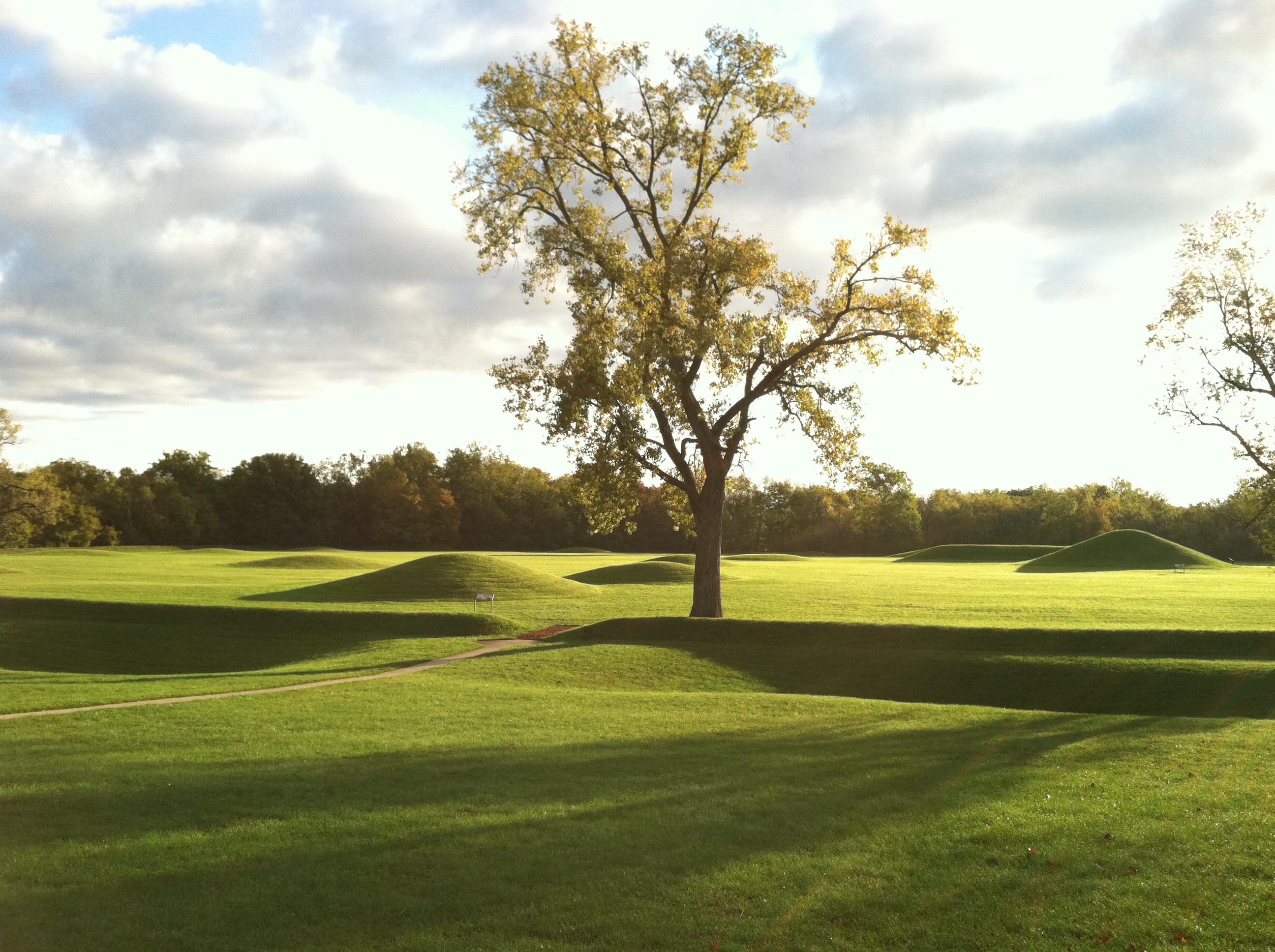
Hopewell Culture National Historical Park
National Historical Park
Nearly 2000 years ago, Native Americans built dozens of monumental mounds and earthen enclosures in southern Ohio. These earthwork complexes were ceremonial landscapes used for feasts, funerals, ritua...
18 mi from route
~44 min detour
Free
near mile 91.7
Caution: Hopeton Earthworks Closed for Construction Until May 2026
Park data from the National Park Service API. Alerts update every 2 hours.
Fuel & Cost
Regular Gas
$22.92 one way
$45.85 round trip
$3.94/gal25.4 MPG avg52 kg CO2
Fuel Type
$/gal
One Way
Round Trip
midgrade
$4.38
$25.44
$50.88
premium
$4.91
$28.55
$57.09
diesel
$5.61
$32.61
$65.22
No toll roads detected on this route.
Estimated Trip Cost (one way, 1 person)
Fuel
$23
Meals
$25–$50
Total
$48–$73
Rough estimate based on US averages. Hotel $80–$140/night, meals $25–$50/day.
Estimated CO2 emission: 51.7 kg one way.
Prices: EIA weekly data, 2026-04-13.
Driving Electric?
About $16 in charging
· 0 stops
· 67% less CO2
Vehicle Type
kWh
Stops
DC Fast
Home Charge
Average EV
44.3
0
$15.51
$7.09
Efficient EV
36.9
0
$12.92
$5.91
EV Truck/SUV
59.1
0
$20.68
$9.45
Gas CO2
52 kg
EV CO2
17 kg (67% less)
This trip is well within single-charge range for most EVs. No charging stops needed if you start fully charged.
DC fast charging avg $0.35/kWh. Home charging avg $0.16/kWh. US grid CO2: 0.39 kg/kWh.
Travel Intel
Current conditions at both ends of the drive.
Forecast data refreshed 3 hours ago
Origin
Cincinnati, OH
Night
in Cincinnati on Tuesday
Local time
10:39 PM
EDT
Current temp
69°F
Unavailable
Live forecast
Destination
Spring Valley, OH
Night
in Spring Valley on Tuesday
Local time
10:39 PM
EDT
Current temp
65°F
Slight Chance Rain Showers then Partly Cloudy
SW 7 to 14 mph19% chanceLive forecast
Severe Thunderstorm Watch
Severe Thunderstorm Watch issued April 14 at 6:41PM EDT until April 14 at 11:00PM EDT by NWS Northern Indiana
Severe Thunderstorm Warning
Severe Thunderstorm Warning issued April 14 at 6:34PM EDT until April 14 at 7:00PM EDT by NWS Northern Indiana
Seasonal Notes
Summer travel usually means heavier construction, hotter rest stops, and busier weekend traffic around major cities.
Winter travel shortens daylight, so a route that looks manageable on paper can feel much longer after dark.
Holiday weekends tend to make both departure and arrival windows slower than the raw route time suggests.
Time zone
Same local time
Origin and destination are on the same clock, so arrival timing is easier to judge at a glance.
Temperature spread
4 degrees cooler at arrival
A meaningful temperature swing is a good cue to rethink layers, water, and how soon you want to arrive.
Road read
3h 4m on the road
The weather snapshot is not static. If you are leaving later, give both cities one more quick forecast check before departure.
Weather data from the National Weather Service. Conditions may change; check closer to your travel date.
Frequently Asked Questions
The drive from Cincinnati, OH to Spring Valley, OH covers 147.7 miles and takes about 3h 4m without stops. Add 15-30 minutes for a fuel or rest stop on longer drives.
The main roads are James A. Rhodes Appalachian Highway, US 35, Circle Freeway. Expect a mix of highway and local road driving.
This is a comfortable same-day trip.
The midpoint is about 73.9 miles from Cincinnati, OH. Look for rest areas, gas stations, or food options near the halfway mark.
At current regular gas prices, expect to spend about $22.92 one way. This estimate uses 25.4 MPG — your actual cost will vary with your vehicle's fuel efficiency and current gas prices.
An early start around 7-8 AM gets you there with plenty of daylight left. A late afternoon start means arriving after dark. Morning is better.
Plan about 1 meaningful break for fuel, food, or rest. A short stop every 2 to 3 hours is enough for this drive.
This is a demanding drive. With 20 significant decision points across 147.7 miles, you will need to stay alert — especially through interchange areas and urban stretches. Consider splitting it into segments if you are not comfortable with fast highway navigation.
The main spots that need attention: at 1.8 miles: Lane positioning matters here; at 7.4 miles: Exit ramp - move to the correct lane early. Lane positioning matters here. Multiple destination signs - pick the right one; at 19.1 miles: Exit ramp - move to the correct lane early. Lane positioning matters here. Multiple destination signs - pick the right one.
Between Cincinnati, OH and Spring Valley, OH, road signs point toward Ohio, Batavia, Newtown and Chillicothe.