The drive from Clifton, CO to Westminster, CO covers 239.6 miles and takes about 4h 33m behind the wheel.
This route is realistic as a one-day drive if you keep your stops efficient.
The route leans on I 70 BUS, Sheridan Boulevard, Heartland Expressway for much of the mileage,
and the overall profile is highway-focused drive.
The longest uninterrupted segment is about 234.1 miles on I 70 BUS.
At current regular gas prices, budget about $36.10 one way before food or hotel costs.
Trip Pace
Same-day drive is realistic
A same-day return is possible, but it will make for a full day on the road.
Break Rhythm
1 planned break
Plan on a short reset every 3 to 4 hours to stay fresh behind the wheel.
Midpoint
119.8 miles from Clifton, CO
A natural place for your longest stop of the day
, about 2h 15m into the drive
.
Who Is This Route For?
Weekend Trip
Doable as a same-day drive at 4h 33m. Total distance: 239.6 miles.
Family Friendly
Moderate complexity with 1 natural rest stops along the way.
Solo Traveler
4h 33m drive, comfortable solo distance.
First-Time Driver
Mostly highway driving (98%). Some complex stretches to watch for.
Drive Character
This is a 4h 33m highway drive covering 239.6 miles, with most of the trip on I 70 BUS and Sheridan Boulevard. The longest continuous stretch is about 234.1 miles on I 70 BUS.
Most of the miles stay on highways, which makes pacing and fuel planning easier than turn-by-turn city driving.
There are about 11 navigation steps in the underlying route data, so the final approach matters more than the middle miles.
I 70 BUS is the longest continuous segment at about 234.1 miles.
Elevation Profile
Mountain driving with significant elevation changes
10,477 ft4,720 ft
Total Climb
6,483 ft
Total Descent
5,823 ft
Highest Point
10,477 ft
~154 mi in
Elevation Range
5,757 ft
Notable High Points
10,477 ft at ~154 miles+1,631 ft prominence
9,572 ft at ~188.3 miles+726 ft prominence
How Hard Is This Drive?
This is a straightforward highway drive that stays mostly on I 70 BUS and Sheridan Boulevard. You will hit about 8 points where you need to pay attention to lane position or signs. The trickiest moment comes around 0.1 miles in near US 6 / F Road.
Driving Effort5/10
Moderate - straightforward overall, but long enough or busy enough to require pacing
Balances navigation complexity with total wheel time.
This drive requires moderate attention. Across 239.6 miles you will encounter 8 spots where lane choice or exit timing matters. Not difficult for experienced highway drivers, but worth previewing the tricky sections before you go.
Where does it get tricky?
The main spots that need attention: at 0.1 miles (US 6 / F Road): Roundabout - know your exit number before entering; at 0.9 miles (I 70 BUS): Highway fork - watch signs carefully. Lane positioning matters here; at 234.3 miles (I 76 / Heartland Expressway): Highway fork - watch signs carefully. Lane positioning matters here.
Critical Maneuvers
5 of 8 key points
These are the spots where you need to pay the most attention. Preview them before you drive.
5
0.1 mi into trip|~0m in|US 6 / F Road
Enter roundabout onto US 6 / F Road
Roundabout - know your exit number before entering
7
0.9 mi into trip|~1m in|I 70 BUS
Keep slight right at fork onto I 70 BUS toward I 70 East: Denver
Highway fork - watch signs carefully. Lane positioning matters here
Use the slight right lane.
Toward I 70 East: Denver
8
234.3 mi into trip|~4h 23m in|I 76 / Heartland Expressway
Keep slight left at fork onto I 76 / Heartland Expressway toward I 76 East: Fort Morgan
Highway fork - watch signs carefully. Lane positioning matters here
Use the left lane.
Exit 269B
Toward I 76 East: Fort Morgan
7
235.6 mi into trip|~4h 25m in
Take the exit toward CO 95: Sheridan Boulevard
Exit ramp - move to the correct lane early. Lane positioning matters here
Use the straight / slight right lanes.
Exit 1B
Toward CO 95: Sheridan Boulevard
4
235.9 mi into trip|~4h 26m in|CO 95 / Sheridan Boulevard
Turn left onto CO 95 / Sheridan Boulevard
Lane positioning matters here
Use the left / straight lanes.
Main Roads
Road
Distance
Duration
I 70 BUS
234.1 mi
4h 23m
Sheridan Boulevard
2.7 mi
4m
Heartland Expressway
1.3 mi
1m
West 76th Avenue
0.8 mi
2m
F Road
0.2 mi
<1m
Newton Street
0.1 mi
<1m
Longest stretch:
I 70 BUS
— 234.1 mi, about 4h 23m
Turn-by-Turn Driving Directions
Step-by-step road directions between Clifton, CO and Westminster, CO.
1
Start on US 6
355 ft·10 sec·F Road
2
Enter roundabout onto US 6
78 ft·1 sec·F Road
3
Continue on US 6
0.1 mi·18 sec·F Road
4
Turn sharp right onto I 70 BUS
0.7 mi·1 min·I 70 BUS
5
Keep slight right at fork onto I 70 BUS
233 mi·4 hr 22 min·I 70 BUS
Toward I 70 East: DenverUse the slight right lane.
6
Keep slight left at fork onto I 76
1.3 mi·1 min·Heartland Expressway
Exit 269BToward I 76 East: Fort MorganUse the left lane.
7
Take the exit
0.3 mi·40 sec
Exit 1BToward CO 95: Sheridan BoulevardUse the straight / slight right lanes.
8
Turn left onto CO 95
2.7 mi·4 min·Sheridan Boulevard
Use the left / straight lanes.
9
Turn right onto West 76th Avenue
0.8 mi·2 min·West 76th Avenue
10
Turn left onto Newton Street
0.1 mi·33 sec·Newton Street
11
Arrive at destination
Newton Street
Trip Plan
Morning Departure
An early start around 7-8 AM gets you there with plenty of daylight left.
Evening Departure
A late afternoon start means arriving after dark. Morning is better.
You can normally do this drive in one day.
Plan roughly 1 meaningful break for fuel, food, and rest.
The halfway point lands around 119.8 miles from Clifton, CO, or about 2h 15m into the drive.
The longest continuous stretch on this route runs about 234.1 miles.
This is a comfortable same-day trip.
Departure
Before you leave
Start with fuel, water, and navigation already sorted so the first hour feels easy.
First stop
Around 53 miles or 1h in
Use this first pause for coffee, a restroom break, and a quick traffic check ahead.
Halfway reset
Around 119.8 miles or 2h 15m in
This is the best place for your longest stop, a real meal, and a full fuel check.
Final approach
Final hour starts around 3h 41m
Traffic, exits, and arrival timing usually matter more near Westminster, CO than in the middle of the route.
Before You Leave
+
Open the route before leaving Clifton, CO so your first major turns are already loaded.
+
Leave with enough water and a charging cable within reach, not packed away.
+
Check your fuel range against the first long segment, especially if you are starting outside city service areas.
Day 1
Settle into the route from Clifton, CO
This is one driving day of about 239.6 miles and 4h 33m.
Your first comfortable stop window is around 53 miles from Clifton, CO.
This route can stay practical as a one-day drive if traffic stays reasonable.
Plan about 1 real break rather than only quick fuel stops.
The longest stretch is on I 70 BUS for about 234.1 miles.
Where to Stop
Rest stops, refuel points, and overnight suggestions along this route.
Halfway Point
Midpoint
About 119.8 mi from Clifton, CO
· 2h 15m into the drive
The midpoint is around 119.8 miles from Clifton, CO, which is a good place for a longer meal and fuel stop.
Before the longest stretch
Fuel check
Top up before I 70 BUS if your tank is already low. That segment runs about 234.1 miles.
Arriving in Westminster, CO
The final approach into Westminster, CO usually feels slower than the middle of the drive, so avoid planning your tightest schedule at the very end.
Try to arrive with enough fuel left to skip an immediate station stop unless you already know the area around Westminster, CO.
After long uninterrupted mileage, take five minutes before the last urban segment to reset and refocus on exits, merges, and city traffic.
These stop ideas are pacing suggestions — the exact town or exit can change with traffic, hotel plans, and fuel range.
National Parks Near This Route
Worth a detour if your schedule allows.
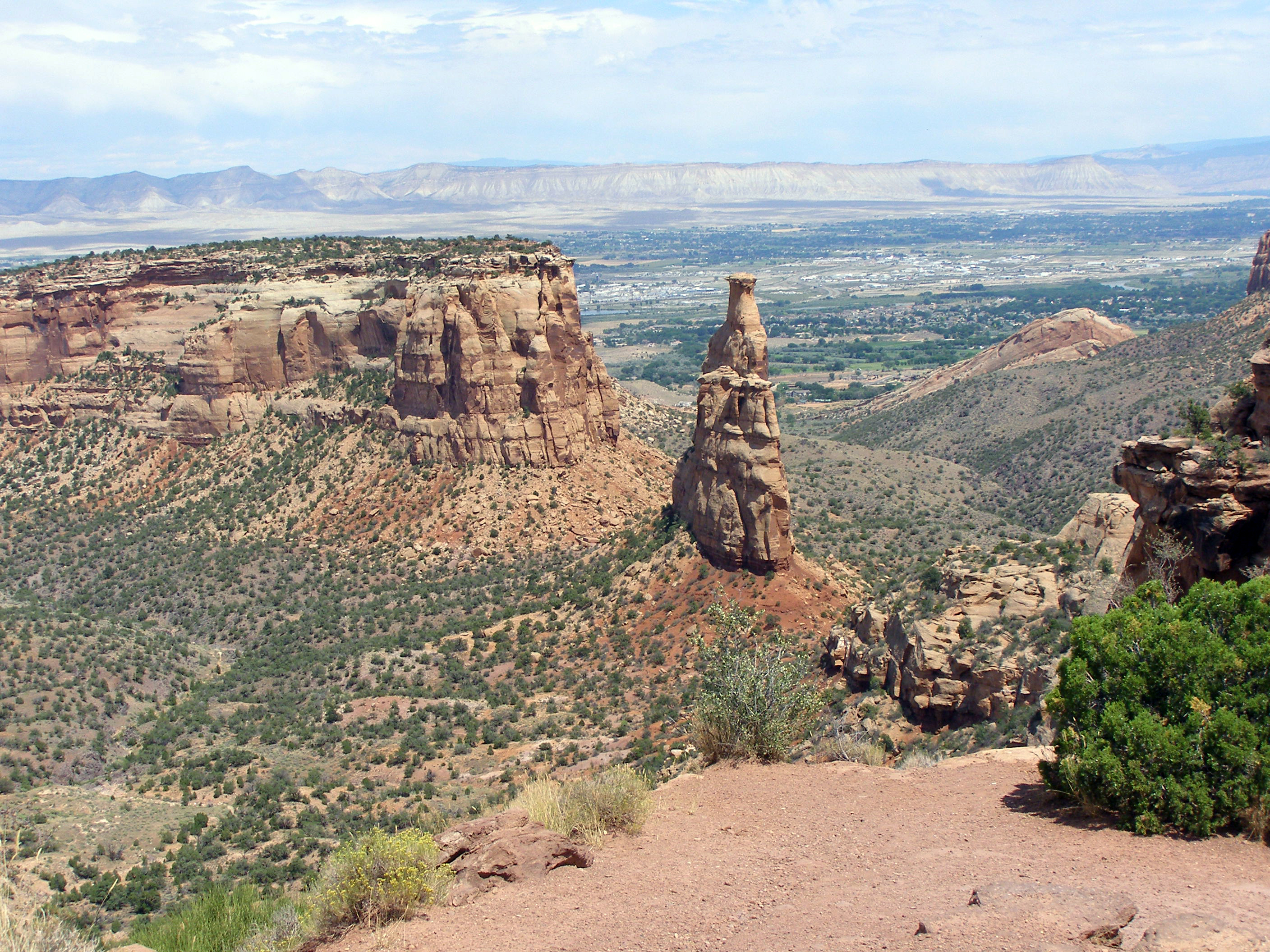
Colorado National Monument
National Monument
Colorado National Monument preserves one of the grand landscapes of the American West. But this treasure is much more than a monument. Towering monoliths exist within a vast plateau and canyon panoram...
Park data from the National Park Service API. Alerts update every 2 hours.
Fuel & Cost
Regular Gas
$36.10 one way
$72.20 round trip
$3.83/gal25.4 MPG avg84 kg CO2
Fuel Type
$/gal
One Way
Round Trip
midgrade
$4.05
$38.22
$76.45
premium
$4.39
$41.45
$82.90
diesel
$5.61
$52.90
$105.80
No toll roads detected on this route.
Estimated Trip Cost (one way, 1 person)
Fuel
$36
Meals
$25–$50
Total
$61–$86
Rough estimate based on US averages. Hotel $80–$140/night, meals $25–$50/day.
Estimated CO2 emission: 83.8 kg one way.
Prices: EIA weekly data, 2026-04-13.
Driving Electric?
About $25 in charging
· 0 stops
· 67% less CO2
Vehicle Type
kWh
Stops
DC Fast
Home Charge
Average EV
71.9
0
$25.16
$11.50
Efficient EV
59.9
0
$20.97
$9.58
EV Truck/SUV
95.8
1
$33.54
$15.33
Gas CO2
84 kg
EV CO2
28 kg (67% less)
Plan for 0 charging stops, roughly every 270 miles. Allow 25-40 minutes per stop at a DC fast charger.
DC fast charging avg $0.35/kWh. Home charging avg $0.16/kWh. US grid CO2: 0.39 kg/kWh.
Travel Intel
Current conditions at both ends of the drive.
Forecast as of Apr 13, 2026
Origin
Clifton, CO
Late night
in Clifton on Friday
Local time
2:45 AM
MDT
Current temp
44°F
Mostly Clear
SSW 10 to 15 mph6% chanceLive forecast
Red Flag Warning
Red Flag Warning issued April 13 at 12:18AM MDT until April 13 at 9:00PM MDT by NWS Pueblo CO
Red Flag Warning
Red Flag Warning issued April 13 at 12:18AM MDT until April 13 at 9:00PM MDT by NWS Pueblo CO
Destination
Westminster, CO
Late night
in Westminster on Friday
Local time
2:45 AM
MDT
Current temp
47°F
Partly Cloudy
SW 6 to 9 mph3% chanceLive forecast
Red Flag Warning
Red Flag Warning issued April 13 at 12:18AM MDT until April 13 at 9:00PM MDT by NWS Pueblo CO
Red Flag Warning
Red Flag Warning issued April 13 at 12:18AM MDT until April 13 at 9:00PM MDT by NWS Pueblo CO
35°F
Avon, CO
120 mi in
Seasonal Notes
Summer travel usually means heavier construction, hotter rest stops, and busier weekend traffic around major cities.
Winter travel shortens daylight, so a route that looks manageable on paper can feel much longer after dark.
Holiday weekends tend to make both departure and arrival windows slower than the raw route time suggests.
Time zone
Same local time
Origin and destination are on the same clock, so arrival timing is easier to judge at a glance.
Temperature spread
3 degrees warmer at arrival
A meaningful temperature swing is a good cue to rethink layers, water, and how soon you want to arrive.
Road read
4h 33m on the road
An early start around 7-8 AM gets you there with plenty of daylight left.
Weather data from the National Weather Service. Conditions may change; check closer to your travel date.
Frequently Asked Questions
The drive from Clifton, CO to Westminster, CO covers 239.6 miles and takes about 4h 33m without stops. Add 15-30 minutes for a fuel or rest stop on longer drives.
The main roads are I 70 BUS, Sheridan Boulevard, Heartland Expressway. Most of the drive stays on highways, so watch for ramps and exits.
This is a comfortable same-day trip.
The midpoint is about 119.8 miles from Clifton, CO. Look for rest areas, gas stations, or food options near the halfway mark.
At current regular gas prices, expect to spend about $36.10 one way. This estimate uses 25.4 MPG — your actual cost will vary with your vehicle's fuel efficiency and current gas prices.
An early start around 7-8 AM gets you there with plenty of daylight left. A late afternoon start means arriving after dark. Morning is better.
Plan about 1 meaningful break for fuel, food, or rest. Plan on a short reset every 3 to 4 hours to stay fresh behind the wheel.
This drive requires moderate attention. Across 239.6 miles you will encounter 8 spots where lane choice or exit timing matters. Not difficult for experienced highway drivers, but worth previewing the tricky sections before you go.
The main spots that need attention: at 0.1 miles (US 6 / F Road): Roundabout - know your exit number before entering; at 0.9 miles (I 70 BUS): Highway fork - watch signs carefully. Lane positioning matters here; at 234.3 miles (I 76 / Heartland Expressway): Highway fork - watch signs carefully. Lane positioning matters here.
The route from Clifton, CO to Westminster, CO does not surface many named destination signs beyond the main corridor.
Mountain driving with significant elevation changes. The route ranges from 4,720 ft to 10,477 ft elevation with about 6,483 ft of total climbing. There are 2 notable high points along the way.
Yes. Nearby national parks include Colorado National Monument.
How this page is built
Compiled and maintained by the Trip.ovh planning team at COD Solutions Oy (Helsinki). Each route is built from authoritative open government and mapping datasets rather than crowdsourced reviews. Distances and geometry come from
OSRM
over
OpenStreetMap.
Fuel cost uses
EIA
weekly regional averages.
Elevation is sampled from
USGS 3DEP.
National park proximity is from the
NPS API.
Pages are published only after passing our data-quality checks; our
methodology page
documents refresh cadence, editorial standards, and known limitations.