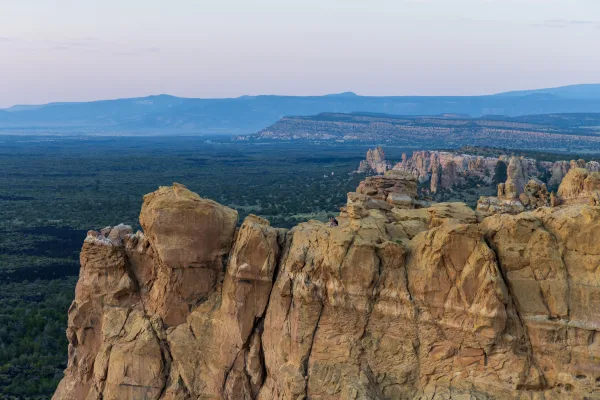
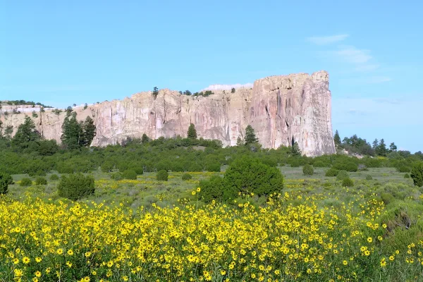
El Morro National Monument
National Monument
Imagine the refreshment of finding water after days of dusty travel. A reliable waterhole hidden at the base of a sandstone bluff made El Morro (the headland) a popular campsite for hundreds of years....
Last recalculated Apr 16, 2026
Drive Time
7h 3m
Distance
368 mi
592 km
Drive Score
8/10
Great drive
Same Day?
Yes, doable
Fuel Cost
$56
one way
EV Charging
Unknown
Estimated drive times based on typical traffic patterns. Actual times may vary with weather, construction, and real-time conditions.
Clovis, NM
Wikimedia Commons
Black Rock, NM
Dexter Fernandes
The drive from Clovis, NM to Black Rock, NM covers 368 miles and takes about 7h 3m behind the wheel. This route is realistic as a one-day drive if you keep your stops efficient.
The route leans on I 40, US 60, US Highway 84 for much of the mileage, and the overall profile is highway-focused drive. The longest uninterrupted segment is about 194.3 miles on I 40. At current regular gas prices, budget about $55.58 one way before food or hotel costs.
Trip Pace
Same-day drive is realistic
A same-day return is possible, but it will make for a full day on the road.
Break Rhythm
2 planned breaks
Plan on a short reset every 3 to 4 hours to stay fresh behind the wheel.
Midpoint
184 miles from Clovis, NM
A natural place for your longest stop of the day , about 3h 24m into the drive .
Weekend Trip
Doable as a same-day drive at 7h 3m. Total distance: 368 miles.
Family Friendly
Moderate complexity with 2 natural rest stops along the way.
Solo Traveler
7h 3m drive, plan rest stops for pacing.
First-Time Driver
Mostly highway driving (92%). Straightforward navigation.
This is a 7h 3m highway drive covering 368 miles, with most of the trip on I 40 and US 60. The longest continuous stretch is about 194.3 miles on I 40.
This is a straightforward highway drive that stays mostly on I 40 and US 60. There are only a few real navigation decisions along the way. The trickiest moment comes around 102.3 miles in.
Easy - simple navigation with a manageable amount of wheel time
Balances navigation complexity with total wheel time.
The route itself is not hard, but at 7h 3m, endurance matters. Plan breaks every 2-3 hours. The 10 decision points are all manageable with basic attention.
Where does it get tricky?
The main spots that need attention: at 102.3 miles: Navigation decision point; at 102.6 miles (I 40): Merge point - match speed before joining. Lane positioning matters here; at 296.8 miles: Exit ramp - move to the correct lane early. Multiple destination signs - pick the right one.
These are the spots where you need to pay the most attention. Preview them before you drive.
Turn left toward I 40 West
Navigation decision point
Merge onto I 40
Merge point - match speed before joining. Lane positioning matters here
Take the exit toward I 40, NM 53, NM122: Grants, San Rafael
Exit ramp - move to the correct lane early. Multiple destination signs - pick the right one
Keep slight left at fork
Highway fork - watch signs carefully
Turn left onto 6th Street
Navigation decision point
Based on OSRM destination-sign hints, not a full list of every settlement the road passes.
On the drive from Clovis, NM to Black Rock, NM, road signs begin pointing toward San Rafael along the way.
San Rafael
| Road | Distance | Duration |
|---|---|---|
| I 40 | 194.3 mi | 3h 19m |
| US 60 | 58.1 mi | 1h 8m |
| US Highway 84 | 41.1 mi | 46m |
| Ice Caves Rd. - NM53 | 25 mi | 34m |
| Ice Caves Road | 17.3 mi | 21m |
| Highway 53 - NM53 | 11.6 mi | 15m |
| San Rafael Road | 9.3 mi | 12m |
| NM 53 | 5.4 mi | 13m |
Step-by-step road directions between Clovis, NM and Black Rock, NM.
Start on North Main Street
Turn right onto West 7th Street
Turn right onto US 60; US 84
Turn right onto US 84
Continue on US 84
Continue on US 84
Turn left
Merge onto I 40
Take the exit
Keep slight left at fork
Turn left onto NM 53
Continue on NM 53
Continue on NM 53
Continue on NM 53
Continue on NM 53
Continue on NM 53
Continue on NM 53
Turn right onto Route 301 East
Turn right onto B Avenue
Turn left onto 6th Street
Arrive at destination
Morning Departure
Start early — leave by 6-7 AM to arrive at a reasonable hour.
Evening Departure
This is a long drive — plan for a morning departure or consider splitting it into two days.
This is a comfortable same-day trip.
Departure
Before you leave
Start with fuel, water, and navigation already sorted so the first hour feels easy.
First stop
Around 81 miles or 1h 36m in
Use this first pause for coffee, a restroom break, and a quick traffic check ahead.
Halfway reset
Around 184 miles or 3h 24m in
This is the best place for your longest stop, a real meal, and a full fuel check.
Final approach
Final hour starts around 5h 35m
Traffic, exits, and arrival timing usually matter more near Black Rock, NM than in the middle of the route.
Open the route before leaving Clovis, NM so your first major turns are already loaded.
Leave with enough water and a charging cable within reach, not packed away.
Check your fuel range against the first long segment, especially if you are starting outside city service areas.
Pick one backup stop option before the midpoint in case traffic changes your pacing.
Day 1
Settle into the route from Clovis, NM
This is one driving day of about 368 miles and 7h 3m.
Rest stops, refuel points, and overnight suggestions along this route.
Halfway Point
Midpoint
About 184 mi from Clovis, NM · 3h 24m into the drive
Mid-route town
Meal stop
184 mi into the route
Best for: Lunch, fuel, and a longer reset
This sits close to the middle of the route, so it works well for the longest stop of the day.
A short stop after about 81 miles helps settle the day before fatigue starts building.
The midpoint is around 184 miles from Clovis, NM, which is a good place for a longer meal and fuel stop.
The final approach into Black Rock, NM usually feels slower than the middle of the drive, so avoid planning your tightest schedule at the very end.
Try to arrive with enough fuel left to skip an immediate station stop unless you already know the area around Black Rock, NM.
After long uninterrupted mileage, take five minutes before the last urban segment to reset and refocus on exits, merges, and city traffic.
These stop ideas are pacing suggestions — the exact town or exit can change with traffic, hotel plans, and fuel range.
Worth a detour if your schedule allows.
National Monument
Imagine the refreshment of finding water after days of dusty travel. A reliable waterhole hidden at the base of a sandstone bluff made El Morro (the headland) a popular campsite for hundreds of years....
National Monument
Petroglyph National Monument protects one of the largest petroglyph sites in North America, featuring designs and symbols carved onto volcanic rocks by Native Americans and Spanish settlers 400 to 700...
National Monument
The richly diverse volcanic landscape of El Malpais (el-mal-pie-EES) offers solitude, recreation, and adventure. Explore incredible geologic features such as young lava flows, cinder cones, lava tubes...
Park data from the National Park Service API. Alerts update every 2 hours.
Regular Gas
$55.58 one way
$111.15 round trip
| Fuel Type | $/gal | One Way | Round Trip |
|---|---|---|---|
| midgrade | $4.21 | $61.01 | $122.02 |
| premium | $4.56 | $66.05 | $132.10 |
| diesel | $5.61 | $81.25 | $162.50 |
No toll roads detected on this route.
Estimated Trip Cost (one way, 1 person)
Fuel
$56
Meals
$25–$50
Total
$81–$106
Rough estimate based on US averages. Hotel $80–$140/night, meals $25–$50/day.
Estimated CO2 emission: 128.8 kg one way. Prices: EIA weekly data, 2026-04-13.
Driving Electric?
About $39 in charging · 1 stop · 67% less CO2
| Vehicle Type | kWh | Stops | DC Fast | Home Charge |
|---|---|---|---|---|
| Average EV | 110.4 | 1 | $38.64 | $17.66 |
| Efficient EV | 92 | 1 | $32.20 | $14.72 |
| EV Truck/SUV | 147.2 | 1 | $51.52 | $23.55 |
Gas CO2
129 kg
EV CO2
43 kg (67% less)
Plan for 1 charging stop. A 30-minute DC fast charge mid-route should be enough to complete the trip comfortably.
DC fast charging avg $0.35/kWh. Home charging avg $0.16/kWh. US grid CO2: 0.39 kg/kWh.
Current conditions at both ends of the drive.
Origin
Afternoon in Clovis on Thursday
Local time
1:31 PM
MDT
Current temp
83°F
Unavailable
Destination
Afternoon in Black Rock on Thursday
Local time
1:31 PM
MDT
Current temp
43°F
Unavailable
Seasonal Notes
Summer travel usually means heavier construction, hotter rest stops, and busier weekend traffic around major cities.
Winter travel shortens daylight, so a route that looks manageable on paper can feel much longer after dark.
Holiday weekends tend to make both departure and arrival windows slower than the raw route time suggests.
Time zone
Origin and destination are on the same clock, so arrival timing is easier to judge at a glance.
Temperature spread
A meaningful temperature swing is a good cue to rethink layers, water, and how soon you want to arrive.
Road read
Start early — leave by 6-7 AM to arrive at a reasonable hour.
Weather data from the National Weather Service. Conditions may change; check closer to your travel date.
Was this helpful?
Thanks for your feedback!
Your tip has been submitted. Thanks!
/500
Recent Tips
·
Explore more options from Clovis, NM or browse trips ending in Black Rock, NM.
Looking for more statewide routes? Browse NM road trips.
Explore maps for Clovis, NM or Black Rock, NM on MapSof.net.