
Trip from Coeburn, VA to East Hampton, VA

Data updated 1 hour ago

Drive Time

8h 9m

Distance

427.2 mi

688 km

Drive Score

7/10

Good drive

Same Day?

2-day trip

Fuel Cost

$67

one way

EV Charging

Excellent

32 DC fast

Best Time to Leave

Save up to 25 min
4 AM
8h 1m ★
6 AM
8h 9m
8 AM
8h 26m
10 AM
8h 15m
12 PM
8h 14m
3 PM
8h 16m
5 PM
8h 25m
8 PM
8h 5m

Estimated drive times based on typical traffic patterns. Actual times may vary with weather, construction, and real-time conditions.

Downtown Coeburn, VA, VA

Coeburn, VA

Vladislav Nahorny

Downtown East Hampton, VA, VA

East Hampton, VA

Sarah O'Shea

Trip Overview

Embarking from Coeburn, Virginia, this 427.2-mile journey to East Hampton, Virginia, is best tackled over two days. With an estimated driving time of 8 hours and 9 minutes, it's a substantial trip that benefits from an overnight stop. The primary arteries for this drive are I-81, I-64, and the Korean War Veterans Memorial Highway, making it a largely highway-focused experience. Expect your fuel costs to be around $67 for this Southeast Virginia to Southeast Virginia excursion. This route offers a practical way to traverse the state, with two planned stops to break up the nearly 200 miles you'll cover on I-81.

Trip Pace

Best split across 2 days

Treat the return leg as its own travel day rather than an afterthought.

Break Rhythm

2 planned breaks

Plan on a short reset every 3 to 4 hours to stay fresh behind the wheel.

Midpoint

213.6 miles from Coeburn, VA

A natural place for your longest stop of the day , about 4h 9m into the drive .

Loading map...

Drive Character

This route is predominantly a highway-focused drive, with 89% of the journey taking place on major interstates. You'll experience long, uninterrupted stretches, including the longest single segment of 196.9 miles on I-81. While the majority of the drive is on high-speed highways, the transition onto I-64 and the Korean War Veterans Memorial Highway will still maintain a consistent pace. Expect a driving experience characterized by efficient travel rather than winding scenic byways.

Most of the miles stay on highways, which makes pacing and fuel planning easier than turn-by-turn city driving.
There are about 27 navigation steps in the underlying route data, so the final approach matters more than the middle miles.
I 81 is the longest continuous segment at about 196.9 miles.

How Hard Is This Drive?

This is a straightforward highway drive that stays mostly on I 81 and I 64. This route has several spots where lane changes, forks, or exits need your full attention. The trickiest moment comes around 105.9 miles in near I 81; US 11.

Route Complexity 9/10

High effort - long or complex enough to need steady focus all day

This is a demanding drive. With 17 significant decision points across 427.2 miles, you will need to stay alert — especially through interchange areas and urban stretches. Consider splitting it into segments if you are not comfortable with fast highway navigation.

Where does it get tricky?

The main spots that need attention: at 105.9 miles (I 81; US 11): Highway fork - watch signs carefully. Lane positioning matters here. Multiple destination signs - pick the right one; at 335.9 miles: Exit ramp - move to the correct lane early. Lane positioning matters here. Multiple destination signs - pick the right one; at 360 miles: Exit ramp - move to the correct lane early. Lane positioning matters here. Multiple destination signs - pick the right one.

Critical Maneuvers

5 of 17 key points

These are the spots where you need to pay the most attention. Preview them before you drive.

8
105.9 mi into trip | ~2h 10m in | I 81; US 11

Keep slight left at fork onto I 81; US 11 toward I 81 North, US 11 North: Roanoke

Highway fork - watch signs carefully. Lane positioning matters here. Multiple destination signs - pick the right one

Use the straight lane. Toward I 81 North, US 11 North: Roanoke
8
335.9 mi into trip | ~6h 23m in

Take the exit toward I 295 North: Washington, Norfolk

Exit ramp - move to the correct lane early. Lane positioning matters here. Multiple destination signs - pick the right one

Use the slight right lane. Exit 177 Toward I 295 North: Washington, Norfolk
8
360 mi into trip | ~6h 49m in

Take the exit toward I 64 East: Norfolk, Virginia Beach

Exit ramp - move to the correct lane early. Lane positioning matters here. Multiple destination signs - pick the right one

Use the straight / slight right lanes. Exit 28A Toward I 64 East: Norfolk, Virginia Beach
8
422.6 mi into trip | ~8h in | VA 134

Take the exit onto VA 134 toward US 258 South, US 258 North, VA 134 South: Mercury Boulevard, James River Bridge, Coliseum

Exit ramp - move to the correct lane early. Lane positioning matters here. Multiple destination signs - pick the right one

Use the straight / slight right lanes. Exit 263 Toward US 258 South, US 258 North, VA 134 South...
8
422.8 mi into trip | ~8h 1m in | VA 134

Keep slight right at fork onto VA 134 toward US 258 North, VA 134 South: Mercury Boulevard, Coliseum

Highway fork - watch signs carefully. Lane positioning matters here. Multiple destination signs - pick the right one

Use the slight right lane. Toward US 258 North, VA 134 South: Mercury Boul...

Towns Mentioned on Route Signs

Based on OSRM destination-sign hints, not a full list of every settlement the road passes.

Between Coeburn, VA and East Hampton, VA, road signs point toward Norfolk and Virginia Beach.

Norfolk

335.9 mi in | ~6h 23m

Virginia Beach

360 mi in | ~6h 49m

Main Roads

Road Distance Duration
I 81 196.9 mi 3h 35m
I 64 151.7 mi 2h 46m
Korean War Veterans Memorial Highway 22.9 mi 25m
US 19 12.7 mi 18m
Bull Run Road 11.2 mi 15m
Trail of the Lonesome Pine 7.9 mi 10m
I 77 7.1 mi 7m
US Highway 58 Alternate 6.9 mi 9m
Longest stretch: I 81 — 196.9 mi, about 3h 35m

Turn-by-Turn Driving Directions

Step-by-step road directions between Coeburn, VA and East Hampton, VA.

1

Start on this road

86 ft · 8 sec · this road
2

Turn right onto 2nd Street Northeast

0.4 mi · 55 sec · 2nd Street Northeast
3

Continue on VA 72

0.2 mi · 23 sec · VA 72
4

Turn left

0.2 mi · 24 sec
Toward US 58 Alternate East
5

Merge onto US 58 ALT

11 mi · 15 min · Bull Run Road
6

Continue on US 58 ALT

365 ft · 6 sec · Trail of the Lonesome Pine
7

Continue on US 58 ALT

6.9 mi · 9 min · US Highway 58 Alternate
8

Continue on US 58 ALT; VA 71

7.8 mi · 10 min · Trail of the Lonesome Pine
9

Turn right onto US 19

13 mi · 18 min · US 19
10

Turn left onto US 11

0.5 mi · 1 min · West Main Street
11

Turn right onto Preston Street Southwest

0.2 mi · 33 sec · Preston Street Southwest
12

At end of road, turn left onto Bradley Street Southwest

0.5 mi · 1 min · Bradley Street Southwest
13

At end of road, turn right onto US 58 ALT; VA 75

0.6 mi · 1 min · Cummings Street
Use the straight lane.
14

Take the exit

0.2 mi · 31 sec
15

Merge onto I 81; US 58

57 mi · 1 hr 1 min · I 81; US 58
Use the straight lane.
16

Continue on I 77; I 81; US 11; US 52

7.1 mi · 7 min · I 77; I 81; US 11; US 52
17

Keep slight left at fork onto I 81; US 11

140 mi · 2 hr 33 min · I 81; US 11
Toward I 81 North, US 11 North: Roanoke Use the straight lane.
18

Continue on I 64; I 81

0.3 mi · 17 sec · I 64; I 81
19

Keep slight right at fork onto I 64

90 mi · 1 hr 38 min · I 64
Toward I 64 East: Richmond Use the straight lane.
20

Take the exit

1.2 mi · 1 min
Exit 177 Toward I 295 North: Washington, Norfolk Use the slight right lane.
21

Continue on I 295

23 mi · 25 min · Korean War Veterans Memorial Highway
Use the straight / slight right lanes.
22

Take the exit

1.3 mi · 2 min
Exit 28A Toward I 64 East: Norfolk, Virginia Beach Use the straight / slight right lanes.
23

Merge onto I 64

61 mi · 1 hr 7 min · I 64
Use the straight / slight right lanes.
24

Take the exit onto VA 134

0.2 mi · 28 sec · VA 134
Exit 263 Toward US 258 South, US 258 North, VA 134 South: Mercury Boulevard, James River Bridge, Coliseum Use the straight / slight right lanes.
25

Keep slight right at fork onto VA 134

4.2 mi · 7 min · VA 134
Toward US 258 North, VA 134 South: Mercury Boulevard, Coliseum Use the slight right lane.
26

Turn right onto Southerland Drive

0.2 mi · 46 sec · Southerland Drive
27

Arrive at destination

Southerland Drive

Trip Plan

To make the most of this 8-hour, 9-minute drive, consider starting early to maximize daylight. Since this trip is recommended for two days, planning your overnight stop strategically will be key. You'll have two designated stops along the way, and it's wise to fuel up before embarking on the longest stretch of 196.9 miles on I-81, as services can be more spread out on interstates. Keep an eye on your fuel gauge, especially as you approach the latter half of your journey, to ensure a smooth arrival in East Hampton.

Morning Departure

Start early — leave by 6-7 AM to arrive at a reasonable hour.

Evening Departure

This is a long drive — plan for a morning departure or consider splitting it into two days.

This drive is better paced as a 2-day trip.
Plan roughly 2 meaningful breaks for fuel, food, and rest.
The halfway point lands around 213.6 miles from Coeburn, VA, or about 4h 9m into the drive.
The longest continuous stretch on this route runs about 196.9 miles.

Consider an overnight stop or starting very early.

Departure

Before you leave

Start with fuel, water, and navigation already sorted so the first hour feels easy.

First stop

Around 94 miles or 1h 58m in

Use this first pause for coffee, a restroom break, and a quick traffic check ahead.

Halfway reset

Around 213.6 miles or 4h 9m in

This is the best place for your longest stop, a real meal, and a full fuel check.

Overnight split

Day 1 wrap after about 213.6 miles or 4h 9m

Stop before fatigue turns the last few hours into a grind. You want day two to start fresh, not just resumed.

Final approach

Final hour starts around 6h 59m

Traffic, exits, and arrival timing usually matter more near East Hampton, VA than in the middle of the route.

Before You Leave

+

Open the route before leaving Coeburn, VA so your first major turns are already loaded.

+

Leave with enough water and a charging cable within reach, not packed away.

+

Check your fuel range against the first long segment, especially if you are starting outside city service areas.

+

Pick one backup stop option before the midpoint in case traffic changes your pacing.

+

Treat this as a 2-day road trip and book the overnight stop before the busiest arrival window.

Day 1

Settle into the route from Coeburn, VA

Aim for roughly 214 miles and 4.1 hours of wheel time on this day.

Day 2

Finish the approach into East Hampton, VA

Aim for roughly 214 miles and 4.1 hours of wheel time on this day.

Your first comfortable stop window is around 94 miles from Coeburn, VA.
This route usually feels better as a 2-day drive than as one long push.
Plan about 2 real breaks rather than only quick fuel stops.
The longest stretch is on I 81 for about 196.9 miles.

Where to Stop

Rest stops, refuel points, and overnight suggestions along this route.

Halfway Point

Midpoint

About 213.6 mi from Coeburn, VA · 4h 9m into the drive

Mid-route town

Overnight candidate

Winston-Salem, NC

214 mi into the route

Best for: Hotel check-in, dinner, and a fresh start

This lines up well with a realistic day-end stop if you are breaking the drive into stages.

Find hotels in Winston-Salem, NC

Overnight Options

Night 1

Winston-Salem, NC

214 mi · about 4.1h in

A practical overnight split lands near Winston-Salem, NC after about 214 miles or 4.1 hours of driving.

Find hotels

Pacing Suggestions

Winston-Salem, NC

Fuel and coffee

A short stop after about 94 miles helps settle the day before fatigue starts building.

Oakland, MD

Meal break

The midpoint is around 213.6 miles from Coeburn, VA, which is a good place for a longer meal and fuel stop.

Before the longest stretch

Fuel check

Top up before I 81 if your tank is already low. That segment runs about 196.9 miles.

Overnight split

Hotel stop

For a steadier pace, wrap day one after about 214 miles or 4.1 hours on the road.

Arriving in East Hampton, VA

The final approach into East Hampton, VA usually feels slower than the middle of the drive, so avoid planning your tightest schedule at the very end.

Try to arrive with enough fuel left to skip an immediate station stop unless you already know the area around East Hampton, VA.

On a multi-day trip, keep the last day a little lighter so you reach East Hampton, VA with some flexibility left in the schedule.

After long uninterrupted mileage, take five minutes before the last urban segment to reset and refocus on exits, merges, and city traffic.

These stop ideas are pacing suggestions — the exact town or exit can change with traffic, hotel plans, and fuel range.

National Parks Near This Route

Worth a detour if your schedule allows.

Fort Monroe National Monument

Fort Monroe National Monument

National Monument

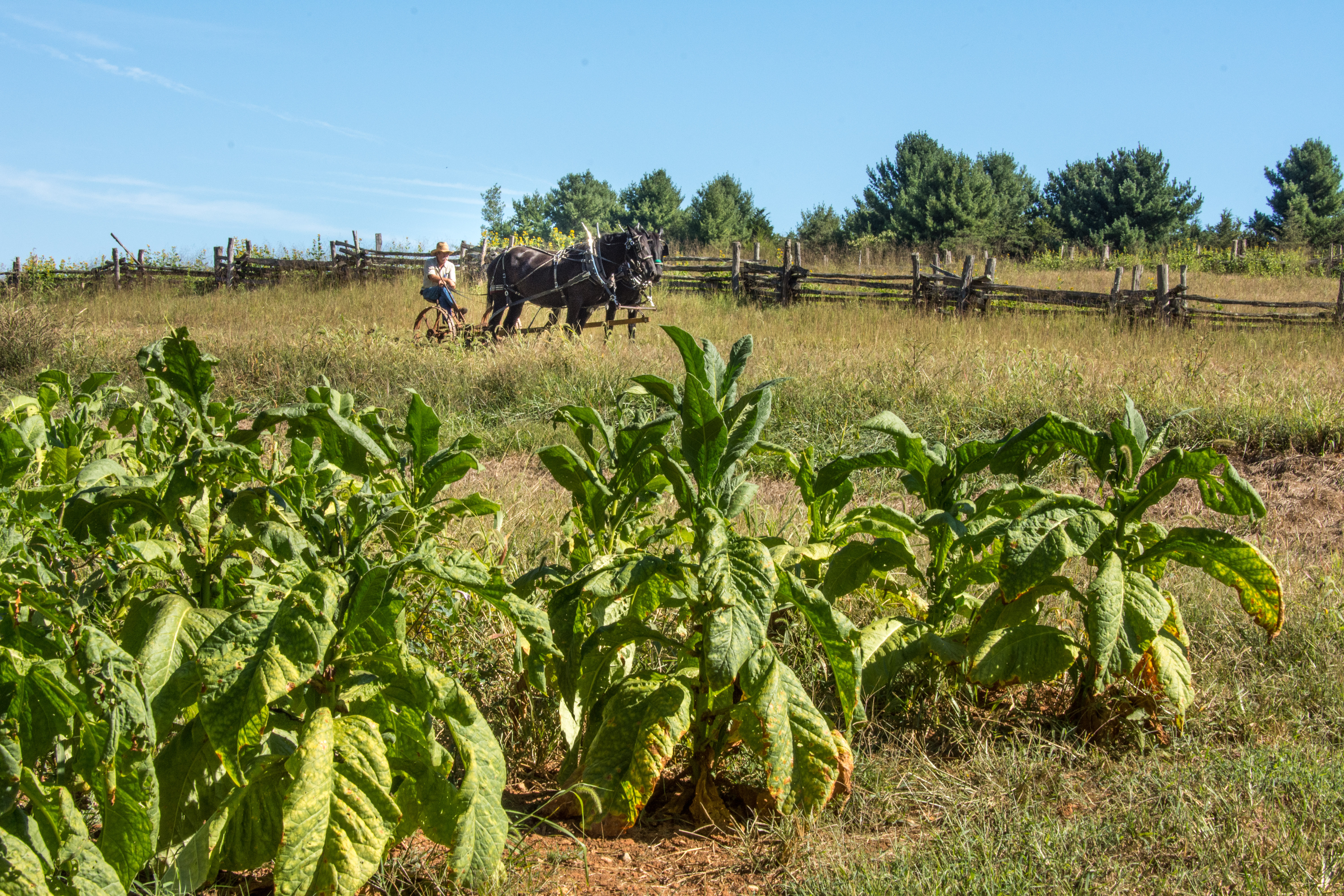
Fort Monroe's story spans from prehistory to the 2000s. Kecoughtan Indians occupied Old Point Comfort before the arrival of English colonists. The first enslaved Africans arrived in 1619. Those escapi...

2 mi from route ~5 min detour Free near mile 427.2
Park Closure: Road Closure and Fishing Pier Impact
View on nps.gov
Colonial National Historical Park

Colonial National Historical Park

National Historical Park

On May 13, 1607, Jamestown was established as the first permanent English settlement in North America. Three cultures came together – European, Virginia Indian and African–to create a new society that...

7 mi from route ~17 min detour $15 near mile 397.8
View on nps.gov
Booker T Washington National Monument

Booker T Washington National Monument

National Monument

Booker T. Washington was born a slave in April 1856 on the 207-acre farm of James Burroughs. After the Civil War, Washington became the first principal of Tuskegee Normal and Industrial School. Later...

22 mi from route ~56 min detour Free near mile 176.8
View on nps.gov
Petersburg National Battlefield

Petersburg National Battlefield

National Battlefield

Two hundred ninety-two days, eight offensives, over 70,000 casualties, U. S. Colored Troops, and the decline of Gen. Lee's Army of Northern Virginia all describe the Siege of Petersburg. U.S. forces c...

29 mi from route ~72 min detour Free near mile 353.6
View on nps.gov

Park data from the National Park Service API. Alerts update every 2 hours.

Fuel & Cost

Regular Gas

$66.80 one way

$133.61 round trip

$3.97/gal 25.4 MPG avg 150 kg CO2
Fuel Type $/gal One Way Round Trip
midgrade $4.34 $73.04 $146.09
premium $4.70 $79.07 $158.13
diesel $5.61 $94.32 $188.64

No toll roads detected on this route.

Estimated Trip Cost (one way, 1 person)

Fuel

$67

Hotel (1n)

$80–$140

Meals

$50–$100

Total

$197–$307

Rough estimate based on US averages. Hotel $80–$140/night, meals $25–$50/day.

Estimated CO2 emission: 149.5 kg one way. Prices: EIA weekly data, 2026-04-13.

EV Charging Along Route

32 DC fast chargers · Coverage: excellent

Chik-fil-A - Tesla Supercharger

Lexington, VA

Tesla

12 DCFC

Wawa - Tesla Supercharger

Staunton, VA

Tesla

12 DCFC

Royal Farms - Tesla Supercharger

Abingdon, VA

Tesla

8 DCFC

Comfort Inn - Tesla Supercharger

Atkins, VA

Tesla

8 DCFC

Salem, VA - Tesla Supercharger

Salem, VA

Tesla

8 DCFC

Sheetz - Tesla Supercharger

Salem, VA

Tesla

8 DCFC

Sheetz - Tesla Supercharger

Lexington, VA

Tesla

8 DCFC

Comfort Inn - Tesla Supercharger

Raphine, VA

Tesla

8 DCFC

Tesla: 12 Non-Networked: 3 Electrify America: 3 EV Connect: 3 ChargePoint Network: 3 FORD_CHARGE: 2 eVgo Network: 2 CIRCLE_K: 1 RED_E: 1 CHARGELAB: 1 RIVIAN_ADVENTURE: 1

Station data from NREL Alternative Fuel Stations database.

Driving Electric?

About $45 in charging · 1 stop · 66% less CO2

Vehicle Type kWh Stops DC Fast Home Charge
Average EV 128.2 1 $44.86 $20.51
Efficient EV 106.8 1 $37.38 $17.09
EV Truck/SUV 170.9 2 $59.81 $27.34

Gas CO2

149 kg

EV CO2

50 kg (66% less)

Plan for 1 charging stop. A 30-minute DC fast charge mid-route should be enough to complete the trip comfortably.

DC fast charging avg $0.35/kWh. Home charging avg $0.16/kWh. US grid CO2: 0.39 kg/kWh.

Travel Intel

Current conditions at both ends of the drive.

Forecast data refreshed 1 day ago

Origin

Coeburn, VA

Night in Coeburn on Tuesday

Local time

11:11 PM

EDT

Current temp

41°F

Unavailable

Live forecast

Destination

East Hampton, VA

Night in East Hampton on Tuesday

Local time

11:11 PM

EDT

Current temp

53°F

Unavailable

Live forecast

Seasonal Notes

Summer travel usually means heavier construction, hotter rest stops, and busier weekend traffic around major cities.

Winter travel shortens daylight, so a route that looks manageable on paper can feel much longer after dark.

Holiday weekends tend to make both departure and arrival windows slower than the raw route time suggests.

For long drives, weather on day two can matter just as much as conditions at departure, so check the whole travel window rather than only the first day.

Time zone

Same local time

Origin and destination are on the same clock, so arrival timing is easier to judge at a glance.

Temperature spread

12 degrees warmer at arrival

A meaningful temperature swing is a good cue to rethink layers, water, and how soon you want to arrive.

Road read

8h 9m on the road

This is long enough that the arrival forecast matters almost as much as departure conditions. Recheck both ends before you roll.

Weather data from the National Weather Service. Conditions may change; check closer to your travel date.

Frequently Asked Questions

The drive from Coeburn, VA to East Hampton, VA covers 427.2 miles and takes about 8h 9m without stops. Add 15-30 minutes for a fuel or rest stop on longer drives.
The main roads are I 81, I 64, Korean War Veterans Memorial Highway. Most of the drive stays on highways, so watch for ramps and exits.
Consider an overnight stop or starting very early.
Yes. This route is usually more comfortable as a 2-day drive. A sensible stopping point is after roughly 214 miles on day one.
The midpoint is about 213.6 miles from Coeburn, VA. Look for rest areas, gas stations, or food options near the halfway mark.
At current regular gas prices, expect to spend about $66.80 one way. This estimate uses 25.4 MPG — your actual cost will vary with your vehicle's fuel efficiency and current gas prices.
Start early — leave by 6-7 AM to arrive at a reasonable hour. This is a long drive — plan for a morning departure or consider splitting it into two days.
Plan about 2 meaningful breaks for fuel, food, or rest. Plan on a short reset every 3 to 4 hours to stay fresh behind the wheel.
This is a demanding drive. With 17 significant decision points across 427.2 miles, you will need to stay alert — especially through interchange areas and urban stretches. Consider splitting it into segments if you are not comfortable with fast highway navigation.
The main spots that need attention: at 105.9 miles (I 81; US 11): Highway fork - watch signs carefully. Lane positioning matters here. Multiple destination signs - pick the right one; at 335.9 miles: Exit ramp - move to the correct lane early. Lane positioning matters here. Multiple destination signs - pick the right one; at 360 miles: Exit ramp - move to the correct lane early. Lane positioning matters here. Multiple destination signs - pick the right one.
Between Coeburn, VA and East Hampton, VA, road signs point toward Norfolk and Virginia Beach.

Was this route helpful?

Thanks for your feedback!

Your tip has been submitted. Thanks!

/500

Explore More

Explore more options from Coeburn, VA or browse trips ending in East Hampton, VA.

Looking for more statewide routes? Browse VA road trips.

Explore maps for Coeburn, VA or East Hampton, VA on MapSof.net.