The drive from Corvallis, OR to Astoria, OR covers 145.2 miles and takes about 3h 34m behind the wheel.
This route is realistic as a one-day drive if you keep your stops efficient.
The route leans on Nehalem Highway, Pacific Highway West, Tualatin Valley Highway for much of the mileage,
and the overall profile is turn-heavy local drive.
The longest uninterrupted segment is about 26.1 miles on Nehalem Highway.
At current regular gas prices, budget about $28.93 one way before food or hotel costs.
Trip Pace
Same-day drive is realistic
A same-day return is realistic if you keep stops short.
Break Rhythm
1 planned break
A short stop every 2 to 3 hours is enough for this drive.
Midpoint
72.6 miles from Corvallis, OR
A natural place for your longest stop of the day
, about 1h 43m into the drive
.
Who Is This Route For?
Weekend Trip
Doable as a same-day drive at 3h 34m. Total distance: 145.2 miles.
Family Friendly
Moderate complexity with 1 natural rest stops along the way.
Solo Traveler
3h 34m drive, comfortable solo distance.
Scenic Drive
Turn-heavy local drive route profile with national parks nearby.
Drive Character
Expect a 3h 34m drive with frequent turns across 145.2 miles of local and secondary roads.
This route has more turning and local-road decision points than a simple highway run.
There are about 57 navigation steps in the underlying route data, so the final approach matters more than the middle miles.
Nehalem Highway is the longest continuous segment at about 26.1 miles.
How Hard Is This Drive?
Expect a hands-on drive with frequent turns and local roads rather than long highway stretches. You will hit about 26 points where you need to pay attention to lane position or signs. The trickiest moment comes around 0.1 miles in near Southwest Madison Avenue.
Driving Effort6/10
Moderate - straightforward overall, but long enough or busy enough to require pacing
Balances navigation complexity with total wheel time.
This drive requires moderate attention. Across 145.2 miles you will encounter 26 spots where lane choice or exit timing matters. Not difficult for experienced highway drivers, but worth previewing the tricky sections before you go.
Where does it get tricky?
The main spots that need attention: at 0.1 miles (Southwest Madison Avenue): Navigation decision point; at 0.1 miles (Southwest 5th Street): Lane positioning matters here; at 0.5 miles (OR 99W / Northwest 3rd Street): Lane positioning matters here.
Critical Maneuvers
5 of 26 key points
These are the spots where you need to pay the most attention. Preview them before you drive.
5
0.1 mi into trip|~0m in|Southwest Madison Avenue
Turn right onto Southwest Madison Avenue
Navigation decision point
7
0.1 mi into trip|~0m in|Southwest 5th Street
Turn right onto Southwest 5th Street
Lane positioning matters here
Use the right lane.
6
0.5 mi into trip|~1m in|OR 99W / Northwest 3rd Street
Turn left onto OR 99W / Northwest 3rd Street
Lane positioning matters here
Use the straight / left lanes.
8
80.2 mi into trip|~1h 55m in|OR 47
Keep slight right at fork onto OR 47 toward US 26 West: Vernonia, Seaside
Highway fork - watch signs carefully. Lane positioning matters here. Multiple destination signs - pick the right one
Use the straight / right lanes.
Toward US 26 West: Vernonia, Seaside
6
144.6 mi into trip|~3h 32m in|Jerome Avenue
At end of road, turn left onto Jerome Avenue
Complex interchange - multiple decisions in a short stretch
Towns Mentioned on Route Signs
Based on OSRM destination-sign hints, not a full list of every settlement the road passes.
On the drive from Corvallis, OR to Astoria, OR, road signs begin pointing toward Seaside along the way.
Seaside
80.2 mi in|~1h 55m|via OR 47
Main Roads
Road
Distance
Duration
Nehalem Highway
26.1 mi
45m
Pacific Highway West
23.8 mi
29m
Tualatin Valley Highway
15.1 mi
21m
OR 47
14.5 mi
20m
Sunset Highway
13.4 mi
15m
North Pacific Highway West
12.6 mi
14m
Oregon Route 103
9 mi
12m
Northwest Highway 47
6.9 mi
9m
Longest stretch:
Nehalem Highway
— 26.1 mi, about 45m
Turn-by-Turn Driving Directions
Step-by-step road directions between Corvallis, OR and Astoria, OR.
1
Start on US 20; OR 99W
354 ft·16 sec·Southwest 4th Street
2
Turn right onto Southwest Madison Avenue
298 ft·10 sec·Southwest Madison Avenue
3
Turn right onto Southwest 5th Street
0.2 mi·43 sec·Southwest 5th Street
Use the right lane.
4
Turn right onto Northwest Van Buren Avenue
0.1 mi·18 sec·Northwest Van Buren Avenue
5
Turn left onto OR 99W
0.8 mi·1 min·Northwest 3rd Street
Use the straight / left lanes.
6
Continue on OR 99W
19 mi·23 min·Pacific Highway West
Use the straight / right lanes.
7
Continue on OR 99W
1.0 mi·2 min·Pacific Avenue South
Use the straight / right lanes.
8
Continue on OR 99W
2.7 mi·3 min·South Pacific Highway West
Use the straight lane.
9
Enter roundabout onto OR 99W
145 ft·1 sec·South Pacific Highway West
10
Continue on OR 99W
2.2 mi·3 min·South Pacific Highway West
11
Continue on OR 99W
0.4 mi·47 sec·Main Street
Use the straight / right lanes.
12
Continue on OR 99W
13 mi·14 min·North Pacific Highway West
Use the straight lane.
13
Continue on OR 99W
0.7 mi·54 sec·South Trade Street
14
Continue on OR 99W
4.9 mi·5 min·Pacific Highway West
15
Continue on OR 99W
0.3 mi·42 sec·Southwest Baker Street
16
Continue on OR 99W
0.7 mi·1 min·Southwest Baker Street
17
Continue on OR 99W
1.3 mi·1 min·Southeast Baker Street
18
Turn slight left onto Northeast Baker Street
0.6 mi·1 min·Northeast Baker Street
19
Continue on Westside Road
4.6 mi·6 min·Westside Road
20
Turn right onto Northwest Meadow Lake Road
0.9 mi·1 min·Northwest Meadow Lake Road
21
Continue on West Main Street
0.3 mi·40 sec·West Main Street
22
Turn left onto OR 47
0.5 mi·1 min·North Yamhill Street
23
Continue on OR 47
2.7 mi·3 min·Tualatin Valley Highway
24
Continue on OR 47
0.5 mi·1 min·South Maple Street
25
Continue on OR 47
7.6 mi·10 min·Tualatin Valley Highway
26
Continue on OR 47
0.4 mi·58 sec·Front Street
27
Continue on OR 47
4.7 mi·6 min·Tualatin Valley Highway
28
Turn left onto B Street
1.1 mi·1 min·B Street
29
Turn right onto OR 8
0.2 mi·34 sec·19th Avenue
30
Turn left onto Main Street
0.3 mi·49 sec·Main Street
31
Turn right onto University Avenue
0.2 mi·27 sec·University Avenue
32
Turn left onto Sunset Drive
0.5 mi·1 min·Sunset Drive
33
Continue on Northwest Sunset Drive
0.4 mi·53 sec·Northwest Sunset Drive
34
Turn left onto OR 47
0.3 mi·23 sec·Northwest Highway 47
35
Enter roundabout onto Northwest Highway 47
152 ft·5 sec·Northwest Highway 47
36
Continue on Northwest Highway 47
0.6 mi·53 sec·Northwest Highway 47
37
Enter roundabout onto OR 47
164 ft·5 sec·Northwest Highway 47
38
Continue on OR 47
4.3 mi·6 min·Northwest Highway 47
39
Continue on OR 47
0.9 mi·2 min·Northwest Main Street
40
Continue on OR 47
1.6 mi·2 min·Northwest Highway 47
41
Keep slight right at fork onto OR 47
14 mi·20 min·OR 47
Toward US 26 West: Vernonia, SeasideUse the straight / right lanes.
42
Continue on US 26
13 mi·15 min·Sunset Highway
43
Turn left onto OR 103
432 ft·6 sec·Oregon Route 103
44
Continue on OR 103
8.9 mi·12 min·Oregon Route 103
45
At end of road, turn left onto OR 202
26 mi·45 min·Nehalem Highway
46
Continue on OR 202
0.2 mi·24 sec·Southeast Front Street
47
Turn right onto Williamsport Road
0.9 mi·2 min·Williamsport Road
48
Continue on 16th Street
0.1 mi·17 sec·16th Street
49
Continue on Niagara Avenue
347 ft·11 sec·Niagara Avenue
50
Turn right onto 15th Street
0.2 mi·36 sec·15th Street
51
At end of road, turn left onto Jerome Avenue
358 ft·11 sec·Jerome Avenue
52
Turn right onto 14th Street
359 ft·15 sec·14th Street
53
Turn left onto Irving Avenue
0.2 mi·30 sec·Irving Avenue
54
Turn right onto 11th Street
0.2 mi·24 sec·11th Street
55
Turn right onto Exchange Street
52 ft·6 sec·Exchange Street
56
Turn left
177 ft·12 sec
57
Arrive at destination
Trip Plan
Morning Departure
An early start around 7-8 AM gets you there with plenty of daylight left.
Evening Departure
A late afternoon start means arriving after dark. Morning is better.
You can normally do this drive in one day.
Plan roughly 1 meaningful break for fuel, food, and rest.
The halfway point lands around 72.6 miles from Corvallis, OR, or about 1h 43m into the drive.
The longest continuous stretch on this route runs about 26.1 miles.
This is a comfortable same-day trip.
Departure
Before you leave
Start with fuel, water, and navigation already sorted so the first hour feels easy.
First stop
Around 32 miles or 43m in
Use this first pause for coffee, a restroom break, and a quick traffic check ahead.
Halfway reset
Around 72.6 miles or 1h 43m in
This is the best place for your longest stop, a real meal, and a full fuel check.
Final approach
Final hour starts around 2h 47m
Traffic, exits, and arrival timing usually matter more near Astoria, OR than in the middle of the route.
Before You Leave
+
Open the route before leaving Corvallis, OR so your first major turns are already loaded.
+
Leave with enough water and a charging cable within reach, not packed away.
+
Check your fuel range against the first long segment, especially if you are starting outside city service areas.
Day 1
Settle into the route from Corvallis, OR
This is one driving day of about 145.2 miles and 3h 34m.
Your first comfortable stop window is around 32 miles from Corvallis, OR.
This route can stay practical as a one-day drive if traffic stays reasonable.
Plan about 1 real break rather than only quick fuel stops.
The longest stretch is on Nehalem Highway for about 26.1 miles.
Where to Stop
Rest stops, refuel points, and overnight suggestions along this route.
Halfway Point
Midpoint
About 72.6 mi from Corvallis, OR
· 1h 43m into the drive
The midpoint is around 72.6 miles from Corvallis, OR, which is a good place for a longer meal and fuel stop.
Arriving in Astoria, OR
The final approach into Astoria, OR usually feels slower than the middle of the drive, so avoid planning your tightest schedule at the very end.
Try to arrive with enough fuel left to skip an immediate station stop unless you already know the area around Astoria, OR.
These stop ideas are pacing suggestions — the exact town or exit can change with traffic, hotel plans, and fuel range.
National Parks Near This Route
Worth a detour if your schedule allows.
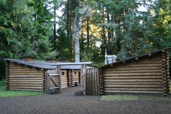
Lewis and Clark National Historical Park
National Historical Park
Explore the timeless rainforests and majestic coastal vistas. Discover the rich heritage of the native people. Unfold the dramatic stories of America's most famous explorers. The park encompasses site...
7 mi from route
~16 min detour
$10
near mile 145.2
Park data from the National Park Service API. Alerts update every 2 hours.
Fuel & Cost
Regular Gas
$28.93 one way
$57.85 round trip
$5.06/gal25.4 MPG avg51 kg CO2
Fuel Type
$/gal
One Way
Round Trip
midgrade
$5.36
$30.61
$61.22
premium
$5.59
$31.96
$63.92
diesel
$5.61
$32.06
$64.12
No toll roads detected on this route.
Estimated Trip Cost (one way, 1 person)
Fuel
$29
Meals
$25–$50
Total
$54–$79
Rough estimate based on US averages. Hotel $80–$140/night, meals $25–$50/day.
Estimated CO2 emission: 50.8 kg one way.
Prices: EIA weekly data, 2026-04-13.
Driving Electric?
About $15 in charging
· 0 stops
· 67% less CO2
Vehicle Type
kWh
Stops
DC Fast
Home Charge
Average EV
43.6
0
$15.25
$6.97
Efficient EV
36.3
0
$12.70
$5.81
EV Truck/SUV
58.1
0
$20.33
$9.29
Gas CO2
51 kg
EV CO2
17 kg (67% less)
This trip is well within single-charge range for most EVs. No charging stops needed if you start fully charged.
DC fast charging avg $0.35/kWh. Home charging avg $0.16/kWh. US grid CO2: 0.39 kg/kWh.
Travel Intel
Current conditions at both ends of the drive.
Forecast as of Apr 15, 2026
Origin
Corvallis, OR
Morning
in Corvallis on Saturday
Local time
9:40 AM
PDT
Current temp
66°F
Unavailable
Live forecast
Destination
Astoria, OR
Morning
in Astoria on Saturday
Local time
9:40 AM
PDT
Current temp
58°F
Unavailable
Live forecast
Seasonal Notes
Summer travel usually means heavier construction, hotter rest stops, and busier weekend traffic around major cities.
Winter travel shortens daylight, so a route that looks manageable on paper can feel much longer after dark.
Holiday weekends tend to make both departure and arrival windows slower than the raw route time suggests.
Time zone
Same local time
Origin and destination are on the same clock, so arrival timing is easier to judge at a glance.
Temperature spread
8 degrees cooler at arrival
A meaningful temperature swing is a good cue to rethink layers, water, and how soon you want to arrive.
Road read
3h 34m on the road
Use the two city cards together: check the sky where you start, then compare it with the local time and temperature at arrival.
Weather data from the National Weather Service. Conditions may change; check closer to your travel date.
Frequently Asked Questions
The drive from Corvallis, OR to Astoria, OR covers 145.2 miles and takes about 3h 34m without stops. Add 15-30 minutes for a fuel or rest stop on longer drives.
The main roads are Nehalem Highway, Pacific Highway West, Tualatin Valley Highway. Expect a mix of highway and local road driving.
This is a comfortable same-day trip.
The midpoint is about 72.6 miles from Corvallis, OR. Look for rest areas, gas stations, or food options near the halfway mark.
At current regular gas prices, expect to spend about $28.93 one way. This estimate uses 25.4 MPG — your actual cost will vary with your vehicle's fuel efficiency and current gas prices.
An early start around 7-8 AM gets you there with plenty of daylight left. A late afternoon start means arriving after dark. Morning is better.
Plan about 1 meaningful break for fuel, food, or rest. A short stop every 2 to 3 hours is enough for this drive.
This drive requires moderate attention. Across 145.2 miles you will encounter 26 spots where lane choice or exit timing matters. Not difficult for experienced highway drivers, but worth previewing the tricky sections before you go.
The main spots that need attention: at 0.1 miles (Southwest Madison Avenue): Navigation decision point; at 0.1 miles (Southwest 5th Street): Lane positioning matters here; at 0.5 miles (OR 99W / Northwest 3rd Street): Lane positioning matters here.
On the drive from Corvallis, OR to Astoria, OR, road signs begin pointing toward Seaside along the way.
Yes. Nearby national parks include Lewis and Clark National Historical Park.
How this page is built
Compiled by the Trip.ovh planning team at COD Solutions Oy from open government datasets — OSRM over OpenStreetMap for geometry, EIA for fuel prices, and NPS for national parks. See our methodology for refresh cadence and limitations.