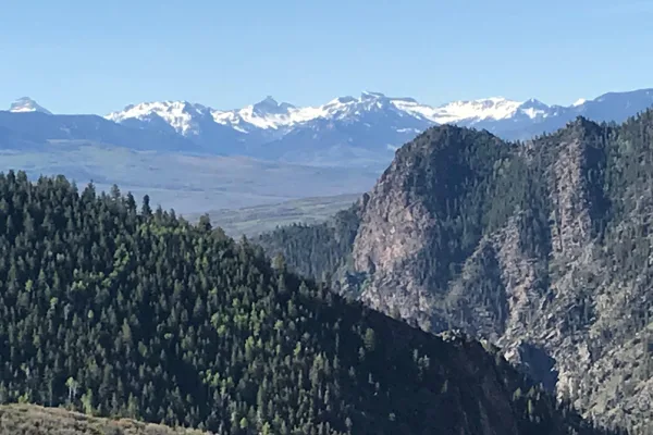
Origin
Crested Butte, CO
Morning in Crested Butte on Saturday
Local time
11:35 AM
MDT
Current temp
53°F
Unavailable
Live forecast
Compiled and reviewed by the Trip.ovh planning team at COD Solutions Oy · Last reviewed Apr 18, 2026 · Editorial standards
Drive Time
5h 26m
Distance
226.2 mi
364 km
Drive Score
9/10
Great drive
Same Day?
Yes, doable
Fuel Cost
$34
one way
EV Charging
Unknown
Estimated drive times based on typical traffic patterns. Actual times may vary with weather, construction, and real-time conditions.

Crested Butte, CO
Kevin Wiley

Arvada, CO
Wikimedia Commons
The drive from Crested Butte, CO to Arvada, CO covers 226.2 miles and takes about 5h 26m behind the wheel. This route is realistic as a one-day drive if you keep your stops efficient.
The route leans on US 24, US 285, East Tomichi Avenue for much of the mileage, and the overall profile is highway-focused drive. The longest uninterrupted segment is about 73.9 miles on US 24. At current regular gas prices, budget about $34.08 one way before food or hotel costs.
Trip Pace
Same-day drive is realistic
A same-day return is possible, but it will make for a full day on the road.
Break Rhythm
1 planned break
Plan on a short reset every 3 to 4 hours to stay fresh behind the wheel.
Midpoint
113.1 miles from Crested Butte, CO
A natural place for your longest stop of the day , about 2h 56m into the drive .
| Road | Distance | Duration |
|---|---|---|
| US 24 | 73.9 mi | 1h 33m |
| US 285 | 49 mi | 1h 13m |
| East Tomichi Avenue | 41.9 mi | 59m |
| CO 135 | 26.5 mi | 43m |
| US 50 | 17.6 mi | 28m |
| I 70 | 6.7 mi | 7m |
| CO 470 | 5.3 mi | 6m |
| Kipling Parkway | 1 mi | 1m |
Step-by-step road directions between Crested Butte, CO and Arvada, CO.
Start on Elk Avenue
Turn right onto Sixth Street
Continue on CO 135
Continue on CO 135
Turn left onto US 50
Continue on US 50
Turn left onto US 285
Continue on US 285
Take the exit onto US 285
Merge onto US 24; US 285
Continue on US 285
Take the exit
Merge onto CO 470
Take the exit
Keep slight right at fork
Merge onto I 70
Take the exit
Turn left onto CO 391
Continue on Kipling Parkway
Turn right onto West 58th Avenue
Continue on Ralston Road
Turn left onto Carr Street
Turn right onto West 59th Avenue
Turn right onto Ammons Street
Turn right
Arrive at destination
Morning Departure
An early start around 7-8 AM gets you there with plenty of daylight left.
Evening Departure
A late afternoon start means arriving after dark. Morning is better.
This is a comfortable same-day trip.
Departure
Before you leave
Start with fuel, water, and navigation already sorted so the first hour feels easy.
First stop
Around 50 miles or 1h 19m in
Use this first pause for coffee, a restroom break, and a quick traffic check ahead.
Halfway reset
Around 113.1 miles or 2h 56m in
This is the best place for your longest stop, a real meal, and a full fuel check.
Final approach
Final hour starts around 4h 28m
Traffic, exits, and arrival timing usually matter more near Arvada, CO than in the middle of the route.
Open the route before leaving Crested Butte, CO so your first major turns are already loaded.
Leave with enough water and a charging cable within reach, not packed away.
Check your fuel range against the first long segment, especially if you are starting outside city service areas.
Day 1
Settle into the route from Crested Butte, CO
This is one driving day of about 226.2 miles and 5h 26m.
Rest stops, refuel points, and overnight suggestions along this route.

Mid-route town
Meal stop
113 mi into the route
Best for: Lunch, fuel, and a longer reset
This sits close to the middle of the route, so it works well for the longest stop of the day.
A short stop after about 50 miles helps settle the day before fatigue starts building.
The midpoint is around 113.1 miles from Crested Butte, CO, which is a good place for a longer meal and fuel stop.
These stop ideas are pacing suggestions — the exact town or exit can change with traffic, hotel plans, and fuel range.
5 decision points cluster between mile 27.7 and 223.2 — GPS handles the exact turns, but know they're coming. Your lane choice matters more than the turn itself.
Turn left onto US 50 / East Tomichi Avenue
Lane positioning matters here
Take the exit toward CO 470 West: West CO 470 to I-70
Exit ramp - move to the correct lane early. Lane positioning matters here
Take the exit toward I 70: Grand Junction, Denver
Exit ramp - move to the correct lane early. Lane positioning matters here. Multiple destination signs - pick the right one
Keep slight right at fork toward I 70 East: Denver
Highway fork - watch signs carefully. Lane positioning matters here
Take the exit toward CO 391: Kipling Street
Exit ramp - move to the correct lane early. Lane positioning matters here
Regular Gas
$34.08 one way
$68.16 round trip
| Fuel Type | $/gal | One Way | Round Trip |
|---|---|---|---|
| midgrade | $4.05 | $36.09 | $72.17 |
| premium | $4.39 | $39.13 | $78.26 |
| diesel | $5.61 | $49.94 | $99.88 |
No toll roads detected on this route.
Estimated Trip Cost (one way, 1 person)
Fuel
$34
Meals
$25–$50
Total
$59–$84
Rough estimate based on US averages. Hotel $80–$140/night, meals $25–$50/day.
Estimated CO2 emission: 79.1 kg one way. Prices: EIA weekly data, 2026-04-13.
Driving Electric?
About $24 in charging · 0 stops · 67% less CO2
| Vehicle Type | kWh | Stops | DC Fast | Home Charge |
|---|---|---|---|---|
| Average EV | 67.9 | 0 | $23.75 | $10.86 |
| Efficient EV | 56.6 | 0 | $19.79 | $9.05 |
| EV Truck/SUV | 90.5 | 1 | $31.67 | $14.48 |
Gas CO2
79 kg
EV CO2
26 kg (67% less)
Plan for 0 charging stops, roughly every 270 miles. Allow 25-40 minutes per stop at a DC fast charger.
DC fast charging avg $0.35/kWh. Home charging avg $0.16/kWh. US grid CO2: 0.39 kg/kWh.
Current conditions at both ends of the drive.
Origin
Morning in Crested Butte on Saturday
Local time
11:35 AM
MDT
Current temp
53°F
Unavailable
Destination
Morning in Arvada on Saturday
Local time
11:35 AM
MDT
Current temp
46°F
Unavailable
Seasonal Notes
Summer travel usually means heavier construction, hotter rest stops, and busier weekend traffic around major cities.
Winter travel shortens daylight, so a route that looks manageable on paper can feel much longer after dark.
Holiday weekends tend to make both departure and arrival windows slower than the raw route time suggests.
Time zone
Origin and destination are on the same clock, so arrival timing is easier to judge at a glance.
Temperature spread
A meaningful temperature swing is a good cue to rethink layers, water, and how soon you want to arrive.
Road read
An early start around 7-8 AM gets you there with plenty of daylight left.
Weather data from the National Weather Service. Conditions may change; check closer to your travel date.
Worth a detour if your schedule allows.
National Recreation Area
Three reservoirs and surrounding lands make up this recreation area in western Colorado. It is a landscape of tradeoffs; natural and human made features exist together. Geologic wonders are abundant f...
Park data from the National Park Service API. Alerts update every 2 hours.
This is a 5h 26m highway drive covering 226.2 miles, with most of the trip on US 24 and US 285. The longest continuous stretch is about 73.9 miles on US 24.
This is a straightforward highway drive that stays mostly on US 24 and US 285. This route has several spots where lane changes, forks, or exits need your full attention. The trickiest moment comes around 27.7 miles in near US 50 / East Tomichi Avenue.
Demanding - plan breaks and stay ahead of the key maneuvers
Balances navigation complexity with total wheel time.
This is a demanding drive. With 16 significant decision points across 226.2 miles, you will need to stay alert - especially through interchange areas and urban stretches. Consider splitting it into segments if you are not comfortable with fast highway navigation.
Where does it get tricky?
The main spots that need attention: at 27.7 miles (US 50 / East Tomichi Avenue): Lane positioning matters here; at 210 miles: Exit ramp - move to the correct lane early. Lane positioning matters here; at 215.5 miles: Exit ramp - move to the correct lane early. Lane positioning matters here. Multiple destination signs - pick the right one.
Arvada is a city of about 125,000 in the Denver Metropolitan Area of the U.S. state of Colorado. A former farming community in Jefferson and Adams counties, the city is now a residential suburb of Denver. Olde Town Arvada lies 7 miles (11 km) northwest of the Colorado State Capitol and 9 miles (14 km) east of the Front Range foothills.
City content from Wikivoyage (CC BY-SA 4.0) and Wikidata (CC0).
Weekend Trip
Doable as a same-day drive at 5h 26m. Total distance: 226.2 miles.
Family Friendly
Moderate complexity with 1 natural rest stops along the way.
Solo Traveler
5h 26m drive, comfortable solo distance.
First-Time Driver
Mostly highway driving (80%). Some complex stretches to watch for.
Compiled by the Trip.ovh planning team at COD Solutions Oy from open government datasets — OSRM over OpenStreetMap for geometry, EIA for fuel prices, and NPS for national parks. See our methodology for refresh cadence and limitations.
Was this helpful?
Thanks for your feedback!
Your tip has been submitted. Thanks!
/500
Recent Tips
·
Explore more options from Crested Butte, CO or browse trips ending in Arvada, CO.
Looking for more statewide routes? Browse CO road trips.