The drive from Derry, NH to Alstead, NH covers 78.3 miles and takes about 2h behind the wheel.
This route is realistic as a one-day drive if you keep your stops efficient.
The route leans on US 202, I 89, Route 123 North for much of the mileage,
and the overall profile is highway-focused drive.
The longest uninterrupted segment is about 15.5 miles on US 202.
At current regular gas prices, budget about $12.61 one way before food or hotel costs.
Trip Pace
Same-day drive is realistic
A same-day return is realistic if you keep stops short.
Midpoint
39.1 miles from Derry, NH
A natural place for your longest stop of the day
, about 50m into the drive
.
Who Is This Route For?
Weekend Trip
Doable as a same-day drive at 2h. Total distance: 78.3 miles.
Family Friendly
Moderate complexity with 0 natural rest stops along the way.
Solo Traveler
2h drive, comfortable solo distance.
First-Time Driver
Mostly highway driving (68%). Some complex stretches to watch for.
Drive Character
This is a 2h highway drive covering 78.3 miles, with most of the trip on US 202 and I 89. The longest continuous stretch is about 15.5 miles on US 202.
Most of the miles stay on highways, which makes pacing and fuel planning easier than turn-by-turn city driving.
There are about 26 navigation steps in the underlying route data, so the final approach matters more than the middle miles.
US 202 is the longest continuous segment at about 15.5 miles.
How Hard Is This Drive?
This is a straightforward highway drive that stays mostly on US 202 and I 89. This route has several spots where lane changes, forks, or exits need your full attention. The trickiest moment comes around 0.9 miles in.
Driving Effort8/10
Demanding - plan breaks and stay ahead of the key maneuvers
Balances navigation complexity with total wheel time.
This is a demanding drive. With 13 significant decision points across 78.3 miles, you will need to stay alert - especially through interchange areas and urban stretches. Consider splitting it into segments if you are not comfortable with fast highway navigation.
Where does it get tricky?
The main spots that need attention: at 0.9 miles: Lane positioning matters here. Multiple destination signs - pick the right one; at 10.2 miles (I 93): Highway fork - watch signs carefully. Multiple destination signs - pick the right one; at 24.3 miles: Exit ramp - move to the correct lane early. Multiple destination signs - pick the right one.
Critical Maneuvers
5 of 13 key points
These are the spots where you need to pay the most attention. Preview them before you drive.
7
0.9 mi into trip|~2m in
Take the ramp toward I 93 North: Manchester, Concord
Lane positioning matters here. Multiple destination signs - pick the right one
Use the right lane.
Toward I 93 North: Manchester, Concord
6
10.2 mi into trip|~14m in|I 93
Keep slight left at fork onto I 93 toward I 93 North: Concord, Plymouth
Highway fork - watch signs carefully. Multiple destination signs - pick the right one
Toward I 93 North: Concord, Plymouth
5
24.3 mi into trip|~30m in
Take the exit toward I 89 North: Lebanon, White River Junction Vermont
Exit ramp - move to the correct lane early. Multiple destination signs - pick the right one
Toward I 89 North: Lebanon, White River Junctio...
8
24.8 mi into trip|~32m in
Keep slight right at fork toward I 89 North: Lebanon, White River Junction Vermont
Highway fork - watch signs carefully. Lane positioning matters here. Multiple destination signs - pick the right one
Use the slight right lane.
Toward I 89 North: Lebanon, White River Junctio...
6
33.1 mi into trip|~42m in
Take the exit toward US 202 West, NH 9 West: Henniker, Keene
Exit ramp - move to the correct lane early. Multiple destination signs - pick the right one
Place data sourced from public business listings. Hours and availability may vary.
National Parks Near This Route
Worth a detour if your schedule allows.
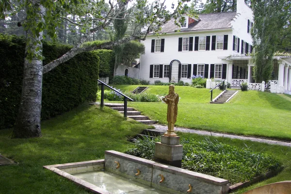
Saint-Gaudens National Historical Park
National Historical Park
Your National Park for the Arts preserves the home and studio of sculptor Augustus Saint-Gaudens (1848-1907). Here stories flow through a landscape of inspiration. Discover the history behind the capt...
24 mi from route
~61 min detour
$10
near mile 78.3
Park data from the National Park Service API. Alerts update every 2 hours.
Fuel & Cost
Regular Gas
$12.61 one way
$25.21 round trip
$4.09/gal25.4 MPG avg27 kg CO2
Fuel Type
$/gal
One Way
Round Trip
midgrade
$4.50
$13.87
$27.74
premium
$4.86
$14.99
$29.99
diesel
$5.61
$17.29
$34.58
Estimated Tolls: $0.49
Everett Turnpike
(7 mi)$0.49
Toll estimates based on average 2024-2025 rates. EZ-Pass/SunPass discounts may lower the actual cost.
Estimated Trip Cost (one way, 1 person)
Fuel
$13
Tolls
$0
Meals
$25–$50
Total
$38–$63
Rough estimate based on US averages. Hotel $80–$140/night, meals $25–$50/day.
Estimated CO2 emission: 27.4 kg one way.
Prices: EIA weekly data, 2026-04-13.
Driving Electric?
About $8 in charging
· 0 stops
· 67% less CO2
Vehicle Type
kWh
Stops
DC Fast
Home Charge
Average EV
23.5
0
$8.22
$3.76
Efficient EV
19.6
0
$6.85
$3.13
EV Truck/SUV
31.3
0
$10.96
$5.01
Gas CO2
27 kg
EV CO2
9 kg (67% less)
This trip is well within single-charge range for most EVs. No charging stops needed if you start fully charged.
DC fast charging avg $0.35/kWh. Home charging avg $0.16/kWh. US grid CO2: 0.39 kg/kWh.
Travel Intel
Current conditions at both ends of the drive.
Forecast as of Apr 16, 2026
Origin
Derry, NH
Late night
in Derry on Saturday
Local time
4:49 AM
EDT
Current temp
60°F
Unavailable
Live forecast
Destination
Alstead, NH
Late night
in Alstead on Saturday
Local time
4:49 AM
EDT
Current temp
56°F
Unavailable
Live forecast
Seasonal Notes
Summer travel usually means heavier construction, hotter rest stops, and busier weekend traffic around major cities.
Winter travel shortens daylight, so a route that looks manageable on paper can feel much longer after dark.
Holiday weekends tend to make both departure and arrival windows slower than the raw route time suggests.
Time zone
Same local time
Origin and destination are on the same clock, so arrival timing is easier to judge at a glance.
Temperature spread
4 degrees cooler at arrival
A meaningful temperature swing is a good cue to rethink layers, water, and how soon you want to arrive.
Road read
2h on the road
Use the two city cards together: check the sky where you start, then compare it with the local time and temperature at arrival.
Weather data from the National Weather Service. Conditions may change; check closer to your travel date.
Frequently Asked Questions
The drive from Derry, NH to Alstead, NH covers 78.3 miles and takes about 2h without stops. Add 15-30 minutes for a fuel or rest stop on longer drives.
The main roads are US 202, I 89, Route 123 North. Most of the drive stays on highways, so watch for ramps and exits.
This is a comfortable same-day trip.
The midpoint is about 39.1 miles from Derry, NH. Look for rest areas, gas stations, or food options near the halfway mark.
At current regular gas prices, expect to spend about $12.61 one way. This estimate uses 25.4 MPG — your actual cost will vary with your vehicle's fuel efficiency and current gas prices.
Leave by 9 AM and you'll arrive before lunch. Even a 4 PM departure gets you there before dark in summer.
This is a demanding drive. With 13 significant decision points across 78.3 miles, you will need to stay alert - especially through interchange areas and urban stretches. Consider splitting it into segments if you are not comfortable with fast highway navigation.
The main spots that need attention: at 0.9 miles: Lane positioning matters here. Multiple destination signs - pick the right one; at 10.2 miles (I 93): Highway fork - watch signs carefully. Multiple destination signs - pick the right one; at 24.3 miles: Exit ramp - move to the correct lane early. Multiple destination signs - pick the right one.
Between Derry, NH and Alstead, NH, road signs point toward Plymouth, White River Junction Vermont and Keene.
Yes. Nearby national parks include Saint-Gaudens National Historical Park.
How this page is built
Compiled by the Trip.ovh planning team at COD Solutions Oy from open government datasets — OSRM over OpenStreetMap for geometry, EIA for fuel prices, and NPS for national parks. See our methodology for refresh cadence and limitations.