The drive from Eagle, ID to Fremont County, ID covers 358.2 miles and takes about 6h 6m behind the wheel.
This route is realistic as a one-day drive if you keep your stops efficient.
The route leans on Vietnam Veterans Memorial Highway, I 86, I 15 BUS for much of the mileage,
and the overall profile is mixed drive.
The longest uninterrupted segment is about 175.4 miles on Vietnam Veterans Memorial Highway.
At current regular gas prices, budget about $56.76 one way before food or hotel costs.
Trip Pace
Same-day drive is realistic
A same-day return is possible, but it will make for a full day on the road.
Break Rhythm
1 planned break
Plan on a short reset every 3 to 4 hours to stay fresh behind the wheel.
Midpoint
179.1 miles from Eagle, ID
A natural place for your longest stop of the day
, about 2h 54m into the drive
.
Who Is This Route For?
Weekend Trip
Doable as a same-day drive at 6h 6m. Total distance: 358.2 miles.
Family Friendly
Moderate complexity with 1 natural rest stops along the way.
Solo Traveler
6h 6m drive, plan rest stops for pacing.
Scenic Drive
Mixed drive route profile with national parks nearby.
Drive Character
The drive from Eagle, ID to Fremont County, ID covers 358.2 miles and takes about 6h 6m, using a mix of highways and local roads.
Expect a mix of faster highway mileage and slower local approaches near the beginning or end.
There are about 14 navigation steps in the underlying route data, so the final approach matters more than the middle miles.
Vietnam Veterans Memorial Highway is the longest continuous segment at about 175.4 miles.
How Hard Is This Drive?
This route mixes highway mileage with some local-road sections near the start or finish. You will hit about 8 points where you need to pay attention to lane position or signs. The trickiest moment comes early in the drive near North Eagle Road.
Driving Effort6/10
Moderate - straightforward overall, but long enough or busy enough to require pacing
Balances navigation complexity with total wheel time.
This drive requires moderate attention. Across 358.2 miles you will encounter 8 spots where lane choice or exit timing matters. Not difficult for experienced highway drivers, but worth previewing the tricky sections before you go.
Where does it get tricky?
The main spots that need attention: near the start (North Eagle Road): Lane positioning matters here; at 6.9 miles: Exit ramp - move to the correct lane early. Lane positioning matters here; at 10.6 miles (I 84; US 30 / Vietnam Veterans Memorial Highway): Highway fork - watch signs carefully. Lane positioning matters here.
Critical Maneuvers
5 of 8 key points
These are the spots where you need to pay the most attention. Preview them before you drive.
4
0 mi into trip|~0m in|North Eagle Road
Depart onto North Eagle Road
Lane positioning matters here
Use the right lane.
6
6.9 mi into trip|~11m in
Take the exit toward I 84 East: Boise
Exit ramp - move to the correct lane early. Lane positioning matters here
Use the straight / right lanes.
Toward I 84 East: Boise
6
10.6 mi into trip|~15m in|I 84; US 30 / Vietnam Veterans Memorial Highway
Keep slight right at fork onto I 84; US 30 / Vietnam Veterans Memorial Highway
Highway fork - watch signs carefully. Lane positioning matters here
Use the slight right lane.
5
245.6 mi into trip|~3h 57m in
Keep slight left at fork toward Idaho Falls
Highway fork - watch signs carefully
Toward Idaho Falls
6
292.5 mi into trip|~4h 42m in|US 20
Take the exit onto US 20 toward US 20 East, I 15: Rigby, West Yellowstone
Exit ramp - move to the correct lane early. Multiple destination signs - pick the right one
Exit 119
Toward US 20 East, I 15: Rigby, West Yellowston...
Towns Mentioned on Route Signs
Based on OSRM destination-sign hints, not a full list of every settlement the road passes.
Between Eagle, ID and Fremont County, ID, road signs point toward Idaho Falls and Yellowstone.
Idaho Falls
245.6 mi in|~3h 57m
Yellowstone
292.5 mi in|~4h 42m|via US 20
Main Roads
Road
Distance
Duration
Vietnam Veterans Memorial Highway
175.4 mi
2h 46m
I 86
62.7 mi
59m
I 15 BUS
46.3 mi
43m
Idaho Medal of Honor Highway
40.9 mi
45m
Yellowstone Highway
17.2 mi
18m
North Eagle Road
6.9 mi
11m
South Antelope Flat Road
4.3 mi
16m
Rigby Highway
3.1 mi
3m
Longest stretch:
Vietnam Veterans Memorial Highway
— 175.4 mi, about 2h 46m
Turn-by-Turn Driving Directions
Step-by-step road directions between Eagle, ID and Fremont County, ID.
1
Start on North Eagle Road
6.9 mi·11 min·North Eagle Road
Use the right lane.
2
Take the exit
0.5 mi·35 sec
Toward I 84 East: BoiseUse the straight / right lanes.
3
Merge onto I 84; US 30
3.1 mi·3 min·Vietnam Veterans Memorial Highway
4
Keep slight right at fork onto I 84; US 30
172 mi·2 hr 42 min·Vietnam Veterans Memorial Highway
Use the slight right lane.
5
Continue on I 86; US 30
63 mi·59 min·I 86; US 30
6
Keep slight left at fork
0.6 mi·40 sec
Toward Idaho Falls
7
Merge onto I 15 BUS
46 mi·43 min·I 15 BUS
8
Take the exit onto US 20
0.3 mi·35 sec·US 20
Exit 119Toward US 20 East, I 15: Rigby, West Yellowstone
9
Continue on US 20
3.1 mi·3 min·Rigby Highway
Use the right lane.
10
Continue on US 20
15 mi·16 min·Idaho Medal of Honor Highway
11
Continue on US 20
17 mi·18 min·Yellowstone Highway
12
Continue on US 20
25 mi·28 min·Idaho Medal of Honor Highway
13
Turn left onto South Antelope Flat Road
4.3 mi·16 min·South Antelope Flat Road
14
Arrive at destination
South Antelope Flat Road
Trip Plan
Morning Departure
Start early — leave by 6-7 AM to arrive at a reasonable hour.
Evening Departure
This is a long drive — plan for a morning departure or consider splitting it into two days.
You can normally do this drive in one day.
Plan roughly 1 meaningful break for fuel, food, and rest.
The halfway point lands around 179.1 miles from Eagle, ID, or about 2h 54m into the drive.
The longest continuous stretch on this route runs about 175.4 miles.
This is a comfortable same-day trip.
Departure
Before you leave
Start with fuel, water, and navigation already sorted so the first hour feels easy.
First stop
Around 79 miles or 1h 20m in
Use this first pause for coffee, a restroom break, and a quick traffic check ahead.
Halfway reset
Around 179.1 miles or 2h 54m in
This is the best place for your longest stop, a real meal, and a full fuel check.
Final approach
Final hour starts around 4h 49m
Traffic, exits, and arrival timing usually matter more near Fremont County, ID than in the middle of the route.
Before You Leave
+
Open the route before leaving Eagle, ID so your first major turns are already loaded.
+
Leave with enough water and a charging cable within reach, not packed away.
+
Check your fuel range against the first long segment, especially if you are starting outside city service areas.
Day 1
Settle into the route from Eagle, ID
This is one driving day of about 358.2 miles and 6h 6m.
Your first comfortable stop window is around 79 miles from Eagle, ID.
This route can stay practical as a one-day drive if traffic stays reasonable.
Plan about 1 real break rather than only quick fuel stops.
The longest stretch is on Vietnam Veterans Memorial Highway for about 175.4 miles.
Where to Stop
Rest stops, refuel points, and overnight suggestions along this route.
Halfway Point
Midpoint
About 179.1 mi from Eagle, ID
· 2h 54m into the drive
The midpoint is around 179.1 miles from Eagle, ID, which is a good place for a longer meal and fuel stop.
Before the longest stretch
Fuel check
Top up before Vietnam Veterans Memorial Highway if your tank is already low. That segment runs about 175.4 miles.
Arriving in Fremont County, ID
The final approach into Fremont County, ID usually feels slower than the middle of the drive, so avoid planning your tightest schedule at the very end.
Try to arrive with enough fuel left to skip an immediate station stop unless you already know the area around Fremont County, ID.
After long uninterrupted mileage, take five minutes before the last urban segment to reset and refocus on exits, merges, and city traffic.
These stop ideas are pacing suggestions — the exact town or exit can change with traffic, hotel plans, and fuel range.
National Parks Near This Route
Worth a detour if your schedule allows.
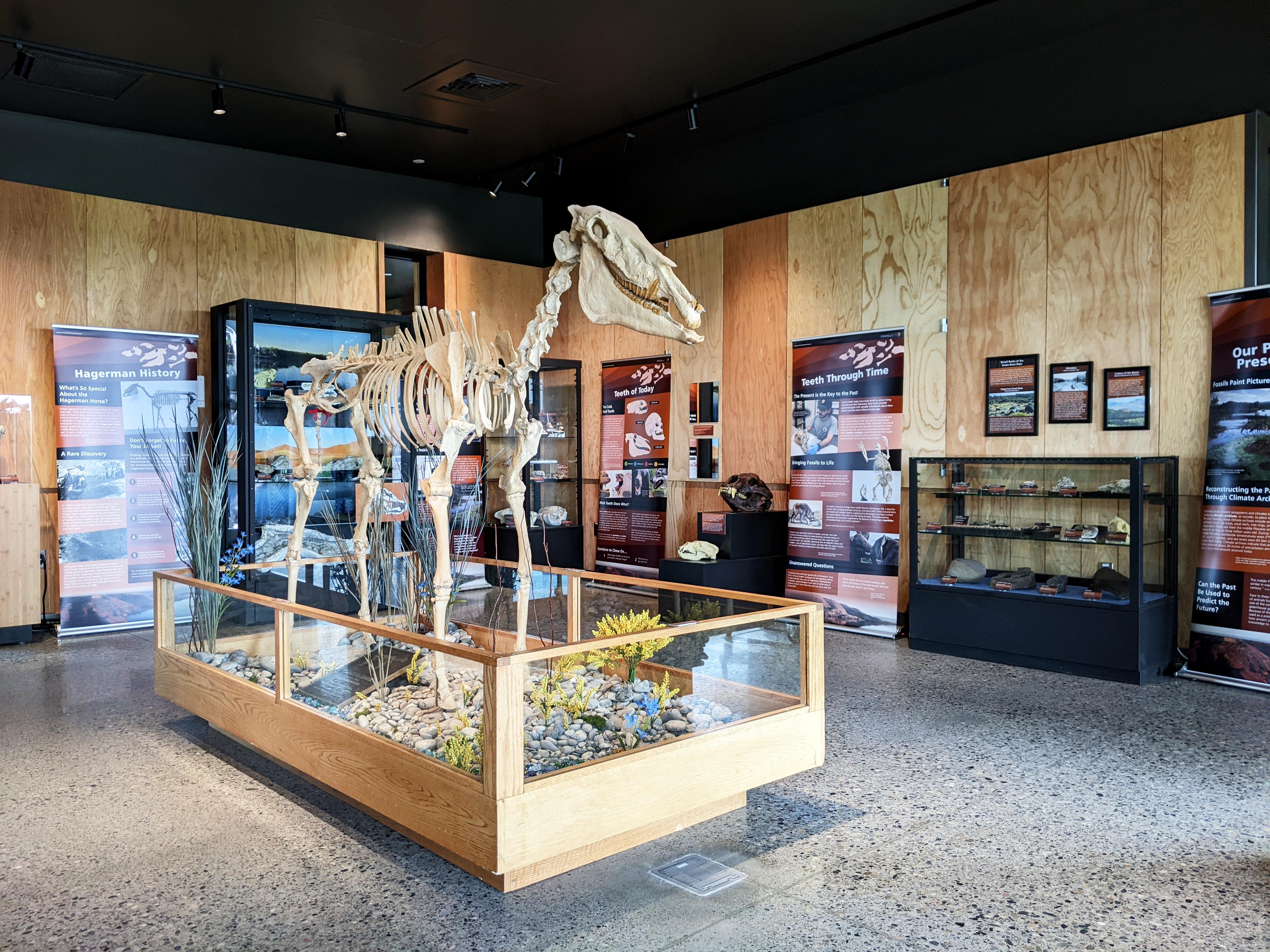
Hagerman Fossil Beds National Monument
National Monument
During the Pliocene, this place looked quite different. Lush wetlands, forests, and grasslands provided excellent habitat for a variety of animals. From fascinating, now-extinct creatures like the sab...
8 mi from route
~19 min detour
Free
near mile 111.2
Caution: Use Caution with "Fossil Beds Information" Signs
Caution: If You Can't Reach Us By Phone, Please Email Us
Park data from the National Park Service API. Alerts update every 2 hours.
Fuel & Cost
Regular Gas
$56.76 one way
$113.52 round trip
$4.03/gal25.4 MPG avg125 kg CO2
Fuel Type
$/gal
One Way
Round Trip
midgrade
$4.22
$59.50
$119.00
premium
$4.53
$63.90
$127.80
diesel
$5.61
$79.09
$158.17
No toll roads detected on this route.
Estimated Trip Cost (one way, 1 person)
Fuel
$57
Meals
$25–$50
Total
$82–$107
Rough estimate based on US averages. Hotel $80–$140/night, meals $25–$50/day.
Estimated CO2 emission: 125.3 kg one way.
Prices: EIA weekly data, 2026-04-13.
Driving Electric?
About $38 in charging
· 1 stop
· 66% less CO2
Vehicle Type
kWh
Stops
DC Fast
Home Charge
Average EV
107.5
1
$37.61
$17.19
Efficient EV
89.6
1
$31.34
$14.33
EV Truck/SUV
143.3
1
$50.15
$22.92
Gas CO2
125 kg
EV CO2
42 kg (66% less)
Plan for 1 charging stop. A 30-minute DC fast charge mid-route should be enough to complete the trip comfortably.
DC fast charging avg $0.35/kWh. Home charging avg $0.16/kWh. US grid CO2: 0.39 kg/kWh.
Travel Intel
Current conditions at both ends of the drive.
Forecast as of Apr 15, 2026
Origin
Eagle, ID
Morning
in Eagle on Saturday
Local time
6:31 AM
MDT
Current temp
46°F
Unavailable
Live forecast
Destination
Fremont County, ID
Morning
in Fremont County on Saturday
Local time
6:31 AM
MDT
Current temp
59°F
Unavailable
Live forecast
Seasonal Notes
Summer travel usually means heavier construction, hotter rest stops, and busier weekend traffic around major cities.
Winter travel shortens daylight, so a route that looks manageable on paper can feel much longer after dark.
Holiday weekends tend to make both departure and arrival windows slower than the raw route time suggests.
Time zone
Same local time
Origin and destination are on the same clock, so arrival timing is easier to judge at a glance.
Temperature spread
13 degrees warmer at arrival
A meaningful temperature swing is a good cue to rethink layers, water, and how soon you want to arrive.
Road read
6h 6m on the road
Start early — leave by 6-7 AM to arrive at a reasonable hour.
Weather data from the National Weather Service. Conditions may change; check closer to your travel date.
Frequently Asked Questions
The drive from Eagle, ID to Fremont County, ID covers 358.2 miles and takes about 6h 6m without stops. Add 15-30 minutes for a fuel or rest stop on longer drives.
The main roads are Vietnam Veterans Memorial Highway, I 86, I 15 BUS. Expect a mix of highway and local road driving.
This is a comfortable same-day trip.
The midpoint is about 179.1 miles from Eagle, ID. Look for rest areas, gas stations, or food options near the halfway mark.
At current regular gas prices, expect to spend about $56.76 one way. This estimate uses 25.4 MPG — your actual cost will vary with your vehicle's fuel efficiency and current gas prices.
Start early — leave by 6-7 AM to arrive at a reasonable hour. This is a long drive — plan for a morning departure or consider splitting it into two days.
Plan about 1 meaningful break for fuel, food, or rest. Plan on a short reset every 3 to 4 hours to stay fresh behind the wheel.
This drive requires moderate attention. Across 358.2 miles you will encounter 8 spots where lane choice or exit timing matters. Not difficult for experienced highway drivers, but worth previewing the tricky sections before you go.
The main spots that need attention: near the start (North Eagle Road): Lane positioning matters here; at 6.9 miles: Exit ramp - move to the correct lane early. Lane positioning matters here; at 10.6 miles (I 84; US 30 / Vietnam Veterans Memorial Highway): Highway fork - watch signs carefully. Lane positioning matters here.
Between Eagle, ID and Fremont County, ID, road signs point toward Idaho Falls and Yellowstone.
Yes. Nearby national parks include Hagerman Fossil Beds National Monument.
How this page is built
Compiled by the Trip.ovh planning team at COD Solutions Oy from open government datasets — OSRM over OpenStreetMap for geometry, EIA for fuel prices, and NPS for national parks. See our methodology for refresh cadence and limitations.