The drive from Elba, NY to Staten Island, NY covers 345.1 miles and takes about 7h 27m behind the wheel.
This route is realistic as a one-day drive if you keep your stops efficient.
The route leans on South Main Street, Oak Orchard Road, Oak Street for much of the mileage,
and the overall profile is turn-heavy local drive.
At current regular gas prices, budget about $56.81 one way before food or hotel costs.
Trip Pace
Same-day drive is realistic
A same-day return is possible, but it will make for a full day on the road.
Break Rhythm
2 planned breaks
Plan on a short reset every 3 to 4 hours to stay fresh behind the wheel.
Midpoint
172.5 miles from Elba, NY
A natural place for your longest stop of the day
, about 3h 43m into the drive
.
Staten Island is New York City's "Forgotten Borough" across New York Harbor from Manhattan. Staten Island may seem like it's in an entirely different world than the hustle and bustle expected in New York City. However, it still has some of the features you've come to expect from the city. This combination of city influences and its rural origins have created a unique borough that is a great place to visit.
Top landmarks
•Bayonne Bridge — arch bridge connecting Staten Island, NY with Bayonne, NJ
•Staten Island Museum — museum in Staten Island, New York
Turn-heavy local drive route profile with national parks nearby.
Drive Character
Expect a 7h 27m drive with frequent turns across 345.1 miles of local and secondary roads.
This route has more turning and local-road decision points than a simple highway run.
There are about 72 navigation steps in the underlying route data, so the final approach matters more than the middle miles.
South Main Street is one of the defining roads on this drive.
Elevation Profile
Gently rolling terrain
1,925 ft72 ft
Total Climb
2,256 ft
Total Descent
2,946 ft
Highest Point
1,925 ft
~246.5 mi in
Elevation Range
1,852 ft
Notable High Points
1,925 ft at ~246.5 miles+1,031 ft prominence
How Hard Is This Drive?
Expect a hands-on drive with frequent turns and local roads rather than long highway stretches. There are only a few real navigation decisions along the way.
Driving Effort3/10
Easy - simple navigation with a manageable amount of wheel time
Balances navigation complexity with total wheel time.
The route itself is not hard, but at 7h 27m, endurance matters. Plan breaks every 2-3 hours. The 0 decision points are all manageable with basic attention.
Where does it get tricky?
This route does not have any notably tricky sections. Most of the drive from Elba, NY to Staten Island, NY is straightforward, with well-signed roads and simple exits.
Main Roads
Road
Distance
Duration
South Main Street
—
—
Oak Orchard Road
—
—
Oak Street
—
—
I 90 East
—
—
New York State Thruway
—
—
NY 414
—
—
State Route 414
—
—
Auburn Road
—
—
Some road-level metrics are being recalculated.
Longest stretch:
South Main Street
— detailed segment metrics are refreshing.
Turn-by-Turn Driving Directions
Step-by-step road directions between Elba, NY and Staten Island, NY.
1
Start on the route
92 ft·8 sec·the route
2
Turn left onto South Main Street
0.6 mi·54 sec·South Main Street
3
Continue on Oak Orchard Road
3.6 mi·5 min·Oak Orchard Road
4
Continue on Oak Street
453 ft·15 sec·Oak Street
5
Take the ramp left
0.3 mi·34 sec
6
Keep slight right to continue on I 90 East
0.3 mi·39 sec·I 90 East
7
Merge slight left onto New York State Thruway
69 mi·1 hr 19 min·New York State Thruway
8
Take the exit slight right toward NY 414: Waterloo, Clyde
0.5 mi·59 sec·NY 414: Waterloo, Clyde
9
Keep slight right
328 ft·8 sec
10
Continue on State Route 414
0.3 mi·35 sec·State Route 414
11
Turn left
4.1 mi·7 min
12
At the end of the road, turn left onto Auburn Road
1.9 mi·2 min·Auburn Road
13
Continue on Clark Street Road
9.6 mi·11 min·Clark Street Road
14
Turn right onto State Street
226 ft·12 sec·State Street
15
Turn left onto Dill Street
0.1 mi·22 sec·Dill Street
16
Continue on Loop Road
459 ft·17 sec·Loop Road
17
Turn left onto Genesee Street
5.5 mi·9 min·Genesee Street
18
Continue on West Genesee Street Road
2.2 mi·4 min·West Genesee Street Road
19
Turn right onto East Lake Street
0.5 mi·45 sec·East Lake Street
20
Continue on East Lake Road
9.4 mi·13 min·East Lake Road
21
Continue on State Route 41
4.8 mi·7 min·State Route 41
22
Continue on East Lake Road
0.5 mi·49 sec·East Lake Road
23
Continue on State Highway 41
9.8 mi·13 min·State Highway 41
24
Turn right onto North West Street
1.2 mi·2 min·North West Street
25
Take the ramp left
0.7 mi·1 min
26
Keep slight right to continue on I 81 South: Binghamton
0.3 mi·34 sec·I 81 South: Binghamton
27
Merge slight left
45 mi·54 min
28
Keep slight right to continue on I 81 South: Scranton
53 mi·1 hr 3 min·I 81 South: Scranton
29
Keep slight right to continue on I 84 East, I 380 South, US 6 East: Carbondale, Mt Pocono
0.8 mi·1 min·I 84 East, I 380 South, US 6 East: Carbondale, Mt Pocono
30
Continue on I 84 East, I 380 South: Mount Pocono, Milford
3.7 mi·4 min·I 84 East, I 380 South: Mount Pocono, Milford
31
Keep slight right to continue on I 380 South: Mount Pocono
24 mi·25 min·I 380 South: Mount Pocono
32
Keep slight left to continue on I 80 East: Stroudsburg
1.0 mi·1 min·I 80 East: Stroudsburg
33
Merge slight right onto Keystone Shortway
46 mi·59 min·Keystone Shortway
34
Take the exit slight right toward US 46 East: Ledgewood, Lake Hopatcong
0.3 mi·37 sec·US 46 East: Ledgewood, Lake Hopatcong
35
Continue on Ledgewood Road
0.2 mi·12 sec·Ledgewood Road
36
Continue straight
0.9 mi·1 min
37
Continue straight
213 ft·5 sec
38
Turn straight onto Route 10 East
9.2 mi·11 min·Route 10 East
39
Continue straight
3.5 mi·4 min
40
Take the exit straight toward I 287 South: Morristown, Morristown Airport
The midpoint is around 172.5 miles from Elba, NY, which is a good place for a longer meal and fuel stop.
Arriving in Staten Island, NY
The final approach into Staten Island, NY usually feels slower than the middle of the drive, so avoid planning your tightest schedule at the very end.
Try to arrive with enough fuel left to skip an immediate station stop unless you already know the area around Staten Island, NY.
These stop ideas are pacing suggestions — the exact town or exit can change with traffic, hotel plans, and fuel range.
National Parks Near This Route
Worth a detour if your schedule allows.
Harriet Tubman National Historical Park
National Historical Park
Harriet Tubman was guided by a deep faith and devotion to family, freedom, and community. After emancipating herself and members of her family, she moved them from Ontario, Canada to Fleming and Aubur...
5 mi from route
~12 min detour
Free
near mile 95.2
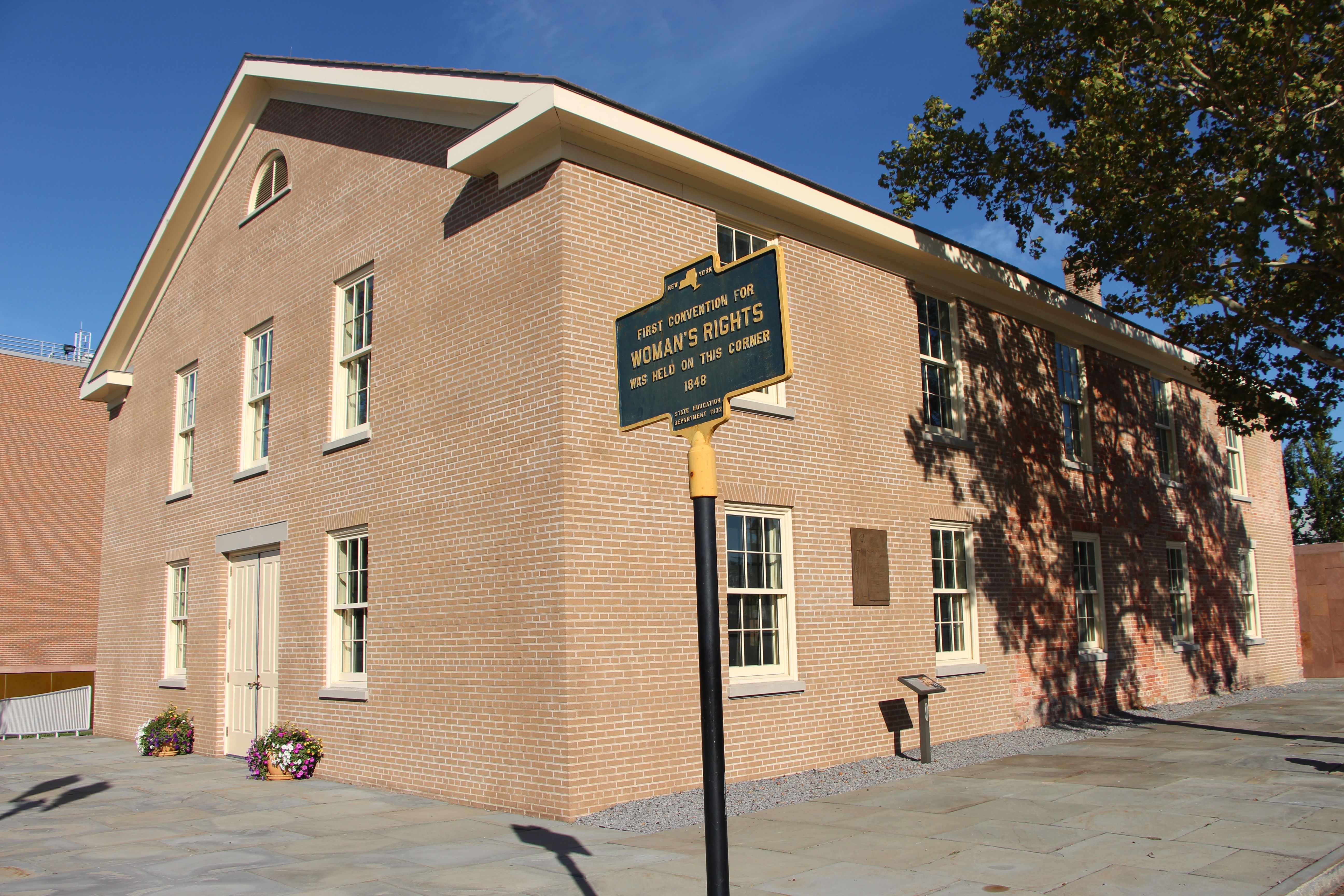
Women’s Rights National Historical Park tells the story of the first Women’s Rights Convention, held in Seneca Falls, New York on July 19-20, 1848. It is a story of struggles for civil rights, human r...
6 mi from route
~14 min detour
Free
near mile 71.4
A gift of friendship from the people of France to the United States "The Statue of Liberty Enlightening the World" is recognized as a universal symbol of freedom and democracy. It was dedicated by Pre...
9 mi from route
~22 min detour
Free
near mile 333.2
Located at the southern tip of Manhattan, Castle Clinton marks the place where New York City began and reflects the growth of both the city and the nation. Built to defend the harbor during the War of...
10 mi from route
~26 min detour
Free
near mile 333.2
From 1794 to 1966, the U.S. Army presence on Governors Island played a vital role in the social, political, and economic life of New York City. The island then served as the headquarters of the U.S. C...
10 mi from route
~26 min detour
Free
near mile 333.2
The African Burial Ground stands as the oldest and largest known excavated burial site in North America for both free and enslaved Africans. It offers a profound testament to the enduring legacy of Af...
11 mi from route
~28 min detour
Free
near mile 333.2
Park data from the National Park Service API. Alerts update every 2 hours.
Fuel & Cost
Regular Gas
$56.81 one way
$113.61 round trip
$4.18/gal25.4 MPG avg121 kg CO2
Fuel Type
$/gal
One Way
Round Trip
midgrade
$4.52
$61.43
$122.85
premium
$4.92
$66.89
$133.77
diesel
$5.61
$76.19
$152.39
Estimated Tolls: $32.00
Holland Tunnel
$16.00
Goethals Bridge
$16.00
New York State Thruway
$0.00
Toll estimates based on average 2024-2025 rates. EZ-Pass/SunPass discounts may lower the actual cost.
Estimated Trip Cost (one way, 1 person)
Fuel
$57
Tolls
$32
Meals
$25–$50
Total
$114–$139
Rough estimate based on US averages. Hotel $80–$140/night, meals $25–$50/day.
Estimated CO2 emission: 120.7 kg one way.
Prices: EIA weekly data, 2026-04-13.
Driving Electric?
About $36 in charging
· 1 stop
· 67% less CO2
Vehicle Type
kWh
Stops
DC Fast
Home Charge
Average EV
103.5
1
$36.24
$16.56
Efficient EV
86.3
0
$30.20
$13.80
EV Truck/SUV
138
1
$48.31
$22.09
Gas CO2
121 kg
EV CO2
40 kg (67% less)
Plan for 1 charging stop. A 30-minute DC fast charge mid-route should be enough to complete the trip comfortably.
DC fast charging avg $0.35/kWh. Home charging avg $0.16/kWh. US grid CO2: 0.39 kg/kWh.
Travel Intel
Current conditions at both ends of the drive.
Forecast as of Apr 15, 2026
Origin
Elba, NY
Night
in Elba on Friday
Local time
10:02 PM
EDT
Current temp
40°F
Unavailable
Live forecast
Destination
Staten Island, NY
Night
in Staten Island on Friday
Local time
10:02 PM
EDT
Current temp
48°F
Unavailable
Live forecast
Seasonal Notes
Summer travel usually means heavier construction, hotter rest stops, and busier weekend traffic around major cities.
Winter travel shortens daylight, so a route that looks manageable on paper can feel much longer after dark.
Holiday weekends tend to make both departure and arrival windows slower than the raw route time suggests.
Time zone
Same local time
Origin and destination are on the same clock, so arrival timing is easier to judge at a glance.
Temperature spread
8 degrees warmer at arrival
A meaningful temperature swing is a good cue to rethink layers, water, and how soon you want to arrive.
Road read
7h 27m on the road
Start early — leave by 6-7 AM to arrive at a reasonable hour.
Weather data from the National Weather Service. Conditions may change; check closer to your travel date.
Frequently Asked Questions
The drive from Elba, NY to Staten Island, NY covers 345.1 miles and takes about 7h 27m without stops. Add 15-30 minutes for a fuel or rest stop on longer drives.
The main roads are South Main Street, Oak Orchard Road, Oak Street. Expect a mix of highway and local road driving.
This is a comfortable same-day trip.
The midpoint is about 172.5 miles from Elba, NY. Look for rest areas, gas stations, or food options near the halfway mark.
At current regular gas prices, expect to spend about $56.81 one way. This estimate uses 25.4 MPG — your actual cost will vary with your vehicle's fuel efficiency and current gas prices.
Start early — leave by 6-7 AM to arrive at a reasonable hour. This is a long drive — plan for a morning departure or consider splitting it into two days.
Plan about 2 meaningful breaks for fuel, food, or rest. Plan on a short reset every 3 to 4 hours to stay fresh behind the wheel.
The route itself is not hard, but at 7h 27m, endurance matters. Plan breaks every 2-3 hours. The 0 decision points are all manageable with basic attention.
This route does not have any notably tricky sections. Most of the drive from Elba, NY to Staten Island, NY is straightforward, with well-signed roads and simple exits.
The route from Elba, NY to Staten Island, NY does not surface many named destination signs beyond the main corridor.
Gently rolling terrain. The route ranges from 72 ft to 1,925 ft elevation with about 2,256 ft of total climbing. There is 1 notable high point along the way.
Yes. Nearby national parks include Harriet Tubman National Historical Park, Women's Rights National Historical Park and Statue Of Liberty National Monument. There are 6 parks within detour distance of this route.