This 75.3-mile drive from Ellington, CT to Danbury, CT takes approximately 1 hour and 36 minutes and is perfectly suited for a single day trip. The route is predominantly highway, with 89% of the journey on major roads, making it a straightforward transit. You'll encounter a manageable fuel cost of around $12 for this trip. Given its relatively short duration and focus on main roads, this drive offers a convenient way to travel within the Northeast region without the need for an overnight stay. It's a practical option for getting from point A to point B efficiently.
Trip Pace
Same-day drive is realistic
A same-day return is realistic if you keep stops short.
Break Rhythm
0 planned breaks
A short stop every 2 to 3 hours is enough for this drive.
Midpoint
37.7 miles from Ellington, CT
A natural place for your longest stop of the day
, about 49m into the drive
.
Loading map...
Drive Character
Expect a highway-focused drive for most of this 75.3-mile journey, as 89% of the route utilizes major roadways like I-84. The longest uninterrupted stretch is a significant 67.1 miles on I-84, indicating extended periods of consistent highway travel. This profile suggests a generally fast-paced experience, with opportunities to cover ground efficiently. While primarily interstate, you’ll also navigate local roads like Talcottville Road and West Road, which will likely involve some transitions in speed and environment as you enter and exit the main highway.
Most of the miles stay on highways, which makes pacing and fuel planning easier than turn-by-turn city driving.
There are about 15 navigation steps in the underlying route data, so the final approach matters more than the middle miles.
I 84 is the longest continuous segment at about 67.1 miles.
How Hard Is This Drive?
This is a straightforward highway drive that stays mostly on I 84 and Talcottville Road. This route has several spots where lane changes, forks, or exits need your full attention. The trickiest moment comes around 0.6 miles in near CT 83 / West Road.
Route Complexity7/10
Demanding - plan breaks and stay ahead of the key maneuvers
This is a demanding drive. With 9 significant decision points across 75.3 miles, you will need to stay alert — especially through interchange areas and urban stretches. Consider splitting it into segments if you are not comfortable with fast highway navigation.
Where does it get tricky?
The main spots that need attention: at 0.6 miles (CT 83 / West Road): Lane positioning matters here; at 7.1 miles (I 84): Merge point - match speed before joining. Lane positioning matters here; at 15.1 miles (I 84; US 6): Highway fork - watch signs carefully. Lane positioning matters here.
Critical Maneuvers
5 of 9 key points
These are the spots where you need to pay the most attention. Preview them before you drive.
5
0.6 mi into trip|~1m in|CT 83 / West Road
Turn right onto CT 83 / West Road
Lane positioning matters here
Use the straight lane.
5
7.1 mi into trip|~12m in|I 84
Merge onto I 84
Merge point - match speed before joining. Lane positioning matters here
Use the straight / right lanes.
6
15.1 mi into trip|~21m in|I 84; US 6
Keep slight right at fork onto I 84; US 6
Highway fork - watch signs carefully. Lane positioning matters here
Use the straight / slight left lanes.
6
30.2 mi into trip|~40m in|I 84
Keep slight left at fork onto I 84
Highway fork - watch signs carefully. Lane positioning matters here
Use the straight / slight right lanes.
8
74.3 mi into trip|~1h 34m in
Take the exit toward CT 39, CT 53: Downtown Danbury, Bethel
Exit ramp - move to the correct lane early. Lane positioning matters here. Multiple destination signs - pick the right one
Use the slight right lane.
Exit 5
Toward CT 39, CT 53: Downtown Danbury, Bethel
Main Roads
Road
Distance
Duration
I 84
67.1 mi
1h 21m
Talcottville Road
3.1 mi
5m
West Road
2.1 mi
3m
North Main Street
0.9 mi
1m
Main Street
0.6 mi
1m
Windsor Avenue
0.5 mi
<1m
Union Street
0.2 mi
<1m
West Street
0.1 mi
<1m
Longest stretch:
I 84
— 67.1 mi, about 1h 21m
Turn-by-Turn Driving Directions
Step-by-step road directions between Ellington, CT and Danbury, CT.
1
Start on CT 286
0.6 mi·1 min·Main Street
2
Turn right onto CT 83
2.1 mi·3 min·West Road
Use the straight lane.
3
Continue on CT 83
0.1 mi·14 sec·West Street
4
Turn right onto CT 74; CT 83
0.2 mi·16 sec·Union Street
5
Continue on CT 74; CT 83
0.5 mi·50 sec·Windsor Avenue
6
Continue on CT 83
3.1 mi·5 min·Talcottville Road
Use the straight / right lanes.
7
Continue on CT 30; CT 83
298 ft·5 sec·Hartford Turnpike
Use the straight lane.
8
Take the ramp
0.5 mi·1 min
Toward I 84 West
9
Merge onto I 84
7.9 mi·9 min·I 84
Use the straight / right lanes.
10
Keep slight right at fork onto I 84; US 6
15 mi·19 min·I 84; US 6
Use the straight / slight left lanes.
11
Keep slight left at fork onto I 84
44 mi·53 min·I 84
Use the straight / slight right lanes.
12
Take the exit
0.1 mi·18 sec
Exit 5Toward CT 39, CT 53: Downtown Danbury, BethelUse the slight right lane.
13
Turn right onto CT 39
0.9 mi·1 min·North Main Street
14
Turn right onto Library Place
234 ft·10 sec·Library Place
15
Arrive at destination
Library Place
Trip Plan
For this 1 hour and 36-minute trip, leaving in the mid-morning or early afternoon can help you avoid the most congested periods. Since the drive is under two hours and mostly on I-84, there are no mandatory stops recommended, but you can easily pull off for fuel or a quick break if needed. Keep an eye on your fuel gauge, as the longest stretch on I-84 is over 67 miles. The $12 estimated fuel cost is a good baseline, but actual prices may vary. Being a single-day trip, you have flexibility to adjust your departure time based on your schedule.
Morning Departure
Leave by 9 AM and you'll arrive before lunch.
Evening Departure
Even a 4 PM departure gets you there before dark in summer.
You can normally do this drive in one day.
You may only need one short stretch break if traffic stays light.
The halfway point lands around 37.7 miles from Ellington, CT, or about 49m into the drive.
The longest continuous stretch on this route runs about 67.1 miles.
This is a comfortable same-day trip.
Departure
Before you leave
Start with fuel, water, and navigation already sorted so the first hour feels easy.
First stop
Around 75.3 miles or 1h 36m in
Use this first pause for coffee, a restroom break, and a quick traffic check ahead.
Halfway reset
Around 37.7 miles or 49m in
This is the best place for your longest stop, a real meal, and a full fuel check.
Final approach
Final hour starts around 1h 21m
Traffic, exits, and arrival timing usually matter more near Danbury, CT than in the middle of the route.
Before You Leave
+
Open the route before leaving Ellington, CT so your first major turns are already loaded.
+
Leave with enough water and a charging cable within reach, not packed away.
+
Check your fuel range against the first long segment, especially if you are starting outside city service areas.
Day 1
Settle into the route from Ellington, CT
This is one driving day of about 75.3 miles and 1h 36m.
Your first comfortable stop window is around 80 miles from Ellington, CT.
This route can stay practical as a one-day drive if traffic stays reasonable.
You may only need one short stretch stop if conditions stay smooth.
The longest stretch is on I 84 for about 67.1 miles.
Where to Stop
Rest stops, refuel points, and overnight suggestions along this route.
Halfway Point
Midpoint
About 37.7 mi from Ellington, CT
· 49m into the drive
The midpoint is around 37.7 miles from Ellington, CT, which is a good place for a longer meal and fuel stop.
Before the longest stretch
Fuel check
Top up before I 84 if your tank is already low. That segment runs about 67.1 miles.
Arriving in Danbury, CT
The final approach into Danbury, CT usually feels slower than the middle of the drive, so avoid planning your tightest schedule at the very end.
Try to arrive with enough fuel left to skip an immediate station stop unless you already know the area around Danbury, CT.
These stop ideas are pacing suggestions — the exact town or exit can change with traffic, hotel plans, and fuel range.
National Parks Near This Route
Worth a detour if your schedule allows.
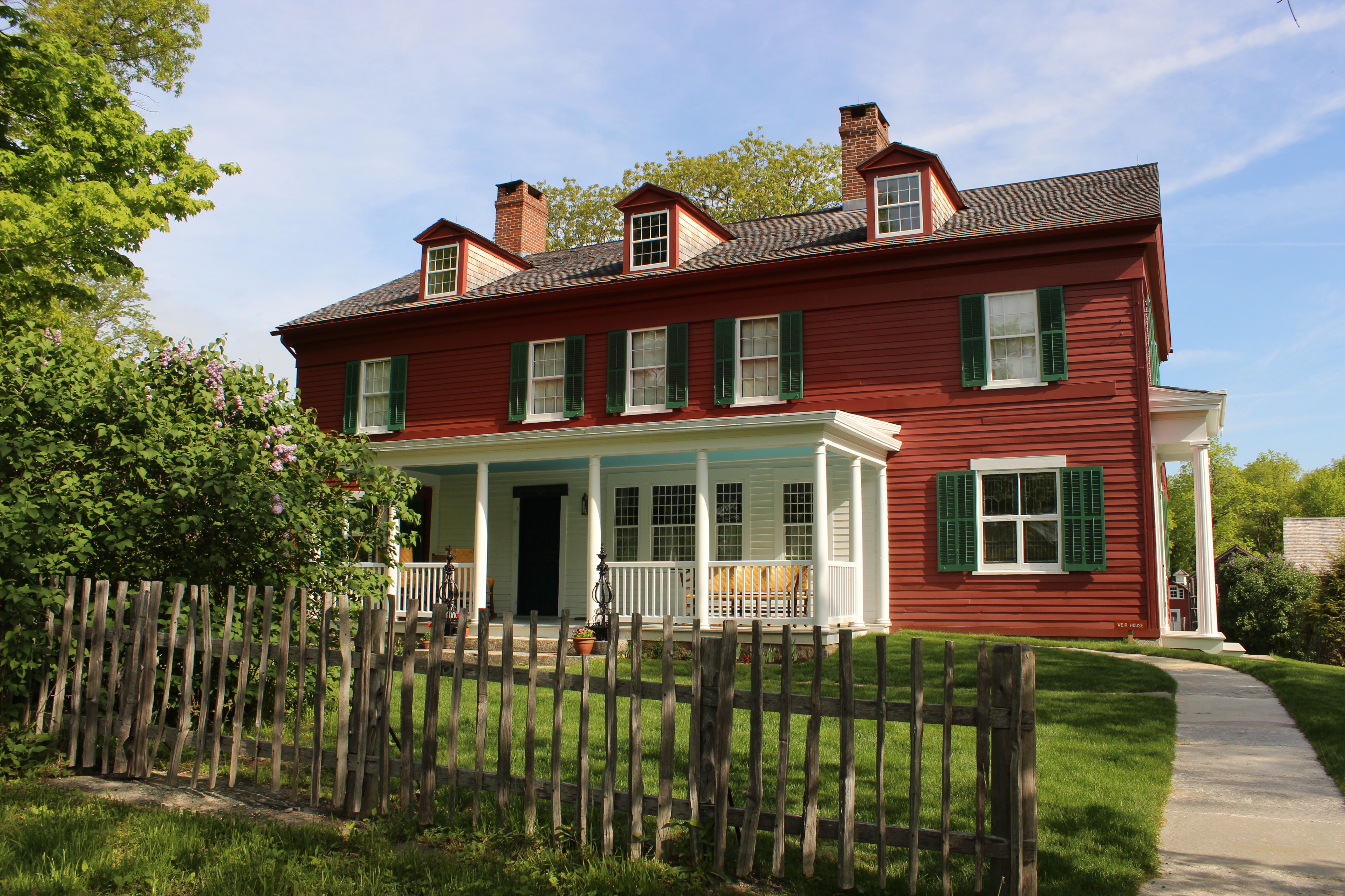
Weir Farm National Historical Park
National Historical Park
Visit the home and studio of America's most beloved Impressionist, J. Alden Weir, and walk in the footsteps of generations of world-class artists. Set amidst more than 60 acres of painterly woods, fie...
9 mi from route
~24 min detour
Free
near mile 75.3
From the Sound to the summits: the New England Trail covers 235 miles from Long Island Sound across long ridges to scenic mountain summits in Connecticut and Massachusetts. The trail offers panoramic...
Park data from the National Park Service API. Alerts update every 2 hours.
Fuel & Cost
Regular Gas
$12.12 one way
$24.24 round trip
$4.09/gal25.4 MPG avg26 kg CO2
Fuel Type
$/gal
One Way
Round Trip
midgrade
$4.50
$13.34
$26.68
premium
$4.86
$14.42
$28.84
diesel
$5.61
$16.63
$33.25
No toll roads detected on this route.
Estimated Trip Cost (one way, 1 person)
Fuel
$12
Meals
$25–$50
Total
$37–$62
Rough estimate based on US averages. Hotel $80–$140/night, meals $25–$50/day.
Estimated CO2 emission: 26.3 kg one way.
Prices: EIA weekly data, 2026-04-13.
Driving Electric?
About $8 in charging
· 0 stops
· 65% less CO2
Vehicle Type
kWh
Stops
DC Fast
Home Charge
Average EV
22.6
0
$7.91
$3.61
Efficient EV
18.8
0
$6.59
$3.01
EV Truck/SUV
30.1
0
$10.54
$4.82
Gas CO2
26 kg
EV CO2
9 kg (65% less)
This trip is well within single-charge range for most EVs. No charging stops needed if you start fully charged.
DC fast charging avg $0.35/kWh. Home charging avg $0.16/kWh. US grid CO2: 0.39 kg/kWh.
Travel Intel
Current conditions at both ends of the drive.
Forecast data refreshed 5 days ago
Origin
Ellington, CT
Late night
in Ellington on Wednesday
Local time
3:01 AM
EDT
Current temp
75°F
Unavailable
Live forecast
Destination
Danbury, CT
Late night
in Danbury on Wednesday
Local time
3:01 AM
EDT
Current temp
57°F
Unavailable
Live forecast
49°F
Brookhaven, NY
38 mi in
Seasonal Notes
Summer travel usually means heavier construction, hotter rest stops, and busier weekend traffic around major cities.
Winter travel shortens daylight, so a route that looks manageable on paper can feel much longer after dark.
Holiday weekends tend to make both departure and arrival windows slower than the raw route time suggests.
Time zone
Same local time
Origin and destination are on the same clock, so arrival timing is easier to judge at a glance.
Temperature spread
18 degrees cooler at arrival
A meaningful temperature swing is a good cue to rethink layers, water, and how soon you want to arrive.
Road read
1h 36m on the road
Use the two city cards together: check the sky where you start, then compare it with the local time and temperature at arrival.
Weather data from the National Weather Service. Conditions may change; check closer to your travel date.
Frequently Asked Questions
The drive from Ellington, CT to Danbury, CT covers 75.3 miles and takes about 1h 36m without stops. Add 15-30 minutes for a fuel or rest stop on longer drives.
The main roads are I 84, Talcottville Road, West Road. Most of the drive stays on highways, so watch for ramps and exits.
This is a comfortable same-day trip.
The midpoint is about 37.7 miles from Ellington, CT. Look for rest areas, gas stations, or food options near the halfway mark.
At current regular gas prices, expect to spend about $12.12 one way. This estimate uses 25.4 MPG — your actual cost will vary with your vehicle's fuel efficiency and current gas prices.
Leave by 9 AM and you'll arrive before lunch. Even a 4 PM departure gets you there before dark in summer.
This is a demanding drive. With 9 significant decision points across 75.3 miles, you will need to stay alert — especially through interchange areas and urban stretches. Consider splitting it into segments if you are not comfortable with fast highway navigation.
The main spots that need attention: at 0.6 miles (CT 83 / West Road): Lane positioning matters here; at 7.1 miles (I 84): Merge point - match speed before joining. Lane positioning matters here; at 15.1 miles (I 84; US 6): Highway fork - watch signs carefully. Lane positioning matters here.
The route from Ellington, CT to Danbury, CT does not surface many named destination signs beyond the main corridor.