
Trip from Erie, PA to Charleroi, PA

Data updated 28 minutes ago

Drive Time

3h 15m

Distance

154.1 mi

248 km

Drive Score

8/10

Great drive

Same Day?

Yes, doable

Fuel Cost

$26

one way

EV Charging

None

0 DC fast

Best Time to Leave

Save up to 36 min
4 AM
3h 3m ★
6 AM
3h 15m
8 AM
3h 39m
10 AM
3h 24m
12 PM
3h 21m
3 PM
3h 25m
5 PM
3h 38m
8 PM
3h 8m

Estimated drive times based on typical traffic patterns. Actual times may vary with weather, construction, and real-time conditions.

borough in Pennsylvania, United States

Charleroi, PA

Wikimedia Commons

Trip Overview

This 154.1-mile drive from Erie to Charleroi, Pennsylvania, is best suited for a single day, taking approximately 3 hours and 15 minutes. You'll navigate a mix of highways, with about 14% of the journey on high-speed roads, including the Raymond P Shafer Highway and the Mon/Fayette Expressway. The estimated fuel cost for this trip is around $26. Given its relatively short duration and turn-heavy profile, it's a straightforward journey within the Northeast region of Pennsylvania. This route offers a practical option for a day trip or a quick leg of a longer adventure.

Trip Pace

Same-day drive is realistic

A same-day return is realistic if you keep stops short.

Break Rhythm

1 planned break

A short stop every 2 to 3 hours is enough for this drive.

Midpoint

77 miles from Erie, PA

A natural place for your longest stop of the day , about 1h 27m into the drive .

Loading map...

Drive Character

Expect a "turn-heavy local drive" for the majority of this 154.1-mile trip. While 14% of the route utilizes highways, much of the journey involves navigating local roads. The longest uninterrupted stretch you'll encounter is 111.8 miles on the Raymond P Shafer Highway, offering a period of consistent travel before the road begins to change. The character of the drive will shift between faster highway segments and more intricate local driving, requiring your attention to road conditions and turns as you progress toward Charleroi.

This route has more turning and local-road decision points than a simple highway run.
There are about 29 navigation steps in the underlying route data, so the final approach matters more than the middle miles.
Raymond P Shafer Highway is the longest continuous segment at about 111.8 miles.

How Hard Is This Drive?

Expect a hands-on drive with frequent turns and local roads rather than long highway stretches. This route has several spots where lane changes, forks, or exits need your full attention. The trickiest moment comes around 114.5 miles in near I 279 / Parkway North.

Route Complexity 9/10

High effort - long or complex enough to need steady focus all day

This is a demanding drive. With 15 significant decision points across 154.1 miles, you will need to stay alert — especially through interchange areas and urban stretches. Consider splitting it into segments if you are not comfortable with fast highway navigation.

Where does it get tricky?

The main spots that need attention: at 114.5 miles (I 279 / Parkway North): Highway fork - watch signs carefully. Lane positioning matters here; at 125.9 miles (I 579): Highway fork - watch signs carefully. Lane positioning matters here; at 127.5 miles: Highway fork - watch signs carefully. Lane positioning matters here.

Critical Maneuvers

5 of 15 key points

These are the spots where you need to pay the most attention. Preview them before you drive.

8
114.5 mi into trip | ~2h 7m in | I 279 / Parkway North

Keep slight left at fork onto I 279 / Parkway North toward I 279: Pittsburgh

Highway fork - watch signs carefully. Lane positioning matters here

Use the slight left / straight lanes. Exit 72 Toward I 279: Pittsburgh
7
125.9 mi into trip | ~2h 23m in | I 579

Keep slight right at fork onto I 579 toward I 579 South: Veterans Bridge

Highway fork - watch signs carefully. Lane positioning matters here

Use the straight / slight right lanes. Toward I 579 South: Veterans Bridge
7
127.5 mi into trip | ~2h 26m in

Keep slight left at fork toward Liberty Bridge

Highway fork - watch signs carefully. Lane positioning matters here

Use the slight left lane. Toward Liberty Bridge
7
129.4 mi into trip | ~2h 30m in

Take the exit toward PA 51: Uniontown

Exit ramp - move to the correct lane early. Lane positioning matters here

Use the right lane. Toward PA 51: Uniontown
8
150.9 mi into trip | ~3h 7m in

Take the exit toward Charleroi, Donora

Exit ramp - move to the correct lane early. Lane positioning matters here. Multiple destination signs - pick the right one

Use the slight right lane. Exit 39 Toward Charleroi, Donora

Main Roads

Road Distance Duration
Raymond P Shafer Highway 111.8 mi 2h 1m
Parkway North 11.4 mi 15m
Mon/Fayette Expressway 8.2 mi 8m
Brownsville Road 6.5 mi 12m
Saw Mill Run Boulevard 2.6 mi 5m
West 12th Street 2 mi 4m
McChain Road 1.8 mi 4m
Fremont Road 1.6 mi 3m
Longest stretch: Raymond P Shafer Highway — 111.8 mi, about 2h 1m

Turn-by-Turn Driving Directions

Step-by-step road directions between Erie, PA and Charleroi, PA.

1

Start on State Street

0.4 mi · 1 min · State Street
2

Turn right onto PA 5; PA 290

2.0 mi · 4 min · West 12th Street
Use the straight lane.
3

Turn right onto Greengarden Boulevard

0.1 mi · 23 sec · Greengarden Boulevard
Use the straight / right lanes.
4

Turn left onto West Bayfront Parkway

0.2 mi · 20 sec · West Bayfront Parkway
5

Continue on I 79

112 mi · 2 hr 1 min · Raymond P Shafer Highway
Use the straight / right lanes.
6

Keep slight left at fork onto I 279

11 mi · 15 min · Parkway North
Exit 72 Toward I 279: Pittsburgh Use the slight left / straight lanes.
7

Keep slight right at fork onto I 579

1.6 mi · 2 min · I 579
Toward I 579 South: Veterans Bridge Use the straight / slight right lanes.
8

Keep slight left at fork

0.2 mi · 26 sec
Toward Liberty Bridge Use the slight left lane.
9

Continue on Liberty Bridge

0.5 mi · 1 min · Liberty Bridge
10

Continue on Liberty Tunnels

1.2 mi · 2 min · Liberty Tunnels
11

Continue on US 19 Truck

152 ft · 3 sec · West Liberty Avenue
Use the straight lane.
12

Take the exit

0.1 mi · 41 sec
Toward PA 51: Uniontown Use the right lane.
13

Merge onto PA 51

2.6 mi · 5 min · Saw Mill Run Boulevard
Use the straight / right lanes.
14

Turn slight right onto Fairhaven Road

0.1 mi · 14 sec · Fairhaven Road
15

Continue on Provost Road

1.3 mi · 2 min · Provost Road
16

Continue on Brownsville Road

2.0 mi · 3 min · Brownsville Road
17

Continue on Yellow Belt

0.5 mi · 1 min · Brownsville Road
Use the straight lane.
18

Continue on Brownsville Road

3.9 mi · 7 min · Brownsville Road
19

Turn slight left onto McChain Road

1.8 mi · 4 min · McChain Road
20

At end of road, turn left onto Finleyville Elrama Road

0.4 mi · 46 sec · Finleyville Elrama Road
21

Take the ramp

0.5 mi · 1 min
22

Merge onto PA Tpke 43

8.2 mi · 8 min · Mon/Fayette Expressway
23

Take the exit

0.3 mi · 35 sec
Exit 39 Toward Charleroi, Donora Use the slight right lane.
24

Turn sharp left onto Coyle Curtin Road

0.2 mi · 30 sec · Coyle Curtin Road
Use the left lane.
25

Turn right onto Dairy Road

0.7 mi · 1 min · Dairy Road
26

Continue on Fremont Road

1.6 mi · 3 min · Fremont Road
27

Continue on 5th Street

0.5 mi · 1 min · 5th Street
28

Turn right onto PA 88

57 ft · 1 sec · Fallowfield Avenue
29

Arrive at destination

PA 88

Trip Plan

With a duration of 3 hours and 15 minutes, this 154.1-mile drive is easily manageable in a single day. Aim to depart in the morning to allow for a relaxed pace and potential for an unplanned stop, though only one is officially noted. The fuel cost is estimated at $26, so ensure your tank is full before you leave Erie. Pay close attention to the "turn-heavy local drive" profile, especially as you transition between the main roads like the Mon/Fayette Expressway and local routes. A good tip is to download offline maps, as cell service can be inconsistent on some stretches.

Morning Departure

An early start around 7-8 AM gets you there with plenty of daylight left.

Evening Departure

A late afternoon start means arriving after dark. Morning is better.

You can normally do this drive in one day.
Plan roughly 1 meaningful break for fuel, food, and rest.
The halfway point lands around 77 miles from Erie, PA, or about 1h 27m into the drive.
The longest continuous stretch on this route runs about 111.8 miles.

This is a comfortable same-day trip.

Departure

Before you leave

Start with fuel, water, and navigation already sorted so the first hour feels easy.

First stop

Around 80 miles or 1h 30m in

Use this first pause for coffee, a restroom break, and a quick traffic check ahead.

Halfway reset

Around 77 miles or 1h 27m in

This is the best place for your longest stop, a real meal, and a full fuel check.

Final approach

Final hour starts around 2h 24m

Traffic, exits, and arrival timing usually matter more near Charleroi, PA than in the middle of the route.

Before You Leave

+

Open the route before leaving Erie, PA so your first major turns are already loaded.

+

Leave with enough water and a charging cable within reach, not packed away.

+

Check your fuel range against the first long segment, especially if you are starting outside city service areas.

Day 1

Settle into the route from Erie, PA

This is one driving day of about 154.1 miles and 3h 15m.

Your first comfortable stop window is around 80 miles from Erie, PA.
This route can stay practical as a one-day drive if traffic stays reasonable.
Plan about 1 real break rather than only quick fuel stops.
The longest stretch is on Raymond P Shafer Highway for about 111.8 miles.

Where to Stop

Rest stops, refuel points, and overnight suggestions along this route.

Halfway Point

Midpoint

About 77 mi from Erie, PA · 1h 27m into the drive

human settlement in Chautauqua County, New York, United States of America

Mid-route town

Meal stop

Mina, NY

77 mi into the route

Best for: Lunch, fuel, and a longer reset

This sits close to the middle of the route, so it works well for the longest stop of the day.

Pacing Suggestions

Mina, NY

Fuel and coffee

A short stop after about 80 miles helps settle the day before fatigue starts building.

Mina, NY

Meal break

The midpoint is around 77 miles from Erie, PA, which is a good place for a longer meal and fuel stop.

Before the longest stretch

Fuel check

Top up before Raymond P Shafer Highway if your tank is already low. That segment runs about 111.8 miles.

Arriving in Charleroi, PA

The final approach into Charleroi, PA usually feels slower than the middle of the drive, so avoid planning your tightest schedule at the very end.

Try to arrive with enough fuel left to skip an immediate station stop unless you already know the area around Charleroi, PA.

After long uninterrupted mileage, take five minutes before the last urban segment to reset and refocus on exits, merges, and city traffic.

These stop ideas are pacing suggestions — the exact town or exit can change with traffic, hotel plans, and fuel range.

National Parks Near This Route

Worth a detour if your schedule allows.

Fort Necessity National Battlefield

Fort Necessity National Battlefield

National Battlefield

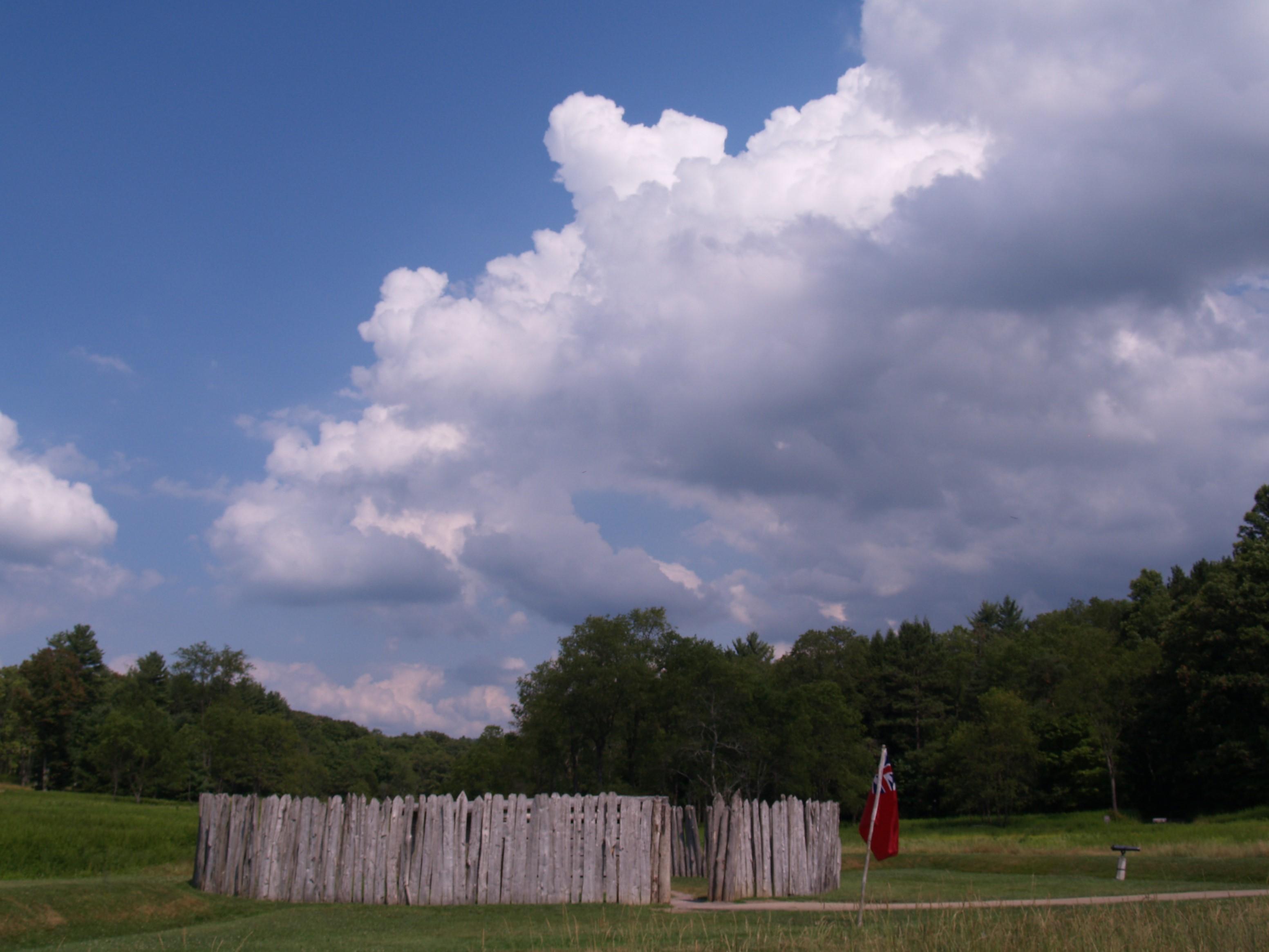
The battle at Fort Necessity in the summer of 1754 was the opening action of the French and Indian War. This war was a clash of British, French and American Indian cultures. It ended with the removal...

28 mi from route ~69 min detour Free near mile 154.1
View on nps.gov

Park data from the National Park Service API. Alerts update every 2 hours.

Fuel & Cost

Regular Gas

$25.55 one way

$51.10 round trip

$4.21/gal 25.4 MPG avg 54 kg CO2
Fuel Type $/gal One Way Round Trip
midgrade $4.61 $27.98 $55.96
premium $4.93 $29.89 $59.77
diesel $5.61 $34.02 $68.05

Estimated Tolls: $0.57

Mon/Fayette Expressway (8.2 mi) $0.57

Toll estimates based on average 2024-2025 rates. EZ-Pass/SunPass discounts may lower the actual cost.

Estimated Trip Cost (one way, 1 person)

Fuel

$26

Tolls

$1

Meals

$25–$50

Total

$51–$76

Rough estimate based on US averages. Hotel $80–$140/night, meals $25–$50/day.

Estimated CO2 emission: 53.9 kg one way. Prices: EIA weekly data, 2026-04-13.

Driving Electric?

About $16 in charging · 0 stops · 67% less CO2

Vehicle Type kWh Stops DC Fast Home Charge
Average EV 46.2 0 $16.18 $7.40
Efficient EV 38.5 0 $13.48 $6.16
EV Truck/SUV 61.6 0 $21.57 $9.86

Gas CO2

54 kg

EV CO2

18 kg (67% less)

This trip is well within single-charge range for most EVs. No charging stops needed if you start fully charged.

DC fast charging avg $0.35/kWh. Home charging avg $0.16/kWh. US grid CO2: 0.39 kg/kWh.

Travel Intel

Current conditions at both ends of the drive.

Forecast data refreshed 5 hours ago

Origin

Erie, PA

Night in Erie on Tuesday

Local time

10:45 PM

EDT

Current temp

65°F

Chance Showers And Thunderstorms

W 14 mph 44% chance Live forecast

Severe Thunderstorm Warning

Severe Thunderstorm Warning issued April 14 at 5:10PM EDT until April 14 at 5:30PM EDT by NWS Pittsburgh PA

Severe Thunderstorm Watch

Severe Thunderstorm Watch issued April 14 at 2:51PM EDT until April 14 at 10:00PM EDT by NWS Binghamton NY

Destination

Charleroi, PA

Night in Charleroi on Tuesday

Local time

10:45 PM

EDT

Current temp

57°F

Unavailable

Live forecast

52°F

Mina, NY

77 mi in

Seasonal Notes

Summer travel usually means heavier construction, hotter rest stops, and busier weekend traffic around major cities.

Winter travel shortens daylight, so a route that looks manageable on paper can feel much longer after dark.

Holiday weekends tend to make both departure and arrival windows slower than the raw route time suggests.

Time zone

Same local time

Origin and destination are on the same clock, so arrival timing is easier to judge at a glance.

Temperature spread

8 degrees cooler at arrival

A meaningful temperature swing is a good cue to rethink layers, water, and how soon you want to arrive.

Road read

3h 15m on the road

The weather snapshot is not static. If you are leaving later, give both cities one more quick forecast check before departure.

Weather data from the National Weather Service. Conditions may change; check closer to your travel date.

Frequently Asked Questions

The drive from Erie, PA to Charleroi, PA covers 154.1 miles and takes about 3h 15m without stops. Add 15-30 minutes for a fuel or rest stop on longer drives.
The main roads are Raymond P Shafer Highway, Parkway North, Mon/Fayette Expressway. Expect a mix of highway and local road driving.
This is a comfortable same-day trip.
The midpoint is about 77 miles from Erie, PA. Look for rest areas, gas stations, or food options near the halfway mark.
At current regular gas prices, expect to spend about $25.55 one way. This estimate uses 25.4 MPG — your actual cost will vary with your vehicle's fuel efficiency and current gas prices.
An early start around 7-8 AM gets you there with plenty of daylight left. A late afternoon start means arriving after dark. Morning is better.
Plan about 1 meaningful break for fuel, food, or rest. A short stop every 2 to 3 hours is enough for this drive.
This is a demanding drive. With 15 significant decision points across 154.1 miles, you will need to stay alert — especially through interchange areas and urban stretches. Consider splitting it into segments if you are not comfortable with fast highway navigation.
The main spots that need attention: at 114.5 miles (I 279 / Parkway North): Highway fork - watch signs carefully. Lane positioning matters here; at 125.9 miles (I 579): Highway fork - watch signs carefully. Lane positioning matters here; at 127.5 miles: Highway fork - watch signs carefully. Lane positioning matters here.
The route from Erie, PA to Charleroi, PA does not surface many named destination signs beyond the main corridor.

Was this route helpful?

Thanks for your feedback!

Your tip has been submitted. Thanks!

/500

Explore More

Explore more options from Erie, PA or browse trips ending in Charleroi, PA.

Looking for more statewide routes? Browse PA road trips.

Explore maps for Erie, PA or Charleroi, PA on MapSof.net.