This 490.9-mile journey from Flint, MI, to Atlantic Mine, MI, is best tackled over two days, as it will take approximately 9 hours and 29 minutes of driving time. With a projected fuel cost of $77, this highway-focused drive primarily utilizes I-75, US-41, and M-28. Given its length and duration, splitting this trip into two days is highly recommended for a more comfortable experience. You'll be traversing the Midwest for this entire route, staying within Michigan. The drive offers a straightforward path through the state, making it a practical choice for reaching the western Upper Peninsula.
Trip Pace
Best split across 2 days
Treat the return leg as its own travel day rather than an afterthought.
Break Rhythm
2 planned breaks
Plan on a short reset every 3 to 4 hours to stay fresh behind the wheel.
Midpoint
245.5 miles from Flint, MI
A natural place for your longest stop of the day
, about 4h 17m into the drive
.
Who Is This Route For?
Family Friendly
Moderate complexity with 2 natural rest stops along the way.
Solo Traveler
9h 29m drive, plan rest stops for pacing.
First-Time Driver
Mostly highway driving (76%). Some complex stretches to watch for.
Drive Character
Expect a predominantly highway-focused experience on this route, with 76% of the drive on high-speed roads. The longest uninterrupted stretch is a significant 218.5 miles on I-75, meaning you'll have plenty of opportunity to maintain a steady pace for a considerable portion of your travel. While the initial stages are highway-centric, the latter parts of the drive will transition to US-41 and M-28, offering a change of scenery as you progress further into Michigan's Upper Peninsula. This mix suggests a drive that starts with efficiency and gradually introduces more varied road conditions.
Most of the miles stay on highways, which makes pacing and fuel planning easier than turn-by-turn city driving.
There are about 47 navigation steps in the underlying route data, so the final approach matters more than the middle miles.
I 75 is the longest continuous segment at about 218.5 miles.
How Hard Is This Drive?
This is a straightforward highway drive that stays mostly on I 75 and US 41. You will hit about 29 points where you need to pay attention to lane position or signs. The trickiest moment comes early in the drive near M 21 / East Court Street.
Driving Effort5/10
Moderate - straightforward overall, but long enough or busy enough to require pacing
Balances navigation complexity with total wheel time.
This drive requires moderate attention. Across 490.9 miles you will encounter 29 spots where lane choice or exit timing matters. Not difficult for experienced highway drivers, but worth previewing the tricky sections before you go.
Where does it get tricky?
The main spots that need attention: near the start (M 21 / East Court Street): Sharp turn - reduce speed on approach; at 0.1 miles (Saginaw Street): Navigation decision point; at 229.1 miles: Exit ramp - move to the correct lane early. Multiple destination signs - pick the right one.
Critical Maneuvers
5 of 29 key points
These are the spots where you need to pay the most attention. Preview them before you drive.
7
0 mi into trip|~0m in|M 21 / East Court Street
Turn uturn onto M 21 / East Court Street
Sharp turn - reduce speed on approach
5
0.1 mi into trip|~0m in|Saginaw Street
Turn right onto Saginaw Street
Navigation decision point
6
229.1 mi into trip|~3h 57m in
Take the exit toward US 2: Manistique, Escanaba
Exit ramp - move to the correct lane early. Multiple destination signs - pick the right one
Exit 344B
Toward US 2: Manistique, Escanaba
5
312 mi into trip|~5h 35m in|M 28 / M-28
Turn sharp left onto M 28 / M-28
Sharp turn - reduce speed on approach
5
347.3 mi into trip|~6h 17m in|M 28 / East Munising
Enter roundabout onto M 28 / East Munising
Roundabout - know your exit number before entering
Towns Mentioned on Route Signs
Based on OSRM destination-sign hints, not a full list of every settlement the road passes.
On the drive from Flint, MI to Atlantic Mine, MI, road signs begin pointing toward Escanaba along the way.
Escanaba
229.1 mi in|~3h 57m
Main Roads
Road
Distance
Duration
I 75
218.5 mi
3h 44m
US 41
77.3 mi
1h 38m
M-28
70.9 mi
1h 23m
US-2 West
62.1 mi
1h 12m
M 77
17.3 mi
20m
County Road 480
12.5 mi
18m
UAW Freeway
9.7 mi
10m
Chassell Painesdale Road
4.1 mi
7m
Longest stretch:
I 75
— 218.5 mi, about 3h 44m
Turn-by-Turn Driving Directions
Step-by-step road directions between Flint, MI and Atlantic Mine, MI.
1
Start on this road
93 ft·11 sec·this road
2
Turn uturn onto M 21
253 ft·17 sec·East Court Street
3
Turn right onto Saginaw Street
0.1 mi·28 sec·Saginaw Street
4
Turn right onto East Third Street
0.4 mi·1 min·East Third Street
5
Turn left onto Chavez Drive
483 ft·13 sec·Chavez Drive
6
Take the ramp
0.2 mi·28 sec
Toward I 475 North
7
Merge onto I 475
9.7 mi·10 min·UAW Freeway
8
Merge onto I 75; US 23
38 mi·40 min·I 75; US 23
9
Keep slight left at fork onto I 75; US 23
63 mi·1 hr 3 min·I 75; US 23
10
Keep slight left at fork onto I 75
118 mi·2 hr 1 min·I 75
11
Take the exit
0.4 mi·1 min
Exit 344BToward US 2: Manistique, Escanaba
12
Merge onto US 2; I 75 BL
0.7 mi·1 min·US-2 West
13
Continue on US 2
3.2 mi·3 min·US 2
14
Continue on US 2
61 mi·1 hr 11 min·US-2 West
15
Turn right onto M 77
17 mi·20 min·M 77
16
Turn sharp left onto M 28
35 mi·41 min·M-28
17
Continue on M 28
0.2 mi·28 sec·Cedar Street
18
Enter roundabout onto M 28
194 ft·11 sec·East Munising
19
Continue on M 28
2.2 mi·4 min·East Munising
20
Continue on M 28
36 mi·42 min·M-28
21
Continue on CR 551
1.8 mi·2 min·Cherry Creek Road
Use the straight lane.
22
Turn right onto CR 480
13 mi·18 min·County Road 480
23
Continue on Rail Street
0.4 mi·36 sec·Rail Street
24
Turn right onto Division Street
503 ft·10 sec·Division Street
25
Turn right onto M 28 BUS
440 ft·12 sec·West Main Street
26
Turn left onto M 28 BUS
0.5 mi·52 sec·North Teal Lake Avenue
27
Turn left onto US 41; M 28
2.7 mi·4 min·US Highway 41
28
Enter roundabout onto US 41; M 28
83 ft·4 sec·US 41; M 28
29
Continue on US 41; M 28
0.9 mi·1 min·US 41; M 28
30
Enter roundabout onto US 41; M 28
88 ft·5 sec·US 41; M 28
31
Continue on US 41; M 28
76 mi·1 hr 36 min·US 41; M 28
32
Turn left onto 5th Street
0.2 mi·17 sec·5th Street
33
Continue on Chassell Painesdale Road
4.1 mi·7 min·Chassell Painesdale Road
34
Turn right onto P-651
0.5 mi·54 sec·Superior Road
35
Continue on County Road P-67
1.5 mi·2 min·County Road P-67
36
Continue on County Road A-67
0.4 mi·44 sec·County Road A-67
37
Continue on Baltic-Onkalo's Corner Road
0.1 mi·15 sec·Baltic-Onkalo's Corner Road
38
Continue on 15th Street
0.2 mi·19 sec·15th Street
39
Continue on County Road A-67
0.2 mi·21 sec·County Road A-67
40
Continue on 12th Street
0.4 mi·50 sec·12th Street
41
At end of road, turn left onto Stanton Avenue
0.3 mi·30 sec·Stanton Avenue
42
Turn left onto Trimountain Avenue
0.1 mi·15 sec·Trimountain Avenue
43
Turn right onto M 26
1.6 mi·2 min·Baltic Avenue
44
Turn left onto Erickson Drive
0.6 mi·1 min·Erickson Drive
45
Turn left onto Huron
302 ft·14 sec·Huron
46
Turn right onto Edwards Street
101 ft·4 sec·Edwards Street
47
Arrive at destination
Edwards Street
Trip Plan
To make the most of this 9.5-hour drive, plan for an overnight stop. Aim to depart early in the morning to maximize daylight driving and allow for two stops along the way. The longest stretch without a break is over 200 miles, so be sure to fuel up before embarking on that segment. Given the $77 fuel cost, budgeting is straightforward. Consider breaking the trip near the halfway point to ensure a balanced driving schedule over your two days, making the journey more enjoyable and less taxing.
Morning Departure
Start early — leave by 6-7 AM to arrive at a reasonable hour.
Evening Departure
This is a long drive — plan for a morning departure or consider splitting it into two days.
This drive is better paced as a 2-day trip.
Plan roughly 2 meaningful breaks for fuel, food, and rest.
The halfway point lands around 245.5 miles from Flint, MI, or about 4h 17m into the drive.
The longest continuous stretch on this route runs about 218.5 miles.
Consider an overnight stop or starting very early.
Departure
Before you leave
Start with fuel, water, and navigation already sorted so the first hour feels easy.
First stop
Around 108 miles or 1h 53m in
Use this first pause for coffee, a restroom break, and a quick traffic check ahead.
Halfway reset
Around 245.5 miles or 4h 17m in
This is the best place for your longest stop, a real meal, and a full fuel check.
Overnight split
Day 1 wrap after about 245.5 miles or 4h 17m
Stop before fatigue turns the last few hours into a grind. You want day two to start fresh, not just resumed.
Final approach
Final hour starts around 8h 7m
Traffic, exits, and arrival timing usually matter more near Atlantic Mine, MI than in the middle of the route.
Before You Leave
+
Open the route before leaving Flint, MI so your first major turns are already loaded.
+
Leave with enough water and a charging cable within reach, not packed away.
+
Check your fuel range against the first long segment, especially if you are starting outside city service areas.
+
Pick one backup stop option before the midpoint in case traffic changes your pacing.
+
Treat this as a 2-day road trip and book the overnight stop before the busiest arrival window.
Day 1
Settle into the route from Flint, MI
Aim for roughly 245 miles and 4.7 hours of wheel time on this day.
Day 2
Finish the approach into Atlantic Mine, MI
Aim for roughly 245 miles and 4.7 hours of wheel time on this day.
Your first comfortable stop window is around 108 miles from Flint, MI.
This route usually feels better as a 2-day drive than as one long push.
Plan about 2 real breaks rather than only quick fuel stops.
The longest stretch is on I 75 for about 218.5 miles.
Where to Stop
Rest stops, refuel points, and overnight suggestions along this route.
Halfway Point
Midpoint
About 245.5 mi from Flint, MI
· 4h 17m into the drive
The midpoint is around 245.5 miles from Flint, MI, which is a good place for a longer meal and fuel stop.
Before the longest stretch
Fuel check
Top up before I 75 if your tank is already low. That segment runs about 218.5 miles.
Overnight split
Hotel stop
For a steadier pace, wrap day one after about 245 miles or 4.7 hours on the road.
Arriving in Atlantic Mine, MI
The final approach into Atlantic Mine, MI usually feels slower than the middle of the drive, so avoid planning your tightest schedule at the very end.
Try to arrive with enough fuel left to skip an immediate station stop unless you already know the area around Atlantic Mine, MI.
On a multi-day trip, keep the last day a little lighter so you reach Atlantic Mine, MI with some flexibility left in the schedule.
After long uninterrupted mileage, take five minutes before the last urban segment to reset and refocus on exits, merges, and city traffic.
These stop ideas are pacing suggestions — the exact town or exit can change with traffic, hotel plans, and fuel range.
National Parks Near This Route
Worth a detour if your schedule allows.
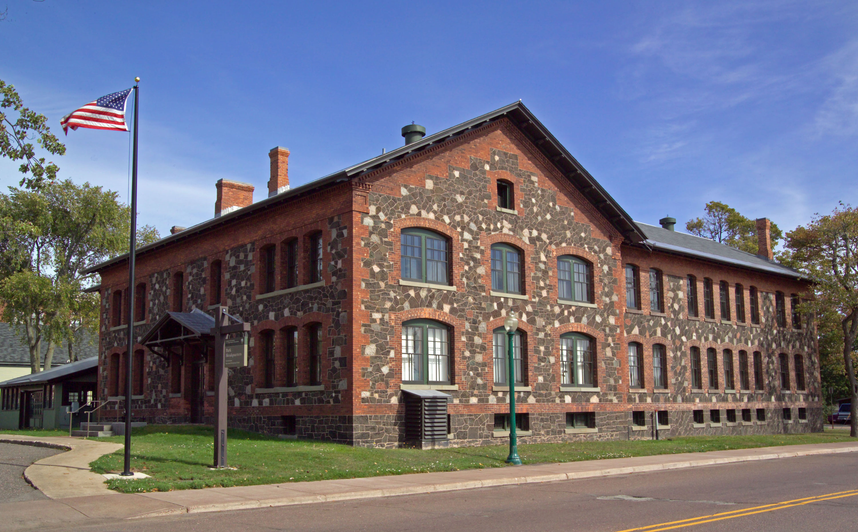
Keweenaw National Historical Park
National Historical Park
The stories of people and copper in the Keweenaw Peninsula have been intertwined for more than 7,000 years. Indigenous peoples made copper into tools and trade items. Investors and immigrants arrived...
8 mi from route
~19 min detour
Free
near mile 490.9
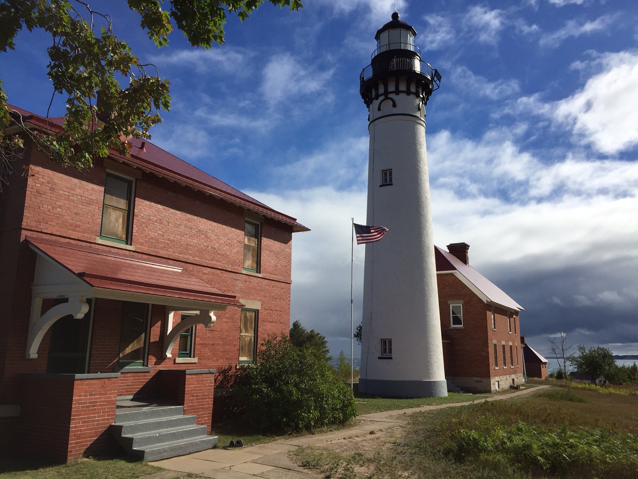
Sandstone cliffs, beaches, waterfalls, sand dunes, inland lakes, deep forest, and wild shoreline beckon you to visit Pictured Rocks National Lakeshore. The power of Lake Superior shapes the park's coa...
17 mi from route
~42 min detour
$25
near mile 321.6
Park data from the National Park Service API. Alerts update every 2 hours.
Fuel & Cost
Regular Gas
$76.75 one way
$153.49 round trip
$3.97/gal25.4 MPG avg172 kg CO2
Fuel Type
$/gal
One Way
Round Trip
midgrade
$4.36
$84.26
$168.53
premium
$4.89
$94.47
$188.94
diesel
$5.61
$108.38
$216.77
No toll roads detected on this route.
Estimated Trip Cost (one way, 1 person)
Fuel
$77
Hotel (1n)
$80–$140
Meals
$50–$100
Total
$207–$317
Rough estimate based on US averages. Hotel $80–$140/night, meals $25–$50/day.
Estimated CO2 emission: 171.8 kg one way.
Prices: EIA weekly data, 2026-04-13.
Driving Electric?
About $52 in charging
· 1 stop
· 67% less CO2
Vehicle Type
kWh
Stops
DC Fast
Home Charge
Average EV
147.3
1
$51.54
$23.56
Efficient EV
122.7
1
$42.95
$19.64
EV Truck/SUV
196.4
2
$68.73
$31.42
Gas CO2
172 kg
EV CO2
57 kg (67% less)
Plan for 1 charging stop. A 30-minute DC fast charge mid-route should be enough to complete the trip comfortably.
DC fast charging avg $0.35/kWh. Home charging avg $0.16/kWh. US grid CO2: 0.39 kg/kWh.
Travel Intel
Current conditions at both ends of the drive.
Forecast as of Apr 16, 2026
Origin
Flint, MI
Morning
in Flint on Friday
Local time
8:59 AM
EDT
Current temp
71°F
Showers And Thunderstorms
W 10 mph84% chanceLive forecast
Destination
Atlantic Mine, MI
Morning
in Atlantic Mine on Friday
Local time
8:59 AM
EDT
Current temp
48°F
Unavailable
Live forecast
33°F
McMillan, MI
245 mi in
Seasonal Notes
Summer travel usually means heavier construction, hotter rest stops, and busier weekend traffic around major cities.
Winter travel shortens daylight, so a route that looks manageable on paper can feel much longer after dark.
Holiday weekends tend to make both departure and arrival windows slower than the raw route time suggests.
For long drives, weather on day two can matter just as much as conditions at departure, so check the whole travel window rather than only the first day.
Time zone
Same local time
Origin and destination are on the same clock, so arrival timing is easier to judge at a glance.
Temperature spread
23 degrees cooler at arrival
A meaningful temperature swing is a good cue to rethink layers, water, and how soon you want to arrive.
Road read
9h 29m on the road
This is long enough that the arrival forecast matters almost as much as departure conditions. Recheck both ends before you roll.
Weather data from the National Weather Service. Conditions may change; check closer to your travel date.
Frequently Asked Questions
The drive from Flint, MI to Atlantic Mine, MI covers 490.9 miles and takes about 9h 29m without stops. Add 15-30 minutes for a fuel or rest stop on longer drives.
The main roads are I 75, US 41, M-28. Most of the drive stays on highways, so watch for ramps and exits.
Consider an overnight stop or starting very early.
Yes. This route is usually more comfortable as a 2-day drive. A sensible stopping point is after roughly 245 miles on day one.
The midpoint is about 245.5 miles from Flint, MI. Look for rest areas, gas stations, or food options near the halfway mark.
At current regular gas prices, expect to spend about $76.75 one way. This estimate uses 25.4 MPG — your actual cost will vary with your vehicle's fuel efficiency and current gas prices.
Start early — leave by 6-7 AM to arrive at a reasonable hour. This is a long drive — plan for a morning departure or consider splitting it into two days.
Plan about 2 meaningful breaks for fuel, food, or rest. Plan on a short reset every 3 to 4 hours to stay fresh behind the wheel.
This drive requires moderate attention. Across 490.9 miles you will encounter 29 spots where lane choice or exit timing matters. Not difficult for experienced highway drivers, but worth previewing the tricky sections before you go.
The main spots that need attention: near the start (M 21 / East Court Street): Sharp turn - reduce speed on approach; at 0.1 miles (Saginaw Street): Navigation decision point; at 229.1 miles: Exit ramp - move to the correct lane early. Multiple destination signs - pick the right one.
On the drive from Flint, MI to Atlantic Mine, MI, road signs begin pointing toward Escanaba along the way.
Yes. Nearby national parks include Keweenaw National Historical Park and Pictured Rocks National Lakeshore.
How this page is built
Compiled and maintained by the Trip.ovh planning team at COD Solutions Oy (Helsinki). Each route is built from authoritative open government and mapping datasets rather than crowdsourced reviews. Distances and geometry come from
OSRM
over
OpenStreetMap.
Fuel cost uses
EIA
weekly regional averages.
National park proximity is from the
NPS API.
Pages are published only after passing our data-quality checks; our
methodology page
documents refresh cadence, editorial standards, and known limitations.