The drive from Fresno, CA to Mariposa, CA covers 71.9 miles and takes about 1h 41m behind the wheel.
This route is realistic as a one-day drive if you keep your stops efficient.
The route leans on Southern Yosemite Highway, CA 49, Dwight David Eisenhower Memorial Freeway for much of the mileage,
and the overall profile is mixed drive.
The longest uninterrupted segment is about 35.5 miles on Southern Yosemite Highway.
At current regular gas prices, budget about $16.53 one way before food or hotel costs.
Trip Pace
Same-day drive is realistic
A same-day return is realistic if you keep stops short.
Midpoint
36 miles from Fresno, CA
A natural place for your longest stop of the day
, about 48m into the drive
.
Fresno is in the San Joaquin Valley of California. Many visitors find themselves stopping in Fresno on the way to Yosemite National Park, Sequoia and Kings Canyon National Parks, or other destinations in the Sierras.
Top landmarks
•Holy Trinity Church, Fresno — church building in Fresno, United States of America
•Fresno station — train station in Fresno, California
•Kearney Park — park in Fresno County, California, United States of America
Mixed drive route profile with national parks nearby.
Drive Character
The drive from Fresno, CA to Mariposa, CA covers 71.9 miles and takes about 1h 41m, using a mix of highways and local roads.
Expect a mix of faster highway mileage and slower local approaches near the beginning or end.
There are about 13 navigation steps in the underlying route data, so the final approach matters more than the middle miles.
Southern Yosemite Highway is the longest continuous segment at about 35.5 miles.
How Hard Is This Drive?
This route mixes highway mileage with some local-road sections near the start or finish. Navigation is very simple - set it and forget it for most of the drive. The trickiest moment comes around 0.3 miles in near East Tulare Avenue.
Driving Effort2/10
Very easy - short and simple to drive
Balances navigation complexity with total wheel time.
The drive from Fresno, CA to Mariposa, CA is easy. At 1h 41m with 49% highway, most drivers will find it relaxed and low-stress.
Where does it get tricky?
The main spots that need attention: at 0.3 miles (East Tulare Avenue): Navigation decision point; at 0.5 miles: Navigation decision point; at 0.8 miles (CA 41 / Dwight David Eisenhower Memorial Freeway): Merge point - match speed before joining. Lane positioning matters here.
Critical Maneuvers
5 of 6 key points
These are the spots where you need to pay the most attention. Preview them before you drive.
4
0.3 mi into trip|~0m in|East Tulare Avenue
Turn right onto East Tulare Avenue
Navigation decision point
5
0.5 mi into trip|~1m in
Take the ramp
Navigation decision point
5
0.8 mi into trip|~1m in|CA 41 / Dwight David Eisenhower Memorial Freeway
Merge onto CA 41 / Dwight David Eisenhower Memorial Freeway
Merge point - match speed before joining. Lane positioning matters here
Use the straight / slight right lanes.
3
45.4 mi into trip|~1h 1m in|CA 49
Turn left onto CA 49
Navigation decision point
5
71.9 mi into trip|~1h 41m in
Turn right
Navigation decision point
Main Roads
Road
Distance
Duration
Southern Yosemite Highway
35.5 mi
49m
CA 49
26.4 mi
40m
Dwight David Eisenhower Memorial Freeway
6.4 mi
7m
Yosemite Freeway
2.6 mi
3m
North First Street
0.3 mi
<1m
East Tulare Avenue
0.2 mi
<1m
Divisadero Street
<0.1 mi
<1m
6th Street
<0.1 mi
<1m
Longest stretch:
Southern Yosemite Highway
— 35.5 mi, about 49m
Turn-by-Turn Driving Directions
Step-by-step road directions between Fresno, CA and Mariposa, CA.
1
Start on East Washington Avenue
28 ft·1 sec·East Washington Avenue
2
Turn left onto North First Street
0.3 mi·48 sec·North First Street
3
Turn right onto East Tulare Avenue
0.2 mi·16 sec·East Tulare Avenue
4
Turn slight right onto Divisadero Street
339 ft·10 sec·Divisadero Street
5
Take the ramp
0.3 mi·36 sec
6
Merge onto CA 41
6.4 mi·7 min·Dwight David Eisenhower Memorial Freeway
Use the straight / slight right lanes.
7
Continue on CA 41
2.6 mi·3 min·Yosemite Freeway
8
Continue on CA 41
36 mi·49 min·Southern Yosemite Highway
Use the straight / slight right lanes.
9
Turn left onto CA 49
21 mi·31 min·CA 49
10
Turn straight onto CA 49
5.5 mi·8 min·CA 49
11
Turn left onto 6th Street
214 ft·9 sec·6th Street
12
Turn right
133 ft·9 sec
13
Arrive at destination
Trip Plan
Morning Departure
Leave by 9 AM and you'll arrive before lunch.
Evening Departure
Even a 4 PM departure gets you there before dark in summer.
You can normally do this drive in one day.
You may only need one short stretch break if traffic stays light.
The halfway point lands around 36 miles from Fresno, CA, or about 48m into the drive.
The longest continuous stretch on this route runs about 35.5 miles.
This is a comfortable same-day trip.
Departure
Before you leave
Start with fuel, water, and navigation already sorted so the first hour feels easy.
First stop
Around 16 miles or 20m in
Use this first pause for coffee, a restroom break, and a quick traffic check ahead.
Halfway reset
Around 36 miles or 48m in
This is the best place for your longest stop, a real meal, and a full fuel check.
Final approach
Final hour starts around 1h 25m
Traffic, exits, and arrival timing usually matter more near Mariposa, CA than in the middle of the route.
Before You Leave
+
Open the route before leaving Fresno, CA so your first major turns are already loaded.
Day 1
Settle into the route from Fresno, CA
This is one driving day of about 71.9 miles and 1h 41m.
Your first comfortable stop window is around 16 miles from Fresno, CA.
This route can stay practical as a one-day drive if traffic stays reasonable.
The longest stretch is on Southern Yosemite Highway for about 35.5 miles.
Where to Stop
Rest stops, refuel points, and overnight suggestions along this route.
The midpoint is around 36 miles from Fresno, CA, which is a good place for a longer meal and fuel stop.
Arriving in Mariposa, CA
The final approach into Mariposa, CA usually feels slower than the middle of the drive, so avoid planning your tightest schedule at the very end.
These stop ideas are pacing suggestions — the exact town or exit can change with traffic, hotel plans, and fuel range.
National Parks Near This Route
Worth a detour if your schedule allows.
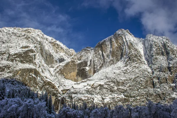
Yosemite National Park
National Park
Not just a great valley, but a shrine to human foresight, the strength of granite, the power of glaciers, the persistence of life, and the tranquility of the High Sierra. First protected in 1864, Yose...
29 mi from route
~73 min detour
$35
near mile 59.5
Park Closure: Tioga Road (Hwy 120 through the park) and Glacier Point Road are closed
Station data from NREL Alternative Fuel Stations database.
Driving Electric?
About $8 in charging
· 0 stops
· 68% less CO2
Vehicle Type
kWh
Stops
DC Fast
Home Charge
Average EV
21.6
0
$7.55
$3.45
Efficient EV
18
0
$6.29
$2.88
EV Truck/SUV
28.8
0
$10.07
$4.60
Gas CO2
25 kg
EV CO2
8 kg (68% less)
This trip is well within single-charge range for most EVs. No charging stops needed if you start fully charged.
DC fast charging avg $0.35/kWh. Home charging avg $0.16/kWh. US grid CO2: 0.39 kg/kWh.
Travel Intel
Current conditions at both ends of the drive.
Forecast as of Apr 18, 2026
Origin
Fresno, CA
Morning
in Fresno on Saturday
Local time
6:38 AM
PDT
Current temp
51°F
Unavailable
Live forecast
Destination
Mariposa, CA
Morning
in Mariposa on Saturday
Local time
6:38 AM
PDT
Current temp
48°F
Partly Cloudy
NE 0 to 5 mph0% chanceLive forecast
Freeze Warning
Freeze Warning issued April 17 at 7:10PM PDT until April 18 at 8:00AM PDT by NWS Eureka CA
39°F
Oakhurst, CA
36 mi in
Seasonal Notes
Summer travel usually means heavier construction, hotter rest stops, and busier weekend traffic around major cities.
Winter travel shortens daylight, so a route that looks manageable on paper can feel much longer after dark.
Holiday weekends tend to make both departure and arrival windows slower than the raw route time suggests.
Time zone
Same local time
Origin and destination are on the same clock, so arrival timing is easier to judge at a glance.
Temperature spread
3 degrees cooler at arrival
A meaningful temperature swing is a good cue to rethink layers, water, and how soon you want to arrive.
Road read
1h 41m on the road
The weather snapshot is not static. If you are leaving later, give both cities one more quick forecast check before departure.
Weather data from the National Weather Service. Conditions may change; check closer to your travel date.
Frequently Asked Questions
The drive from Fresno, CA to Mariposa, CA covers 71.9 miles and takes about 1h 41m without stops. Add 15-30 minutes for a fuel or rest stop on longer drives.
The main roads are Southern Yosemite Highway, CA 49, Dwight David Eisenhower Memorial Freeway. Expect a mix of highway and local road driving.
This is a comfortable same-day trip.
The midpoint is about 36 miles from Fresno, CA. Look for rest areas, gas stations, or food options near the halfway mark.
At current regular gas prices, expect to spend about $16.53 one way. This estimate uses 25.4 MPG — your actual cost will vary with your vehicle's fuel efficiency and current gas prices.
Leave by 9 AM and you'll arrive before lunch. Even a 4 PM departure gets you there before dark in summer.
The drive from Fresno, CA to Mariposa, CA is easy. At 1h 41m with 49% highway, most drivers will find it relaxed and low-stress.
The main spots that need attention: at 0.3 miles (East Tulare Avenue): Navigation decision point; at 0.5 miles: Navigation decision point; at 0.8 miles (CA 41 / Dwight David Eisenhower Memorial Freeway): Merge point - match speed before joining. Lane positioning matters here.
The route from Fresno, CA to Mariposa, CA does not surface many named destination signs beyond the main corridor.
How this page is built
Compiled by the Trip.ovh planning team at COD Solutions Oy from open government datasets — OSRM over OpenStreetMap for geometry, EIA for fuel prices, NREL for EV charging, and NPS for national parks. See our methodology for refresh cadence and limitations.