Frost, MI to Rabbit Bay, MI is 80.4 miles and takes about 2 hours 5 minutes via M 26 and Federal Forest Highway 16, with a fuel budget near $13 and enough daylight to finish in a day. This drive stays within Michigan, traversing the Midwest region. Expect a turn-heavy local driving experience for this relatively short trip. Given its manageable distance and duration, this route is best suited for a single-day adventure, allowing ample time for exploration at your destination.
Trip Pace
Same-day drive is realistic
A same-day return is realistic if you keep stops short.
Midpoint
40.2 miles from Frost, MI
A natural place for your longest stop of the day
, about 1h into the drive
.
Who Is This Route For?
Weekend Trip
Doable as a same-day drive at 2h 5m. Total distance: 80.4 miles.
Family Friendly
Moderate complexity with 0 natural rest stops along the way.
Turn-heavy local drive route profile with national parks nearby.
Drive Character
This route is characterized by its frequent turns, making it a more engaging local drive rather than a straight shot. Only about 15% of the journey involves highway driving. You'll encounter the longest uninterrupted stretch of 47.7 miles on M 26. As you progress, the roads will transition, offering a dynamic driving experience that keeps you attentive and involved.
This route has more turning and local-road decision points than a simple highway run.
There are about 10 navigation steps in the underlying route data, so the final approach matters more than the middle miles.
M 26 is the longest continuous segment at about 47.7 miles.
How Hard Is This Drive?
Expect a hands-on drive with frequent turns and local roads rather than long highway stretches. Navigation is very simple - set it and forget it for most of the drive. The trickiest moment comes around 11.7 miles in near M 38.
Driving Effort1/10
Very easy - short and simple to drive
Balances navigation complexity with total wheel time.
The drive from Frost, MI to Rabbit Bay, MI is easy. At 2h 5m with 15% highway, most drivers will find it relaxed and low-stress.
Where does it get tricky?
The main spots that need attention: at 11.7 miles (M 38): Navigation decision point; at 18.9 miles (M 26): Navigation decision point; at 66.6 miles (9th Street): Navigation decision point.
Critical Maneuvers
5 of 6 key points
These are the spots where you need to pay the most attention. Preview them before you drive.
4
11.7 mi into trip|~20m in|M 38
At end of road, turn left onto M 38
Navigation decision point
5
18.9 mi into trip|~30m in|M 26
At end of road, turn right onto M 26
Navigation decision point
4
66.6 mi into trip|~1h 40m in|9th Street
Turn right onto 9th Street
Navigation decision point
4
77.6 mi into trip|~2h in|Rabbit Bay Road
Turn left onto Rabbit Bay Road
Navigation decision point
4
80.4 mi into trip|~2h 5m in|Rabbit Beach Road
Turn right onto Rabbit Beach Road
Navigation decision point
Towns Mentioned on Route Signs
Based on OSRM destination-sign hints, not a full list of every settlement the road passes.
On the drive from Frost, MI to Rabbit Bay, MI, road signs begin pointing toward M 26: Lake Linden along the way.
M 26: Lake Linden
56 mi in|~1h 23m|via M 26
Main Roads
Road
Distance
Duration
M 26
47.7 mi
1h 9m
Federal Forest Highway 16
11.7 mi
20m
Bootjack Road
7.5 mi
13m
M 38
7.2 mi
9m
Jacobsville Road
3.1 mi
5m
Rabbit Bay Road
2.7 mi
4m
9th Street
0.5 mi
<1m
Rabbit Beach Road
<0.1 mi
<1m
Longest stretch:
M 26
— 47.7 mi, about 1h 9m
Turn-by-Turn Driving Directions
Step-by-step road directions between Frost, MI and Rabbit Bay, MI.
1
Start on FH-16
12 mi·20 min·Federal Forest Highway 16
2
At end of road, turn left onto M 38
7.2 mi·9 min·M 38
3
At end of road, turn right onto M 26
37 mi·52 min·M 26
4
Turn slight right onto M 26
11 mi·17 min·M 26
Toward M 26: Lake Linden
5
Turn right onto 9th Street
0.5 mi·52 sec·9th Street
6
Continue on Bootjack Road
7.5 mi·13 min·Bootjack Road
7
Turn left onto Jacobsville Road
3.1 mi·5 min·Jacobsville Road
8
Turn left onto Rabbit Bay Road
2.7 mi·4 min·Rabbit Bay Road
9
Turn right onto Rabbit Beach Road
183 ft·8 sec·Rabbit Beach Road
10
Arrive at destination
Rabbit Beach Road
Trip Plan
For this 80.4-mile drive, consider an early morning departure to maximize your time at Rabbit Bay. Since the total travel time is just over 2 hours, you won't need to split this trip. Keep an eye on your fuel gauge, especially as you travel the 47.7-mile stretch on M 26, as services might be less frequent. Budgeting around $13 for fuel should be sufficient for this journey.
Morning Departure
Leave by 9 AM and you'll arrive before lunch.
Evening Departure
Even a 4 PM departure gets you there before dark in summer.
You can normally do this drive in one day.
You may only need one short stretch break if traffic stays light.
The halfway point lands around 40.2 miles from Frost, MI, or about 1h into the drive.
The longest continuous stretch on this route runs about 47.7 miles.
This is a comfortable same-day trip.
Departure
Before you leave
Start with fuel, water, and navigation already sorted so the first hour feels easy.
First stop
Around 18 miles or 29m in
Use this first pause for coffee, a restroom break, and a quick traffic check ahead.
Halfway reset
Around 40.2 miles or 1h in
This is the best place for your longest stop, a real meal, and a full fuel check.
Final approach
Final hour starts around 1h 43m
Traffic, exits, and arrival timing usually matter more near Rabbit Bay, MI than in the middle of the route.
Before You Leave
+
Open the route before leaving Frost, MI so your first major turns are already loaded.
+
Leave with enough water and a charging cable within reach, not packed away.
+
Check your fuel range against the first long segment, especially if you are starting outside city service areas.
Day 1
Settle into the route from Frost, MI
This is one driving day of about 80.4 miles and 2h 5m.
Your first comfortable stop window is around 18 miles from Frost, MI.
This route can stay practical as a one-day drive if traffic stays reasonable.
The longest stretch is on M 26 for about 47.7 miles.
Where to Stop
Rest stops, refuel points, and overnight suggestions along this route.
The midpoint is around 40.2 miles from Frost, MI, which is a good place for a longer meal and fuel stop.
Arriving in Rabbit Bay, MI
The final approach into Rabbit Bay, MI usually feels slower than the middle of the drive, so avoid planning your tightest schedule at the very end.
Try to arrive with enough fuel left to skip an immediate station stop unless you already know the area around Rabbit Bay, MI.
These stop ideas are pacing suggestions — the exact town or exit can change with traffic, hotel plans, and fuel range.
National Parks Near This Route
Worth a detour if your schedule allows.
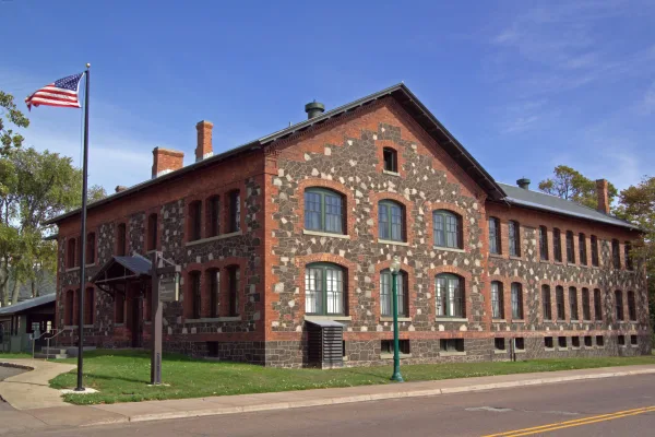
Keweenaw National Historical Park
National Historical Park
The stories of people and copper in the Keweenaw Peninsula have been intertwined for more than 7,000 years. Indigenous peoples made copper into tools and trade items. Investors and immigrants arrived...
Park data from the National Park Service API. Alerts update every 2 hours.
Fuel & Cost
Regular Gas
$12.57 one way
$25.14 round trip
$3.97/gal25.4 MPG avg28 kg CO2
Fuel Type
$/gal
One Way
Round Trip
midgrade
$4.36
$13.80
$27.60
premium
$4.89
$15.47
$30.94
diesel
$5.61
$17.75
$35.50
No toll roads detected on this route.
Estimated Trip Cost (one way, 1 person)
Fuel
$13
Meals
$25–$50
Total
$38–$63
Rough estimate based on US averages. Hotel $80–$140/night, meals $25–$50/day.
Estimated CO2 emission: 28.1 kg one way.
Prices: EIA weekly data, 2026-04-13.
Driving Electric?
About $8 in charging
· 0 stops
· 68% less CO2
Vehicle Type
kWh
Stops
DC Fast
Home Charge
Average EV
24.1
0
$8.44
$3.86
Efficient EV
20.1
0
$7.04
$3.22
EV Truck/SUV
32.2
0
$11.26
$5.15
Gas CO2
28 kg
EV CO2
9 kg (68% less)
This trip is well within single-charge range for most EVs. No charging stops needed if you start fully charged.
DC fast charging avg $0.35/kWh. Home charging avg $0.16/kWh. US grid CO2: 0.39 kg/kWh.
Travel Intel
Current conditions at both ends of the drive.
Forecast as of Apr 15, 2026
Origin
Frost, MI
Late night
in Frost on Saturday
Local time
3:00 AM
EDT
Current temp
36°F
Unavailable
Live forecast
Destination
Rabbit Bay, MI
Late night
in Rabbit Bay on Saturday
Local time
3:00 AM
EDT
Current temp
48°F
Unavailable
Live forecast
Seasonal Notes
Summer travel usually means heavier construction, hotter rest stops, and busier weekend traffic around major cities.
Winter travel shortens daylight, so a route that looks manageable on paper can feel much longer after dark.
Holiday weekends tend to make both departure and arrival windows slower than the raw route time suggests.
Time zone
Same local time
Origin and destination are on the same clock, so arrival timing is easier to judge at a glance.
Temperature spread
12 degrees warmer at arrival
A meaningful temperature swing is a good cue to rethink layers, water, and how soon you want to arrive.
Road read
2h 5m on the road
Use the two city cards together: check the sky where you start, then compare it with the local time and temperature at arrival.
Weather data from the National Weather Service. Conditions may change; check closer to your travel date.
Frequently Asked Questions
The drive from Frost, MI to Rabbit Bay, MI covers 80.4 miles and takes about 2h 5m without stops. Add 15-30 minutes for a fuel or rest stop on longer drives.
The main roads are M 26, Federal Forest Highway 16, Bootjack Road. Expect a mix of highway and local road driving.
This is a comfortable same-day trip.
The midpoint is about 40.2 miles from Frost, MI. Look for rest areas, gas stations, or food options near the halfway mark.
At current regular gas prices, expect to spend about $12.57 one way. This estimate uses 25.4 MPG — your actual cost will vary with your vehicle's fuel efficiency and current gas prices.
Leave by 9 AM and you'll arrive before lunch. Even a 4 PM departure gets you there before dark in summer.
The drive from Frost, MI to Rabbit Bay, MI is easy. At 2h 5m with 15% highway, most drivers will find it relaxed and low-stress.
The main spots that need attention: at 11.7 miles (M 38): Navigation decision point; at 18.9 miles (M 26): Navigation decision point; at 66.6 miles (9th Street): Navigation decision point.
On the drive from Frost, MI to Rabbit Bay, MI, road signs begin pointing toward M 26: Lake Linden along the way.
How this page is built
Compiled by the Trip.ovh planning team at COD Solutions Oy from open government datasets — OSRM over OpenStreetMap for geometry, EIA for fuel prices, and NPS for national parks. See our methodology for refresh cadence and limitations.