
Trip from Hazlehurst, MS to Oxford, MS

Last recalculated Apr 16, 2026

Drive Time

1h 36m

Distance

64.9 mi

104 km

Drive Score

8/10

Great drive

Same Day?

Yes, doable

Fuel Cost

$10

one way

EV Charging

Unknown

Best Time to Leave

Save up to 22 min
4 AM
1h 29m ★
6 AM
1h 36m
8 AM
1h 51m
10 AM
1h 41m
12 PM
1h 40m
3 PM
1h 42m
5 PM
1h 50m
8 PM
1h 32m

Estimated drive times based on typical traffic patterns. Actual times may vary with weather, construction, and real-time conditions.

Downtown Hazlehurst, MS, MS

Hazlehurst, MS

大 董

city in Oxfordshire, England

Oxford, MS

Wikimedia Commons

Trip Overview

The drive from Hazlehurst, MS to Oxford, MS covers 64.9 miles and takes about 1h 36m behind the wheel. This route is realistic as a one-day drive if you keep your stops efficient.

The route leans on US 84, I 55, Gloster Road for much of the mileage, and the overall profile is highway-focused drive. The longest uninterrupted segment is about 22.7 miles on US 84. At current regular gas prices, budget about $9.80 one way before food or hotel costs.

Trip Pace

Same-day drive is realistic

A same-day return is realistic if you keep stops short.

Midpoint

32.4 miles from Hazlehurst, MS

A natural place for your longest stop of the day , about 38m into the drive .

Who Is This Route For?

Weekend Trip

Doable as a same-day drive at 1h 36m. Total distance: 64.9 miles.

Family Friendly

Moderate complexity with 0 natural rest stops along the way.

Solo Traveler

1h 36m drive, comfortable solo distance.

First-Time Driver

Mostly highway driving (72%). Some complex stretches to watch for.

Drive Character

This is a 1h 36m highway drive covering 64.9 miles, with most of the trip on US 84 and I 55. The longest continuous stretch is about 22.7 miles on US 84.

Most of the miles stay on highways, which makes pacing and fuel planning easier than turn-by-turn city driving.
There are about 16 navigation steps in the underlying route data, so the final approach matters more than the middle miles.
US 84 is the longest continuous segment at about 22.7 miles.

How Hard Is This Drive?

This is a straightforward highway drive that stays mostly on US 84 and I 55. You will hit about 11 points where you need to pay attention to lane position or signs. The trickiest moment comes early in the drive near Caldwell Drive.

Driving Effort 5/10

Moderate - straightforward overall, but long enough or busy enough to require pacing

Balances navigation complexity with total wheel time.

This drive requires moderate attention. Across 64.9 miles you will encounter 11 spots where lane choice or exit timing matters. Not difficult for experienced highway drivers, but worth previewing the tricky sections before you go.

Where does it get tricky?

The main spots that need attention: near the start (Caldwell Drive): Navigation decision point; at 2.4 miles: Navigation decision point; at 23.1 miles: Exit ramp - move to the correct lane early. Multiple destination signs - pick the right one.

Critical Maneuvers

5 of 11 key points

These are the spots where you need to pay the most attention. Preview them before you drive.

4
0 mi into trip | ~0m in | Caldwell Drive

Turn left onto Caldwell Drive

Navigation decision point

5
2.4 mi into trip | ~4m in

Take the ramp toward I 55

Navigation decision point

Toward I 55
5
23.1 mi into trip | ~27m in

Take the exit toward US 84: South Brookhaven, Natchez

Exit ramp - move to the correct lane early. Multiple destination signs - pick the right one

Toward US 84: South Brookhaven, Natchez
7
23.4 mi into trip | ~27m in

Keep slight right at fork toward US 84: South Brookhaven, Natchez

Highway fork - watch signs carefully. Multiple destination signs - pick the right one

Toward US 84: South Brookhaven, Natchez
4
46.2 mi into trip | ~54m in | MS 184

Turn left onto MS 184

Navigation decision point

Towns Mentioned on Route Signs

Based on OSRM destination-sign hints, not a full list of every settlement the road passes.

On the drive from Hazlehurst, MS to Oxford, MS, road signs begin pointing toward Natchez along the way.

Natchez

23.1 mi in | ~27m

Main Roads

Road Distance Duration
US 84 22.7 mi 26m
I 55 20.5 mi 21m
Gloster Road 6.5 mi 15m
Oxford-Meadville Road 6.3 mi 15m
Yap 3 Road 2.6 mi 6m
US 98 1.9 mi 2m
MS 184 1.4 mi 2m
South Street 1.2 mi 1m
Longest stretch: US 84 — 22.7 mi, about 26m

Turn-by-Turn Driving Directions

Step-by-step road directions between Hazlehurst, MS and Oxford, MS.

1

Start on West Gallatin Street

85 ft · 5 sec · West Gallatin Street
2

Turn left onto Caldwell Drive

0.1 mi · 11 sec · Caldwell Drive
3

Continue on US 51

1.2 mi · 1 min · South Street
4

Turn right onto County Farm Road

1.0 mi · 2 min · County Farm Road
5

Take the ramp

0.3 mi · 33 sec
Toward I 55
6

Merge onto I 55

20 mi · 21 min · I 55
7

Take the exit

0.3 mi · 35 sec
Toward US 84: South Brookhaven, Natchez
8

Keep slight right at fork

409 ft · 9 sec
Toward US 84: South Brookhaven, Natchez
9

Merge onto US 84

23 mi · 26 min · US 84
10

Turn left onto MS 184

1.4 mi · 2 min · MS 184
11

Turn left onto US 98

1.9 mi · 2 min · US 98
12

Turn right onto Yap 3 Road

2.6 mi · 6 min · Yap 3 Road
13

Continue on Gloster Road

3.8 mi · 9 min · Gloster Road
14

At end of road, turn right onto Gloster Road

2.8 mi · 6 min · Gloster Road
15

Continue on Oxford-Meadville Road

6.3 mi · 15 min · Oxford-Meadville Road
16

Arrive at destination

Oxford-Meadville Road

Trip Plan

Morning Departure

Leave by 9 AM and you'll arrive before lunch.

Evening Departure

Even a 4 PM departure gets you there before dark in summer.

You can normally do this drive in one day.
You may only need one short stretch break if traffic stays light.
The halfway point lands around 32.4 miles from Hazlehurst, MS, or about 38m into the drive.
The longest continuous stretch on this route runs about 22.7 miles.

This is a comfortable same-day trip.

Departure

Before you leave

Start with fuel, water, and navigation already sorted so the first hour feels easy.

First stop

Around 14 miles or 17m in

Use this first pause for coffee, a restroom break, and a quick traffic check ahead.

Halfway reset

Around 32.4 miles or 38m in

This is the best place for your longest stop, a real meal, and a full fuel check.

Final approach

Final hour starts around 1h 12m

Traffic, exits, and arrival timing usually matter more near Oxford, MS than in the middle of the route.

Before You Leave

+

Open the route before leaving Hazlehurst, MS so your first major turns are already loaded.

Day 1

Settle into the route from Hazlehurst, MS

This is one driving day of about 64.9 miles and 1h 36m.

Your first comfortable stop window is around 14 miles from Hazlehurst, MS.
This route can stay practical as a one-day drive if traffic stays reasonable.
The longest stretch is on US 84 for about 22.7 miles.

Where to Stop

Rest stops, refuel points, and overnight suggestions along this route.

Halfway Point

Midpoint

About 32.4 mi from Hazlehurst, MS · 38m into the drive

Mid-route town

Meal stop

Fayette, MS

32 mi into the route

Best for: Lunch, fuel, and a longer reset

This sits close to the middle of the route, so it works well for the longest stop of the day.

Pacing Suggestions

Wesson, MS

Fuel and coffee

A short stop after about 14 miles helps settle the day before fatigue starts building.

Brookhaven, MS

Meal break

The midpoint is around 32.4 miles from Hazlehurst, MS, which is a good place for a longer meal and fuel stop.

Arriving in Oxford, MS

The final approach into Oxford, MS usually feels slower than the middle of the drive, so avoid planning your tightest schedule at the very end.

These stop ideas are pacing suggestions — the exact town or exit can change with traffic, hotel plans, and fuel range.

National Parks Near This Route

Worth a detour if your schedule allows.

Natchez National Historical Park

Natchez National Historical Park

National Historical Park

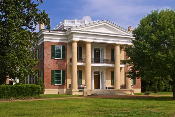
Discover the history of all the peoples of Natchez, Mississippi, from European settlement, African enslavement, the American cotton economy, to the Civil Rights struggle on the lower Mississippi River...

30 mi from route ~74 min detour Free near mile 55.9
View on nps.gov

Park data from the National Park Service API. Alerts update every 2 hours.

Fuel & Cost

Regular Gas

$9.80 one way

$19.60 round trip

$3.84/gal 25.4 MPG avg 23 kg CO2
Fuel Type $/gal One Way Round Trip
midgrade $4.21 $10.76 $21.52
premium $4.56 $11.65 $23.30
diesel $5.61 $14.33 $28.66

No toll roads detected on this route.

Estimated Trip Cost (one way, 1 person)

Fuel

$10

Meals

$25–$50

Total

$35–$60

Rough estimate based on US averages. Hotel $80–$140/night, meals $25–$50/day.

Estimated CO2 emission: 22.7 kg one way. Prices: EIA weekly data, 2026-04-13.

Driving Electric?

About $7 in charging · 0 stops · 65% less CO2

Vehicle Type kWh Stops DC Fast Home Charge
Average EV 19.5 0 $6.81 $3.12
Efficient EV 16.2 0 $5.68 $2.60
EV Truck/SUV 26 0 $9.09 $4.15

Gas CO2

23 kg

EV CO2

8 kg (65% less)

This trip is well within single-charge range for most EVs. No charging stops needed if you start fully charged.

DC fast charging avg $0.35/kWh. Home charging avg $0.16/kWh. US grid CO2: 0.39 kg/kWh.

Travel Intel

Current conditions at both ends of the drive.

Forecast as of Apr 15, 2026

Origin

Hazlehurst, MS

Evening in Hazlehurst on Thursday

Local time

5:15 PM

CDT

Current temp

55°F

Unavailable

Live forecast

Destination

Oxford, MS

Evening in Oxford on Thursday

Local time

5:15 PM

CDT

Current temp

80°F

Unavailable

Live forecast

56°F

Fayette, MS

32 mi in

Seasonal Notes

Summer travel usually means heavier construction, hotter rest stops, and busier weekend traffic around major cities.

Winter travel shortens daylight, so a route that looks manageable on paper can feel much longer after dark.

Holiday weekends tend to make both departure and arrival windows slower than the raw route time suggests.

Time zone

Same local time

Origin and destination are on the same clock, so arrival timing is easier to judge at a glance.

Temperature spread

25 degrees warmer at arrival

A meaningful temperature swing is a good cue to rethink layers, water, and how soon you want to arrive.

Road read

1h 36m on the road

Use the two city cards together: check the sky where you start, then compare it with the local time and temperature at arrival.

Weather data from the National Weather Service. Conditions may change; check closer to your travel date.

Frequently Asked Questions

The drive from Hazlehurst, MS to Oxford, MS covers 64.9 miles and takes about 1h 36m without stops. Add 15-30 minutes for a fuel or rest stop on longer drives.
The main roads are US 84, I 55, Gloster Road. Most of the drive stays on highways, so watch for ramps and exits.
This is a comfortable same-day trip.
The midpoint is about 32.4 miles from Hazlehurst, MS. Look for rest areas, gas stations, or food options near the halfway mark.
At current regular gas prices, expect to spend about $9.80 one way. This estimate uses 25.4 MPG — your actual cost will vary with your vehicle's fuel efficiency and current gas prices.
Leave by 9 AM and you'll arrive before lunch. Even a 4 PM departure gets you there before dark in summer.
This drive requires moderate attention. Across 64.9 miles you will encounter 11 spots where lane choice or exit timing matters. Not difficult for experienced highway drivers, but worth previewing the tricky sections before you go.
The main spots that need attention: near the start (Caldwell Drive): Navigation decision point; at 2.4 miles: Navigation decision point; at 23.1 miles: Exit ramp - move to the correct lane early. Multiple destination signs - pick the right one.
On the drive from Hazlehurst, MS to Oxford, MS, road signs begin pointing toward Natchez along the way.

Was this helpful?

Thanks for your feedback!

Your tip has been submitted. Thanks!

/500

Explore More

Explore more options from Hazlehurst, MS or browse trips ending in Oxford, MS.

Looking for more statewide routes? Browse MS road trips.

Explore maps for Hazlehurst, MS or Oxford, MS on MapSof.net.