This 127.4-mile drive from Isla Vista, CA to Long Beach, CA is easily manageable as a single-day trip, taking approximately 2 hours and 34 minutes. Primarily utilizing the Ventura Freeway and San Diego Freeway, with a segment on El Camino Real, this highway-focused journey offers a straightforward path along the Pacific Coast. With an estimated fuel cost of $29, it's an economical option for exploring Southern California. The route is designed for efficiency, making it a practical choice for those looking to cover ground without extensive planning.
Trip Pace
Same-day drive is realistic
A same-day return is realistic if you keep stops short.
Break Rhythm
1 planned break
A short stop every 2 to 3 hours is enough for this drive.
Midpoint
63.7 miles from Isla Vista, CA
A natural place for your longest stop of the day
, about 1h 16m into the drive
.
Who Is This Route For?
Weekend Trip
Doable as a same-day drive at 2h 34m. Total distance: 127.4 miles.
Family Friendly
Moderate complexity with 1 natural rest stops along the way.
Solo Traveler
2h 34m drive, comfortable solo distance.
First-Time Driver
Mostly highway driving (78%). Some complex stretches to watch for.
Drive Character
The character of this drive is predominantly highway-focused, with 78% of the route on freeways. You'll experience a significant stretch of 65.2 miles on the Ventura Freeway, offering a consistent pace. While largely a freeway experience, the inclusion of El Camino Real provides a slight shift in road personality. Expect a mix of faster highway travel and potentially more local traffic as you approach your destination in Long Beach.
Most of the miles stay on highways, which makes pacing and fuel planning easier than turn-by-turn city driving.
There are about 24 navigation steps in the underlying route data, so the final approach matters more than the middle miles.
Ventura Freeway is the longest continuous segment at about 65.2 miles.
How Hard Is This Drive?
This is a straightforward highway drive that stays mostly on Ventura Freeway and San Diego Freeway. This route has several spots where lane changes, forks, or exits need your full attention. The trickiest moment comes around 0.5 miles in near South Los Carneros Road.
Driving Effort10/10
High effort - long or complex enough to need steady focus all day
Balances navigation complexity with total wheel time.
This is a demanding drive. With 19 significant decision points across 127.4 miles, you will need to stay alert - especially through interchange areas and urban stretches. Consider splitting it into segments if you are not comfortable with fast highway navigation.
Where does it get tricky?
The main spots that need attention: at 0.5 miles (South Los Carneros Road): Lane positioning matters here; at 89.9 miles: Exit ramp - move to the correct lane early. Lane positioning matters here. Multiple destination signs - pick the right one; at 90 miles: Highway fork - watch signs carefully. Lane positioning matters here. Multiple destination signs - pick the right one.
Critical Maneuvers
5 of 19 key points
These are the spots where you need to pay the most attention. Preview them before you drive.
6
0.5 mi into trip|~2m in|South Los Carneros Road
Turn left onto South Los Carneros Road
Lane positioning matters here
Use the left lane.
7
89.9 mi into trip|~1h 47m in
Take the exit toward I 405 North, I 405 South: Sacramento, Santa Monica
Exit ramp - move to the correct lane early. Lane positioning matters here. Multiple destination signs - pick the right one
Use the straight / slight right lanes.
Toward I 405 North, I 405 South: Sacramento, Sa...
9
90 mi into trip|~1h 47m in
Keep slight right at fork toward I 405 South: San Diego Freeway, Santa Monica
Highway fork - watch signs carefully. Lane positioning matters here. Multiple destination signs - pick the right one
Use the slight right lane.
Toward I 405 South: San Diego Freeway, Santa Mo...
8
90.3 mi into trip|~1h 48m in
Keep slight left at fork toward I 405 South: San Diego Freeway
Highway fork - watch signs carefully. Lane positioning matters here
Use the straight / slight right lanes.
Toward I 405 South: San Diego Freeway
7
125 mi into trip|~2h 29m in
Take the exit toward Downtown Long Beach, Convention Center, Aquarium
Exit ramp - move to the correct lane early. Lane positioning matters here. Multiple destination signs - pick the right one
Use the slight left / straight lanes.
Toward Downtown Long Beach, Convention Center,...
Towns Mentioned on Route Signs
Based on OSRM destination-sign hints, not a full list of every settlement the road passes.
On the drive from Isla Vista, CA to Long Beach, CA, road signs begin pointing toward Santa Monica along the way.
Santa Monica
89.9 mi in|~1h 47m
Main Roads
Road
Distance
Duration
Ventura Freeway
65.2 mi
1h 15m
San Diego Freeway
31.3 mi
36m
El Camino Real
22.2 mi
25m
Long Beach Freeway
2.4 mi
3m
South Los Carneros Road
1.6 mi
2m
Shoreline Drive
1.3 mi
2m
West Ocean Boulevard
0.5 mi
1m
Seaside Freeway
0.5 mi
<1m
Longest stretch:
Ventura Freeway
— 65.2 mi, about 1h 15m
Turn-by-Turn Driving Directions
Step-by-step road directions between Isla Vista, CA and Long Beach, CA.
1
Start on this road
90 ft·11 sec·this road
2
Turn left
259 ft·24 sec
3
Turn left onto Abrego Road
0.1 mi·29 sec·Abrego Road
4
Turn right onto Camino del Sur
0.2 mi·56 sec·Camino del Sur
5
Turn right onto El Colegio Road
0.1 mi·21 sec·El Colegio Road
6
Turn left onto South Los Carneros Road
1.6 mi·2 min·South Los Carneros Road
Use the left lane.
7
Take the ramp
0.4 mi·49 sec
Toward US 101 SouthUse the right lane.
8
Merge onto US 101
22 mi·25 min·El Camino Real
Use the straight / slight right lanes.
9
Continue on US 101
65 mi·1 hr 15 min·Ventura Freeway
Use the straight / slight right lanes.
10
Take the exit
0.1 mi·18 sec
Toward I 405 North, I 405 South: Sacramento, Santa MonicaUse the straight / slight right lanes.
11
Keep slight right at fork
0.3 mi·38 sec
Toward I 405 South: San Diego Freeway, Santa MonicaUse the slight right lane.
12
Keep slight left at fork
0.1 mi·13 sec
Toward I 405 South: San Diego FreewayUse the straight / slight right lanes.
13
Merge onto I 405
13 mi·15 min·San Diego Freeway
Use the straight / slight right lanes.
14
Keep slight right at fork onto I 405
18 mi·20 min·San Diego Freeway
Use the straight / slight right lanes.
15
Take the exit
377 ft·9 sec
Toward I 710 South: Long BeachUse the slight right lane.
16
Continue on this road
0.3 mi·39 sec·this road
Exit 32BToward I 710 South: Long Beach
17
Merge onto I 710
2.4 mi·3 min·Long Beach Freeway
Use the straight / slight right lanes.
18
Continue on I 710
0.5 mi·40 sec·Seaside Freeway
Use the straight / slight right lanes.
19
Take the exit
0.3 mi·37 sec
Toward Downtown Long Beach, Convention Center, AquariumUse the slight left / straight lanes.
20
Continue on Shoreline Drive
1.3 mi·2 min·Shoreline Drive
21
Turn left onto South Chestnut Place
0.2 mi·30 sec·South Chestnut Place
Use the left / uturn lanes.
22
Turn right onto West Ocean Boulevard
0.5 mi·1 min·West Ocean Boulevard
23
Continue on East Ocean Boulevard
0.1 mi·21 sec·East Ocean Boulevard
Use the left lane.
24
Arrive at destination
East Ocean Boulevard
Trip Plan
For this 1-day trip, consider an early morning departure from Isla Vista to take advantage of lighter traffic on the Ventura Freeway. With a duration of just over 2.5 hours and a fuel cost around $29, you have flexibility for a brief stop if needed, though only one stop is factored into the general calculation. Pay attention to potential congestion as you merge onto the San Diego Freeway and approach the greater Los Angeles area. The longest uninterrupted stretch of 65.2 miles on the Ventura Freeway means you can settle in for a solid driving segment before potential slowdowns.
Morning Departure
Leave by 9 AM and you'll arrive before lunch.
Evening Departure
Even a 4 PM departure gets you there before dark in summer.
You can normally do this drive in one day.
Plan roughly 1 meaningful break for fuel, food, and rest.
The halfway point lands around 63.7 miles from Isla Vista, CA, or about 1h 16m into the drive.
The longest continuous stretch on this route runs about 65.2 miles.
This is a comfortable same-day trip.
Departure
Before you leave
Start with fuel, water, and navigation already sorted so the first hour feels easy.
First stop
Around 28 miles or 35m in
Use this first pause for coffee, a restroom break, and a quick traffic check ahead.
Halfway reset
Around 63.7 miles or 1h 16m in
This is the best place for your longest stop, a real meal, and a full fuel check.
Final approach
Final hour starts around 2h 4m
Traffic, exits, and arrival timing usually matter more near Long Beach, CA than in the middle of the route.
Before You Leave
+
Open the route before leaving Isla Vista, CA so your first major turns are already loaded.
+
Leave with enough water and a charging cable within reach, not packed away.
+
Check your fuel range against the first long segment, especially if you are starting outside city service areas.
Day 1
Settle into the route from Isla Vista, CA
This is one driving day of about 127.4 miles and 2h 34m.
Your first comfortable stop window is around 28 miles from Isla Vista, CA.
This route can stay practical as a one-day drive if traffic stays reasonable.
Plan about 1 real break rather than only quick fuel stops.
The longest stretch is on Ventura Freeway for about 65.2 miles.
Where to Stop
Rest stops, refuel points, and overnight suggestions along this route.
Halfway Point
Midpoint
About 63.7 mi from Isla Vista, CA
· 1h 16m into the drive
The midpoint is around 63.7 miles from Isla Vista, CA, which is a good place for a longer meal and fuel stop.
Before the longest stretch
Fuel check
Top up before Ventura Freeway if your tank is already low. That segment runs about 65.2 miles.
Arriving in Long Beach, CA
The final approach into Long Beach, CA usually feels slower than the middle of the drive, so avoid planning your tightest schedule at the very end.
Try to arrive with enough fuel left to skip an immediate station stop unless you already know the area around Long Beach, CA.
These stop ideas are pacing suggestions — the exact town or exit can change with traffic, hotel plans, and fuel range.
National Parks Near This Route
Worth a detour if your schedule allows.
Santa Monica Mountains National Recreation Area
National Recreation Area
The Santa Monica Mountains offer easy access to surprisingly wild places. Experience the famous beaches of Malibu or explore more than 500 miles of trails. The park abounds with historical and cultura...
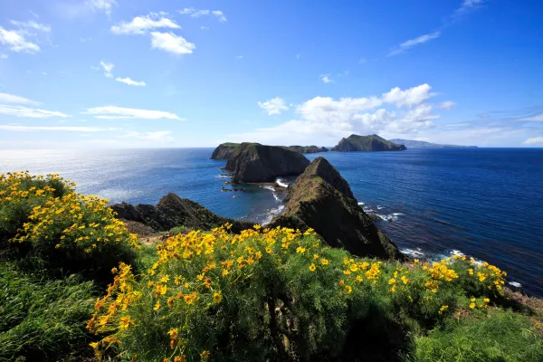
Channel Islands National Park encompasses five remarkable islands and their ocean environment, preserving and protecting a wealth of natural and cultural resources. Isolation over thousands of years h...
Park data from the National Park Service API. Alerts update every 2 hours.
Fuel & Cost
Regular Gas
$29.28 one way
$58.56 round trip
$5.84/gal25.4 MPG avg45 kg CO2
Fuel Type
$/gal
One Way
Round Trip
midgrade
$6.02
$30.17
$60.35
premium
$6.18
$30.98
$61.96
diesel
$5.61
$28.13
$56.26
No toll roads detected on this route.
Estimated Trip Cost (one way, 1 person)
Fuel
$29
Meals
$25–$50
Total
$54–$79
Rough estimate based on US averages. Hotel $80–$140/night, meals $25–$50/day.
Estimated CO2 emission: 44.6 kg one way.
Prices: EIA weekly data, 2026-04-13.
EV Charging Along Route
1 DC fast chargers
· Coverage: fair
Tesla Supercharger
Chatsworth, California
Tesla
1 DCFC
Tesla: 1
Station data from NREL Alternative Fuel Stations database.
Driving Electric?
About $13 in charging
· 0 stops
· 67% less CO2
Vehicle Type
kWh
Stops
DC Fast
Home Charge
Average EV
38.2
0
$13.38
$6.12
Efficient EV
31.9
0
$11.15
$5.10
EV Truck/SUV
51
0
$17.84
$8.15
Gas CO2
45 kg
EV CO2
15 kg (67% less)
This trip is well within single-charge range for most EVs. No charging stops needed if you start fully charged.
DC fast charging avg $0.35/kWh. Home charging avg $0.16/kWh. US grid CO2: 0.39 kg/kWh.
Travel Intel
Current conditions at both ends of the drive.
Forecast as of Apr 16, 2026
Origin
Isla Vista, CA
Evening
in Isla Vista on Thursday
Local time
8:43 PM
PDT
Current temp
75°F
Unavailable
Live forecast
Destination
Long Beach, CA
Evening
in Long Beach on Thursday
Local time
8:43 PM
PDT
Current temp
69°F
Partly Sunny
SW 10 mph0% chanceLive forecast
Lake Wind Advisory
Lake Wind Advisory issued April 16 at 2:48PM PDT until April 16 at 11:00PM PDT by NWS Hanford CA
Wind Advisory
Wind Advisory issued April 16 at 2:48PM PDT until April 17 at 11:00AM PDT by NWS Hanford CA
Seasonal Notes
Summer travel usually means heavier construction, hotter rest stops, and busier weekend traffic around major cities.
Winter travel shortens daylight, so a route that looks manageable on paper can feel much longer after dark.
Holiday weekends tend to make both departure and arrival windows slower than the raw route time suggests.
Time zone
Same local time
Origin and destination are on the same clock, so arrival timing is easier to judge at a glance.
Temperature spread
6 degrees cooler at arrival
A meaningful temperature swing is a good cue to rethink layers, water, and how soon you want to arrive.
Road read
2h 34m on the road
The weather snapshot is not static. If you are leaving later, give both cities one more quick forecast check before departure.
Weather data from the National Weather Service. Conditions may change; check closer to your travel date.
Frequently Asked Questions
The drive from Isla Vista, CA to Long Beach, CA covers 127.4 miles and takes about 2h 34m without stops. Add 15-30 minutes for a fuel or rest stop on longer drives.
The main roads are Ventura Freeway, San Diego Freeway, El Camino Real. Most of the drive stays on highways, so watch for ramps and exits.
This is a comfortable same-day trip.
The midpoint is about 63.7 miles from Isla Vista, CA. Look for rest areas, gas stations, or food options near the halfway mark.
At current regular gas prices, expect to spend about $29.28 one way. This estimate uses 25.4 MPG — your actual cost will vary with your vehicle's fuel efficiency and current gas prices.
Leave by 9 AM and you'll arrive before lunch. Even a 4 PM departure gets you there before dark in summer.
Plan about 1 meaningful break for fuel, food, or rest. A short stop every 2 to 3 hours is enough for this drive.
This is a demanding drive. With 19 significant decision points across 127.4 miles, you will need to stay alert - especially through interchange areas and urban stretches. Consider splitting it into segments if you are not comfortable with fast highway navigation.
The main spots that need attention: at 0.5 miles (South Los Carneros Road): Lane positioning matters here; at 89.9 miles: Exit ramp - move to the correct lane early. Lane positioning matters here. Multiple destination signs - pick the right one; at 90 miles: Highway fork - watch signs carefully. Lane positioning matters here. Multiple destination signs - pick the right one.
On the drive from Isla Vista, CA to Long Beach, CA, road signs begin pointing toward Santa Monica along the way.