Trip from Kearney, NE to Falls City, NE

Drive Time

4h 21m

Distance

236.2 mi

380 km

Drive Score

9/10

Great drive

Same Day?

Yes, doable

Fuel Cost

$36

one way

EV Charging

Excellent

23 DC fast

Best Time to Leave

Save up to 40 min
4 AM
4h 8m ★
6 AM
4h 21m
8 AM
4h 48m
10 AM
4h 30m
12 PM
4h 28m
3 PM
4h 32m
5 PM
4h 46m
8 PM
4h 13m

Estimated drive times based on typical traffic patterns. Actual times may vary with weather, construction, and real-time conditions.

Downtown Kearney, NE, NE

Kearney, NE

Jean-Rene Chazottes

Trip Overview

The drive from Kearney, NE to Falls City, NE covers 236.2 miles and takes about 4h 21m behind the wheel. This route is realistic as a one-day drive if you keep your stops efficient.

The route leans on I 80, Highway 2, Highway 75 for much of the mileage, and the overall profile is highway-focused drive. The longest uninterrupted segment is about 124 miles on I 80. At current regular gas prices, budget about $35.88 one way before food or hotel costs.

Trip Pace

Same-day drive is realistic

A same-day return is possible, but it will make for a full day on the road.

Break Rhythm

1 planned break

Plan on a short reset every 3 to 4 hours to stay fresh behind the wheel.

Midpoint

118.1 miles from Kearney, NE

A natural place for your longest stop of the day , about 2h 4m into the drive .

Drive Character

This is a 4h 21m highway drive covering 236.2 miles, with most of the trip on I 80 and Highway 2. The longest continuous stretch is about 124 miles on I 80.

Most of the miles stay on highways, which makes pacing and fuel planning easier than turn-by-turn city driving.
There are about 32 navigation steps in the underlying route data, so the final approach matters more than the middle miles.
I 80 is the longest continuous segment at about 124 miles.

How Hard Is This Drive?

This is a straightforward highway drive that stays mostly on I 80 and Highway 2. There are only a few real navigation decisions along the way. The trickiest moment comes early in the drive near West 24th Street.

Route Complexity 3/10

Easy - simple navigation with a manageable amount of wheel time

This is a straightforward 4h 21m drive. You will face about 9 decision points, but nothing that requires special attention if you follow navigation.

Where does it get tricky?

The main spots that need attention: near the start (West 24th Street): Navigation decision point; at 2.3 miles: Navigation decision point; at 126.7 miles: Exit ramp - move to the correct lane early. Multiple destination signs - pick the right one.

Critical Maneuvers

5 of 9 key points

These are the spots where you need to pay the most attention. Preview them before you drive.

5
0 mi into trip | ~0m in | West 24th Street

Turn right onto West 24th Street

Navigation decision point

4
2.3 mi into trip | ~5m in

Turn left toward I 80 East

Navigation decision point

Toward I 80 East
6
126.7 mi into trip | ~2h 13m in

Take the exit toward US 77 South, To NE 2: Beatrice, Nebraska City

Exit ramp - move to the correct lane early. Multiple destination signs - pick the right one

Exit 397 Toward US 77 South, To NE 2: Beatrice, Nebraska...
6
136 mi into trip | ~2h 24m in | N-2 / Nebraska Highway 2

Keep slight left at fork onto N-2 / Nebraska Highway 2

Highway fork - watch signs carefully. Lane positioning matters here

Use the slight left / straight lanes.
4
236.2 mi into trip | ~4h 21m in | East 16th Street

Turn right onto East 16th Street

Navigation decision point

Towns Along This Route

Between Kearney, NE and Falls City, NE, road signs point toward To Ne 2: Beatrice and Nebraska City.

To Ne 2: Beatrice

126.7 mi in | ~2h 13m

Nebraska City

126.7 mi in | ~2h 13m

Main Roads

Road Distance Duration
I 80 124 mi 2h 7m
Highway 2 18.3 mi 19m
Highway 75 18.2 mi 21m
712 Road 12.1 mi 14m
Nebraska Highway 2 9.4 mi 10m
South 64th Road 8.7 mi 9m
F Road 7.6 mi 8m
639 Avenue 7.4 mi 8m
Longest stretch: I 80 — 124 mi, about 2h 7m

Turn-by-Turn Driving Directions

Step-by-step road directions between Kearney, NE and Falls City, NE.

1

Start on Central Avenue

51 ft · 3 sec · Central Avenue
2

Turn right onto West 24th Street

0.1 mi · 32 sec · West 24th Street
3

Turn left onto 2nd Avenue

2.2 mi · 4 min · 2nd Avenue
4

Turn left

0.3 mi · 41 sec
Toward I 80 East
5

Merge onto I 80

124 mi · 2 hr 7 min · I 80
6

Take the exit

0.5 mi · 44 sec
Exit 397 Toward US 77 South, To NE 2: Beatrice, Nebraska City
7

Continue on US 77

4.7 mi · 5 min · Homestead Expressway
8

Continue on US 77

4.1 mi · 4 min · US Highway 77
9

Keep slight left at fork onto N-2

9.4 mi · 10 min · Nebraska Highway 2
Use the slight left / straight lanes.
10

Continue on N-2

4.0 mi · 4 min · Rokeby Road
11

Continue on N-2; N-43

3.0 mi · 3 min · F Road
12

Continue on N-2

0.7 mi · 56 sec · Highway 2
13

Continue on N-2

4.6 mi · 5 min · F Road
14

Continue on N-2

3.0 mi · 3 min · Highway 2
15

Continue on N-2

3.5 mi · 3 min · H Road
16

Continue on N-2

2.9 mi · 3 min · Highway 2
17

Continue on N-2

2.2 mi · 2 min · I Road
18

Continue on N-2

12 mi · 12 min · Highway 2
19

Continue on US 75; N-2

1.3 mi · 1 min · Highway 75
20

Turn right onto South 63rd Road

0.2 mi · 40 sec · South 63rd Road
21

Turn left onto Jade Road

0.5 mi · 1 min · Jade Road
22

Turn right onto US 75

8.7 mi · 9 min · South 64th Road
23

Continue on US 75

8.9 mi · 10 min · Highway 75
24

Continue on US 75

1.6 mi · 3 min · J Street
Use the straight lane.
25

Continue on US 75

8.1 mi · 9 min · Highway 75
26

Continue on US 75

7.4 mi · 8 min · 639 Avenue
27

Continue on US 75

0.8 mi · 54 sec · 639 Boulevard
28

Turn left onto US 73

12 mi · 14 min · 712 Road
29

Continue on US 73

4.4 mi · 5 min · 651 Boulevard
30

Continue on US 73

1.3 mi · 2 min · Harlan Street
31

Turn right onto East 16th Street

42 ft · 1 sec · East 16th Street
32

Arrive at destination

East 16th Street

Trip Plan

Morning Departure

An early start around 7-8 AM gets you there with plenty of daylight left.

Evening Departure

A late afternoon start means arriving after dark. Morning is better.

You can normally do this drive in one day.
Plan roughly 1 meaningful break for fuel, food, and rest.
The halfway point lands around 118.1 miles from Kearney, NE, or about 2h 4m into the drive.
The longest continuous stretch on this route runs about 124 miles.

This is a comfortable same-day trip.

Departure

Before you leave

Start with fuel, water, and navigation already sorted so the first hour feels easy.

First stop

Around 80 miles or 1h 25m in

Use this first pause for coffee, a restroom break, and a quick traffic check ahead.

Halfway reset

Around 118.1 miles or 2h 4m in

This is the best place for your longest stop, a real meal, and a full fuel check.

Final approach

Final hour starts around 3h 28m

Traffic, exits, and arrival timing usually matter more near Falls City, NE than in the middle of the route.

Before You Leave

+

Open the route before leaving Kearney, NE so your first major turns are already loaded.

+

Leave with enough water and a charging cable within reach, not packed away.

+

Check your fuel range against the first long segment, especially if you are starting outside city service areas.

Day 1

Settle into the route from Kearney, NE

This is one driving day of about 236.2 miles and 4h 21m.

Your first comfortable stop window is around 80 miles from Kearney, NE.
This route can stay practical as a one-day drive if traffic stays reasonable.
Plan about 1 real break rather than only quick fuel stops.
The longest stretch is on I 80 for about 124 miles.

Where to Stop

Rest stops, refuel points, and overnight suggestions along this route.

Halfway Point

Midpoint

About 118.1 mi from Kearney, NE · 2h 4m into the drive

Downtown Lincoln, NE, NE

Mid-route town

Meal stop

Lincoln, NE

118 mi into the route

Best for: Lunch, fuel, and a longer reset

This sits close to the middle of the route, so it works well for the longest stop of the day.

Pacing Suggestions

Aurora, NE

Fuel and coffee

A short stop after about 80 miles helps settle the day before fatigue starts building.

Lincoln, NE

Meal break

The midpoint is around 118.1 miles from Kearney, NE, which is a good place for a longer meal and fuel stop.

Before the longest stretch

Fuel check

Top up before I 80 if your tank is already low. That segment runs about 124 miles.

Arriving in Falls City, NE

The final approach into Falls City, NE usually feels slower than the middle of the drive, so avoid planning your tightest schedule at the very end.

Try to arrive with enough fuel left to skip an immediate station stop unless you already know the area around Falls City, NE.

After long uninterrupted mileage, take five minutes before the last urban segment to reset and refocus on exits, merges, and city traffic.

These stop ideas are pacing suggestions — the exact town or exit can change with traffic, hotel plans, and fuel range.

National Parks Near This Route

Worth a detour if your schedule allows.

Homestead National Historical Park

Homestead National Historical Park

National Historical Park

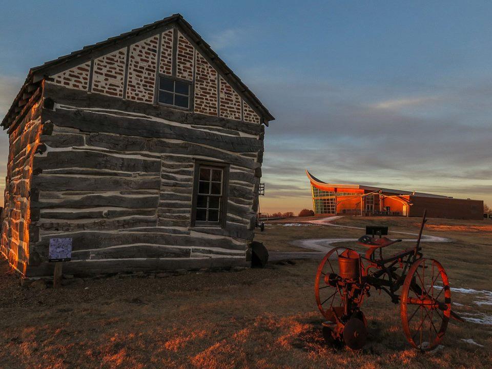
The Homestead Act of 1862 transformed the world. Millions were invited to file claims including families, women, immigrants, and formerly enslaved people. Over 10 percent of the United States was home...

29 mi from route ~73 min detour Free near mile 138.5
View on nps.gov

Park data from the National Park Service API. Alerts update every 2 hours.

Fuel & Cost

Regular Gas

$35.88 one way

$71.75 round trip

$3.86/gal 25.4 MPG avg 83 kg CO2
Fuel Type $/gal One Way Round Trip
midgrade $4.25 $39.55 $79.10
premium $4.80 $44.59 $89.18
diesel $5.64 $52.48 $104.95

No toll roads detected on this route.

Estimated Trip Cost (one way, 1 person)

Fuel

$36

Meals

$25–$50

Total

$61–$86

Rough estimate based on US averages. Hotel $80–$140/night, meals $25–$50/day.

Estimated CO2 emission: 82.6 kg one way. Prices: EIA weekly data, 2026-04-06.

EV Charging Along Route

23 DC fast chargers · Coverage: excellent

Runza - Tesla Supercharger

Kearney, NE

Tesla

8 DCFC

Bosselman Travel Center - Tesla Supercharger

Grand Island, NE

Tesla

8 DCFC

Runza - Tesla Supercharger

Lincoln, NE

Tesla

8 DCFC

Pilot Travel Center 912

Wood River, NE

eVgo Network

4 DCFC

Grand Island Quality Inn (Grand Island, NE)

Grand Island, NE

Electrify America

4 DCFC

Casey's Lincoln #30 (Lincoln, NE)

Lincoln, NE

Electrify America

4 DCFC

Midway Chrysler Dodge Jeep Inc

Kearney, NE

Blink Network

2 DCFC

Friesen Ford

Aurora, NE

FORD_CHARGE

2 DCFC

ChargePoint Network: 14 Tesla: 3 Electrify America: 2 FORD_CHARGE: 2 Blink Network: 1 eVgo Network: 1

Station data from NREL Alternative Fuel Stations database.

Driving Electric?

About $25 in charging · 0 stops · 66% less CO2

Vehicle Type kWh Stops DC Fast Home Charge
Average EV 70.9 0 $24.80 $11.34
Efficient EV 59.1 0 $20.67 $9.45
EV Truck/SUV 94.5 1 $33.07 $15.12

Gas CO2

83 kg

EV CO2

28 kg (66% less)

Plan for 0 charging stops, roughly every 270 miles. Allow 25-40 minutes per stop at a DC fast charger.

DC fast charging avg $0.35/kWh. Home charging avg $0.16/kWh. US grid CO2: 0.39 kg/kWh.

Travel Intel

Current conditions at both ends of the drive.

Forecast data refreshed 3 days ago

Origin

Kearney, NE

Morning in Kearney on Monday

Local time

7:55 AM

CDT

Current temp

77°F

Unavailable

Live forecast

Destination

Falls City, NE

Morning in Falls City on Monday

Local time

7:55 AM

CDT

Current temp

48°F

Unavailable

Live forecast

Along the Route

43°F

Lincoln, NE

118 mi in

Seasonal Notes

Summer travel usually means heavier construction, hotter rest stops, and busier weekend traffic around major cities.

Winter travel shortens daylight, so a route that looks manageable on paper can feel much longer after dark.

Holiday weekends tend to make both departure and arrival windows slower than the raw route time suggests.

Time zone

Same local time

Origin and destination are on the same clock, so arrival timing is easier to judge at a glance.

Temperature spread

29 degrees cooler at arrival

A meaningful temperature swing is a good cue to rethink layers, water, and how soon you want to arrive.

Road read

4h 21m on the road

An early start around 7-8 AM gets you there with plenty of daylight left.

Weather data from the National Weather Service. Conditions may change; check closer to your travel date.

Frequently Asked Questions

The drive from Kearney, NE to Falls City, NE covers 236.2 miles and takes about 4h 21m without stops. Add 15-30 minutes for a fuel or rest stop on longer drives.
The main roads are I 80, Highway 2, Highway 75. Most of the drive stays on highways, so watch for ramps and exits.
This is a comfortable same-day trip.
The midpoint is about 118.1 miles from Kearney, NE. Look for rest areas, gas stations, or food options near the halfway mark.
At current regular gas prices, expect to spend about $35.88 one way. This estimate uses 25.4 MPG — your actual cost will vary with your vehicle's fuel efficiency and current gas prices.
An early start around 7-8 AM gets you there with plenty of daylight left. A late afternoon start means arriving after dark. Morning is better.
Plan about 1 meaningful break for fuel, food, or rest. Plan on a short reset every 3 to 4 hours to stay fresh behind the wheel.
This is a straightforward 4h 21m drive. You will face about 9 decision points, but nothing that requires special attention if you follow navigation.
The main spots that need attention: near the start (West 24th Street): Navigation decision point; at 2.3 miles: Navigation decision point; at 126.7 miles: Exit ramp - move to the correct lane early. Multiple destination signs - pick the right one.
Between Kearney, NE and Falls City, NE, road signs point toward To Ne 2: Beatrice and Nebraska City.

Was this route helpful?

Thanks for your feedback!

Your tip has been submitted. Thanks!

/500

Explore More

More trips to Falls City, NE

Explore more options from Kearney, NE or browse trips ending in Falls City, NE.

Looking for more statewide routes? Browse NE road trips.

Explore maps for Kearney, NE or Falls City, NE on MapSof.net.