
Trip from Kentucky, AR to Ashdown, AR

Last recalculated Apr 16, 2026

Drive Time

2h 28m

Distance

133.7 mi

215 km

Drive Score

8/10

Great drive

Same Day?

Yes, doable

Fuel Cost

$20

one way

EV Charging

Unknown

Best Time to Leave

Save up to 30 min
4 AM
2h 18m ★
6 AM
2h 28m
8 AM
2h 48m
10 AM
2h 35m
12 PM
2h 33m
3 PM
2h 36m
5 PM
2h 47m
8 PM
2h 22m

Estimated drive times based on typical traffic patterns. Actual times may vary with weather, construction, and real-time conditions.

Downtown Kentucky, AR, AR

Kentucky, AR

Owen.outdoors

city in Arkansas, United States

Ashdown, AR

Wikimedia Commons

Trip Overview

The drive from Kentucky, AR to Ashdown, AR covers 133.7 miles and takes about 2h 28m behind the wheel. This route is realistic as a one-day drive if you keep your stops efficient.

The route leans on I 30, North State Line Avenue, State Highway 108 for much of the mileage, and the overall profile is highway-focused drive. The longest uninterrupted segment is about 109.6 miles on I 30. At current regular gas prices, budget about $20.19 one way before food or hotel costs.

Trip Pace

Same-day drive is realistic

A same-day return is realistic if you keep stops short.

Midpoint

66.8 miles from Kentucky, AR

A natural place for your longest stop of the day , about 1h 11m into the drive .

Who Is This Route For?

Weekend Trip

Doable as a same-day drive at 2h 28m. Total distance: 133.7 miles.

Family Friendly

Moderate complexity with 0 natural rest stops along the way.

Solo Traveler

2h 28m drive, comfortable solo distance.

First-Time Driver

Mostly highway driving (87%). Straightforward navigation.

Drive Character

This is a 2h 28m highway drive covering 133.7 miles, with most of the trip on I 30 and North State Line Avenue. The longest continuous stretch is about 109.6 miles on I 30.

Most of the miles stay on highways, which makes pacing and fuel planning easier than turn-by-turn city driving.
There are about 11 navigation steps in the underlying route data, so the final approach matters more than the middle miles.
I 30 is the longest continuous segment at about 109.6 miles.

How Hard Is This Drive?

This is a straightforward highway drive that stays mostly on I 30 and North State Line Avenue. Navigation is very simple - set it and forget it for most of the drive. The trickiest moment comes around 6 miles in.

Driving Effort 1/10

Very easy - short and simple to drive

Balances navigation complexity with total wheel time.

The drive from Kentucky, AR to Ashdown, AR is easy. At 2h 28m with 87% highway, most drivers will find it relaxed and low-stress.

Where does it get tricky?

The main spots that need attention: at 6 miles: Navigation decision point; at 115.7 miles: Exit ramp - move to the correct lane early; at 116 miles (AR 108 / State Highway 108): Navigation decision point.

Critical Maneuvers

5 of 6 key points

These are the spots where you need to pay the most attention. Preview them before you drive.

3
6 mi into trip | ~10m in

Take the ramp

Navigation decision point

4
115.7 mi into trip | ~2h in

Take the exit toward AR 108: Mandeville

Exit ramp - move to the correct lane early

Toward AR 108: Mandeville
4
116 mi into trip | ~2h 1m in | AR 108 / State Highway 108

Turn right onto AR 108 / State Highway 108

Navigation decision point

4
122.3 mi into trip | ~2h 12m in | US 59; US 71 / North State Line Avenue

Turn right onto US 59; US 71 / North State Line Avenue

Navigation decision point

4
133.7 mi into trip | ~2h 28m in | East Main Street

Turn right onto East Main Street

Navigation decision point

Main Roads

Road Distance Duration
I 30 109.6 mi 1h 49m
North State Line Avenue 11.3 mi 15m
State Highway 108 6.3 mi 11m
Old Hot Springs Highway 5.7 mi 10m
I-30 Frontage Road 0.3 mi <1m
East Main Street <0.1 mi <1m
Longest stretch: I 30 — 109.6 mi, about 1h 49m

Turn-by-Turn Driving Directions

Step-by-step road directions between Kentucky, AR and Ashdown, AR.

1

Start on AR 5

5.5 mi · 9 min · Old Hot Springs Highway
2

Continue on AR 5

0.2 mi · 21 sec · Old Hot Springs Highway
3

Turn straight onto I-30 Frontage Road

0.3 mi · 27 sec · I-30 Frontage Road
4

Take the ramp

0.1 mi · 14 sec
5

Merge onto I 30; US 67; US 70

2.4 mi · 2 min · I 30; US 67; US 70
6

Continue on I 30; US 70

107 mi · 1 hr 47 min · I 30; US 70
7

Take the exit

0.3 mi · 43 sec
Toward AR 108: Mandeville
8

Turn right onto AR 108

6.3 mi · 11 min · State Highway 108
9

Turn right onto US 59; US 71

11 mi · 15 min · North State Line Avenue
10

Turn right onto East Main Street

83 ft · 2 sec · East Main Street
11

Arrive at destination

East Main Street

Trip Plan

Morning Departure

Leave by 9 AM and you'll arrive before lunch.

Evening Departure

Even a 4 PM departure gets you there before dark in summer.

You can normally do this drive in one day.
You may only need one short stretch break if traffic stays light.
The halfway point lands around 66.8 miles from Kentucky, AR, or about 1h 11m into the drive.
The longest continuous stretch on this route runs about 109.6 miles.

This is a comfortable same-day trip.

Departure

Before you leave

Start with fuel, water, and navigation already sorted so the first hour feels easy.

First stop

Around 29 miles or 34m in

Use this first pause for coffee, a restroom break, and a quick traffic check ahead.

Halfway reset

Around 66.8 miles or 1h 11m in

This is the best place for your longest stop, a real meal, and a full fuel check.

Final approach

Final hour starts around 1h 54m

Traffic, exits, and arrival timing usually matter more near Ashdown, AR than in the middle of the route.

Before You Leave

+

Open the route before leaving Kentucky, AR so your first major turns are already loaded.

+

Leave with enough water and a charging cable within reach, not packed away.

+

Check your fuel range against the first long segment, especially if you are starting outside city service areas.

Day 1

Settle into the route from Kentucky, AR

This is one driving day of about 133.7 miles and 2h 28m.

Your first comfortable stop window is around 29 miles from Kentucky, AR.
This route can stay practical as a one-day drive if traffic stays reasonable.
The longest stretch is on I 30 for about 109.6 miles.

Where to Stop

Rest stops, refuel points, and overnight suggestions along this route.

Halfway Point

Midpoint

About 66.8 mi from Kentucky, AR · 1h 11m into the drive

city in Clark County, Arkansas, United States

Mid-route town

Meal stop

Arkadelphia, AR

67 mi into the route

Best for: Lunch, fuel, and a longer reset

This sits close to the middle of the route, so it works well for the longest stop of the day.

Pacing Suggestions

Malvern, AR

Fuel and coffee

A short stop after about 29 miles helps settle the day before fatigue starts building.

Arkadelphia, AR

Meal break

The midpoint is around 66.8 miles from Kentucky, AR, which is a good place for a longer meal and fuel stop.

Before the longest stretch

Fuel check

Top up before I 30 if your tank is already low. That segment runs about 109.6 miles.

Arriving in Ashdown, AR

The final approach into Ashdown, AR usually feels slower than the middle of the drive, so avoid planning your tightest schedule at the very end.

Try to arrive with enough fuel left to skip an immediate station stop unless you already know the area around Ashdown, AR.

After long uninterrupted mileage, take five minutes before the last urban segment to reset and refocus on exits, merges, and city traffic.

These stop ideas are pacing suggestions — the exact town or exit can change with traffic, hotel plans, and fuel range.

National Parks Near This Route

Worth a detour if your schedule allows.

Hot Springs National Park

Hot Springs National Park

National Park

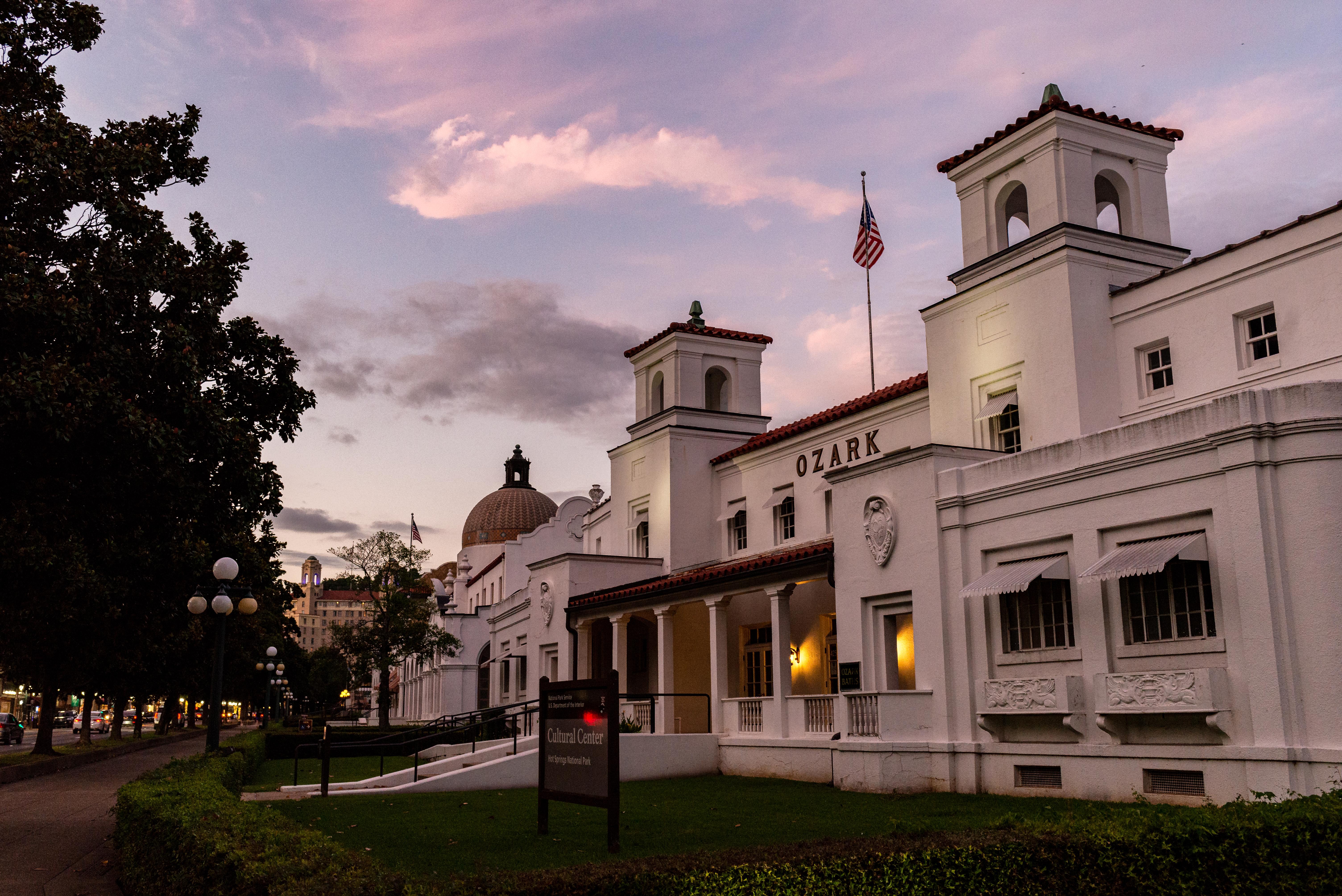
Hot Springs National Park has a rich cultural past. The grand architecture of our historic bathhouses is equally matched by the natural curiosities that have been drawing people here for hundreds of y...

16 mi from route ~39 min detour Free near mile 27.7
View on nps.gov

Park data from the National Park Service API. Alerts update every 2 hours.

Fuel & Cost

Regular Gas

$20.19 one way

$40.38 round trip

$3.84/gal 25.4 MPG avg 47 kg CO2
Fuel Type $/gal One Way Round Trip
midgrade $4.21 $22.17 $44.33
premium $4.56 $24.00 $48.00
diesel $5.61 $29.52 $59.04

No toll roads detected on this route.

Estimated Trip Cost (one way, 1 person)

Fuel

$20

Meals

$25–$50

Total

$45–$70

Rough estimate based on US averages. Hotel $80–$140/night, meals $25–$50/day.

Estimated CO2 emission: 46.8 kg one way. Prices: EIA weekly data, 2026-04-13.

Driving Electric?

About $14 in charging · 0 stops · 66% less CO2

Vehicle Type kWh Stops DC Fast Home Charge
Average EV 40.1 0 $14.04 $6.42
Efficient EV 33.4 0 $11.70 $5.35
EV Truck/SUV 53.5 0 $18.72 $8.56

Gas CO2

47 kg

EV CO2

16 kg (66% less)

This trip is well within single-charge range for most EVs. No charging stops needed if you start fully charged.

DC fast charging avg $0.35/kWh. Home charging avg $0.16/kWh. US grid CO2: 0.39 kg/kWh.

Travel Intel

Current conditions at both ends of the drive.

Forecast as of Apr 15, 2026

Origin

Kentucky, AR

Evening in Kentucky on Thursday

Local time

6:57 PM

CDT

Current temp

76°F

Unavailable

Live forecast

Destination

Ashdown, AR

Evening in Ashdown on Thursday

Local time

6:57 PM

CDT

Current temp

76°F

Unavailable

Live forecast

Seasonal Notes

Summer travel usually means heavier construction, hotter rest stops, and busier weekend traffic around major cities.

Winter travel shortens daylight, so a route that looks manageable on paper can feel much longer after dark.

Holiday weekends tend to make both departure and arrival windows slower than the raw route time suggests.

Time zone

Same local time

Origin and destination are on the same clock, so arrival timing is easier to judge at a glance.

Temperature spread

Very similar conditions

Both ends of the route are sitting at about the same temperature right now.

Road read

2h 28m on the road

Use the two city cards together: check the sky where you start, then compare it with the local time and temperature at arrival.

Weather data from the National Weather Service. Conditions may change; check closer to your travel date.

Frequently Asked Questions

The drive from Kentucky, AR to Ashdown, AR covers 133.7 miles and takes about 2h 28m without stops. Add 15-30 minutes for a fuel or rest stop on longer drives.
The main roads are I 30, North State Line Avenue, State Highway 108. Most of the drive stays on highways, so watch for ramps and exits.
This is a comfortable same-day trip.
The midpoint is about 66.8 miles from Kentucky, AR. Look for rest areas, gas stations, or food options near the halfway mark.
At current regular gas prices, expect to spend about $20.19 one way. This estimate uses 25.4 MPG — your actual cost will vary with your vehicle's fuel efficiency and current gas prices.
Leave by 9 AM and you'll arrive before lunch. Even a 4 PM departure gets you there before dark in summer.
The drive from Kentucky, AR to Ashdown, AR is easy. At 2h 28m with 87% highway, most drivers will find it relaxed and low-stress.
The main spots that need attention: at 6 miles: Navigation decision point; at 115.7 miles: Exit ramp - move to the correct lane early; at 116 miles (AR 108 / State Highway 108): Navigation decision point.
The route from Kentucky, AR to Ashdown, AR does not surface many named destination signs beyond the main corridor.
Yes. Nearby national parks include Hot Springs National Park.

Was this helpful?

Thanks for your feedback!

Your tip has been submitted. Thanks!

/500

Explore More

Explore more options from Kentucky, AR or browse trips ending in Ashdown, AR.

Looking for more statewide routes? Browse AR road trips.

Explore maps for Kentucky, AR or Ashdown, AR on MapSof.net.