This 304.5-mile drive from Kingsbury, NY, to Amherst, NY, will take you approximately 6 hours and 16 minutes. Primarily utilizing the New York State Thruway and Adirondack Northway, this trip is manageable as a single-day excursion. With a fuel cost estimated at $50, it's an economical journey across New York. The route offers a blend of highway and local roads, making for an engaging, albeit turn-heavy, travel experience. You'll be staying within the Northeast region for this entire drive.
Trip Pace
Same-day drive is realistic
A same-day return is possible, but it will make for a full day on the road.
Break Rhythm
1 planned break
Plan on a short reset every 3 to 4 hours to stay fresh behind the wheel.
Midpoint
152.3 miles from Kingsbury, NY
A natural place for your longest stop of the day
, about 3h 19m into the drive
.
Doable as a same-day drive at 6h 16m. Total distance: 304.5 miles.
Family Friendly
Moderate complexity with 1 natural rest stops along the way.
Solo Traveler
6h 16m drive, plan rest stops for pacing.
Scenic Drive
Turn-heavy local drive route profile with national parks nearby.
Drive Character
Expect a varied driving experience on this route, with about 6% of the journey on highways. The "Turn-heavy local drive" profile means you'll encounter numerous turns and potentially slower local roads mixed with faster highway sections. The longest uninterrupted stretch you'll experience is 246 miles, which occurs on the New York State Thruway. This segment likely offers a more consistent pace before transitioning back to more varied road conditions.
This route has more turning and local-road decision points than a simple highway run.
There are about 38 navigation steps in the underlying route data, so the final approach matters more than the middle miles.
New York State Thruway is the longest continuous segment at about 246 miles.
How Hard Is This Drive?
Expect a hands-on drive with frequent turns and local roads rather than long highway stretches. This route has several spots where lane changes, forks, or exits need your full attention. The trickiest moment comes around 5.2 miles in near US 4.
Driving Effort8/10
Demanding - plan breaks and stay ahead of the key maneuvers
Balances navigation complexity with total wheel time.
This is a demanding drive. With 20 significant decision points across 304.5 miles, you will need to stay alert - especially through interchange areas and urban stretches. Consider splitting it into segments if you are not comfortable with fast highway navigation.
Where does it get tricky?
The main spots that need attention: at 5.2 miles (US 4): Highway fork - watch signs carefully; at 29 miles: Exit ramp - move to the correct lane early; at 34 miles (Front Street): Navigation decision point.
Critical Maneuvers
5 of 20 key points
These are the spots where you need to pay the most attention. Preview them before you drive.
5
5.2 mi into trip|~8m in|US 4
Keep slight left at fork onto US 4
Highway fork - watch signs carefully
5
29 mi into trip|~42m in
Take the exit toward US 9 North: Saratoga Springs
Exit ramp - move to the correct lane early
Exit 13N
Toward US 9 North: Saratoga Springs
5
34 mi into trip|~51m in|Front Street
Turn right onto Front Street
Navigation decision point
7
301.2 mi into trip|~6h 11m in
Take the exit toward I 290: Niagara Falls
Exit ramp - move to the correct lane early. Lane positioning matters here
Use the straight / slight right lanes.
Exit 50
Toward I 290: Niagara Falls
8
303.4 mi into trip|~6h 14m in
Take the exit toward NY 324, NY 240: Sheridan Drive, Harlem Road
Exit ramp - move to the correct lane early. Lane positioning matters here. Multiple destination signs - pick the right one
Use the straight / slight right lanes.
Exit 6
Toward NY 324, NY 240: Sheridan Drive, Harlem R...
Main Roads
Road
Distance
Duration
New York State Thruway
246 mi
4h 44m
Adirondack Northway
15.7 mi
18m
Amsterdam Road
12.6 mi
17m
US 4
5.3 mi
9m
State Highway 67
4.7 mi
7m
Malta Avenue
3.5 mi
6m
Bluebird Road
3.1 mi
6m
Route 9
3.1 mi
5m
Longest stretch:
New York State Thruway
— 246 mi, about 4h 44m
Turn-by-Turn Driving Directions
Step-by-step road directions between Kingsbury, NY and Amherst, NY.
1
Start on Church Road
86 ft·2 sec·Church Road
2
Turn straight onto US 4
5.1 mi·8 min·US 4
3
Turn right onto US 4
231 ft·7 sec·Park Place
4
Keep slight left at fork onto US 4
0.2 mi·27 sec·US 4
5
Turn right onto Depot Street
0.2 mi·51 sec·Depot Street
6
Continue on Bridge Street
0.1 mi·24 sec·Bridge Street
7
Continue on CR 27
0.6 mi·1 min·Hudson Falls Road
8
Turn left onto CR 27
3.1 mi·6 min·Bluebird Road
9
Turn left onto US 9
3.1 mi·5 min·Route 9
10
Continue on US 9
0.4 mi·40 sec·Saratoga Road
11
Take the ramp
0.3 mi·41 sec
12
Merge onto I 87
16 mi·18 min·Adirondack Northway
13
Take the exit
0.3 mi·36 sec
Exit 13NToward US 9 North: Saratoga Springs
14
Turn straight onto US 9
378 ft·11 sec·US 9
15
Continue on US 9
1.1 mi·1 min·US 9
16
Turn right onto CR 63
3.5 mi·6 min·Malta Avenue
17
Turn left onto NY 50
328 ft·13 sec·Milton Avenue
18
Turn right onto Front Street
0.3 mi·42 sec·Front Street
19
Keep slight left at fork onto Charlton Street
0.2 mi·25 sec·Charlton Street
20
Turn right onto NY 67
0.3 mi·34 sec·West High Street
21
Continue on NY 67
13 mi·17 min·Amsterdam Road
22
Continue on NY 67
4.5 mi·7 min·State Highway 67
23
Continue on NY 67
1.4 mi·4 min·Church Street
24
Continue on NY 67
0.2 mi·24 sec·State Highway 67
25
Continue on NY 67
0.1 mi·18 sec·Market Street
26
Turn left onto NY 30; NY 67
0.1 mi·22 sec·Pearl Street
27
Continue on NY 30
381 ft·10 sec·East Main Street
28
Continue on NY 30
0.9 mi·1 min·State Highway 30
29
Turn left
398 ft·11 sec
30
Continue on this road
525 ft·14 sec·this road
31
Keep slight right at fork
0.4 mi·1 min
Toward I 90 West
32
Merge onto I 90
246 mi·4 hr 44 min·New York State Thruway
Use the straight lane.
33
Take the exit
0.4 mi·36 sec
Exit 50Toward I 290: Niagara FallsUse the straight / slight right lanes.
34
Continue on I 290
1.8 mi·2 min·Youngmann Expressway
35
Take the exit
0.2 mi·29 sec
Exit 6Toward NY 324, NY 240: Sheridan Drive, Harlem RoadUse the straight / slight right lanes.
36
Turn left onto NY 324
0.9 mi·1 min·Sheridan Drive
Use the left / right lanes.
37
Turn left onto NY 263
469 ft·13 sec·Millersport Highway
Use the left lane.
38
Arrive at destination
NY 263
Trip Plan
Given the 6-hour duration, you can comfortably complete this trip in one day. Leaving early in the morning will allow you to bypass most of the daily traffic. Plan for one stop to break up the journey, perhaps around the midpoint of your longest stretch on the New York State Thruway. Keep an eye on your fuel gauge, as the estimated $50 cost suggests you'll need to refuel at least once. The "Turn-heavy local drive" profile indicates you should stay alert for frequent changes in direction.
Morning Departure
Start early — leave by 6-7 AM to arrive at a reasonable hour.
Evening Departure
This is a long drive — plan for a morning departure or consider splitting it into two days.
You can normally do this drive in one day.
Plan roughly 1 meaningful break for fuel, food, and rest.
The halfway point lands around 152.3 miles from Kingsbury, NY, or about 3h 19m into the drive.
The longest continuous stretch on this route runs about 246 miles.
This is a comfortable same-day trip.
Departure
Before you leave
Start with fuel, water, and navigation already sorted so the first hour feels easy.
First stop
Around 67 miles or 1h 40m in
Use this first pause for coffee, a restroom break, and a quick traffic check ahead.
Halfway reset
Around 152.3 miles or 3h 19m in
This is the best place for your longest stop, a real meal, and a full fuel check.
Final approach
Final hour starts around 5h 11m
Traffic, exits, and arrival timing usually matter more near Amherst, NY than in the middle of the route.
Before You Leave
+
Open the route before leaving Kingsbury, NY so your first major turns are already loaded.
+
Leave with enough water and a charging cable within reach, not packed away.
+
Check your fuel range against the first long segment, especially if you are starting outside city service areas.
Day 1
Settle into the route from Kingsbury, NY
This is one driving day of about 304.5 miles and 6h 16m.
Your first comfortable stop window is around 67 miles from Kingsbury, NY.
This route can stay practical as a one-day drive if traffic stays reasonable.
Plan about 1 real break rather than only quick fuel stops.
The longest stretch is on New York State Thruway for about 246 miles.
Where to Stop
Rest stops, refuel points, and overnight suggestions along this route.
Halfway Point
Midpoint
About 152.3 mi from Kingsbury, NY
· 3h 19m into the drive
The midpoint is around 152.3 miles from Kingsbury, NY, which is a good place for a longer meal and fuel stop.
Before the longest stretch
Fuel check
Top up before New York State Thruway if your tank is already low. That segment runs about 246 miles.
Arriving in Amherst, NY
The final approach into Amherst, NY usually feels slower than the middle of the drive, so avoid planning your tightest schedule at the very end.
Try to arrive with enough fuel left to skip an immediate station stop unless you already know the area around Amherst, NY.
After long uninterrupted mileage, take five minutes before the last urban segment to reset and refocus on exits, merges, and city traffic.
These stop ideas are pacing suggestions — the exact town or exit can change with traffic, hotel plans, and fuel range.
National Parks Near This Route
Worth a detour if your schedule allows.
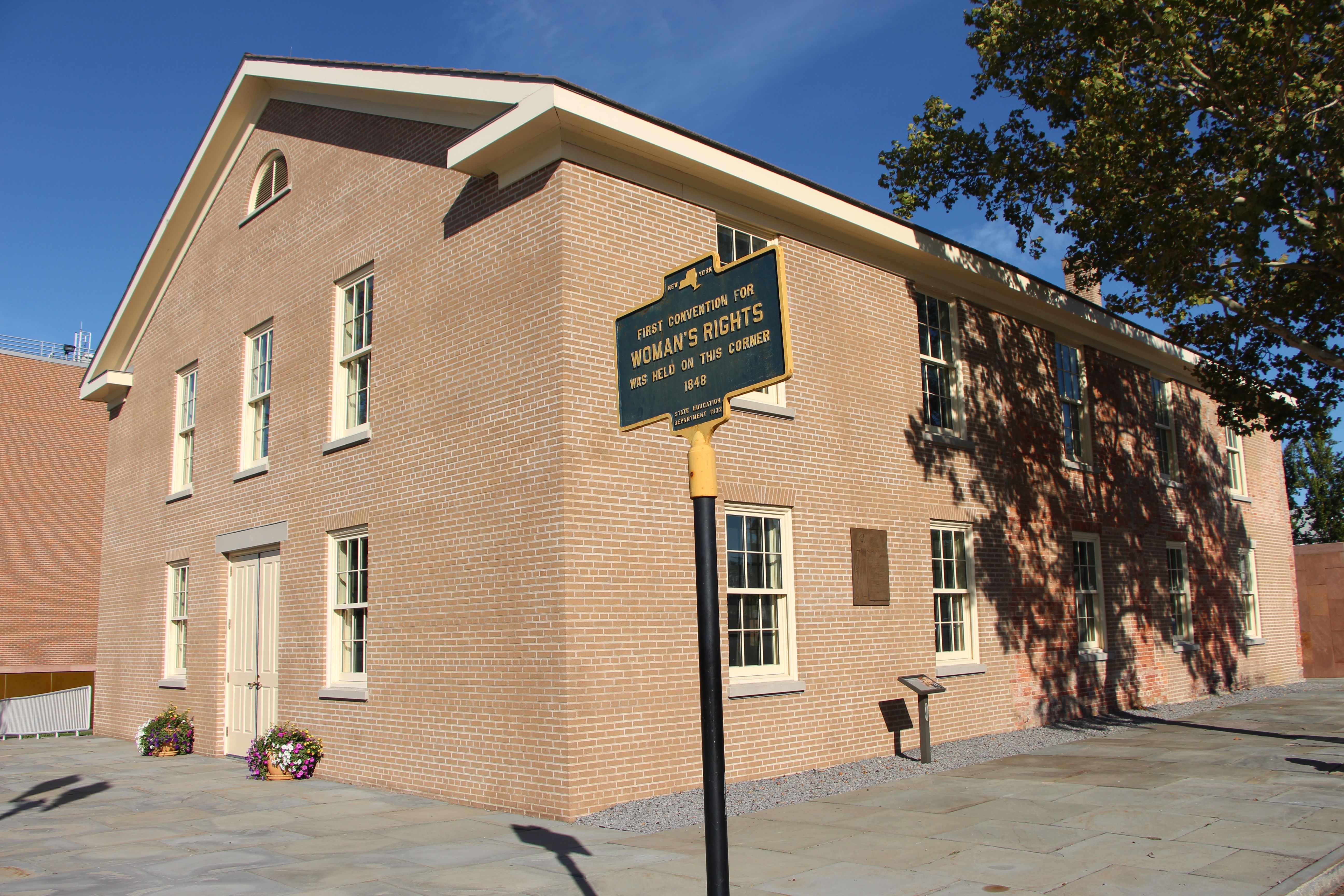
Women's Rights National Historical Park
National Historical Park
Women’s Rights National Historical Park tells the story of the first Women’s Rights Convention, held in Seneca Falls, New York on July 19-20, 1848. It is a story of struggles for civil rights, human r...
5 mi from route
~11 min detour
Free
near mile 199.5
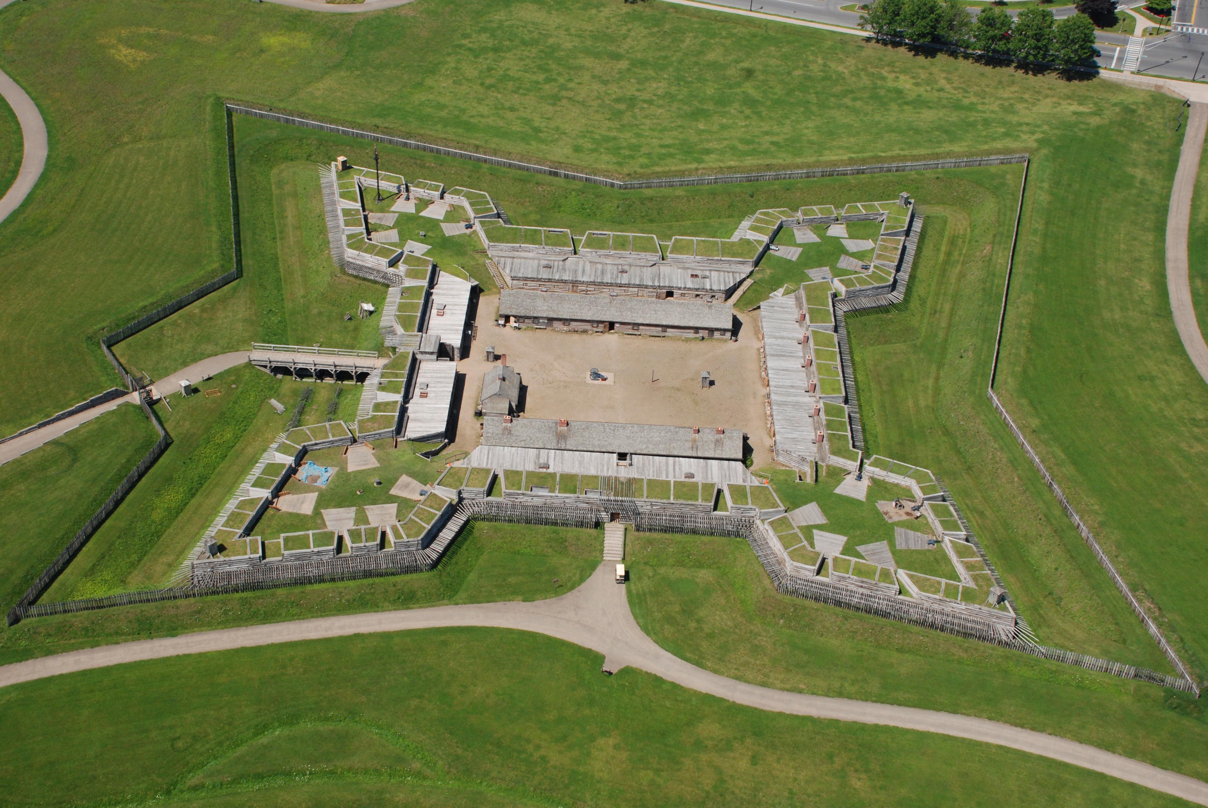
For centuries, the Oneida Carrying Place, a six-mile portage connecting the Mohawk River and Wood Creek, served as a vital link for those traveling by water from the ocean to the Great Lakes. When Eur...
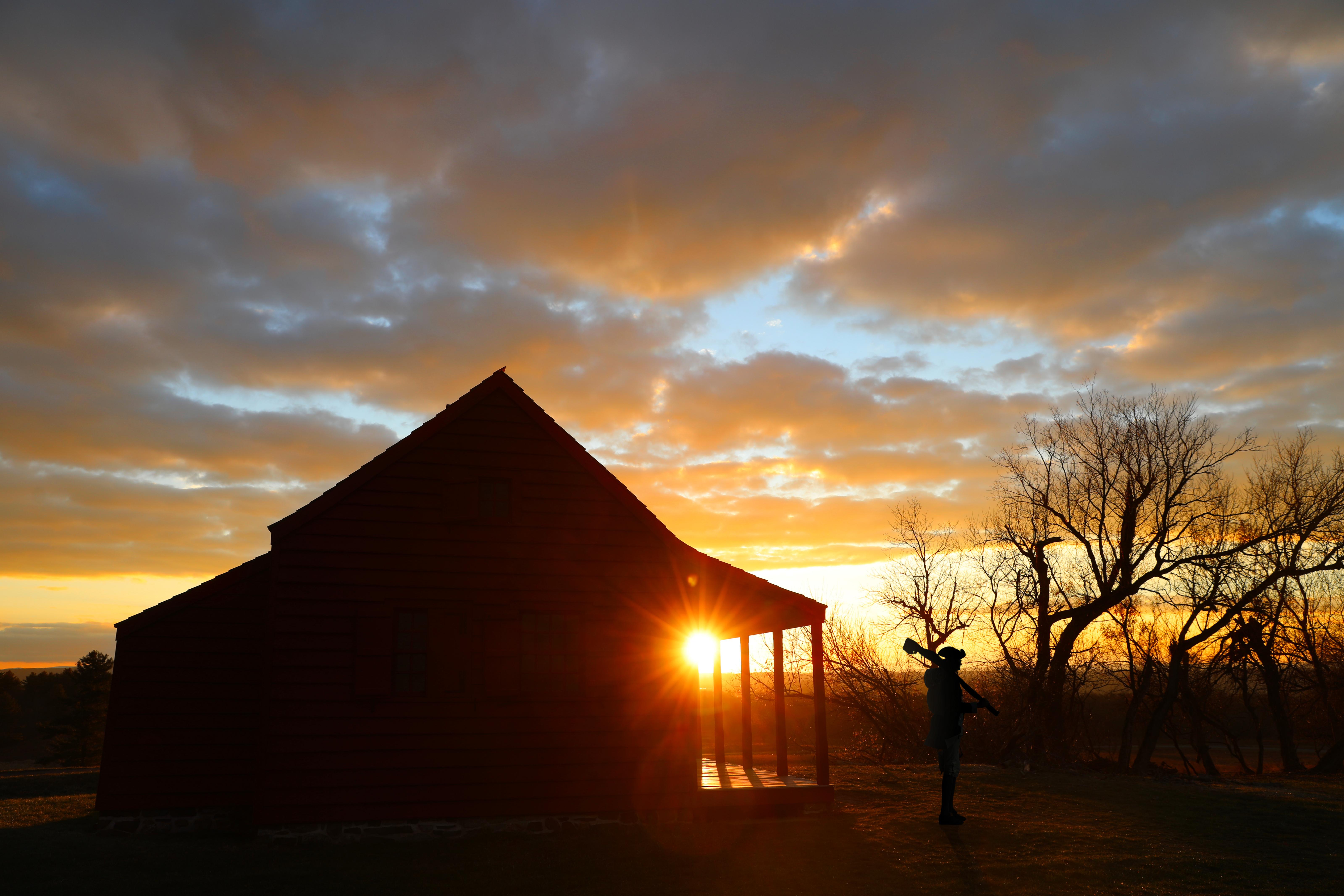
Harriet Tubman was guided by a deep faith and devotion to family, freedom, and community. After emancipating herself and members of her family, she moved them from Ontario, Canada to Fleming and Aubur...
In 1777, a large British invasion force met an equally large American army here at Saratoga. After two intense battles, an eight-mile retreat, and a three-day siege, British General John Burgoyne surr...
9 mi from route
~22 min detour
Free
near mile 31.5
Park data from the National Park Service API. Alerts update every 2 hours.
Fuel & Cost
Regular Gas
$50.12 one way
$100.25 round trip
$4.18/gal25.4 MPG avg107 kg CO2
Fuel Type
$/gal
One Way
Round Trip
midgrade
$4.52
$54.20
$108.40
premium
$4.92
$59.02
$118.04
diesel
$5.61
$67.23
$134.46
Estimated Tolls: $12.30
New York State Thruway
(246 mi)$12.30
Toll estimates based on average 2024-2025 rates. EZ-Pass/SunPass discounts may lower the actual cost.
Estimated Trip Cost (one way, 1 person)
Fuel
$50
Tolls
$12
Meals
$25–$50
Total
$87–$112
Rough estimate based on US averages. Hotel $80–$140/night, meals $25–$50/day.
Estimated CO2 emission: 106.5 kg one way.
Prices: EIA weekly data, 2026-04-13.
Driving Electric?
About $32 in charging
· 1 stop
· 66% less CO2
Vehicle Type
kWh
Stops
DC Fast
Home Charge
Average EV
91.4
1
$31.97
$14.62
Efficient EV
76.1
0
$26.64
$12.18
EV Truck/SUV
121.8
1
$42.63
$19.49
Gas CO2
107 kg
EV CO2
36 kg (66% less)
Plan for 1 charging stop. A 30-minute DC fast charge mid-route should be enough to complete the trip comfortably.
DC fast charging avg $0.35/kWh. Home charging avg $0.16/kWh. US grid CO2: 0.39 kg/kWh.
Travel Intel
Current conditions at both ends of the drive.
Forecast as of Apr 15, 2026
Origin
Kingsbury, NY
Evening
in Kingsbury on Friday
Local time
7:27 PM
EDT
Current temp
51°F
Unavailable
Live forecast
Destination
Amherst, NY
Evening
in Amherst on Friday
Local time
7:27 PM
EDT
Current temp
44°F
Unavailable
Live forecast
39°F
Whitesboro, NY
152 mi in
Seasonal Notes
Summer travel usually means heavier construction, hotter rest stops, and busier weekend traffic around major cities.
Winter travel shortens daylight, so a route that looks manageable on paper can feel much longer after dark.
Holiday weekends tend to make both departure and arrival windows slower than the raw route time suggests.
Time zone
Same local time
Origin and destination are on the same clock, so arrival timing is easier to judge at a glance.
Temperature spread
7 degrees cooler at arrival
A meaningful temperature swing is a good cue to rethink layers, water, and how soon you want to arrive.
Road read
6h 16m on the road
Start early — leave by 6-7 AM to arrive at a reasonable hour.
Weather data from the National Weather Service. Conditions may change; check closer to your travel date.
Frequently Asked Questions
The drive from Kingsbury, NY to Amherst, NY covers 304.5 miles and takes about 6h 16m without stops. Add 15-30 minutes for a fuel or rest stop on longer drives.
The main roads are New York State Thruway, Adirondack Northway, Amsterdam Road. Expect a mix of highway and local road driving.
This is a comfortable same-day trip.
The midpoint is about 152.3 miles from Kingsbury, NY. Look for rest areas, gas stations, or food options near the halfway mark.
At current regular gas prices, expect to spend about $50.12 one way. This estimate uses 25.4 MPG — your actual cost will vary with your vehicle's fuel efficiency and current gas prices.
Start early — leave by 6-7 AM to arrive at a reasonable hour. This is a long drive — plan for a morning departure or consider splitting it into two days.
Plan about 1 meaningful break for fuel, food, or rest. Plan on a short reset every 3 to 4 hours to stay fresh behind the wheel.
This is a demanding drive. With 20 significant decision points across 304.5 miles, you will need to stay alert - especially through interchange areas and urban stretches. Consider splitting it into segments if you are not comfortable with fast highway navigation.
The main spots that need attention: at 5.2 miles (US 4): Highway fork - watch signs carefully; at 29 miles: Exit ramp - move to the correct lane early; at 34 miles (Front Street): Navigation decision point.
The route from Kingsbury, NY to Amherst, NY does not surface many named destination signs beyond the main corridor.
Yes. Nearby national parks include Women's Rights National Historical Park, Fort Stanwix National Monument and Harriet Tubman National Historical Park. There are 4 parks within detour distance of this route.
How this page is built
Compiled by the Trip.ovh planning team at COD Solutions Oy from open government datasets — OSRM over OpenStreetMap for geometry, EIA for fuel prices, and NPS for national parks. See our methodology for refresh cadence and limitations.