Trip from Kingsland, GA to Sandy Springs, GA

Drive Time

6h 24m

Distance

323.9 mi

521 km

Drive Score

9/10

Great drive

Same Day?

Yes, doable

Fuel Cost

$52

one way

EV Charging

Loading...

station data

Best Time to Leave

Save up to 37 min
4 AM
6h 12m ★
6 AM
6h 25m
8 AM
6h 49m
10 AM
6h 33m
12 PM
6h 31m
3 PM
6h 35m
5 PM
6h 48m
8 PM
6h 17m

Estimated drive times based on typical traffic patterns. Actual times may vary with weather, construction, and real-time conditions.

Downtown Kingsland, GA, GA

Kingsland, GA

Quang Nguyen Vinh

Trip Overview

The drive from Kingsland, GA to Sandy Springs, GA covers 323.9 miles and takes about 6h 24m behind the wheel. This route is realistic as a one-day drive if you keep your stops efficient.

The route leans on I 75 Business, US 82, I 75 for much of the mileage, and the overall profile is highway-focused drive. The longest uninterrupted segment is about 92.3 miles on I 75 Business. At current regular gas prices, budget about $51.84 one way before food or hotel costs.

Trip Pace

Same-day drive is realistic

A same-day return is possible, but it will make for a full day on the road.

Break Rhythm

1 planned break

Plan on a short reset every 3 to 4 hours to stay fresh behind the wheel.

Midpoint

161.9 miles from Kingsland, GA

A natural place for your longest stop of the day , about 3h 24m into the drive .

Drive Character

This is a 6h 24m highway drive covering 323.9 miles, with most of the trip on I 75 Business and US 82. The longest continuous stretch is about 92.3 miles on I 75 Business.

Most of the miles stay on highways, which makes pacing and fuel planning easier than turn-by-turn city driving.
There are about 33 navigation steps in the underlying route data, so the final approach matters more than the middle miles.
I 75 Business is the longest continuous segment at about 92.3 miles.

How Hard Is This Drive?

This is a straightforward highway drive that stays mostly on I 75 Business and US 82. This route has several spots where lane changes, forks, or exits need your full attention. The trickiest moment comes around 220.8 miles in near I 475 / Larry Justice Highway.

Route Complexity 8/10

Demanding - plan breaks and stay ahead of the key maneuvers

This is a demanding drive. With 16 significant decision points across 323.9 miles, you will need to stay alert — especially through interchange areas and urban stretches. Consider splitting it into segments if you are not comfortable with fast highway navigation.

Where does it get tricky?

The main spots that need attention: at 220.8 miles (I 475 / Larry Justice Highway): Highway fork - watch signs carefully. Lane positioning matters here; at 286.1 miles (I 675 / Terrell Starr Parkway): Highway fork - watch signs carefully. Lane positioning matters here. Multiple destination signs - pick the right one; at 296.2 miles: Highway fork - watch signs carefully. Lane positioning matters here. Multiple destination signs - pick the right one.

Critical Maneuvers

5 of 16 key points

These are the spots where you need to pay the most attention. Preview them before you drive.

8
220.8 mi into trip | ~4h 27m in | I 475 / Larry Justice Highway

Keep slight left at fork onto I 475 / Larry Justice Highway toward I 475 North: Atlanta

Highway fork - watch signs carefully. Lane positioning matters here

Use the slight left lane. Exit 156 Toward I 475 North: Atlanta
9
286.1 mi into trip | ~5h 38m in | I 675 / Terrell Starr Parkway

Keep slight right at fork onto I 675 / Terrell Starr Parkway toward I 675 North: Augusta, Greenville

Highway fork - watch signs carefully. Lane positioning matters here. Multiple destination signs - pick the right one

Use the straight / slight right lanes. Exit 227 Toward I 675 North: Augusta, Greenville
8
296.2 mi into trip | ~5h 49m in

Keep slight right at fork toward I 285 East: Augusta, Greenville

Highway fork - watch signs carefully. Lane positioning matters here. Multiple destination signs - pick the right one

Use the slight left / slight right lanes. Toward I 285 East: Augusta, Greenville
8
321.4 mi into trip | ~6h 19m in

Take the exit toward US 19 South, GA 400 North: Roswell Road, Sandy Springs

Exit ramp - move to the correct lane early. Lane positioning matters here. Multiple destination signs - pick the right one

Use the slight right lane. Exit 25; 27B Toward US 19 South, GA 400 North: Roswell Road,...
8
322.9 mi into trip | ~6h 22m in | US 19

Keep slight right at fork onto US 19 toward US 19 South: Roswell Road, Sandy Springs

Highway fork - watch signs carefully. Lane positioning matters here. Multiple destination signs - pick the right one

Use the slight right lane. Toward US 19 South: Roswell Road, Sandy Springs

Towns Along This Route

On the drive from Kingsland, GA to Sandy Springs, GA, road signs begin pointing toward Greenville along the way.

Greenville

286.1 mi in | ~5h 38m | via I 675

Main Roads

Road Distance Duration
I 75 Business 92.3 mi 1h 38m
US 82 55.8 mi 1h 9m
I 75 49.5 mi 53m
US 1 33.9 mi 41m
Atlanta Bypass / The Perimeter 24.5 mi 28m
West King Street 18.8 mi 28m
Larry Justice Highway 15.9 mi 17m
Terrell Starr Parkway 10.1 mi 11m
Longest stretch: I 75 Business — 92.3 mi, about 1h 38m

Turn-by-Turn Driving Directions

Step-by-step road directions between Kingsland, GA and Sandy Springs, GA.

1

Start on GA 40

123 ft · 4 sec · East King Avenue
2

Continue on GA 40

19 mi · 28 min · West King Street
Use the straight / right lanes.
3

Turn right onto GA 40 Connector

1.3 mi · 2 min · Indian Trail
4

Turn right onto US 1; US 23; US 301; GA 4; GA 15; GA 23; GA 121

1.7 mi · 2 min · US 1; US 23; US 301; GA 4; GA 15; GA 23; GA 121
5

Continue on US 1; US 23; GA 4; GA 15; GA 121

32 mi · 39 min · US 1; US 23; GA 4; GA 15; GA 121
Toward US 1 North, US 23 North: Waycross Use the straight lane.
6

Continue on Carswell Avenue

3.7 mi · 6 min · Carswell Avenue
7

Turn right onto US 1; US 23; US 82; GA 4; GA 520

5.6 mi · 6 min · South Georgia Parkway
8

Continue on US 82; GA 520

6.6 mi · 7 min · Albany Highway
9

Continue on US 82; GA 520

3.4 mi · 3 min · US 82; GA 520
10

Continue on US 82; GA 520

5.1 mi · 6 min · US 82; GA 520
11

Continue on US 82; GA 520

4.6 mi · 5 min · US 82; GA 520
12

Continue on US 82; GA 520

4.5 mi · 6 min · US 82; GA 520
Use the straight / right lanes.
13

Continue on US 82; GA 520

21 mi · 24 min · US 82; GA 520
14

Continue on US 82; GA 520

0.7 mi · 1 min · US 82; GA 520
15

Continue on US 82; US 129; GA 11; GA 520

1.1 mi · 1 min · US 82; US 129; GA 11; GA 520
16

Continue on US 82; GA 520

15 mi · 18 min · US 82; GA 520
Use the straight / slight right lanes.
17

Continue on US 82; US 319; GA 35; GA 520

0.7 mi · 1 min · US 82; US 319; GA 35; GA 520
Use the straight lane.
18

Take the exit onto East 2nd Street

1.0 mi · 2 min · East 2nd Street
19

Turn right onto Forrest Avenue

0.8 mi · 2 min · Forrest Avenue
20

At end of road, turn left onto US 41; I 75 Business; GA 7

459 ft · 11 sec · West 12th Street
21

Continue on US 41; I 75 Business; GA 7

0.7 mi · 1 min · US Highway 41 North
Use the straight / right lanes.
22

Take the ramp onto I 75 Business

92 mi · 1 hr 38 min · I 75 Business
Use the straight / slight right lanes.
23

Keep slight left at fork onto I 475

16 mi · 17 min · Larry Justice Highway
Exit 156 Toward I 475 North: Atlanta Use the slight left lane.
24

Merge onto I 75

49 mi · 53 min · I 75
Use the straight / slight right lanes.
25

Keep slight right at fork onto I 675

10 mi · 11 min · Terrell Starr Parkway
Exit 227 Toward I 675 North: Augusta, Greenville Use the straight / slight right lanes.
26

Keep slight right at fork

0.6 mi · 1 min
Toward I 285 East: Augusta, Greenville Use the slight left / slight right lanes.
27

Merge onto I 285

25 mi · 28 min · Atlanta Bypass / The Perimeter
Use the straight / slight right lanes.
28

Take the exit

518 ft · 12 sec
Exit 25; 27B Toward US 19 South, GA 400 North: Roswell Road, Sandy Springs Use the slight right lane.
29

Continue on this road

1.4 mi · 2 min · this road
Exit 25 Toward US 19 South: Roswell Road
30

Keep slight right at fork onto US 19

0.2 mi · 24 sec · US 19
Toward US 19 South: Roswell Road, Sandy Springs Use the slight right lane.
31

Turn right onto GA 9

0.8 mi · 1 min · Roswell Road
Use the right lane.
32

Turn right onto Mount Vernon Highway

180 ft · 3 sec · Mount Vernon Highway
33

Arrive at destination

Mount Vernon Highway

Trip Plan

Morning Departure

Start early — leave by 6-7 AM to arrive at a reasonable hour.

Evening Departure

This is a long drive — plan for a morning departure or consider splitting it into two days.

You can normally do this drive in one day.
Plan roughly 1 meaningful break for fuel, food, and rest.
The halfway point lands around 161.9 miles from Kingsland, GA, or about 3h 24m into the drive.
The longest continuous stretch on this route runs about 92.3 miles.

This is a comfortable same-day trip.

Departure

Before you leave

Start with fuel, water, and navigation already sorted so the first hour feels easy.

First stop

Around 80 miles or 1h 44m in

Use this first pause for coffee, a restroom break, and a quick traffic check ahead.

Halfway reset

Around 161.9 miles or 3h 24m in

This is the best place for your longest stop, a real meal, and a full fuel check.

Final approach

Final hour starts around 5h 15m

Traffic, exits, and arrival timing usually matter more near Sandy Springs, GA than in the middle of the route.

Before You Leave

+

Open the route before leaving Kingsland, GA so your first major turns are already loaded.

+

Leave with enough water and a charging cable within reach, not packed away.

+

Check your fuel range against the first long segment, especially if you are starting outside city service areas.

Day 1

Settle into the route from Kingsland, GA

This is one driving day of about 323.9 miles and 6h 24m.

Your first comfortable stop window is around 80 miles from Kingsland, GA.
This route can stay practical as a one-day drive if traffic stays reasonable.
Plan about 1 real break rather than only quick fuel stops.
The longest stretch is on I 75 Business for about 92.3 miles.

Where to Stop

Rest stops, refuel points, and overnight suggestions along this route.

Halfway Point

Midpoint

About 161.9 mi from Kingsland, GA · 3h 24m into the drive

Mid-route town

Meal stop

Warner Robins, GA

162 mi into the route

Best for: Lunch, fuel, and a longer reset

This sits close to the middle of the route, so it works well for the longest stop of the day.

Popular next leg

Warner Robins, GA to Sandy Springs, GA

120.4 mi · 1h 57m

Pacing Suggestions

Alma, GA

Fuel and coffee

A short stop after about 80 miles helps settle the day before fatigue starts building.

Warner Robins, GA

Meal break

The midpoint is around 163.1 miles from Kingsland, GA, which is a good place for a longer meal and fuel stop.

Arriving in Sandy Springs, GA

The final approach into Sandy Springs, GA usually feels slower than the middle of the drive, so avoid planning your tightest schedule at the very end.

Try to arrive with enough fuel left to skip an immediate station stop unless you already know the area around Sandy Springs, GA.

These stop ideas are pacing suggestions — the exact town or exit can change with traffic, hotel plans, and fuel range.

National Parks Near This Route

Worth a detour if your schedule allows.

Chattahoochee River National Recreation Area

Chattahoochee River National Recreation Area

National Recreation Area

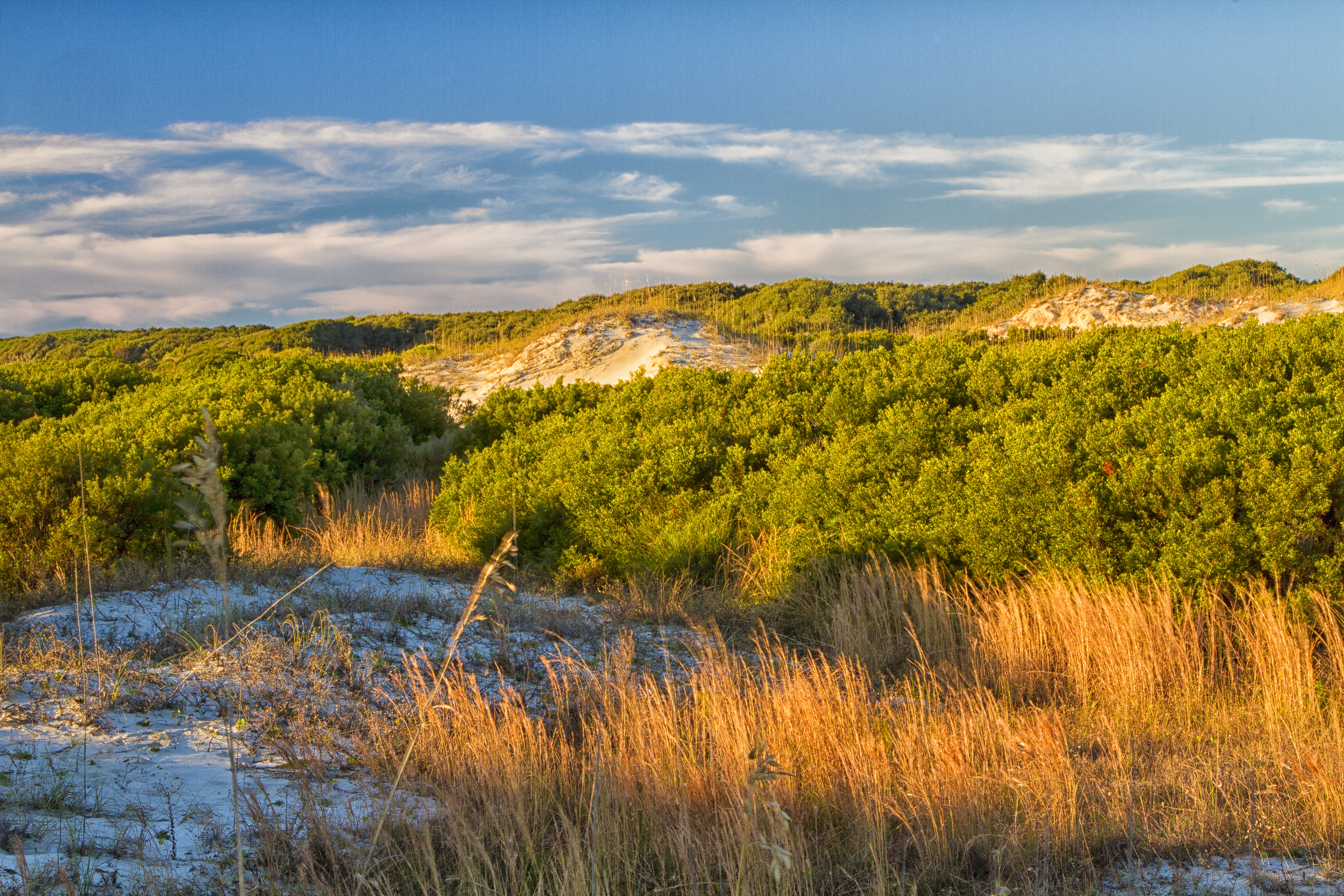
Today the river valley attracts us for so many reasons. Take a solitary walk to enjoy nature’s display, raft leisurely through the rocky shoals with friends, fish the misty waters as the sun comes up,...

7 mi from route ~18 min detour $5 near mile 326.1
Park Closure: Island Ford Trail Closures Winter 2025-2026
Park Closure: Restrooms and Water Fountains Unavailable at Powers Island and Akers Mill
View on nps.gov
Martin Luther King, Jr. National Historical Park

Martin Luther King, Jr. National Historical Park

National Historical Park

Welcome to Martin Luther King, Jr. National Historical Park & Preservation District where a young boy grows up in a time of segregation. He was moved by destiny to lead the modern civil rights movemen...

8 mi from route ~20 min detour Free near mile 303.6
View on nps.gov
Ocmulgee Mounds National Historical Park

Ocmulgee Mounds National Historical Park

National Historical Park

Welcome to Ocmulgee Mounds National Historical Park. This park is a prehistoric American Indian site, where many different American Indian cultures occupied this land for thousands of years. American...

8 mi from route ~19 min detour Free near mile 224.9
View on nps.gov
Cumberland Island National Seashore

Cumberland Island National Seashore

National Seashore

St Marys is the gateway to Cumberland Island, Georgia's largest and southernmost barrier island. Here pristine maritime forests, undeveloped beaches and wide marshes whisper the stories of both man an...

15 mi from route ~37 min detour $15
View on nps.gov

Park data from the National Park Service API. Alerts update every 2 hours.

Fuel & Cost

Regular Gas

$51.84 one way

$103.67 round trip

$4.07/gal 25.4 MPG avg 113 kg CO2
Fuel Type $/gal One Way Round Trip
midgrade $4.43 $56.48 $112.96
premium $4.78 $60.93 $121.86
diesel $5.64 $71.96 $143.92

No toll roads detected on this route.

Estimated Trip Cost (one way, 1 person)

Fuel

$52

Meals

$25–$50

Total

$77–$102

Rough estimate based on US averages. Hotel $80–$140/night, meals $25–$50/day.

Estimated CO2 emission: 113.3 kg one way. Prices: EIA weekly data, 2026-04-06.

Driving Electric?

About $34 in charging · 1 stop · 66% less CO2

Vehicle Type kWh Stops DC Fast Home Charge
Average EV 97.2 1 $34.01 $15.55
Efficient EV 81 0 $28.34 $12.96
EV Truck/SUV 129.6 1 $45.35 $20.73

Gas CO2

113 kg

EV CO2

38 kg (66% less)

Plan for 1 charging stop. A 30-minute DC fast charge mid-route should be enough to complete the trip comfortably.

DC fast charging avg $0.35/kWh. Home charging avg $0.16/kWh. US grid CO2: 0.39 kg/kWh.

Travel Intel

Current conditions at both ends of the drive.

Forecast data refreshed 3 days ago

Origin

Kingsland, GA

Afternoon in Kingsland on Monday

Local time

1:26 PM

EDT

Current temp

60°F

Unavailable

Live forecast

Destination

Sandy Springs, GA

Afternoon in Sandy Springs on Monday

Local time

1:26 PM

EDT

Current temp

64°F

Unavailable

Live forecast

Seasonal Notes

Summer travel usually means heavier construction, hotter rest stops, and busier weekend traffic around major cities.

Winter travel shortens daylight, so a route that looks manageable on paper can feel much longer after dark.

Holiday weekends tend to make both departure and arrival windows slower than the raw route time suggests.

Time zone

Same local time

Origin and destination are on the same clock, so arrival timing is easier to judge at a glance.

Temperature spread

4 degrees warmer at arrival

A meaningful temperature swing is a good cue to rethink layers, water, and how soon you want to arrive.

Road read

6h 24m on the road

Start early — leave by 6-7 AM to arrive at a reasonable hour.

Weather data from the National Weather Service. Conditions may change; check closer to your travel date.

Frequently Asked Questions

The drive from Kingsland, GA to Sandy Springs, GA covers 323.9 miles and takes about 6h 24m without stops. Add 15-30 minutes for a fuel or rest stop on longer drives.
The main roads are I 75 Business, US 82, I 75. Most of the drive stays on highways, so watch for ramps and exits.
This is a comfortable same-day trip.
The midpoint is about 161.9 miles from Kingsland, GA. Look for rest areas, gas stations, or food options near the halfway mark.
At current regular gas prices, expect to spend about $51.84 one way. This estimate uses 25.4 MPG — your actual cost will vary with your vehicle's fuel efficiency and current gas prices.
Start early — leave by 6-7 AM to arrive at a reasonable hour. This is a long drive — plan for a morning departure or consider splitting it into two days.
Plan about 1 meaningful break for fuel, food, or rest. Plan on a short reset every 3 to 4 hours to stay fresh behind the wheel.
This is a demanding drive. With 16 significant decision points across 323.9 miles, you will need to stay alert — especially through interchange areas and urban stretches. Consider splitting it into segments if you are not comfortable with fast highway navigation.
The main spots that need attention: at 220.8 miles (I 475 / Larry Justice Highway): Highway fork - watch signs carefully. Lane positioning matters here; at 286.1 miles (I 675 / Terrell Starr Parkway): Highway fork - watch signs carefully. Lane positioning matters here. Multiple destination signs - pick the right one; at 296.2 miles: Highway fork - watch signs carefully. Lane positioning matters here. Multiple destination signs - pick the right one.
On the drive from Kingsland, GA to Sandy Springs, GA, road signs begin pointing toward Greenville along the way.

Was this route helpful?

Thanks for your feedback!

Your tip has been submitted. Thanks!

/500

Explore More

Explore more options from Kingsland, GA or browse trips ending in Sandy Springs, GA.

Looking for more statewide routes? Browse GA road trips.

Explore maps for Kingsland, GA or Sandy Springs, GA on MapSof.net.