
Trip from Las Vegas, NM to Truth or Consequences, NM

Compiled and reviewed by the Trip.ovh planning team at COD Solutions Oy · Last reviewed Apr 17, 2026 · Editorial standards

Drive Time

4h 38m

Distance

270.5 mi

435 km

Drive Score

8/10

Great drive

Same Day?

Yes, doable

Fuel Cost

$41

one way

EV Charging

Unknown

Best Time to Leave

Save up to 40 min
4 AM
4h 25m ★
6 AM
4h 38m
8 AM
5h 5m
10 AM
4h 48m
12 PM
4h 45m
3 PM
4h 49m
5 PM
5h 4m
8 PM
4h 30m

Estimated drive times based on typical traffic patterns. Actual times may vary with weather, construction, and real-time conditions.

city in and county seat of San Miguel County, New Mexico, United States

Las Vegas, NM

Wikimedia Commons

Downtown Truth or Consequences, NM, NM

Truth or Consequences, NM

Kevin Malik

Trip Overview

The drive from Las Vegas, NM to Truth or Consequences, NM covers 270.5 miles and takes about 4h 38m behind the wheel. This route is realistic as a one-day drive if you keep your stops efficient.

The route leans on I 25, North Date Street, I 25 Business for much of the mileage, and the overall profile is highway-focused drive. The longest uninterrupted segment is about 266.3 miles on I 25. At current regular gas prices, budget about $40.85 one way before food or hotel costs.

Trip Pace

Same-day drive is realistic

A same-day return is possible, but it will make for a full day on the road.

Break Rhythm

1 planned break

Plan on a short reset every 3 to 4 hours to stay fresh behind the wheel.

Midpoint

135.2 miles from Las Vegas, NM

A natural place for your longest stop of the day , about 2h 17m into the drive .

Who Is This Route For?

Weekend Trip

Doable as a same-day drive at 4h 38m. Total distance: 270.5 miles.

Family Friendly

Moderate complexity with 1 natural rest stops along the way.

Solo Traveler

4h 38m drive, comfortable solo distance.

First-Time Driver

Mostly highway driving (99%). Straightforward navigation.

Drive Character

This is a 4h 38m highway drive covering 270.5 miles, with most of the trip on I 25 and North Date Street. The longest continuous stretch is about 266.3 miles on I 25.

Most of the miles stay on highways, which makes pacing and fuel planning easier than turn-by-turn city driving.
There are about 16 navigation steps in the underlying route data, so the final approach matters more than the middle miles.
I 25 is the longest continuous segment at about 266.3 miles.

How Hard Is This Drive?

This is a straightforward highway drive that stays mostly on I 25 and North Date Street. There are only a few real navigation decisions along the way. The trickiest moment comes around 0.7 miles in near NM 104 / East University.

Driving Effort 4/10

Easy - simple navigation with a manageable amount of wheel time

Balances navigation complexity with total wheel time.

This is a straightforward 4h 38m drive. You will face about 10 decision points, but nothing that requires special attention if you follow navigation.

Where does it get tricky?

The main spots that need attention: at 0.7 miles (NM 104 / East University): Navigation decision point; at 1.3 miles (I 25): Merge point - match speed before joining. Lane positioning matters here; at 267.8 miles (I 25 Business): Highway fork - watch signs carefully.

Critical Maneuvers

5 of 10 key points

These are the spots where you need to pay the most attention. Preview them before you drive.

5
0.7 mi into trip | ~1m in | NM 104 / East University

Turn left onto NM 104 / East University

Navigation decision point

5
1.3 mi into trip | ~2m in | I 25

Merge onto I 25

Merge point - match speed before joining. Lane positioning matters here

Use the straight / slight right lanes.
5
267.8 mi into trip | ~4h 32m in | I 25 Business

Keep slight right at fork onto I 25 Business toward Truth or Consequences

Highway fork - watch signs carefully

Toward Truth or Consequences
5
270.3 mi into trip | ~4h 37m in | Jones Street

Turn left onto Jones Street

Navigation decision point

6
270.4 mi into trip | ~4h 38m in | I 25 Business / Broadway Street

At end of road, turn left onto I 25 Business / Broadway Street

Complex interchange - multiple decisions in a short stretch

Main Roads

Road Distance Duration
I 25 266.3 mi 4h 28m
North Date Street 1.7 mi 3m
I 25 Business 0.9 mi 2m
National Avenue 0.6 mi 1m
East University 0.2 mi <1m
Main Street 0.2 mi <1m
Jones Street <0.1 mi <1m
4th Street <0.1 mi <1m
Longest stretch: I 25 — 266.3 mi, about 4h 28m

Turn-by-Turn Driving Directions

Step-by-step road directions between Las Vegas, NM and Truth or Consequences, NM.

1

Start on Bridge Street

91 ft · 1 sec · Bridge Street
2

Continue on National Avenue

0.6 mi · 1 min · National Avenue
3

Turn right onto 4th Street

284 ft · 12 sec · 4th Street
4

Turn right onto I 25 Bus

218 ft · 11 sec · Grand Avenue
5

Turn left onto NM 104

0.2 mi · 20 sec · East University
6

Take the ramp

0.3 mi · 40 sec
7

Merge onto I 25

266 mi · 4 hr 28 min · I 25
Use the straight / slight right lanes.
8

Take the exit onto I 25 Business

0.3 mi · 50 sec · I 25 Business
Toward Truth or Consequences
9

Keep slight right at fork onto I 25 Business

0.6 mi · 1 min · I 25 Business
Toward Truth or Consequences
10

Continue on NM 181

0.3 mi · 30 sec · North Date Street
11

Keep slight right at fork onto I 25 Business

1.4 mi · 3 min · North Date Street
12

Continue on I 25 Business

0.2 mi · 34 sec · Main Street
13

Turn left onto Jones Street

525 ft · 24 sec · Jones Street
14

At end of road, turn left onto I 25 Business

177 ft · 8 sec · Broadway Street
15

Turn right onto South Pershing Street

47 ft · 1 sec · South Pershing Street
16

Arrive at destination

South Pershing Street

Trip Plan

Morning Departure

An early start around 7-8 AM gets you there with plenty of daylight left.

Evening Departure

A late afternoon start means arriving after dark. Morning is better.

You can normally do this drive in one day.
Plan roughly 1 meaningful break for fuel, food, and rest.
The halfway point lands around 135.2 miles from Las Vegas, NM, or about 2h 17m into the drive.
The longest continuous stretch on this route runs about 266.3 miles.

This is a comfortable same-day trip.

Departure

Before you leave

Start with fuel, water, and navigation already sorted so the first hour feels easy.

First stop

Around 60 miles or 1h 1m in

Use this first pause for coffee, a restroom break, and a quick traffic check ahead.

Halfway reset

Around 135.2 miles or 2h 17m in

This is the best place for your longest stop, a real meal, and a full fuel check.

Final approach

Final hour starts around 3h 45m

Traffic, exits, and arrival timing usually matter more near Truth or Consequences, NM than in the middle of the route.

Before You Leave

+

Open the route before leaving Las Vegas, NM so your first major turns are already loaded.

+

Leave with enough water and a charging cable within reach, not packed away.

+

Check your fuel range against the first long segment, especially if you are starting outside city service areas.

Day 1

Settle into the route from Las Vegas, NM

This is one driving day of about 270.5 miles and 4h 38m.

Your first comfortable stop window is around 60 miles from Las Vegas, NM.
This route can stay practical as a one-day drive if traffic stays reasonable.
Plan about 1 real break rather than only quick fuel stops.
The longest stretch is on I 25 for about 266.3 miles.

Where to Stop

Rest stops, refuel points, and overnight suggestions along this route.

Halfway Point

Midpoint

About 135.2 mi from Las Vegas, NM · 2h 17m into the drive

census designated place in Bernalillo County, New Mexico, United States

Mid-route town

Meal stop

South Valley, NM

135 mi into the route

Best for: Lunch, fuel, and a longer reset

This sits close to the middle of the route, so it works well for the longest stop of the day.

Pacing Suggestions

Eldorado at Santa Fe, NM

Fuel and coffee

A short stop after about 60 miles helps settle the day before fatigue starts building.

South Valley, NM

Meal break

The midpoint is around 135.2 miles from Las Vegas, NM, which is a good place for a longer meal and fuel stop.

Before the longest stretch

Fuel check

Top up before I 25 if your tank is already low. That segment runs about 266.3 miles.

Arriving in Truth or Consequences, NM

The final approach into Truth or Consequences, NM usually feels slower than the middle of the drive, so avoid planning your tightest schedule at the very end.

Try to arrive with enough fuel left to skip an immediate station stop unless you already know the area around Truth or Consequences, NM.

After long uninterrupted mileage, take five minutes before the last urban segment to reset and refocus on exits, merges, and city traffic.

These stop ideas are pacing suggestions — the exact town or exit can change with traffic, hotel plans, and fuel range.

National Parks Near This Route

Worth a detour if your schedule allows.

Pecos National Historical Park

Pecos National Historical Park

National Historical Park

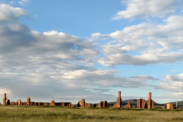
Pecos is a natural and cultural crossroads through which hunters, gatherers, traders, missionaries, immigrants, soldiers, ranchers, and other travelers passed and lived. Follow in their footsteps and...

5 mi from route ~12 min detour Free near mile 46.6
View on nps.gov
Petroglyph National Monument

Petroglyph National Monument

National Monument

Petroglyph National Monument protects one of the largest petroglyph sites in North America, featuring designs and symbols carved onto volcanic rocks by Native Americans and Spanish settlers 400 to 700...

7 mi from route ~18 min detour Free near mile 121.2
View on nps.gov
Bandelier National Monument

Bandelier National Monument

National Monument

Bandelier National Monument protects over 33,000 acres of ruggedly beautiful canyon and mesa country. Petroglyphs, dwellings carved into the soft rock cliffs, and standing masonry walls pay tribute to...

20 mi from route ~49 min detour $25 near mile 74.6
View on nps.gov
Fort Union National Monument

Fort Union National Monument

National Monument

Exposed to the wind, within a sweeping valley of short grass prairie, and along the eroded Santa Fe Trail, lie the adobe walled ruins of the largest 19th century military fort in the region. From 1851...

25 mi from route ~62 min detour Free
View on nps.gov
Manhattan Project National Historical Park

Manhattan Project National Historical Park

National Historical Park

The Manhattan Project is one of the most transformative events of the 20th century. It ushered in the nuclear age with the development of the world’s first atomic bombs. Most of this development took...

25 mi from route ~62 min detour Free near mile 74.6
View on nps.gov

Park data from the National Park Service API. Alerts update every 2 hours.

Fuel & Cost

Regular Gas

$40.85 one way

$81.70 round trip

$3.84/gal 25.4 MPG avg 95 kg CO2
Fuel Type $/gal One Way Round Trip
midgrade $4.21 $44.85 $89.69
premium $4.56 $48.55 $97.10
diesel $5.61 $59.72 $119.45

No toll roads detected on this route.

Estimated Trip Cost (one way, 1 person)

Fuel

$41

Meals

$25–$50

Total

$66–$91

Rough estimate based on US averages. Hotel $80–$140/night, meals $25–$50/day.

Estimated CO2 emission: 94.6 kg one way. Prices: EIA weekly data, 2026-04-13.

Driving Electric?

About $28 in charging · 1 stop · 66% less CO2

Vehicle Type kWh Stops DC Fast Home Charge
Average EV 81.1 1 $28.40 $12.98
Efficient EV 67.6 0 $23.67 $10.82
EV Truck/SUV 108.2 1 $37.87 $17.31

Gas CO2

95 kg

EV CO2

32 kg (66% less)

Plan for 1 charging stop. A 30-minute DC fast charge mid-route should be enough to complete the trip comfortably.

DC fast charging avg $0.35/kWh. Home charging avg $0.16/kWh. US grid CO2: 0.39 kg/kWh.

Travel Intel

Current conditions at both ends of the drive.

Forecast as of Apr 15, 2026

Origin

Las Vegas, NM

Late night in Las Vegas on Friday

Local time

5:49 AM

MDT

Current temp

73°F

Unavailable

Live forecast

Destination

Truth or Consequences, NM

Late night in Truth or Consequences on Friday

Local time

5:49 AM

MDT

Current temp

83°F

Unavailable

Live forecast

Seasonal Notes

Summer travel usually means heavier construction, hotter rest stops, and busier weekend traffic around major cities.

Winter travel shortens daylight, so a route that looks manageable on paper can feel much longer after dark.

Holiday weekends tend to make both departure and arrival windows slower than the raw route time suggests.

Time zone

Same local time

Origin and destination are on the same clock, so arrival timing is easier to judge at a glance.

Temperature spread

10 degrees warmer at arrival

A meaningful temperature swing is a good cue to rethink layers, water, and how soon you want to arrive.

Road read

4h 38m on the road

An early start around 7-8 AM gets you there with plenty of daylight left.

Weather data from the National Weather Service. Conditions may change; check closer to your travel date.

Frequently Asked Questions

The drive from Las Vegas, NM to Truth or Consequences, NM covers 270.5 miles and takes about 4h 38m without stops. Add 15-30 minutes for a fuel or rest stop on longer drives.

The main roads are I 25, North Date Street, I 25 Business. Most of the drive stays on highways, so watch for ramps and exits.

This is a comfortable same-day trip.

The midpoint is about 135.2 miles from Las Vegas, NM. Look for rest areas, gas stations, or food options near the halfway mark.

At current regular gas prices, expect to spend about $40.85 one way. This estimate uses 25.4 MPG — your actual cost will vary with your vehicle's fuel efficiency and current gas prices.

An early start around 7-8 AM gets you there with plenty of daylight left. A late afternoon start means arriving after dark. Morning is better.

Plan about 1 meaningful break for fuel, food, or rest. Plan on a short reset every 3 to 4 hours to stay fresh behind the wheel.

This is a straightforward 4h 38m drive. You will face about 10 decision points, but nothing that requires special attention if you follow navigation.

The main spots that need attention: at 0.7 miles (NM 104 / East University): Navigation decision point; at 1.3 miles (I 25): Merge point - match speed before joining. Lane positioning matters here; at 267.8 miles (I 25 Business): Highway fork - watch signs carefully.

The route from Las Vegas, NM to Truth or Consequences, NM does not surface many named destination signs beyond the main corridor.

Yes. Nearby national parks include Pecos National Historical Park, Petroglyph National Monument and Bandelier National Monument. There are 5 parks within detour distance of this route.

How this page is built

Compiled and maintained by the Trip.ovh planning team at COD Solutions Oy (Helsinki). Each route is built from authoritative open government and mapping datasets rather than crowdsourced reviews. Distances and geometry come from OSRM over OpenStreetMap. Fuel cost uses EIA weekly regional averages. National park proximity is from the NPS API. Pages are published only after passing our data-quality checks; our methodology page documents refresh cadence, editorial standards, and known limitations.

Was this helpful?

Thanks for your feedback!

Your tip has been submitted. Thanks!

/500

Explore More

Explore more options from Las Vegas, NM or browse trips ending in Truth or Consequences, NM.

Looking for more statewide routes? Browse NM road trips.