
Trip from Liberty, KY to Louisville, KY

Compiled and reviewed by the Trip.ovh planning team at COD Solutions Oy · Last reviewed Apr 18, 2026 · Editorial standards

Drive Time

2h 11m

Distance

110.3 mi

177 km

Drive Score

9/10

Great drive

Same Day?

Yes, doable

Fuel Cost

$17

one way

EV Charging

Unknown

Best Time to Leave

Save up to 27 min
4 AM
2h 2m ★
6 AM
2h 11m
8 AM
2h 29m
10 AM
2h 17m
12 PM
2h 16m
3 PM
2h 18m
5 PM
2h 29m
8 PM
2h 5m

Estimated drive times based on typical traffic patterns. Actual times may vary with weather, construction, and real-time conditions.

city in Kentucky, United States

Liberty, KY

Wikimedia Commons

Downtown Louisville, KY, KY

Louisville, KY

Wikimedia Commons

Trip Overview

The drive from Liberty, KY to Louisville, KY covers 110.3 miles and takes about 2h 11m behind the wheel. This route is realistic as a one-day drive if you keep your stops efficient.

The route leans on I 64, Wallace Wilkerson Boulevard, Louisville Road for much of the mileage, and the overall profile is mixed drive. The longest uninterrupted segment is about 42.8 miles on I 64. At current regular gas prices, budget about $17.24 one way before food or hotel costs.

Trip Pace

Same-day drive is realistic

A same-day return is realistic if you keep stops short.

Midpoint

55.1 miles from Liberty, KY

A natural place for your longest stop of the day , about 1h 3m into the drive .

Who Is This Route For?

Weekend Trip

Doable as a same-day drive at 2h 11m. Total distance: 110.3 miles.

Family Friendly

Moderate complexity with 0 natural rest stops along the way.

Solo Traveler

2h 11m drive, comfortable solo distance.

First-Time Driver

Mostly highway driving (43%). Straightforward navigation.

Scenic Drive

Mixed drive route profile with national parks nearby.

Drive Character

The drive from Liberty, KY to Louisville, KY covers 110.3 miles and takes about 2h 11m, using a mix of highways and local roads.

Expect a mix of faster highway mileage and slower local approaches near the beginning or end.
There are about 19 navigation steps in the underlying route data, so the final approach matters more than the middle miles.
I 64 is the longest continuous segment at about 42.8 miles.

How Hard Is This Drive?

This route mixes highway mileage with some local-road sections near the start or finish. There are only a few real navigation decisions along the way. The trickiest moment comes early in the drive near KY 70 Business / Campbellsville Street.

Driving Effort 3/10

Easy - simple navigation with a manageable amount of wheel time

Balances navigation complexity with total wheel time.

This is a straightforward 2h 11m drive. You will face about 9 decision points, but nothing that requires special attention if you follow navigation.

Where does it get tricky?

The main spots that need attention: near the start (KY 70 Business / Campbellsville Street): Navigation decision point; at 0.5 miles (US 127 / Wallace Wilkerson Boulevard): Navigation decision point; at 34.6 miles (US 127 Bypass): Exit ramp - move to the correct lane early.

Critical Maneuvers

5 of 9 key points

These are the spots where you need to pay the most attention. Preview them before you drive.

5
0 mi into trip | ~0m in | KY 70 Business / Campbellsville Street

Turn left onto KY 70 Business / Campbellsville Street

Navigation decision point

3
0.5 mi into trip | ~1m in | US 127 / Wallace Wilkerson Boulevard

Turn left onto US 127 / Wallace Wilkerson Boulevard

Navigation decision point

3
34.6 mi into trip | ~40m in | US 127 Bypass

Take the exit onto US 127 Bypass

Exit ramp - move to the correct lane early

5
66.6 mi into trip | ~1h 19m in | I 64

Merge onto I 64

Merge point - match speed before joining. Lane positioning matters here

Use the straight / slight right lanes.
8
109.4 mi into trip | ~2h 9m in

Take the exit toward 3rd Street, River Road, Downtown

Exit ramp - move to the correct lane early. Lane positioning matters here. Multiple destination signs - pick the right one

Use the straight / slight right lanes. Exit 5B Toward 3rd Street, River Road, Downtown

Main Roads

Road Distance Duration
I 64 42.8 mi 49m
Wallace Wilkerson Boulevard 24.1 mi 27m
Louisville Road 17.7 mi 20m
Graefenburg Road 5.9 mi 8m
US 127 Bypass 4.5 mi 5m
South Danville Bypass 3.2 mi 3m
Bypass North 2.5 mi 3m
Danville Road 2.4 mi 2m
Longest stretch: I 64 — 42.8 mi, about 49m

Turn-by-Turn Driving Directions

Step-by-step road directions between Liberty, KY and Louisville, KY.

1

Start on KY 49

233 ft · 9 sec · Lebanon Road
2

Turn left onto KY 70 Business

370 ft · 7 sec · Campbellsville Street
3

Continue on KY 70 Business

0.4 mi · 42 sec · Middleburg Road
4

Turn left onto US 127

24 mi · 27 min · Wallace Wilkerson Boulevard
5

Turn left onto US 127 Bypass; US 150 Bypass

3.2 mi · 3 min · South Danville Bypass
6

Continue on US 127 Bypass

2.1 mi · 2 min · North Danville Byp
7

Continue on US 127

2.3 mi · 2 min · Harrodsburg Road
8

Continue on US 127

2.4 mi · 2 min · Danville Road
9

Take the exit onto US 127 Bypass

4.5 mi · 5 min · US 127 Bypass
10

Turn right onto US 127

18 mi · 20 min · Louisville Road
11

Continue on US 127 Bypass

2.5 mi · 3 min · Bypass North
12

Turn left onto KY 151

1.1 mi · 1 min · Alton Road
13

Continue on KY 151; KY 512

5.9 mi · 8 min · Graefenburg Road
14

Turn left

0.3 mi · 41 sec
15

Merge onto I 64

43 mi · 49 min · I 64
Use the straight / slight right lanes.
16

Take the exit

0.2 mi · 29 sec
Exit 5B Toward 3rd Street, River Road, Downtown Use the straight / slight right lanes.
17

Continue on North 3rd Street

0.3 mi · 40 sec · North 3rd Street
Use the straight / left lanes.
18

Turn right onto West Jefferson Street

0.2 mi · 44 sec · West Jefferson Street
19

Arrive at destination

West Jefferson Street

Trip Plan

Morning Departure

Leave by 9 AM and you'll arrive before lunch.

Evening Departure

Even a 4 PM departure gets you there before dark in summer.

You can normally do this drive in one day.
You may only need one short stretch break if traffic stays light.
The halfway point lands around 55.1 miles from Liberty, KY, or about 1h 3m into the drive.
The longest continuous stretch on this route runs about 42.8 miles.

This is a comfortable same-day trip.

Departure

Before you leave

Start with fuel, water, and navigation already sorted so the first hour feels easy.

First stop

Around 24 miles or 27m in

Use this first pause for coffee, a restroom break, and a quick traffic check ahead.

Halfway reset

Around 55.1 miles or 1h 3m in

This is the best place for your longest stop, a real meal, and a full fuel check.

Final approach

Final hour starts around 1h 47m

Traffic, exits, and arrival timing usually matter more near Louisville, KY than in the middle of the route.

Before You Leave

+

Open the route before leaving Liberty, KY so your first major turns are already loaded.

+

Leave with enough water and a charging cable within reach, not packed away.

+

Check your fuel range against the first long segment, especially if you are starting outside city service areas.

Day 1

Settle into the route from Liberty, KY

This is one driving day of about 110.3 miles and 2h 11m.

Your first comfortable stop window is around 24 miles from Liberty, KY.
This route can stay practical as a one-day drive if traffic stays reasonable.
The longest stretch is on I 64 for about 42.8 miles.

Where to Stop

Rest stops, refuel points, and overnight suggestions along this route.

Halfway Point

Midpoint

About 55.1 mi from Liberty, KY · 1h 3m into the drive

Downtown Oregon, KY, KY

Mid-route town

Meal stop

Oregon, KY

55 mi into the route

Best for: Lunch, fuel, and a longer reset

This sits close to the middle of the route, so it works well for the longest stop of the day.

Pacing Suggestions

Junction City, KY

Fuel and coffee

A short stop after about 24 miles helps settle the day before fatigue starts building.

Lawrenceburg, KY

Meal break

The midpoint is around 55.1 miles from Liberty, KY, which is a good place for a longer meal and fuel stop.

Arriving in Louisville, KY

The final approach into Louisville, KY usually feels slower than the middle of the drive, so avoid planning your tightest schedule at the very end.

Try to arrive with enough fuel left to skip an immediate station stop unless you already know the area around Louisville, KY.

These stop ideas are pacing suggestions — the exact town or exit can change with traffic, hotel plans, and fuel range.

National Parks Near This Route

Worth a detour if your schedule allows.

Camp Nelson National Monument

Camp Nelson National Monument

National Monument

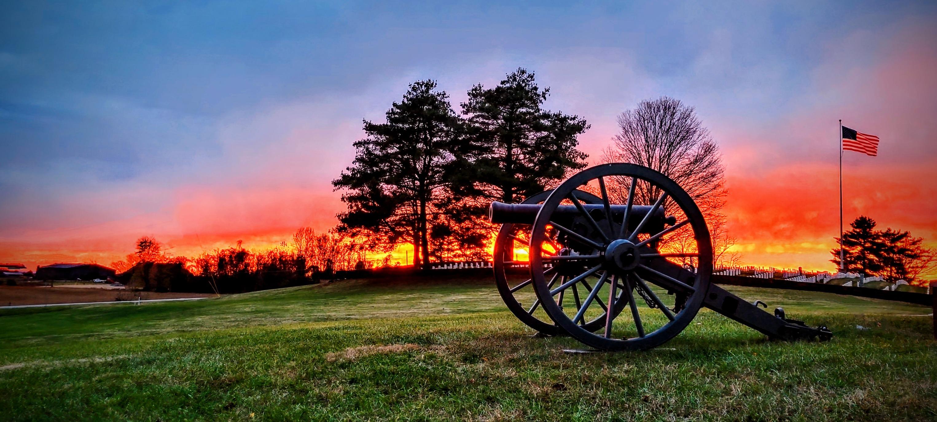
The US Army established Camp Nelson as a fortified supply depot in April 1863. Over the next 3 years, the site evolved into a massive recruitment and training center for United States Colored Troops a...

13 mi from route ~32 min detour Free near mile 38
View on nps.gov
Mill Springs Battlefield National Monument

Mill Springs Battlefield National Monument

National Monument

The US won a significant victory early in the Civil War at the Battle of Mill Springs. Explore the rolling fields of Kentucky where the battle took place and learn about that state's strategic importa...

21 mi from route ~51 min detour Free
View on nps.gov

Park data from the National Park Service API. Alerts update every 2 hours.

Fuel & Cost

Regular Gas

$17.24 one way

$34.49 round trip

$3.97/gal 25.4 MPG avg 39 kg CO2
Fuel Type $/gal One Way Round Trip
midgrade $4.36 $18.93 $37.87
premium $4.89 $21.23 $42.45
diesel $5.61 $24.35 $48.71

No toll roads detected on this route.

Estimated Trip Cost (one way, 1 person)

Fuel

$17

Meals

$25–$50

Total

$42–$67

Rough estimate based on US averages. Hotel $80–$140/night, meals $25–$50/day.

Estimated CO2 emission: 38.6 kg one way. Prices: EIA weekly data, 2026-04-13.

Driving Electric?

About $12 in charging · 0 stops · 67% less CO2

Vehicle Type kWh Stops DC Fast Home Charge
Average EV 33.1 0 $11.58 $5.29
Efficient EV 27.6 0 $9.65 $4.41
EV Truck/SUV 44.1 0 $15.44 $7.06

Gas CO2

39 kg

EV CO2

13 kg (67% less)

This trip is well within single-charge range for most EVs. No charging stops needed if you start fully charged.

DC fast charging avg $0.35/kWh. Home charging avg $0.16/kWh. US grid CO2: 0.39 kg/kWh.

Travel Intel

Current conditions at both ends of the drive.

Forecast as of Apr 16, 2026

Origin

Liberty, KY

Late night in Liberty on Saturday

Local time

4:22 AM

EDT

Current temp

76°F

Unavailable

Live forecast

Destination

Louisville, KY

Late night in Louisville on Saturday

Local time

4:22 AM

EDT

Current temp

54°F

Unavailable

Live forecast

73°F

Oregon, KY

55 mi in

Seasonal Notes

Summer travel usually means heavier construction, hotter rest stops, and busier weekend traffic around major cities.

Winter travel shortens daylight, so a route that looks manageable on paper can feel much longer after dark.

Holiday weekends tend to make both departure and arrival windows slower than the raw route time suggests.

Time zone

Same local time

Origin and destination are on the same clock, so arrival timing is easier to judge at a glance.

Temperature spread

22 degrees cooler at arrival

A meaningful temperature swing is a good cue to rethink layers, water, and how soon you want to arrive.

Road read

2h 11m on the road

Use the two city cards together: check the sky where you start, then compare it with the local time and temperature at arrival.

Weather data from the National Weather Service. Conditions may change; check closer to your travel date.

Frequently Asked Questions

The drive from Liberty, KY to Louisville, KY covers 110.3 miles and takes about 2h 11m without stops. Add 15-30 minutes for a fuel or rest stop on longer drives.

The main roads are I 64, Wallace Wilkerson Boulevard, Louisville Road. Expect a mix of highway and local road driving.

This is a comfortable same-day trip.

The midpoint is about 55.1 miles from Liberty, KY. Look for rest areas, gas stations, or food options near the halfway mark.

At current regular gas prices, expect to spend about $17.24 one way. This estimate uses 25.4 MPG — your actual cost will vary with your vehicle's fuel efficiency and current gas prices.

Leave by 9 AM and you'll arrive before lunch. Even a 4 PM departure gets you there before dark in summer.

This is a straightforward 2h 11m drive. You will face about 9 decision points, but nothing that requires special attention if you follow navigation.

The main spots that need attention: near the start (KY 70 Business / Campbellsville Street): Navigation decision point; at 0.5 miles (US 127 / Wallace Wilkerson Boulevard): Navigation decision point; at 34.6 miles (US 127 Bypass): Exit ramp - move to the correct lane early.

The route from Liberty, KY to Louisville, KY does not surface many named destination signs beyond the main corridor.

Yes. Nearby national parks include Camp Nelson National Monument and Mill Springs Battlefield National Monument.

How this page is built

Compiled by the Trip.ovh planning team at COD Solutions Oy from open government datasets — OSRM over OpenStreetMap for geometry, EIA for fuel prices, and NPS for national parks. See our methodology for refresh cadence and limitations.

Was this helpful?

Thanks for your feedback!

Your tip has been submitted. Thanks!

/500

Explore More

Return Trip

Louisville, KY to Liberty, KY

Plan the drive back the other way.

110.6 mi 2h 11m

Explore more options from Liberty, KY or browse trips ending in Louisville, KY.

Looking for more statewide routes? Browse KY road trips.