The drive from Lyons, CO to Colorado Springs, CO covers 112.9 miles and takes about 2h 16m behind the wheel.
This route is realistic as a one-day drive if you keep your stops efficient.
The route leans on North Valley Highway, Denver–Boulder Turnpike, North Foothills Highway for much of the mileage,
and the overall profile is turn-heavy local drive.
The longest uninterrupted segment is about 68.1 miles on North Valley Highway.
At current regular gas prices, budget about $17.01 one way before food or hotel costs.
Trip Pace
Same-day drive is realistic
A same-day return is realistic if you keep stops short.
Midpoint
56.5 miles from Lyons, CO
A natural place for your longest stop of the day
, about 1h 11m into the drive
.
Who Is This Route For?
Weekend Trip
Doable as a same-day drive at 2h 16m. Total distance: 112.9 miles.
Family Friendly
Moderate complexity with 0 natural rest stops along the way.
Solo Traveler
2h 16m drive, comfortable solo distance.
Scenic Drive
Turn-heavy local drive route profile with national parks nearby.
Drive Character
Expect a 2h 16m drive with frequent turns across 112.9 miles of local and secondary roads.
This route has more turning and local-road decision points than a simple highway run.
There are about 31 navigation steps in the underlying route data, so the final approach matters more than the middle miles.
North Valley Highway is the longest continuous segment at about 68.1 miles.
How Hard Is This Drive?
Expect a hands-on drive with frequent turns and local roads rather than long highway stretches. This route has several spots where lane changes, forks, or exits need your full attention. The trickiest moment comes around 0.1 miles in near US 36 / Broadway.
Driving Effort10/10
High effort - long or complex enough to need steady focus all day
Balances navigation complexity with total wheel time.
This is a demanding drive. With 24 significant decision points across 112.9 miles, you will need to stay alert - especially through interchange areas and urban stretches. Consider splitting it into segments if you are not comfortable with fast highway navigation.
Where does it get tricky?
The main spots that need attention: at 0.1 miles (US 36 / Broadway): Lane positioning matters here; at 33.8 miles (US 36 / Denver–Boulder Turnpike): Highway fork - watch signs carefully. Lane positioning matters here; at 35.8 miles (US 36 / Denver–Boulder Turnpike): Highway fork - watch signs carefully. Lane positioning matters here. Multiple destination signs - pick the right one.
Critical Maneuvers
5 of 24 key points
These are the spots where you need to pay the most attention. Preview them before you drive.
6
0.1 mi into trip|~0m in|US 36 / Broadway
Turn left onto US 36 / Broadway
Lane positioning matters here
Use the left / straight lanes.
6
33.8 mi into trip|~46m in|US 36 / Denver–Boulder Turnpike
Keep slight right at fork onto US 36 / Denver–Boulder Turnpike
Highway fork - watch signs carefully. Lane positioning matters here
Use the straight / slight right lanes.
8
35.8 mi into trip|~48m in|US 36 / Denver–Boulder Turnpike
Keep slight right at fork onto US 36 / Denver–Boulder Turnpike toward I 25: Denver, Fort Collins
Highway fork - watch signs carefully. Lane positioning matters here. Multiple destination signs - pick the right one
Use the straight / slight right lanes.
Toward I 25: Denver, Fort Collins
7
111.8 mi into trip|~2h 13m in
Take the exit toward Bijou Street
Exit ramp - move to the correct lane early. Lane positioning matters here
Use the straight / slight right lanes.
Exit 142
Toward Bijou Street
8
112 mi into trip|~2h 13m in
Keep slight left at fork toward I 25: Downtown
Highway fork - watch signs carefully. Lane positioning matters here
Use the straight / left lanes.
Toward I 25: Downtown
Towns Mentioned on Route Signs
Based on OSRM destination-sign hints, not a full list of every settlement the road passes.
On the drive from Lyons, CO to Colorado Springs, CO, road signs begin pointing toward Fort Collins along the way.
Fort Collins
35.8 mi in|~48m|via US 36
Main Roads
Road
Distance
Duration
North Valley Highway
68.1 mi
1h 15m
Denver–Boulder Turnpike
19.7 mi
23m
North Foothills Highway
12.2 mi
15m
Monument Valley Freeway
5.9 mi
6m
28th Street
3.3 mi
6m
Ute Highway
1 mi
1m
I 25
0.4 mi
<1m
East Kiowa Street
0.3 mi
1m
Longest stretch:
North Valley Highway
— 68.1 mi, about 1h 15m
Turn-by-Turn Driving Directions
Step-by-step road directions between Lyons, CO and Colorado Springs, CO.
1
Start on US 36
260 ft·16 sec·West Main Street
2
Continue on US 36
427 ft·17 sec·West Main Street
3
Turn left onto US 36
0.3 mi·50 sec·Broadway
Use the left / straight lanes.
4
Merge onto US 36
0.2 mi·33 sec·Main Street
5
Continue on US 36
1.0 mi·1 min·Ute Highway
Use the straight lane.
6
Take the exit onto US 36
198 ft·6 sec·US 36
7
Merge onto US 36
12 mi·15 min·North Foothills Highway
Use the straight lane.
8
Turn sharp right onto Jay Road
84 ft·10 sec·Jay Road
9
Take the ramp
128 ft·3 sec
10
Merge onto US 36
3.3 mi·6 min·28th Street
Use the left / straight lanes.
11
Turn straight onto US 36
3.4 mi·4 min·Denver–Boulder Turnpike
Use the straight / slight right lanes.
12
Keep slight right at fork onto US 36
1.7 mi·1 min·Denver–Boulder Turnpike
13
Keep slight right at fork onto US 36
2.6 mi·3 min·Denver–Boulder Turnpike
14
Keep slight right at fork onto US 36
2.4 mi·2 min·Denver–Boulder Turnpike
15
Keep slight right at fork onto US 36
2.2 mi·2 min·Denver–Boulder Turnpike
16
Keep slight right at fork onto US 36
1.9 mi·2 min·Denver–Boulder Turnpike
17
Keep slight right at fork onto US 36
2.5 mi·2 min·Denver–Boulder Turnpike
18
Keep slight right at fork onto US 36
2.0 mi·2 min·Denver–Boulder Turnpike
Use the straight / slight right lanes.
19
Keep slight right at fork onto US 36
1.1 mi·1 min·Denver–Boulder Turnpike
Toward I 25: Denver, Fort CollinsUse the straight / slight right lanes.
20
Take the exit
0.5 mi·47 sec
Toward I 25 south: DenverUse the straight / slight right lanes.
21
Continue on I 25
0.4 mi·33 sec·I 25
Toward I 25 south: Denver
22
Merge onto I 25; US 87
68 mi·1 hr 15 min·North Valley Highway
Use the straight / slight right lanes.
23
Continue on I 25
5.9 mi·6 min·Monument Valley Freeway
Use the straight / slight right lanes.
24
Take the exit
0.2 mi·30 sec
Exit 142Toward Bijou StreetUse the straight / slight right lanes.
25
Keep slight left at fork
495 ft·14 sec
Toward I 25: DowntownUse the straight / left lanes.
26
Turn left onto West Bijou Street
0.2 mi·26 sec·West Bijou Street
Use the left / straight lanes.
27
Continue on West Kiowa Street
0.2 mi·35 sec·West Kiowa Street
28
Continue on East Kiowa Street
0.3 mi·1 min·East Kiowa Street
29
Turn right onto North Weber Street
490 ft·17 sec·North Weber Street
30
Turn right onto East Pikes Peak Avenue
422 ft·14 sec·East Pikes Peak Avenue
31
Arrive at destination
East Pikes Peak Avenue
Trip Plan
Morning Departure
Leave by 9 AM and you'll arrive before lunch.
Evening Departure
Even a 4 PM departure gets you there before dark in summer.
You can normally do this drive in one day.
You may only need one short stretch break if traffic stays light.
The halfway point lands around 56.5 miles from Lyons, CO, or about 1h 11m into the drive.
The longest continuous stretch on this route runs about 68.1 miles.
This is a comfortable same-day trip.
Departure
Before you leave
Start with fuel, water, and navigation already sorted so the first hour feels easy.
First stop
Around 25 miles or 35m in
Use this first pause for coffee, a restroom break, and a quick traffic check ahead.
Halfway reset
Around 56.5 miles or 1h 11m in
This is the best place for your longest stop, a real meal, and a full fuel check.
Final approach
Final hour starts around 1h 51m
Traffic, exits, and arrival timing usually matter more near Colorado Springs, CO than in the middle of the route.
Before You Leave
+
Open the route before leaving Lyons, CO so your first major turns are already loaded.
+
Leave with enough water and a charging cable within reach, not packed away.
+
Check your fuel range against the first long segment, especially if you are starting outside city service areas.
Day 1
Settle into the route from Lyons, CO
This is one driving day of about 112.9 miles and 2h 16m.
Your first comfortable stop window is around 25 miles from Lyons, CO.
This route can stay practical as a one-day drive if traffic stays reasonable.
The longest stretch is on North Valley Highway for about 68.1 miles.
Where to Stop
Rest stops, refuel points, and overnight suggestions along this route.
Halfway Point
Midpoint
About 56.5 mi from Lyons, CO
· 1h 11m into the drive
The midpoint is around 56.5 miles from Lyons, CO, which is a good place for a longer meal and fuel stop.
Before the longest stretch
Fuel check
Top up before North Valley Highway if your tank is already low. That segment runs about 68.1 miles.
Arriving in Colorado Springs, CO
The final approach into Colorado Springs, CO usually feels slower than the middle of the drive, so avoid planning your tightest schedule at the very end.
Try to arrive with enough fuel left to skip an immediate station stop unless you already know the area around Colorado Springs, CO.
These stop ideas are pacing suggestions — the exact town or exit can change with traffic, hotel plans, and fuel range.
National Parks Near This Route
Worth a detour if your schedule allows.
Florissant Fossil Beds National Monument
National Monument
Beneath a grassy mountain valley in central Colorado lies one of the richest and most diverse fossil deposits in the world. Petrified redwood stumps up to 14 feet wide and thousands of detailed fossil...
24 mi from route
~60 min detour
$10
near mile 109.1
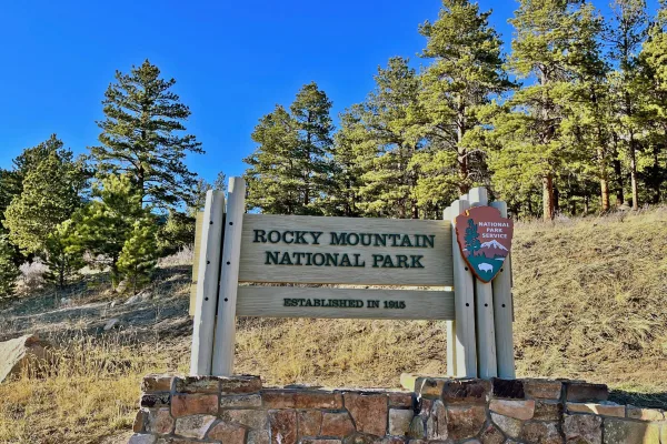
Rocky Mountain National Park's 415 square miles (265,807 acres) encompasses a spectacular range of mountain environments. From meadows found in the montane life zone to glistening alpine lakes and up...
Park data from the National Park Service API. Alerts update every 2 hours.
Fuel & Cost
Regular Gas
$17.01 one way
$34.02 round trip
$3.83/gal25.4 MPG avg40 kg CO2
Fuel Type
$/gal
One Way
Round Trip
midgrade
$4.05
$18.01
$36.02
premium
$4.39
$19.53
$39.06
diesel
$5.61
$24.93
$49.85
Estimated Tolls: $1.38
Denver–Boulder Turnpike
(19.7 mi)$1.38
Toll estimates based on average 2024-2025 rates. EZ-Pass/SunPass discounts may lower the actual cost.
Estimated Trip Cost (one way, 1 person)
Fuel
$17
Tolls
$1
Meals
$25–$50
Total
$43–$68
Rough estimate based on US averages. Hotel $80–$140/night, meals $25–$50/day.
Estimated CO2 emission: 39.5 kg one way.
Prices: EIA weekly data, 2026-04-13.
Driving Electric?
About $12 in charging
· 0 stops
· 68% less CO2
Vehicle Type
kWh
Stops
DC Fast
Home Charge
Average EV
33.9
0
$11.85
$5.42
Efficient EV
28.2
0
$9.88
$4.52
EV Truck/SUV
45.2
0
$15.81
$7.23
Gas CO2
40 kg
EV CO2
13 kg (68% less)
This trip is well within single-charge range for most EVs. No charging stops needed if you start fully charged.
DC fast charging avg $0.35/kWh. Home charging avg $0.16/kWh. US grid CO2: 0.39 kg/kWh.
Travel Intel
Current conditions at both ends of the drive.
Forecast as of Apr 15, 2026
Origin
Lyons, CO
Morning
in Lyons on Saturday
Local time
10:28 AM
MDT
Current temp
74°F
Unavailable
Live forecast
Destination
Colorado Springs, CO
Morning
in Colorado Springs on Saturday
Local time
10:28 AM
MDT
Current temp
44°F
Unavailable
Live forecast
Seasonal Notes
Summer travel usually means heavier construction, hotter rest stops, and busier weekend traffic around major cities.
Winter travel shortens daylight, so a route that looks manageable on paper can feel much longer after dark.
Holiday weekends tend to make both departure and arrival windows slower than the raw route time suggests.
Time zone
Same local time
Origin and destination are on the same clock, so arrival timing is easier to judge at a glance.
Temperature spread
30 degrees cooler at arrival
A meaningful temperature swing is a good cue to rethink layers, water, and how soon you want to arrive.
Road read
2h 16m on the road
Use the two city cards together: check the sky where you start, then compare it with the local time and temperature at arrival.
Weather data from the National Weather Service. Conditions may change; check closer to your travel date.
Frequently Asked Questions
The drive from Lyons, CO to Colorado Springs, CO covers 112.9 miles and takes about 2h 16m without stops. Add 15-30 minutes for a fuel or rest stop on longer drives.
The main roads are North Valley Highway, Denver–Boulder Turnpike, North Foothills Highway. Expect a mix of highway and local road driving.
This is a comfortable same-day trip.
The midpoint is about 56.5 miles from Lyons, CO. Look for rest areas, gas stations, or food options near the halfway mark.
At current regular gas prices, expect to spend about $17.01 one way. This estimate uses 25.4 MPG — your actual cost will vary with your vehicle's fuel efficiency and current gas prices.
Leave by 9 AM and you'll arrive before lunch. Even a 4 PM departure gets you there before dark in summer.
This is a demanding drive. With 24 significant decision points across 112.9 miles, you will need to stay alert - especially through interchange areas and urban stretches. Consider splitting it into segments if you are not comfortable with fast highway navigation.
The main spots that need attention: at 0.1 miles (US 36 / Broadway): Lane positioning matters here; at 33.8 miles (US 36 / Denver–Boulder Turnpike): Highway fork - watch signs carefully. Lane positioning matters here; at 35.8 miles (US 36 / Denver–Boulder Turnpike): Highway fork - watch signs carefully. Lane positioning matters here. Multiple destination signs - pick the right one.
On the drive from Lyons, CO to Colorado Springs, CO, road signs begin pointing toward Fort Collins along the way.
Yes. Nearby national parks include Florissant Fossil Beds National Monument and Rocky Mountain National Park.
How this page is built
Compiled by the Trip.ovh planning team at COD Solutions Oy from open government datasets — OSRM over OpenStreetMap for geometry, EIA for fuel prices, and NPS for national parks. See our methodology for refresh cadence and limitations.