
Trip from Maricopa, AZ to Sahuarita, AZ

Last recalculated Apr 17, 2026

Drive Time

2h 15m

Distance

124.7 mi

201 km

Drive Score

8/10

Great drive

Same Day?

Yes, doable

Fuel Cost

$25

one way

EV Charging

Excellent

20 DC fast

Best Time to Leave

Save up to 28 min
4 AM
2h 7m ★
6 AM
2h 16m
8 AM
2h 35m
10 AM
2h 23m
12 PM
2h 21m
3 PM
2h 24m
5 PM
2h 34m
8 PM
2h 10m

Estimated drive times based on typical traffic patterns. Actual times may vary with weather, construction, and real-time conditions.

city in the Gila River Valley in Pinal County, Arizona, United States

Maricopa, AZ

Wikimedia Commons

town in Pima County, Arizona, United States

Sahuarita, AZ

Wikimedia Commons

Trip Overview

The drive from Maricopa, AZ to Sahuarita, AZ covers 124.7 miles and takes about 2h 15m behind the wheel. This route is realistic as a one-day drive if you keep your stops efficient.

The route leans on Casa Grande-Tucson Highway, Phoenix Bypass Route, Nogales–Tucson Highway for much of the mileage, and the overall profile is turn-heavy local drive. The longest uninterrupted segment is about 54.6 miles on Casa Grande-Tucson Highway. At current regular gas prices, budget about $24.84 one way before food or hotel costs.

Trip Pace

Same-day drive is realistic

A same-day return is realistic if you keep stops short.

Midpoint

62.3 miles from Maricopa, AZ

A natural place for your longest stop of the day , about 1h 6m into the drive .

Who Is This Route For?

Weekend Trip

Doable as a same-day drive at 2h 15m. Total distance: 124.7 miles.

Family Friendly

Moderate complexity with 0 natural rest stops along the way.

Solo Traveler

2h 15m drive, comfortable solo distance.

Scenic Drive

Turn-heavy local drive route profile with national parks nearby.

Drive Character

Expect a 2h 15m drive with frequent turns across 124.7 miles of local and secondary roads.

This route has more turning and local-road decision points than a simple highway run.
There are about 14 navigation steps in the underlying route data, so the final approach matters more than the middle miles.
Casa Grande-Tucson Highway is the longest continuous segment at about 54.6 miles.

How Hard Is This Drive?

Expect a hands-on drive with frequent turns and local roads rather than long highway stretches. You will hit about 8 points where you need to pay attention to lane position or signs. The trickiest moment comes around 12.6 miles in near AZ 84 / Gila Bend–Casa Grande Highway.

Driving Effort 6/10

Moderate - straightforward overall, but long enough or busy enough to require pacing

Balances navigation complexity with total wheel time.

This drive requires moderate attention. Across 124.7 miles you will encounter 8 spots where lane choice or exit timing matters. Not difficult for experienced highway drivers, but worth previewing the tricky sections before you go.

Where does it get tricky?

The main spots that need attention: at 12.6 miles (AZ 84 / Gila Bend–Casa Grande Highway): Lane positioning matters here; at 18.4 miles: Exit ramp - move to the correct lane early; at 44.6 miles: Highway fork - watch signs carefully.

Critical Maneuvers

5 of 8 key points

These are the spots where you need to pay the most attention. Preview them before you drive.

6
12.6 mi into trip | ~14m in | AZ 84 / Gila Bend–Casa Grande Highway

At end of road, turn right onto AZ 84 / Gila Bend–Casa Grande Highway

Lane positioning matters here

Use the right lane.
6
18.4 mi into trip | ~21m in

Take the exit toward I 8 East: Tucson

Exit ramp - move to the correct lane early

Toward I 8 East: Tucson
6
44.6 mi into trip | ~47m in

Keep slight right at fork toward I 10 East: Tucson

Highway fork - watch signs carefully

Exit 178A Toward I 10 East: Tucson
7
105.6 mi into trip | ~1h 51m in

Take the exit toward I 19 South: Nogales

Exit ramp - move to the correct lane early. Lane positioning matters here

Use the straight / slight right lanes. Exit 260 Toward I 19 South: Nogales
7
122.1 mi into trip | ~2h 10m in

Take the exit toward Sahuarita Road

Exit ramp - move to the correct lane early. Lane positioning matters here

Use the straight / slight right lanes. Exit 75 Toward Sahuarita Road

Main Roads

Road Distance Duration
Casa Grande-Tucson Highway 54.6 mi 55m
Phoenix Bypass Route 26.4 mi 26m
Nogales–Tucson Highway 16 mi 19m
North John Wayne Parkway 12.6 mi 14m
Gila Bend–Casa Grande Highway 5.7 mi 6m
North Freeway 5.4 mi 6m
West Sahuarita Road 2.1 mi 3m
East Sahuarita Road <0.1 mi <1m
Longest stretch: Casa Grande-Tucson Highway — 54.6 mi, about 55m

Turn-by-Turn Driving Directions

Step-by-step road directions between Maricopa, AZ and Sahuarita, AZ.

1

Start on AZ 347

13 mi · 14 min · North John Wayne Parkway
Use the left lane.
2

At end of road, turn right onto AZ 84

5.7 mi · 6 min · Gila Bend–Casa Grande Highway
Use the right lane.
3

Take the exit

0.3 mi · 32 sec
Toward I 8 East: Tucson
4

Merge onto I 8

26 mi · 26 min · Phoenix Bypass Route
5

Keep slight right at fork

0.6 mi · 38 sec
Exit 178A Toward I 10 East: Tucson
6

Continue on Phoenix Bypass Route

0.4 mi · 27 sec · Phoenix Bypass Route
Exit 178A Toward I 10 East: Tucson
7

Continue on I 10

55 mi · 55 min · Casa Grande-Tucson Highway
Use the straight / slight right lanes.
8

Continue on I 10

5.4 mi · 6 min · North Freeway
Use the straight / slight right lanes.
9

Take the exit

0.5 mi · 37 sec
Exit 260 Toward I 19 South: Nogales Use the straight / slight right lanes.
10

Continue on I 19

16 mi · 19 min · Nogales–Tucson Highway
Use the straight / slight right lanes.
11

Take the exit

0.4 mi · 58 sec
Exit 75 Toward Sahuarita Road Use the straight / slight right lanes.
12

Turn left onto West Sahuarita Road

2.1 mi · 3 min · West Sahuarita Road
13

Continue on East Sahuarita Road

403 ft · 16 sec · East Sahuarita Road
14

Arrive at destination

East Sahuarita Road

Trip Plan

Morning Departure

Leave by 9 AM and you'll arrive before lunch.

Evening Departure

Even a 4 PM departure gets you there before dark in summer.

You can normally do this drive in one day.
You may only need one short stretch break if traffic stays light.
The halfway point lands around 62.3 miles from Maricopa, AZ, or about 1h 6m into the drive.
The longest continuous stretch on this route runs about 54.6 miles.

This is a comfortable same-day trip.

Departure

Before you leave

Start with fuel, water, and navigation already sorted so the first hour feels easy.

First stop

Around 27 miles or 30m in

Use this first pause for coffee, a restroom break, and a quick traffic check ahead.

Halfway reset

Around 62.3 miles or 1h 6m in

This is the best place for your longest stop, a real meal, and a full fuel check.

Final approach

Final hour starts around 1h 47m

Traffic, exits, and arrival timing usually matter more near Sahuarita, AZ than in the middle of the route.

Before You Leave

+

Open the route before leaving Maricopa, AZ so your first major turns are already loaded.

+

Leave with enough water and a charging cable within reach, not packed away.

+

Check your fuel range against the first long segment, especially if you are starting outside city service areas.

Day 1

Settle into the route from Maricopa, AZ

This is one driving day of about 124.7 miles and 2h 15m.

Your first comfortable stop window is around 27 miles from Maricopa, AZ.
This route can stay practical as a one-day drive if traffic stays reasonable.
The longest stretch is on Casa Grande-Tucson Highway for about 54.6 miles.

Where to Stop

Rest stops, refuel points, and overnight suggestions along this route.

Halfway Point

Midpoint

About 62.3 mi from Maricopa, AZ · 1h 6m into the drive

Downtown Eloy, AZ, AZ

Mid-route town

Meal stop

Eloy, AZ

62 mi into the route

Best for: Lunch, fuel, and a longer reset

This sits close to the middle of the route, so it works well for the longest stop of the day.

Pacing Suggestions

Casa Grande, AZ

Fuel and coffee

A short stop after about 27 miles helps settle the day before fatigue starts building.

Eloy, AZ

Meal break

The midpoint is around 62.3 miles from Maricopa, AZ, which is a good place for a longer meal and fuel stop.

Arriving in Sahuarita, AZ

The final approach into Sahuarita, AZ usually feels slower than the middle of the drive, so avoid planning your tightest schedule at the very end.

Try to arrive with enough fuel left to skip an immediate station stop unless you already know the area around Sahuarita, AZ.

These stop ideas are pacing suggestions — the exact town or exit can change with traffic, hotel plans, and fuel range.

Nearby Places

Restaurants, cafes, gas stations and more along your route.

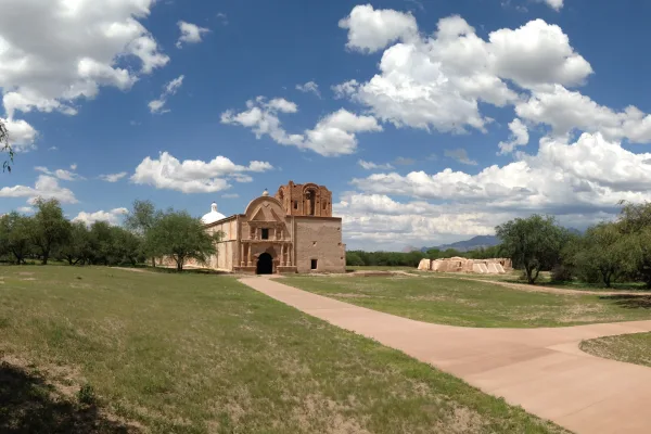
Arizona History Museum

4.6 ★ ★ ★ ★ ★

Near the end, ~10 min detour

3.8 mi from route ~10 min detour mile 106.9

Tucson, Arizona

Hours: 10 am–3 pm

+15206285774

Visit website

Titan Missile Museum

4.8 ★ ★ ★ ★ ★

Near the end, ~11 min detour

4.6 mi from route ~11 min detour mile 124.7

Green Valley, Arizona

Hours: 9:45 am–5 pm

+15209341863

Visit website

Place data sourced from public business listings. Hours and availability may vary.

National Parks Near This Route

Worth a detour if your schedule allows.

Saguaro National Park

Saguaro National Park

National Park

Tucson, Arizona is home to the nation's largest cacti. The giant saguaro is the universal symbol of the American west. These majestic plants, found only in a small portion of the United States, are pr...

13 mi from route ~33 min detour $25 near mile 103.2
Park Closure: Red Hills Visitor Center (TMD) theater closed for repairs
View on nps.gov
Casa Grande Ruins National Monument

Casa Grande Ruins National Monument

National Monument

An Ancestral Sonoran Desert People's farming community and "Great House" are preserved at Casa Grande Ruins. Whether a gathering place for people or simply a waypoint marker in an extensive system of...

15 mi from route ~38 min detour Free near mile 43
View on nps.gov
Tumacácori National Historical Park

Tumacácori National Historical Park

National Historical Park

Tumacácori sits at a cultural crossroads in the Santa Cruz River valley. Here O’odham, Yaqui, and Apache people met and mingled with European Jesuit and Franciscan missionaries, settlers, and soldiers...

28 mi from route ~69 min detour $10 near mile 124.7
View on nps.gov

Park data from the National Park Service API. Alerts update every 2 hours.

Fuel & Cost

Regular Gas

$24.84 one way

$49.68 round trip

$5.06/gal 25.4 MPG avg 44 kg CO2
Fuel Type $/gal One Way Round Trip
midgrade $5.36 $26.29 $52.58
premium $5.59 $27.45 $54.90
diesel $5.61 $27.53 $55.06

No toll roads detected on this route.

Estimated Trip Cost (one way, 1 person)

Fuel

$25

Meals

$25–$50

Total

$50–$75

Rough estimate based on US averages. Hotel $80–$140/night, meals $25–$50/day.

Estimated CO2 emission: 43.6 kg one way. Prices: EIA weekly data, 2026-04-13.

EV Charging Along Route

20 DC fast chargers · Coverage: excellent

Circle K - Tesla Supercharger

Eloy, AZ

Tesla

28 DCFC

The Marketplace at Marana - Tesla Supercharger

Tucson, AZ

Tesla

16 DCFC

Starbucks - Tesla Supercharger

Tucson, AZ

Tesla

12 DCFC

Tucson Premium Outlets (Tucson, AZ)

Tucson, AZ

Electrify America

10 DCFC

Culver's - Tesla Supercharger

Casa Grande, AZ

Tesla

6 DCFC

Target Tucson #T0854

Tucson, AZ

eVgo Network

6 DCFC

Walmart 1218 (Casa Grande, AZ)

Casa Grande, AZ

Electrify America

4 DCFC

Jones Ford Casa Grande

Casa Grande, AZ

RED_E

4 DCFC

ChargePoint Network: 5 Tesla: 4 RED_E: 3 Electrify America: 2 eVgo Network: 2 Blink Network: 1 IN_CHARGE: 1 FORD_CHARGE: 1 Non-Networked: 1

Station data from NREL Alternative Fuel Stations database.

Driving Electric?

About $13 in charging · 0 stops · 66% less CO2

Vehicle Type kWh Stops DC Fast Home Charge
Average EV 37.4 0 $13.09 $5.99
Efficient EV 31.2 0 $10.91 $4.99
EV Truck/SUV 49.9 0 $17.46 $7.98

Gas CO2

44 kg

EV CO2

15 kg (66% less)

This trip is well within single-charge range for most EVs. No charging stops needed if you start fully charged.

DC fast charging avg $0.35/kWh. Home charging avg $0.16/kWh. US grid CO2: 0.39 kg/kWh.

Travel Intel

Current conditions at both ends of the drive.

Forecast as of Apr 15, 2026

Origin

Maricopa, AZ

Night in Maricopa on Thursday

Local time

9:20 PM

MST

Current temp

57°F

Unavailable

Live forecast

Destination

Sahuarita, AZ

Night in Sahuarita on Thursday

Local time

9:20 PM

MST

Current temp

52°F

Unavailable

Live forecast

Seasonal Notes

Summer travel usually means heavier construction, hotter rest stops, and busier weekend traffic around major cities.

Winter travel shortens daylight, so a route that looks manageable on paper can feel much longer after dark.

Holiday weekends tend to make both departure and arrival windows slower than the raw route time suggests.

Time zone

Same local time

Origin and destination are on the same clock, so arrival timing is easier to judge at a glance.

Temperature spread

5 degrees cooler at arrival

A meaningful temperature swing is a good cue to rethink layers, water, and how soon you want to arrive.

Road read

2h 15m on the road

Use the two city cards together: check the sky where you start, then compare it with the local time and temperature at arrival.

Weather data from the National Weather Service. Conditions may change; check closer to your travel date.

Frequently Asked Questions

The drive from Maricopa, AZ to Sahuarita, AZ covers 124.7 miles and takes about 2h 15m without stops. Add 15-30 minutes for a fuel or rest stop on longer drives.
The main roads are Casa Grande-Tucson Highway, Phoenix Bypass Route, Nogales–Tucson Highway. Expect a mix of highway and local road driving.
This is a comfortable same-day trip.
The midpoint is about 62.3 miles from Maricopa, AZ. Look for rest areas, gas stations, or food options near the halfway mark.
At current regular gas prices, expect to spend about $24.84 one way. This estimate uses 25.4 MPG — your actual cost will vary with your vehicle's fuel efficiency and current gas prices.
Leave by 9 AM and you'll arrive before lunch. Even a 4 PM departure gets you there before dark in summer.
This drive requires moderate attention. Across 124.7 miles you will encounter 8 spots where lane choice or exit timing matters. Not difficult for experienced highway drivers, but worth previewing the tricky sections before you go.
The main spots that need attention: at 12.6 miles (AZ 84 / Gila Bend–Casa Grande Highway): Lane positioning matters here; at 18.4 miles: Exit ramp - move to the correct lane early; at 44.6 miles: Highway fork - watch signs carefully.
The route from Maricopa, AZ to Sahuarita, AZ does not surface many named destination signs beyond the main corridor.

Was this helpful?

Thanks for your feedback!

Your tip has been submitted. Thanks!

/500

Explore More

Explore more options from Maricopa, AZ or browse trips ending in Sahuarita, AZ.

Looking for more statewide routes? Browse AZ road trips.