Origin
Moab, UT
Afternoon in Moab on Saturday
Local time
1:56 PM
MDT
Current temp
79°F
Unavailable
Live forecast
Compiled and reviewed by the Trip.ovh planning team at COD Solutions Oy · Last reviewed Apr 18, 2026 · Editorial standards
Drive Time
2h 4m
Distance
112.9 mi
182 km
Drive Score
8/10
Great drive
Same Day?
Yes, doable
Fuel Cost
$18
one way
EV Charging
Unknown
Estimated drive times based on typical traffic patterns. Actual times may vary with weather, construction, and real-time conditions.

Moab, UT
Wikimedia Commons

Grand Junction, CO
Wikimedia Commons
The drive from Moab, UT to Grand Junction, CO covers 112.9 miles and takes about 2h 4m behind the wheel. This route is realistic as a one-day drive if you keep your stops efficient.
The route leans on Dinosaur Diamond Prehistoric Highway, I 70, Dinosaur Diamond Scenic Byway for much of the mileage, and the overall profile is mostly surface roads. The longest uninterrupted segment is about 81.9 miles on Dinosaur Diamond Prehistoric Highway. At current regular gas prices, budget about $17.89 one way before food or hotel costs.
Trip Pace
Same-day drive is realistic
A same-day return is realistic if you keep stops short.
Midpoint
56.5 miles from Moab, UT
A natural place for your longest stop of the day , about 1h 4m into the drive .
| Road | Distance | Duration |
|---|---|---|
| Dinosaur Diamond Prehistoric Highway | 81.9 mi | 1h 26m |
| I 70 | 14.6 mi | 14m |
| Dinosaur Diamond Scenic Byway | 10.8 mi | 10m |
| Main Street | 2.5 mi | 5m |
| I 70 BUS | 2.5 mi | 5m |
| Center Street | <0.1 mi | <1m |
| Pitkin Avenue | — | — |
Some road-level metrics are being recalculated.
Step-by-step road directions between Moab, UT and Grand Junction, CO.
Start on Center Street
Turn sharp right onto US 191
Continue on US 191
Take the exit
Merge onto I 70; US 6; US 50
Continue on I 70; US 6; US 50
Continue on I 70; US 50
Take the exit onto I 70 BUS; US 50
Keep slight right at fork onto I 70 BUS; US 50
Merge onto I 70 BUS; US 6; US 50
Continue on I 70 BUS; US 50
Arrive at destination
Morning Departure
Leave by 9 AM and you'll arrive before lunch.
Evening Departure
Even a 4 PM departure gets you there before dark in summer.
This is a comfortable same-day trip.
Departure
Before you leave
Start with fuel, water, and navigation already sorted so the first hour feels easy.
First stop
Around 25 miles or 32m in
Use this first pause for coffee, a restroom break, and a quick traffic check ahead.
Halfway reset
Around 56.5 miles or 1h 4m in
This is the best place for your longest stop, a real meal, and a full fuel check.
Final approach
Final hour starts around 1h 38m
Traffic, exits, and arrival timing usually matter more near Grand Junction, CO than in the middle of the route.
Open the route before leaving Moab, UT so your first major turns are already loaded.
Leave with enough water and a charging cable within reach, not packed away.
Check your fuel range against the first long segment, especially if you are starting outside city service areas.
Day 1
Settle into the route from Moab, UT
This is one driving day of about 112.9 miles and 2h 4m.
Rest stops, refuel points, and overnight suggestions along this route.

Mid-route town
Meal stop
56 mi into the route
Best for: Lunch, fuel, and a longer reset
This sits close to the middle of the route, so it works well for the longest stop of the day.
First break window
Fuel and coffeeA short stop after about 25 miles helps settle the day before fatigue starts building.
The midpoint is around 56.5 miles from Moab, UT, which is a good place for a longer meal and fuel stop.
Before the longest stretch
Fuel checkTop up before Dinosaur Diamond Prehistoric Highway if your tank is already low. That segment runs about 81.9 miles.
These stop ideas are pacing suggestions — the exact town or exit can change with traffic, hotel plans, and fuel range.
5 decision points cluster between mile 0.1 and 106.7 — GPS handles the exact turns, but know they're coming. Your lane choice matters more than the turn itself.
Turn sharp right onto US 191 / Main Street
Sharp turn - reduce speed on approach
Take the exit toward I-70 East
Exit ramp - move to the correct lane early
Take the exit onto I 70 BUS; US 50 toward US 6, US 50: Grand Junction
Exit ramp - move to the correct lane early. Lane positioning matters here. Multiple destination signs - pick the right one
Keep slight right at fork onto I 70 BUS; US 50 toward US 6, US 50
Highway fork - watch signs carefully. Multiple destination signs - pick the right one
Merge onto I 70 BUS; US 6; US 50 / Dinosaur Diamond Prehistoric Highway
Merge point - match speed before joining. Lane positioning matters here
Regular Gas
$17.89 one way
$35.78 round trip
| Fuel Type | $/gal | One Way | Round Trip |
|---|---|---|---|
| midgrade | $4.22 | $18.75 | $37.51 |
| premium | $4.53 | $20.14 | $40.28 |
| diesel | $5.61 | $24.93 | $49.85 |
No toll roads detected on this route.
Estimated Trip Cost (one way, 1 person)
Fuel
$18
Meals
$25–$50
Total
$43–$68
Rough estimate based on US averages. Hotel $80–$140/night, meals $25–$50/day.
Estimated CO2 emission: 39.5 kg one way. Prices: EIA weekly data, 2026-04-13.
Driving Electric?
About $12 in charging · 0 stops · 68% less CO2
| Vehicle Type | kWh | Stops | DC Fast | Home Charge |
|---|---|---|---|---|
| Average EV | 33.9 | 0 | $11.85 | $5.42 |
| Efficient EV | 28.2 | 0 | $9.88 | $4.52 |
| EV Truck/SUV | 45.2 | 0 | $15.81 | $7.23 |
Gas CO2
40 kg
EV CO2
13 kg (68% less)
This trip is well within single-charge range for most EVs. No charging stops needed if you start fully charged.
DC fast charging avg $0.35/kWh. Home charging avg $0.16/kWh. US grid CO2: 0.39 kg/kWh.
Current conditions at both ends of the drive.
Origin
Afternoon in Moab on Saturday
Local time
1:56 PM
MDT
Current temp
79°F
Unavailable
Destination
Afternoon in Grand Junction on Saturday
Local time
1:56 PM
MDT
Current temp
76°F
Unavailable
Seasonal Notes
Summer travel usually means heavier construction, hotter rest stops, and busier weekend traffic around major cities.
Winter travel shortens daylight, so a route that looks manageable on paper can feel much longer after dark.
Holiday weekends tend to make both departure and arrival windows slower than the raw route time suggests.
Time zone
Origin and destination are on the same clock, so arrival timing is easier to judge at a glance.
Temperature spread
A meaningful temperature swing is a good cue to rethink layers, water, and how soon you want to arrive.
Road read
Use the two city cards together: check the sky where you start, then compare it with the local time and temperature at arrival.
Weather data from the National Weather Service. Conditions may change; check closer to your travel date.
Worth a detour if your schedule allows.
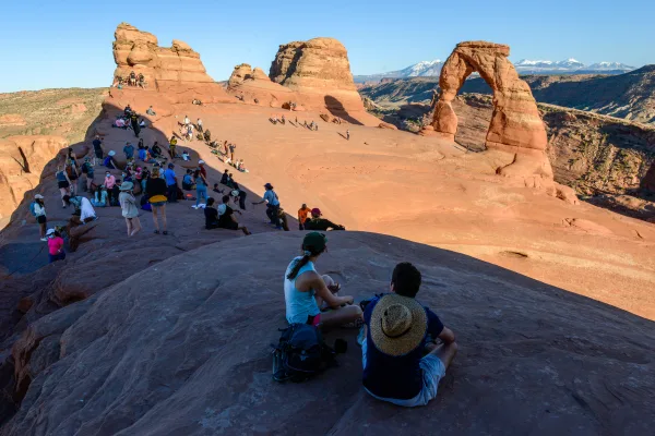
National Park
Discover a landscape of contrasting colors, land forms, and textures unlike any other. The park has over 2,000 natural stone arches, hundreds of soaring pinnacles, massive rock fins, and giant balance...
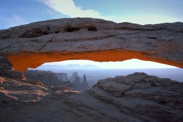
National Park
Canyonlands is a wilderness of canyons, buttes, and spires carved by the Colorado River and Green River. The park is divided into four distinct districts; no roads join them together. The districts sh...
Park data from the National Park Service API. Alerts update every 2 hours.
112.9 mi in 2h 4m across surface roads — expect steady turns and local traffic rather than long highway runs.
Expect a hands-on drive with frequent turns and local roads rather than long highway stretches. There are only a few real navigation decisions along the way. The trickiest moment comes around 0.1 miles in near US 191 / Main Street.
Easy - simple navigation with a manageable amount of wheel time
Balances navigation complexity with total wheel time.
This is a straightforward 2h 4m drive. You will face about 7 decision points, but nothing that requires special attention if you follow navigation.
Where does it get tricky?
The main spots that need attention: at 0.1 miles (US 191 / Main Street): Sharp turn - reduce speed on approach; at 31.4 miles: Exit ramp - move to the correct lane early; at 106.4 miles (I 70 BUS; US 50): Exit ramp - move to the correct lane early. Lane positioning matters here. Multiple destination signs - pick the right one.
Weekend Trip
Doable as a same-day drive at 2h 4m. Total distance: 112.9 miles.
Family Friendly
Moderate complexity with 0 natural rest stops along the way.
Solo Traveler
2h 4m drive, comfortable solo distance.
First-Time Driver
Mostly highway driving (15%). Straightforward navigation.
Scenic Drive
Mostly surface roads route profile with national parks nearby.
Compiled by the Trip.ovh planning team at COD Solutions Oy from open government datasets — OSRM over OpenStreetMap for geometry, EIA for fuel prices, and NPS for national parks. See our methodology for refresh cadence and limitations.
Was this helpful?
Thanks for your feedback!
Your tip has been submitted. Thanks!
/500
Recent Tips
·
Explore more options from Moab, UT or browse trips ending in Grand Junction, CO.
Looking for more statewide routes? Browse UT road trips.