Trip from Nauset Heights, MA to Harwich, MA

Drive Time

24m

Distance

12.3 mi

20 km

Drive Score

6/10

Good drive

Same Day?

Yes, doable

Fuel Cost

$2

one way

EV Charging

None

0 DC fast

Best Time to Leave

Save up to 6 min
4 AM
0h 22m ★
6 AM
0h 24m
8 AM
0h 28m
10 AM
0h 25m
12 PM
0h 25m
3 PM
0h 26m
5 PM
0h 28m
8 PM
0h 23m

Estimated drive times based on typical traffic patterns. Actual times may vary with weather, construction, and real-time conditions.

Trip Overview

The drive from Nauset Heights, MA to Harwich, MA covers 12.3 miles and takes about 24m behind the wheel. This route is realistic as a one-day drive if you keep your stops efficient.

The route leans on Orleans Road, South Orleans Road, Main Street for much of the mileage, and the overall profile is turn-heavy local drive. The longest uninterrupted segment is about 3.7 miles on Orleans Road. At current regular gas prices, budget about $1.96 one way before food or hotel costs.

Trip Pace

Same-day drive is realistic

A same-day return is realistic if you keep stops short.

Break Rhythm

0 planned breaks

A short stop every 2 to 3 hours is enough for this drive.

Midpoint

6.1 miles from Nauset Heights, MA

A natural place for your longest stop of the day , about 13m into the drive .

Drive Character

Expect a 24m drive with frequent turns across 12.3 miles of local and secondary roads.

This route has more turning and local-road decision points than a simple highway run.
There are about 13 navigation steps in the underlying route data, so the final approach matters more than the middle miles.
Orleans Road is the longest continuous segment at about 3.7 miles.

How Hard Is This Drive?

Expect a hands-on drive with frequent turns and local roads rather than long highway stretches. There are only a few real navigation decisions along the way. The trickiest moment comes around 3.1 miles in near Tonset Road.

Route Complexity 4/10

Easy - simple navigation with a manageable amount of wheel time

This is a straightforward 24m drive. You will face about 4 decision points, but nothing that requires special attention if you follow navigation.

Where does it get tricky?

The main spots that need attention: at 3.1 miles (Tonset Road): Navigation decision point; at 3.3 miles (MA 28 / South Orleans Road): Navigation decision point; at 8.2 miles (MA 39 / Orleans Road): Highway fork - watch signs carefully.

Critical Maneuvers

4 of 4 key points

These are the spots where you need to pay the most attention. Preview them before you drive.

3
3.1 mi into trip | ~7m in | Tonset Road

Turn left onto Tonset Road

Navigation decision point

3
3.3 mi into trip | ~8m in | MA 28 / South Orleans Road

Turn left onto MA 28 / South Orleans Road

Navigation decision point

4
8.2 mi into trip | ~16m in | MA 39 / Orleans Road

Keep slight right at fork onto MA 39 / Orleans Road

Highway fork - watch signs carefully

4
9.7 mi into trip | ~19m in | MA 39 / Orleans Road

Enter roundabout onto MA 39 / Orleans Road

Roundabout - know your exit number before entering

Main Roads

Road Distance Duration
Orleans Road 3.7 mi 6m
South Orleans Road 3.6 mi 6m
Main Street 1.4 mi 3m
Harwich Road 1.2 mi 2m
Beach Road 1.2 mi 2m
Nauset Heights Road 0.7 mi 1m
Tonset Road 0.2 mi <1m
Standish Road 0.2 mi <1m
Longest stretch: Orleans Road — 3.7 mi, about 6m

Turn-by-Turn Driving Directions

Step-by-step road directions between Nauset Heights, MA and Harwich, MA.

1

Start on Standish Road

0.2 mi · 35 sec · Standish Road
2

Continue on Nauset Heights Road

0.7 mi · 1 min · Nauset Heights Road
3

Continue on Beach Road

1.2 mi · 2 min · Beach Road
4

Continue on Main Street

1.0 mi · 2 min · Main Street
5

Turn left onto Tonset Road

0.2 mi · 37 sec · Tonset Road
6

Turn left onto MA 28

2.2 mi · 3 min · South Orleans Road
7

Turn straight onto MA 39

1.2 mi · 2 min · Harwich Road
8

Continue on MA 39

1.4 mi · 2 min · South Orleans Road
9

Keep slight right at fork onto MA 39

1.6 mi · 2 min · Orleans Road
10

Enter roundabout onto MA 39

113 ft · 2 sec · Orleans Road
11

Continue on MA 39

2.1 mi · 3 min · Orleans Road
12

Continue on MA 39

0.4 mi · 46 sec · Main Street
13

Arrive at destination

MA 39

Trip Plan

Morning Departure

Leave by 9 AM and you'll arrive before lunch.

Evening Departure

Even a 4 PM departure gets you there before dark in summer.

You can normally do this drive in one day.
You may only need one short stretch break if traffic stays light.
The halfway point lands around 6.1 miles from Nauset Heights, MA, or about 13m into the drive.
The longest continuous stretch on this route runs about 3.7 miles.

This is a comfortable same-day trip.

Departure

Before you leave

Start with fuel, water, and navigation already sorted so the first hour feels easy.

First stop

Around 12.3 miles or 24m in

Use this first pause for coffee, a restroom break, and a quick traffic check ahead.

Halfway reset

Around 6.1 miles or 13m in

This is the best place for your longest stop, a real meal, and a full fuel check.

Final approach

Final hour starts around 20m

Traffic, exits, and arrival timing usually matter more near Harwich, MA than in the middle of the route.

Before You Leave

+

Open the route before leaving Nauset Heights, MA so your first major turns are already loaded.

+

Leave with enough water and a charging cable within reach, not packed away.

+

Check your fuel range against the first long segment, especially if you are starting outside city service areas.

Day 1

Settle into the route from Nauset Heights, MA

This is one driving day of about 12.3 miles and 24m.

Your first comfortable stop window is around 80 miles from Nauset Heights, MA.
This route can stay practical as a one-day drive if traffic stays reasonable.
You may only need one short stretch stop if conditions stay smooth.
The longest stretch is on Orleans Road for about 3.7 miles.

Where to Stop

Rest stops, refuel points, and overnight suggestions along this route.

Halfway Point

Midpoint

About 6.1 mi from Nauset Heights, MA · 13m into the drive

Downtown Plymouth, MA, MA

Mid-route town

Meal stop

Plymouth, MA

6 mi into the route

Best for: Lunch, fuel, and a longer reset

This sits close to the middle of the route, so it works well for the longest stop of the day.

Pacing Suggestions

Plymouth, MA

Fuel and coffee

A short stop after about 12.3 miles helps settle the day before fatigue starts building.

Plymouth, MA

Meal break

The midpoint is around 6.1 miles from Nauset Heights, MA, which is a good place for a longer meal and fuel stop.

Arriving in Harwich, MA

The final approach into Harwich, MA usually feels slower than the middle of the drive, so avoid planning your tightest schedule at the very end.

Try to arrive with enough fuel left to skip an immediate station stop unless you already know the area around Harwich, MA.

These stop ideas are pacing suggestions — the exact town or exit can change with traffic, hotel plans, and fuel range.

National Parks Near This Route

Worth a detour if your schedule allows.

Cape Cod National Seashore

Cape Cod National Seashore

National Seashore

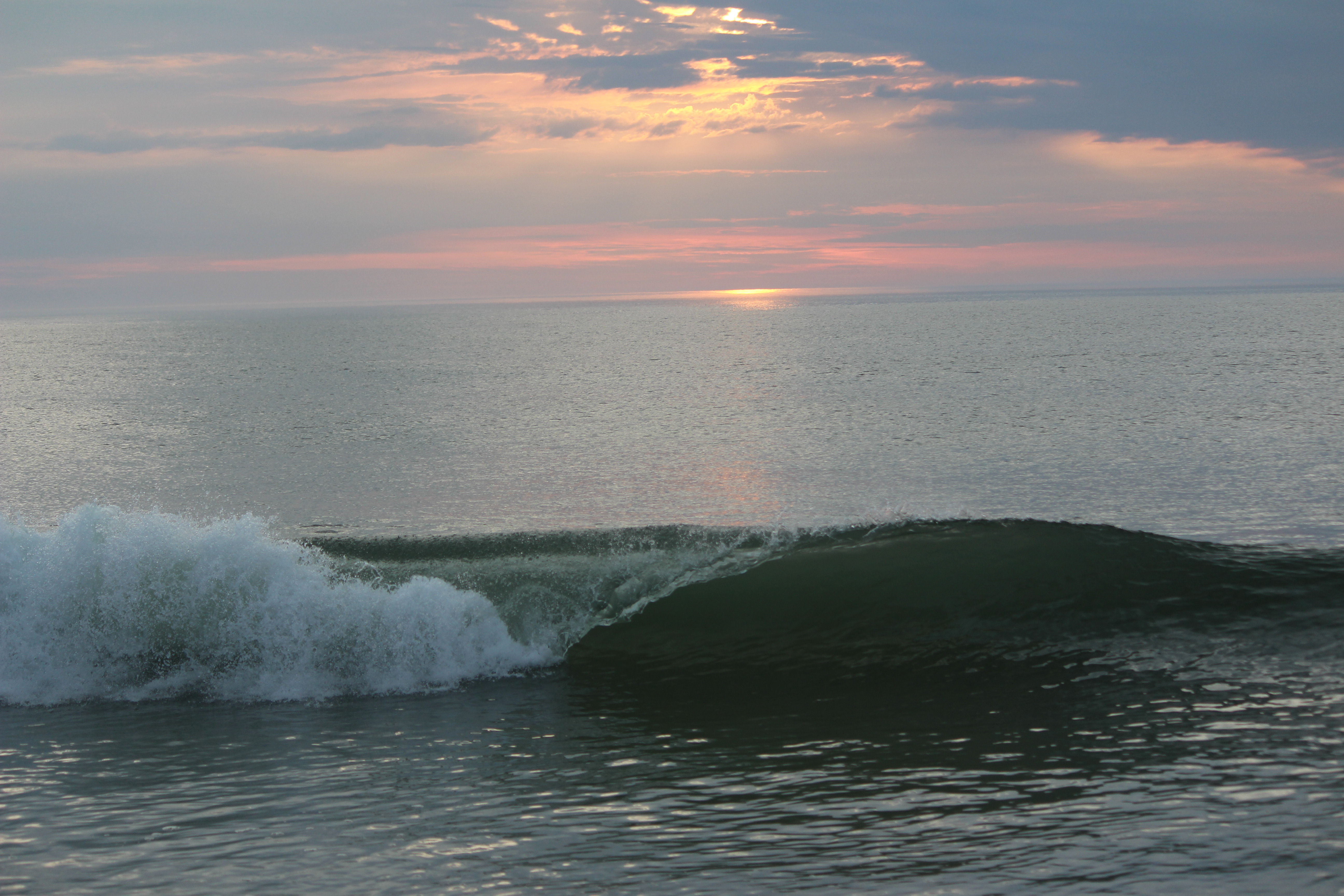
The great Outer Beach described by Thoreau in the 1800s is protected within the national seashore. Forty miles of pristine sandy beach, marshes, ponds, and uplands support diverse species. Lighthouses...

10 mi from route ~25 min detour $25
View on nps.gov

Park data from the National Park Service API. Alerts update every 2 hours.

Fuel & Cost

Regular Gas

$1.96 one way

$3.92 round trip

$4.04/gal 25.4 MPG avg 4 kg CO2
Fuel Type $/gal One Way Round Trip
midgrade $4.40 $2.13 $4.26
premium $4.80 $2.32 $4.65
diesel $5.64 $2.73 $5.47

No toll roads detected on this route.

Estimated Trip Cost (one way, 1 person)

Fuel

$2

Meals

$25–$50

Total

$27–$52

Rough estimate based on US averages. Hotel $80–$140/night, meals $25–$50/day.

Estimated CO2 emission: 4.3 kg one way. Prices: EIA weekly data, 2026-04-06.

Driving Electric?

About $1 in charging · 0 stops · 75% less CO2

Vehicle Type kWh Stops DC Fast Home Charge
Average EV 3.7 0 $1.29 $0.59
Efficient EV 3.1 0 $1.08 $0.49
EV Truck/SUV 4.9 0 $1.72 $0.79

Gas CO2

4 kg

EV CO2

1 kg (75% less)

This trip is well within single-charge range for most EVs. No charging stops needed if you start fully charged.

DC fast charging avg $0.35/kWh. Home charging avg $0.16/kWh. US grid CO2: 0.39 kg/kWh.

Travel Intel

Current conditions at both ends of the drive.

Forecast data refreshed 3 years ago

Origin

Nauset Heights, MA

Morning in Nauset Heights on Monday

Local time

7:44 AM

EDT

Current temp

--

Unavailable

Destination

Harwich, MA

Morning in Harwich on Monday

Local time

7:44 AM

EDT

Current temp

78°F

Unavailable

Live forecast

Along the Route

47°F

Plymouth, MA

6 mi in

Seasonal Notes

Summer travel usually means heavier construction, hotter rest stops, and busier weekend traffic around major cities.

Winter travel shortens daylight, so a route that looks manageable on paper can feel much longer after dark.

Holiday weekends tend to make both departure and arrival windows slower than the raw route time suggests.

Time zone

Same local time

Origin and destination are on the same clock, so arrival timing is easier to judge at a glance.

Road read

24m on the road

Use the two city cards together: check the sky where you start, then compare it with the local time and temperature at arrival.

Weather data from the National Weather Service. Conditions may change; check closer to your travel date.

Frequently Asked Questions

The drive from Nauset Heights, MA to Harwich, MA covers 12.3 miles and takes about 24m without stops. Add 15-30 minutes for a fuel or rest stop on longer drives.
The main roads are Orleans Road, South Orleans Road, Main Street. Expect a mix of highway and local road driving.
This is a comfortable same-day trip.
The midpoint is about 6.1 miles from Nauset Heights, MA. Look for rest areas, gas stations, or food options near the halfway mark.
At current regular gas prices, expect to spend about $1.96 one way. This estimate uses 25.4 MPG — your actual cost will vary with your vehicle's fuel efficiency and current gas prices.
Leave by 9 AM and you'll arrive before lunch. Even a 4 PM departure gets you there before dark in summer.
This is a straightforward 24m drive. You will face about 4 decision points, but nothing that requires special attention if you follow navigation.
The main spots that need attention: at 3.1 miles (Tonset Road): Navigation decision point; at 3.3 miles (MA 28 / South Orleans Road): Navigation decision point; at 8.2 miles (MA 39 / Orleans Road): Highway fork - watch signs carefully.
The route from Nauset Heights, MA to Harwich, MA does not surface many named destination signs beyond the main corridor.

Was this route helpful?

Thanks for your feedback!

Your tip has been submitted. Thanks!

/500

Explore More

Explore more options from Nauset Heights, MA or browse trips ending in Harwich, MA.

Looking for more statewide routes? Browse MA road trips.

Explore maps for Nauset Heights, MA or Harwich, MA on MapSof.net.