This 432.8-mile drive from New South Memphis, TN, to Harrogate, TN, will take you approximately 8 hours and 20 minutes. Given the duration, it's best planned as a two-day trip. You'll navigate primarily on Isaac Hayes Memorial Highway and I-40 before transitioning to Appalachian Highway. The estimated fuel cost for this journey is $68. This route is entirely within Tennessee, offering a consistent regional experience as you traverse the Southeast. With two planned stops, you can break up the journey comfortably.
Trip Pace
Best split across 2 days
Treat the return leg as its own travel day rather than an afterthought.
Break Rhythm
2 planned breaks
Plan on a short reset every 3 to 4 hours to stay fresh behind the wheel.
Midpoint
216.4 miles from New South Memphis, TN
A natural place for your longest stop of the day
, about 4h 2m into the drive
.
Who Is This Route For?
Solo Traveler
8h 20m drive, plan rest stops for pacing.
Scenic Drive
Mixed drive route profile.
Drive Character
This drive offers a mixed experience, with 36% of it being on highways. You'll encounter a significant 196.5-mile stretch on Isaac Hayes Memorial Highway, providing an extended period of consistent travel. As you progress, the road character shifts from the initial highway segments to the more characteristic Appalachian Highway. Expect a blend of efficient travel on major arteries and potentially more local road driving as you near your destination.
Expect a mix of faster highway mileage and slower local approaches near the beginning or end.
There are about 41 navigation steps in the underlying route data, so the final approach matters more than the middle miles.
Isaac Hayes Memorial Highway is the longest continuous segment at about 196.5 miles.
How Hard Is This Drive?
This route mixes highway mileage with some local-road sections near the start or finish. This route has several spots where lane changes, forks, or exits need your full attention. The trickiest moment comes around 210.8 miles in.
Driving Effort8/10
Demanding - plan breaks and stay ahead of the key maneuvers
Balances navigation complexity with total wheel time.
This is a demanding drive. With 23 significant decision points across 432.8 miles, you will need to stay alert - especially through interchange areas and urban stretches. Consider splitting it into segments if you are not comfortable with fast highway navigation.
Where does it get tricky?
The main spots that need attention: at 210.8 miles: Highway fork - watch signs carefully. Lane positioning matters here. Multiple destination signs - pick the right one; at 211 miles (I 40; I 65 / Downtown Loop): Merge point - match speed before joining. Lane positioning matters here; at 213.4 miles (I 40 / Downtown Loop): Lane positioning matters here. Multiple destination signs - pick the right one.
Critical Maneuvers
5 of 23 key points
These are the spots where you need to pay the most attention. Preview them before you drive.
9
210.8 mi into trip|~3h 55m in
Keep slight right at fork toward I 40 East, I 65 South: Knoxville, Huntsville
Highway fork - watch signs carefully. Lane positioning matters here. Multiple destination signs - pick the right one
Use the slight left / slight right lanes.
Exit 208A
Toward I 40 East, I 65 South: Knoxville, Huntsv...
5
211 mi into trip|~3h 56m in|I 40; I 65 / Downtown Loop
Merge onto I 40; I 65 / Downtown Loop
Merge point - match speed before joining. Lane positioning matters here
Use the straight / slight right lanes.
5
213.4 mi into trip|~3h 59m in|I 40 / Downtown Loop
Continue onto I 40 / Downtown Loop toward I 24 West, I 40 East, I 24 East: Clarksville, Louisville, Knoxville, Chattanooga
Lane positioning matters here. Multiple destination signs - pick the right one
Use the straight / slight right lanes.
Exit 211B; 211A
Toward I 24 West, I 40 East, I 24 East: Clarksv...
9
214 mi into trip|~4h in|I 40
Keep slight right at fork onto I 40 toward I 40 East, I 24 East: Knoxville, Chattanooga
Highway fork - watch signs carefully. Lane positioning matters here. Multiple destination signs - pick the right one
Use the slight left / slight right lanes.
Exit 211A
Toward I 40 East, I 24 East: Knoxville, Chattan...
5
351 mi into trip|~6h 29m in
Take the exit toward US 27: Harriman, Rockwood
Exit ramp - move to the correct lane early. Multiple destination signs - pick the right one
Toward US 27: Harriman, Rockwood
Towns Mentioned on Route Signs
Based on OSRM destination-sign hints, not a full list of every settlement the road passes.
Between New South Memphis, TN and Harrogate, TN, road signs point toward Huntsville, Louisville, Knoxville, Chattanooga, Rockwood and Jacksboro - among others.
Huntsville
210.8 mi in|~3h 55m
Louisville
213.4 mi in|~3h 59m|via I 40
Knoxville
213.4 mi in|~3h 59m|via I 40
Chattanooga
213.4 mi in|~3h 59m|via I 40
Rockwood
351 mi in|~6h 29m
Jacksboro
393.4 mi in|~7h 33m|via US 25W
La Follette
393.4 mi in|~7h 33m|via US 25W
Main Roads
Road
Distance
Duration
Isaac Hayes Memorial Highway
196.5 mi
3h 32m
I 40
137 mi
2h 28m
Appalachian Highway
18.1 mi
20m
General Carl W Stiner Highway
10 mi
11m
Harriman Highway
9.6 mi
10m
Briceville Highway
9 mi
18m
Frost Bottom Road
7.2 mi
12m
US 27
6.8 mi
7m
Longest stretch:
Isaac Hayes Memorial Highway
— 196.5 mi, about 3h 32m
Turn-by-Turn Driving Directions
Step-by-step road directions between New South Memphis, TN and Harrogate, TN.
1
Start on US 61
1.4 mi·2 min·South Third Street
2
Turn right onto South Parkway East
1.4 mi·2 min·South Parkway East
3
Continue on South Parkway East
2.7 mi·4 min·South Parkway East
4
Continue on South Parkway East
0.4 mi·40 sec·South Parkway East
Use the right lane.
5
Continue on SR 277
2.3 mi·3 min·East Parkway South
Use the straight / right lanes.
6
Turn right onto Sam Cooper Boulevard
6.1 mi·9 min·Sam Cooper Boulevard
Use the straight / slight right lanes.
7
Continue on I 40
197 mi·3 hr 32 min·Isaac Hayes Memorial Highway
Use the straight / slight right lanes.
8
Keep slight right at fork
0.2 mi·24 sec
Exit 208AToward I 40 East, I 65 South: Knoxville, HuntsvilleUse the slight left / slight right lanes.
9
Merge onto I 40; I 65
2.4 mi·3 min·Downtown Loop
Use the straight / slight right lanes.
10
Continue on I 40
0.5 mi·42 sec·Downtown Loop
Exit 211B; 211AToward I 24 West, I 40 East, I 24 East: Clarksville, Louisville, Knoxville, ChattanoogaUse the straight / slight right lanes.
11
Keep slight right at fork onto I 40
137 mi·2 hr 28 min·I 40
Exit 211AToward I 40 East, I 24 East: Knoxville, ChattanoogaUse the slight left / slight right lanes.
12
Take the exit
0.2 mi·27 sec
Toward US 27: Harriman, Rockwood
13
Keep slight right at fork
335 ft·8 sec
14
Merge onto US 27
6.8 mi·7 min·US 27
15
Keep slight right at fork onto SR 61
9.6 mi·10 min·Harriman Highway
16
Continue on SR 61
1.2 mi·1 min·West Tri County Boulevard
17
Turn right onto SR 330
447 ft·10 sec·Winter Gap Road
18
Turn left onto SR 330
0.2 mi·23 sec·Railroad Avenue
19
Continue on SR 330
0.1 mi·16 sec·Main Street
20
Turn left onto SR 330
0.6 mi·1 min·East Spring Street
21
Continue on SR 330
0.5 mi·1 min·Walden Avenue
22
Continue on SR 330
0.4 mi·49 sec·Dutch Valley Road
23
Turn left onto SR 330
7.2 mi·12 min·Frost Bottom Road
24
Continue on SR 116
5.2 mi·9 min·Briceville Highway
25
Continue on SR 116
234 ft·6 sec·Briceville Highway
26
Continue on SR 116
3.8 mi·9 min·Briceville Highway
27
At end of road, turn left onto US 25W; SR 116
1.0 mi·2 min·North Main Street
28
Take the ramp onto I 75; US 25W
5.4 mi·6 min·I 75; US 25W
Toward Louisville
29
Take the exit onto US 25W
0.2 mi·20 sec·US 25W
Toward US 25W North, TN 63 East: Caryville, Jacksboro, La Follette
30
Keep slight right at fork onto US 25W
239 ft·5 sec·US 25W
31
Merge onto US 25W; TN 63
3.7 mi·4 min·West Central Avenue
32
Continue on US 25W; SR 63
3.3 mi·5 min·Jacksboro Pike
33
Continue on US 25W; SR 63
0.3 mi·19 sec·Jackson Pike
34
Continue on US 25W; SR 63
2.6 mi·3 min·West Central Avenue
35
Continue on SR 63
10 mi·11 min·General Carl W Stiner Highway
36
Continue on SR 63
18 mi·20 min·Appalachian Highway
37
At end of road, turn left onto US 25E; SR 32
0.6 mi·50 sec·Cumberland Gap Highway
38
Continue on US 25E; SR 32
0.5 mi·43 sec·Cumberland Gap Parkway
39
Continue on US 25E; SR 32
258 ft·12 sec·Cumberland Gap Parkway
40
Keep slight right at fork onto US 25E; SR 32
18 ft·0 sec·Cumberland Gap Parkway
41
Arrive at destination
US 25E; SR 32
Trip Plan
To make the most of this 8-hour, 20-minute drive, consider splitting it over two days. Leaving early in the morning is recommended to maximize daylight driving. You'll have two designated stops, so plan those breaks strategically to avoid fatigue. Keep an eye on your fuel levels, especially during the 196.5-mile stretch on Isaac Hayes Memorial Highway, as services might be less frequent. The $68 fuel budget should cover your needs, but it's always wise to have a buffer.
Morning Departure
Start early — leave by 6-7 AM to arrive at a reasonable hour.
Evening Departure
This is a long drive — plan for a morning departure or consider splitting it into two days.
This drive is better paced as a 2-day trip.
Plan roughly 2 meaningful breaks for fuel, food, and rest.
The halfway point lands around 216.4 miles from New South Memphis, TN, or about 4h 2m into the drive.
The longest continuous stretch on this route runs about 196.5 miles.
Consider an overnight stop or starting very early.
Departure
Before you leave
Start with fuel, water, and navigation already sorted so the first hour feels easy.
First stop
Around 95 miles or 1h 50m in
Use this first pause for coffee, a restroom break, and a quick traffic check ahead.
Halfway reset
Around 216.4 miles or 4h 2m in
This is the best place for your longest stop, a real meal, and a full fuel check.
Overnight split
Day 1 wrap after about 216.4 miles or 4h 2m
Stop before fatigue turns the last few hours into a grind. You want day two to start fresh, not just resumed.
Final approach
Final hour starts around 6h 57m
Traffic, exits, and arrival timing usually matter more near Harrogate, TN than in the middle of the route.
Before You Leave
+
Open the route before leaving New South Memphis, TN so your first major turns are already loaded.
+
Leave with enough water and a charging cable within reach, not packed away.
+
Check your fuel range against the first long segment, especially if you are starting outside city service areas.
+
Pick one backup stop option before the midpoint in case traffic changes your pacing.
+
Treat this as a 2-day road trip and book the overnight stop before the busiest arrival window.
Day 1
Settle into the route from New South Memphis, TN
Aim for roughly 216 miles and 4.2 hours of wheel time on this day.
Day 2
Finish the approach into Harrogate, TN
Aim for roughly 216 miles and 4.2 hours of wheel time on this day.
Your first comfortable stop window is around 95 miles from New South Memphis, TN.
This route usually feels better as a 2-day drive than as one long push.
Plan about 2 real breaks rather than only quick fuel stops.
The longest stretch is on Isaac Hayes Memorial Highway for about 196.5 miles.
Where to Stop
Rest stops, refuel points, and overnight suggestions along this route.
Halfway Point
Midpoint
About 216.4 mi from New South Memphis, TN
· 4h 2m into the drive
The midpoint is around 216.4 miles from New South Memphis, TN, which is a good place for a longer meal and fuel stop.
Overnight split
Hotel stop
For a steadier pace, wrap day one after about 216 miles or 4.2 hours on the road.
Arriving in Harrogate, TN
The final approach into Harrogate, TN usually feels slower than the middle of the drive, so avoid planning your tightest schedule at the very end.
Try to arrive with enough fuel left to skip an immediate station stop unless you already know the area around Harrogate, TN.
On a multi-day trip, keep the last day a little lighter so you reach Harrogate, TN with some flexibility left in the schedule.
After long uninterrupted mileage, take five minutes before the last urban segment to reset and refocus on exits, merges, and city traffic.
These stop ideas are pacing suggestions — the exact town or exit can change with traffic, hotel plans, and fuel range.
National Parks Near This Route
Worth a detour if your schedule allows.
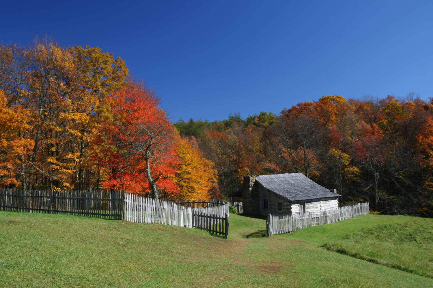
Cumberland Gap National Historical Park
National Historical Park
Cumberland Gap was the first great gateway to the west. Come follow the path of bison, Native Americans, longhunters, and pioneers. Walk where 300,000 people crossed the Appalachians to settle America...
4 mi from route
~10 min detour
Free
near mile 432.8
Park Closure: Little Yellow Creek Bridge Closure - Construction Underway
The Battle of Stones River began on the last day of 1862 and became one of the bloodiest conflicts of the Civil War. The battle produced important military and political gains for the Union, and it ch...
22 mi from route
~55 min detour
Free
near mile 238.8
Park data from the National Park Service API. Alerts update every 2 hours.
Fuel & Cost
Regular Gas
$67.66 one way
$135.33 round trip
$3.97/gal25.4 MPG avg151 kg CO2
Fuel Type
$/gal
One Way
Round Trip
midgrade
$4.36
$74.29
$148.58
premium
$4.89
$83.29
$166.58
diesel
$5.61
$95.56
$191.11
No toll roads detected on this route.
Estimated Trip Cost (one way, 1 person)
Fuel
$68
Hotel (1n)
$80–$140
Meals
$50–$100
Total
$198–$308
Rough estimate based on US averages. Hotel $80–$140/night, meals $25–$50/day.
Estimated CO2 emission: 151.4 kg one way.
Prices: EIA weekly data, 2026-04-13.
Driving Electric?
About $45 in charging
· 1 stop
· 66% less CO2
Vehicle Type
kWh
Stops
DC Fast
Home Charge
Average EV
129.8
1
$45.44
$20.77
Efficient EV
108.2
1
$37.87
$17.31
EV Truck/SUV
173.1
2
$60.59
$27.70
Gas CO2
151 kg
EV CO2
51 kg (66% less)
Plan for 1 charging stop. A 30-minute DC fast charge mid-route should be enough to complete the trip comfortably.
DC fast charging avg $0.35/kWh. Home charging avg $0.16/kWh. US grid CO2: 0.39 kg/kWh.
Travel Intel
Current conditions at both ends of the drive.
Forecast as of Apr 13, 2026
Origin
New South Memphis, TN
Afternoon
in New South Memphis on Thursday
Local time
2:13 PM
CDT
Current temp
68°F
Unavailable
Live forecast
Destination
Harrogate, TN
Afternoon
in Harrogate on Thursday
Local time
3:13 PM
EDT
Current temp
73°F
Unavailable
Live forecast
74°F
Sparta, TN
216 mi in
Seasonal Notes
Summer travel usually means heavier construction, hotter rest stops, and busier weekend traffic around major cities.
Winter travel shortens daylight, so a route that looks manageable on paper can feel much longer after dark.
Holiday weekends tend to make both departure and arrival windows slower than the raw route time suggests.
For long drives, weather on day two can matter just as much as conditions at departure, so check the whole travel window rather than only the first day.
Time zone
1 hour later
The destination clock does not match departure time, so double-check hotel check-in windows and late arrival plans.
Temperature spread
5 degrees warmer at arrival
A meaningful temperature swing is a good cue to rethink layers, water, and how soon you want to arrive.
Road read
8h 20m on the road
This is long enough that the arrival forecast matters almost as much as departure conditions. Recheck both ends before you roll.
Weather data from the National Weather Service. Conditions may change; check closer to your travel date.
Frequently Asked Questions
The drive from New South Memphis, TN to Harrogate, TN covers 432.8 miles and takes about 8h 20m without stops. Add 15-30 minutes for a fuel or rest stop on longer drives.
The main roads are Isaac Hayes Memorial Highway, I 40, Appalachian Highway. Expect a mix of highway and local road driving.
Consider an overnight stop or starting very early.
Yes. This route is usually more comfortable as a 2-day drive. A sensible stopping point is after roughly 216 miles on day one.
The midpoint is about 216.4 miles from New South Memphis, TN. Look for rest areas, gas stations, or food options near the halfway mark.
At current regular gas prices, expect to spend about $67.66 one way. This estimate uses 25.4 MPG — your actual cost will vary with your vehicle's fuel efficiency and current gas prices.
Start early — leave by 6-7 AM to arrive at a reasonable hour. This is a long drive — plan for a morning departure or consider splitting it into two days.
Plan about 2 meaningful breaks for fuel, food, or rest. Plan on a short reset every 3 to 4 hours to stay fresh behind the wheel.
This is a demanding drive. With 23 significant decision points across 432.8 miles, you will need to stay alert - especially through interchange areas and urban stretches. Consider splitting it into segments if you are not comfortable with fast highway navigation.
The main spots that need attention: at 210.8 miles: Highway fork - watch signs carefully. Lane positioning matters here. Multiple destination signs - pick the right one; at 211 miles (I 40; I 65 / Downtown Loop): Merge point - match speed before joining. Lane positioning matters here; at 213.4 miles (I 40 / Downtown Loop): Lane positioning matters here. Multiple destination signs - pick the right one.
Between New South Memphis, TN and Harrogate, TN, road signs point toward Huntsville, Louisville, Knoxville, Chattanooga, Rockwood and Jacksboro - among others.