The drive from Oakland, CA to Chester, CA covers 221 miles and takes about 4h 44m behind the wheel.
This route is realistic as a one-day drive if you keep your stops efficient.
The route leans on CA 99, Deer Creek Highway, Dwight D. Eisenhower Highway for much of the mileage,
and the overall profile is mixed drive.
The longest uninterrupted segment is about 53.5 miles on CA 99.
At current regular gas prices, budget about $50.80 one way before food or hotel costs.
Trip Pace
Same-day drive is realistic
A same-day return is possible, but it will make for a full day on the road.
Break Rhythm
1 planned break
Plan on a short reset every 3 to 4 hours to stay fresh behind the wheel.
Midpoint
110.5 miles from Oakland, CA
A natural place for your longest stop of the day
, about 2h 18m into the drive
.
Who Is This Route For?
Weekend Trip
Doable as a same-day drive at 4h 44m. Total distance: 221 miles.
Family Friendly
Moderate complexity with 1 natural rest stops along the way.
Solo Traveler
4h 44m drive, comfortable solo distance.
Scenic Drive
Mixed drive route profile with national parks nearby.
Drive Character
The drive from Oakland, CA to Chester, CA covers 221 miles and takes about 4h 44m, using a mix of highways and local roads.
Expect a mix of faster highway mileage and slower local approaches near the beginning or end.
There are about 28 navigation steps in the underlying route data, so the final approach matters more than the middle miles.
CA 99 is the longest continuous segment at about 53.5 miles.
How Hard Is This Drive?
This route mixes highway mileage with some local-road sections near the start or finish. This route has several spots where lane changes, forks, or exits need your full attention. The trickiest moment comes around 1.2 miles in.
Driving Effort9/10
High effort - long or complex enough to need steady focus all day
Balances navigation complexity with total wheel time.
This is a demanding drive. With 19 significant decision points across 221 miles, you will need to stay alert - especially through interchange areas and urban stretches. Consider splitting it into segments if you are not comfortable with fast highway navigation.
Where does it get tricky?
The main spots that need attention: at 1.2 miles: Exit ramp - move to the correct lane early. Lane positioning matters here. Multiple destination signs - pick the right one; at 1.5 miles: Highway fork - watch signs carefully. Lane positioning matters here. Multiple destination signs - pick the right one; at 7.1 miles (I 80 / Eastshore Freeway): Highway fork - watch signs carefully. Lane positioning matters here. Multiple destination signs - pick the right one.
Critical Maneuvers
5 of 19 key points
These are the spots where you need to pay the most attention. Preview them before you drive.
7
1.2 mi into trip|~2m in
Take the exit toward I 580: San Francisco, Hayward
Exit ramp - move to the correct lane early. Lane positioning matters here. Multiple destination signs - pick the right one
Use the slight right lane.
Toward I 580: San Francisco, Hayward
8
1.5 mi into trip|~3m in
Keep slight left at fork toward I 580 West: San Francisco, MacArthur Freeway
Highway fork - watch signs carefully. Lane positioning matters here. Multiple destination signs - pick the right one
Use the slight left / slight right lanes.
Toward I 580 West: San Francisco, MacArthur Fre...
8
7.1 mi into trip|~11m in|I 80 / Eastshore Freeway
Keep slight left at fork onto I 80 / Eastshore Freeway toward I 80 East: Vallejo, Sacramento
Highway fork - watch signs carefully. Lane positioning matters here. Multiple destination signs - pick the right one
Use the straight / slight right lanes.
Toward I 80 East: Vallejo, Sacramento
8
64.2 mi into trip|~1h 17m in|CA 113 / Vic Fazio Highway
Keep slight right at fork onto CA 113 / Vic Fazio Highway toward CA 113 North: Woodland
Highway fork - watch signs carefully. Lane positioning matters here
Use the straight / slight right lanes.
Exit 70
Toward CA 113 North: Woodland
7
75.3 mi into trip|~1h 30m in
Take the exit toward I 5 South: Main Street
Exit ramp - move to the correct lane early. Lane positioning matters here
Use the slight right lane.
Exit 37
Toward I 5 South: Main Street
Main Roads
Road
Distance
Duration
CA 99
53.5 mi
1h 8m
Deer Creek Highway
52.3 mi
1h 9m
Dwight D. Eisenhower Highway
41.7 mi
48m
CA 113
17.4 mi
23m
Eastshore Freeway
14.3 mi
16m
State Highway 36 East
12.6 mi
17m
Vic Fazio Highway
11.1 mi
12m
County Road 102
8 mi
11m
Longest stretch:
CA 99
— 53.5 mi, about 1h 8m
Turn-by-Turn Driving Directions
Step-by-step road directions between Oakland, CA and Chester, CA.
1
Start on 14th Street
0.4 mi·1 min·14th Street
2
Turn right onto Castro Street
0.2 mi·34 sec·Castro Street
3
Take the ramp
0.2 mi·25 sec
Toward I 980 East, CA 24: Walnut Creek, San Francisco, Hayward
4
Merge onto I 980
0.4 mi·25 sec·John B. Williams Freeway
5
Take the exit
0.3 mi·38 sec
Toward I 580: San Francisco, HaywardUse the slight right lane.
6
Keep slight left at fork
0.6 mi·1 min
Toward I 580 West: San Francisco, MacArthur FreewayUse the slight left / slight right lanes.
7
Merge onto I 580
1.7 mi·2 min·MacArthur Freeway
Use the straight / slight right lanes.
8
Continue on I 80; I 580
3.3 mi·4 min·Eastshore Freeway
Use the straight / slight right lanes.
9
Keep slight left at fork onto I 80
7.4 mi·8 min·Eastshore Freeway
Toward I 80 East: Vallejo, SacramentoUse the straight / slight right lanes.
10
Continue on I 80
3.2 mi·3 min·Eastshore Freeway
Exit 21Use the straight / slight left lanes.
11
Continue on I 80
3.5 mi·3 min·Linus F. Claeys Freeway
Use the straight / slight right lanes.
12
Continue on I 80
0.3 mi·26 sec·Eastshore Freeway
13
Continue on I 80
1.0 mi·1 min·Carquinez Bridge
14
Continue on I 80
14 mi·16 min·Dwight D. Eisenhower Highway
Use the straight / slight left lanes.
15
Keep slight left at fork onto I 80
27 mi·31 min·Dwight D. Eisenhower Highway
Use the straight / slight right lanes.
16
Keep slight right at fork onto CA 113
11 mi·12 min·Vic Fazio Highway
Exit 70Toward CA 113 North: WoodlandUse the straight / slight right lanes.
17
Take the exit
0.5 mi·1 min
Exit 37Toward I 5 South: Main StreetUse the slight right lane.
18
Turn right onto I 5 BUS
1.1 mi·2 min·East Main Street
Use the straight lane.
19
Turn left onto E8
227 ft·9 sec·County Road 102
Use the left lane.
20
Continue on E8
7.9 mi·11 min·County Road 102
21
Continue on CA 113
17 mi·23 min·CA 113
Use the straight lane.
22
Take the ramp
0.2 mi·27 sec
Toward CA 99 North: Yuba CityUse the slight right lane.
23
Merge onto CA 99
54 mi·1 hr 8 min·CA 99
Use the straight lane.
24
Take the exit
0.2 mi·15 sec
Toward CA 32: Orland, Chester
25
Turn right onto CA 32
52 mi·1 hr 9 min·Deer Creek Highway
Use the right lane.
26
At end of road, turn right onto CA 36; CA 89
13 mi·17 min·State Highway 36 East
27
Turn right onto Aspen Street
27 ft·1 sec·Aspen Street
28
Arrive at destination
Aspen Street
Trip Plan
Morning Departure
An early start around 7-8 AM gets you there with plenty of daylight left.
Evening Departure
A late afternoon start means arriving after dark. Morning is better.
You can normally do this drive in one day.
Plan roughly 1 meaningful break for fuel, food, and rest.
The halfway point lands around 110.5 miles from Oakland, CA, or about 2h 18m into the drive.
The longest continuous stretch on this route runs about 53.5 miles.
This is a comfortable same-day trip.
Departure
Before you leave
Start with fuel, water, and navigation already sorted so the first hour feels easy.
First stop
Around 49 miles or 59m in
Use this first pause for coffee, a restroom break, and a quick traffic check ahead.
Halfway reset
Around 110.5 miles or 2h 18m in
This is the best place for your longest stop, a real meal, and a full fuel check.
Final approach
Final hour starts around 3h 50m
Traffic, exits, and arrival timing usually matter more near Chester, CA than in the middle of the route.
Before You Leave
+
Open the route before leaving Oakland, CA so your first major turns are already loaded.
+
Leave with enough water and a charging cable within reach, not packed away.
+
Check your fuel range against the first long segment, especially if you are starting outside city service areas.
Day 1
Settle into the route from Oakland, CA
This is one driving day of about 221 miles and 4h 44m.
Your first comfortable stop window is around 49 miles from Oakland, CA.
This route can stay practical as a one-day drive if traffic stays reasonable.
Plan about 1 real break rather than only quick fuel stops.
The longest stretch is on CA 99 for about 53.5 miles.
Where to Stop
Rest stops, refuel points, and overnight suggestions along this route.
Halfway Point
Midpoint
About 110.5 mi from Oakland, CA
· 2h 18m into the drive
Place data sourced from public business listings. Hours and availability may vary.
National Parks Near This Route
Worth a detour if your schedule allows.
Rosie the Riveter WWII Home Front National Historical Park
National Historical Park
Celebrate and honor the contributions and sacrifices of American civilians on the WWII home front. Discover how diverse communities lived, worked, and interacted. Many faces, many stories, many truths...
Established in 1988, San Francisco Maritime National Historical Park celebrates America’s maritime heritage on the Pacific Coast. Our 50-acre park has grown around Aquatic Park Cove, a protected area...
On July 17, 1944, a massive explosion jolted the San Francisco East Bay area, shattering windows and lighting up the night sky. At Port Chicago Naval Magazine, 320 men were killed instantly when two s...
11 mi from route
~27 min detour
Free
near mile 22.9
Walk among old growth coast redwoods, cooling their roots in the fresh water of Redwood Creek and lifting their crowns to reach the sun and fog. Federally protected as a National Monument since 1908,...
Experience a park so rich it supports 19 distinct ecosystems with over 2,000 plant and animal species. Go for a hike, enjoy a vista, have a picnic or learn about the centuries of overlapping history f...
16 mi from route
~40 min detour
Free
near mile 7.6
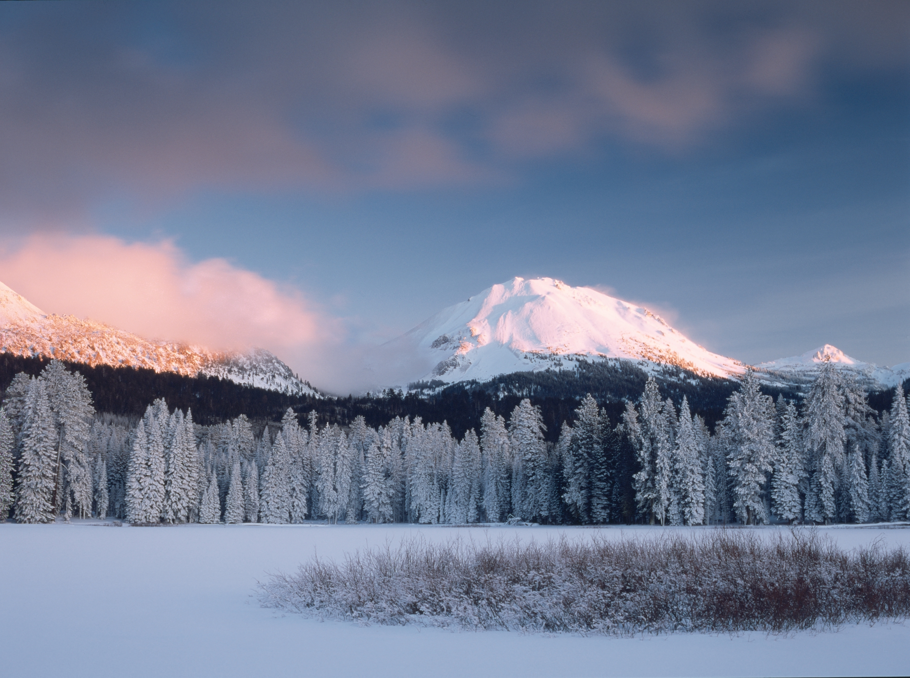
Lassen Volcanic National Park is home to steaming fumaroles, meadows freckled with wildflowers, clear mountain lakes, and numerous volcanoes. Jagged peaks tell the story of its eruptive past while hot...
Park data from the National Park Service API. Alerts update every 2 hours.
Fuel & Cost
Regular Gas
$50.80 one way
$101.59 round trip
$5.84/gal25.4 MPG avg77 kg CO2
Fuel Type
$/gal
One Way
Round Trip
midgrade
$6.02
$52.34
$104.69
premium
$6.18
$53.74
$107.49
diesel
$5.61
$48.79
$97.59
No toll roads detected on this route.
Estimated Trip Cost (one way, 1 person)
Fuel
$51
Meals
$25–$50
Total
$76–$101
Rough estimate based on US averages. Hotel $80–$140/night, meals $25–$50/day.
Estimated CO2 emission: 77.3 kg one way.
Prices: EIA weekly data, 2026-04-13.
EV Charging Along Route
3 DC fast chargers
· Coverage: fair
Electrify America Charging Station
Chico, California
Electrify America
1 DCFC
EVgo Charging Station
Chico, California
EVgo
1 DCFC
ChargePoint Charging Station
Chico, California
ChargePoint
1 DCFC
Electrify America: 1
EVgo: 1
ChargePoint: 1
Station data from NREL Alternative Fuel Stations database.
Driving Electric?
About $23 in charging
· 0 stops
· 66% less CO2
Vehicle Type
kWh
Stops
DC Fast
Home Charge
Average EV
66.3
0
$23.21
$10.61
Efficient EV
55.3
0
$19.34
$8.84
EV Truck/SUV
88.4
1
$30.94
$14.14
Gas CO2
77 kg
EV CO2
26 kg (66% less)
Plan for 0 charging stops, roughly every 270 miles. Allow 25-40 minutes per stop at a DC fast charger.
DC fast charging avg $0.35/kWh. Home charging avg $0.16/kWh. US grid CO2: 0.39 kg/kWh.
Travel Intel
Current conditions at both ends of the drive.
Forecast as of Apr 15, 2026
Origin
Oakland, CA
Evening
in Oakland on Thursday
Local time
8:36 PM
PDT
Current temp
67°F
Unavailable
Live forecast
Destination
Chester, CA
Evening
in Chester on Thursday
Local time
8:36 PM
PDT
Current temp
31°F
Unavailable
Live forecast
Seasonal Notes
Summer travel usually means heavier construction, hotter rest stops, and busier weekend traffic around major cities.
Winter travel shortens daylight, so a route that looks manageable on paper can feel much longer after dark.
Holiday weekends tend to make both departure and arrival windows slower than the raw route time suggests.
Time zone
Same local time
Origin and destination are on the same clock, so arrival timing is easier to judge at a glance.
Temperature spread
36 degrees cooler at arrival
A meaningful temperature swing is a good cue to rethink layers, water, and how soon you want to arrive.
Road read
4h 44m on the road
An early start around 7-8 AM gets you there with plenty of daylight left.
Weather data from the National Weather Service. Conditions may change; check closer to your travel date.
Frequently Asked Questions
The drive from Oakland, CA to Chester, CA covers 221 miles and takes about 4h 44m without stops. Add 15-30 minutes for a fuel or rest stop on longer drives.
The main roads are CA 99, Deer Creek Highway, Dwight D. Eisenhower Highway. Expect a mix of highway and local road driving.
This is a comfortable same-day trip.
The midpoint is about 110.5 miles from Oakland, CA. Look for rest areas, gas stations, or food options near the halfway mark.
At current regular gas prices, expect to spend about $50.80 one way. This estimate uses 25.4 MPG — your actual cost will vary with your vehicle's fuel efficiency and current gas prices.
An early start around 7-8 AM gets you there with plenty of daylight left. A late afternoon start means arriving after dark. Morning is better.
Plan about 1 meaningful break for fuel, food, or rest. Plan on a short reset every 3 to 4 hours to stay fresh behind the wheel.
This is a demanding drive. With 19 significant decision points across 221 miles, you will need to stay alert - especially through interchange areas and urban stretches. Consider splitting it into segments if you are not comfortable with fast highway navigation.
The main spots that need attention: at 1.2 miles: Exit ramp - move to the correct lane early. Lane positioning matters here. Multiple destination signs - pick the right one; at 1.5 miles: Highway fork - watch signs carefully. Lane positioning matters here. Multiple destination signs - pick the right one; at 7.1 miles (I 80 / Eastshore Freeway): Highway fork - watch signs carefully. Lane positioning matters here. Multiple destination signs - pick the right one.
The route from Oakland, CA to Chester, CA does not surface many named destination signs beyond the main corridor.
Yes. Nearby national parks include Rosie the Riveter WWII Home Front National Historical Park, San Francisco Maritime National Historical Park and Port Chicago Naval Magazine National Memorial. There are 6 parks within detour distance of this route.