The drive from Osceola, MI to Lansing, MI covers 506.6 miles and takes about 9h 47m behind the wheel.
It usually feels better as a 2-day road trip than as one long push.
The route leans on US 127, I 75, Townsend Drive for much of the mileage,
and the overall profile is long-distance drive.
The longest uninterrupted segment is about 137.3 miles on US 127.
At current regular gas prices, budget about $79.20 one way before food or hotel costs.
Trip Pace
Best split across 2 days
Treat the return leg as its own travel day rather than an afterthought.
Break Rhythm
2 planned breaks
Plan on a short reset every 3 to 4 hours to stay fresh behind the wheel.
Midpoint
253.3 miles from Osceola, MI
A natural place for your longest stop of the day
, about 5h 23m into the drive
.
Drive Character
At 506.6 miles and 9h 47m of driving, this is a route where fuel stops, weather, and timing matter more than any single turn. The main roads are US 127 and I 75.
Most of the miles stay on highways, which makes pacing and fuel planning easier than turn-by-turn city driving.
There are about 44 navigation steps in the underlying route data, so the final approach matters more than the middle miles.
US 127 is the longest continuous segment at about 137.3 miles.
Elevation Profile
Gently rolling terrain
1,630 ft608 ft
Total Climb
1,701 ft
Total Descent
2,075 ft
Highest Point
1,630 ft
~72.4 mi in
Elevation Range
1,022 ft
Notable High Points
1,630 ft at ~72.4 miles+723 ft prominence
How Hard Is This Drive?
At 9h 47m, this is a long-haul route where pacing matters more than any single turn. This route has several spots where lane changes, forks, or exits need your full attention. The trickiest moment comes around 10.3 miles in near US 41 / Hancock Street.
Driving Effort7/10
Demanding - plan breaks and stay ahead of the key maneuvers
Balances navigation complexity with total wheel time.
This is a demanding drive. With 26 significant decision points across 506.6 miles, you will need to stay alert - especially through interchange areas and urban stretches. Consider splitting it into segments if you are not comfortable with fast highway navigation.
Where does it get tricky?
The main spots that need attention: at 10.3 miles (US 41 / Hancock Street): Lane positioning matters here; at 10.9 miles (US 41 / Front Street): Merge point - match speed before joining. Lane positioning matters here; at 110.9 miles (US 41; M 28 / Marquette Bypass): Roundabout - know your exit number before entering.
Critical Maneuvers
5 of 26 key points
These are the spots where you need to pay the most attention. Preview them before you drive.
6
10.3 mi into trip|~15m in|US 41 / Hancock Street
At end of road, turn left onto US 41 / Hancock Street
Lane positioning matters here
Use the straight / right lanes.
5
10.9 mi into trip|~17m in|US 41 / Front Street
Merge onto US 41 / Front Street
Merge point - match speed before joining. Lane positioning matters here
Use the straight / slight right lanes.
5
110.9 mi into trip|~2h 31m in|US 41; M 28 / Marquette Bypass
Enter roundabout onto US 41; M 28 / Marquette Bypass
Roundabout - know your exit number before entering
7
365.9 mi into trip|~7h 22m in|US 127
Keep slight right at fork onto US 127 toward US 127: Clare, Lansing
Highway fork - watch signs carefully. Multiple destination signs - pick the right one
Exit 249
Toward US 127: Clare, Lansing
7
503.3 mi into trip|~9h 42m in
Take the exit toward I 496 West: Downtown Lansing
Exit ramp - move to the correct lane early. Lane positioning matters here
Use the slight right lane.
Exit 77
Toward I 496 West: Downtown Lansing
Main Roads
Road
Distance
Duration
US 127
137.3 mi
2h 20m
I 75
94.1 mi
1h 37m
Townsend Drive
84 mi
1h 47m
M-28
70.9 mi
1h 24m
US 2
65.1 mi
1h 15m
M 77
17.3 mi
20m
Palms Avenue
10.2 mi
14m
US-41
8.4 mi
11m
Longest stretch:
US 127
— 137.3 mi, about 2h 20m
Turn-by-Turn Driving Directions
Step-by-step road directions between Osceola, MI and Lansing, MI.
1
Start on A Street
90 ft·7 sec·A Street
2
Turn right onto US 41
1.1 mi·1 min·County Road
3
Continue on US 41
8.4 mi·11 min·US-41
4
Continue on US 41
0.4 mi·51 sec·North Lincoln Drive
5
Turn left onto Scott Street
0.3 mi·1 min·Scott Street
6
At end of road, turn left onto US 41
0.6 mi·1 min·Hancock Street
Use the straight / right lanes.
7
Merge onto US 41
0.2 mi·26 sec·Front Street
Use the straight / slight right lanes.
8
Continue on US 41; M 26
0.3 mi·1 min·Houghton-Hancock Lift Bridge
9
Turn left onto US 41
276 ft·8 sec·US 41 South
Toward US 41 South: Marquette
10
Continue on US 41
0.6 mi·1 min·West Montezuma Avenue
Use the straight lane.
11
Merge onto US 41
0.4 mi·1 min·College Avenue
12
Continue on US 41
84 mi·1 hr 47 min·Townsend Drive
Use the left / straight lanes.
13
Enter roundabout onto US 41; M 28
92 ft·5 sec·US 41; M 28
14
Continue on US 41; M 28
0.9 mi·1 min·US 41; M 28
15
Enter roundabout onto US 41; M 28
94 ft·5 sec·Palms Avenue
16
Continue on US 41; M 28
10 mi·14 min·Palms Avenue
17
Enter roundabout onto US 41; M 28
116 ft·6 sec·US-41/M-28
18
Continue on US 41; M 28
0.5 mi·45 sec·US-41/M-28
19
Enter roundabout onto US 41; M 28
103 ft·6 sec·US-41/M-28
20
Continue on US 41; M 28
1.6 mi·2 min·US-41/M-28
21
Continue on US 41; M 28
1.0 mi·1 min·Marquette Bypass
22
Enter roundabout onto US 41; M 28
109 ft·6 sec·Marquette Bypass
23
Continue on US 41; M 28
0.2 mi·14 sec·Marquette Bypass
24
Enter roundabout onto US 41; M 28
107 ft·1 sec·Marquette Bypass
25
Continue on US 41; M 28
0.5 mi·52 sec·Marquette Bypass
26
Take the exit onto US 41; M 28
410 ft·10 sec·US 41; M 28
27
Merge onto US 41; M 28
2.6 mi·4 min·South Front Street
28
Continue on US 41; M 28
1.6 mi·2 min·US-41/M-28
29
Turn left onto M 28
36 mi·42 min·M-28
30
Continue on M 28
2.2 mi·4 min·West Munising Avenue
31
Continue on M 28
0.2 mi·22 sec·Cedar Street
32
Continue on M 28
35 mi·41 min·M-28
33
Turn sharp right onto M 77
17 mi·20 min·M 77
34
At end of road, turn left onto US 2
65 mi·1 hr 15 min·US 2
35
Take the exit
0.3 mi·44 sec
Toward I 75 South: Mackinac Bridge
36
Merge onto I 75
94 mi·1 hr 37 min·I 75
37
Keep slight right at fork onto US 127
137 mi·2 hr 20 min·US 127
Exit 249Toward US 127: Clare, Lansing
38
Take the exit
0.6 mi·1 min
Exit 77Toward I 496 West: Downtown LansingUse the slight right lane.
39
Merge onto I 496
1.9 mi·1 min·Ransom E Olds Freeway
40
Take the exit
0.3 mi·38 sec
Exit 6Toward Downtown
41
Turn right onto South Walnut Street
0.4 mi·1 min·South Walnut Street
42
Turn right onto West Allegan Street
412 ft·12 sec·West Allegan Street
43
Turn right onto Townsend Street
22 ft·1 sec·Townsend Street
44
Arrive at destination
Townsend Street
Trip Plan
Morning Departure
Start early — leave by 6-7 AM to arrive at a reasonable hour.
Evening Departure
This is a long drive — plan for a morning departure or consider splitting it into two days.
This drive is better paced as a 2-day trip.
Plan roughly 2 meaningful breaks for fuel, food, and rest.
The halfway point lands around 253.3 miles from Osceola, MI, or about 5h 23m into the drive.
The longest continuous stretch on this route runs about 137.3 miles.
Consider an overnight stop or starting very early.
Departure
Before you leave
Start with fuel, water, and navigation already sorted so the first hour feels easy.
First stop
Around 111 miles or 2h 31m in
Use this first pause for coffee, a restroom break, and a quick traffic check ahead.
Halfway reset
Around 253.3 miles or 5h 23m in
This is the best place for your longest stop, a real meal, and a full fuel check.
Overnight split
Day 1 wrap after about 253.3 miles or 5h 23m
Stop before fatigue turns the last few hours into a grind. You want day two to start fresh, not just resumed.
Final approach
Final hour starts around 8h 44m
Traffic, exits, and arrival timing usually matter more near Lansing, MI than in the middle of the route.
Before You Leave
+
Open the route before leaving Osceola, MI so your first major turns are already loaded.
+
Leave with enough water and a charging cable within reach, not packed away.
+
Check your fuel range against the first long segment, especially if you are starting outside city service areas.
+
Pick one backup stop option before the midpoint in case traffic changes your pacing.
+
Treat this as a 2-day road trip and book the overnight stop before the busiest arrival window.
Day 1
Settle into the route from Osceola, MI
Aim for roughly 253 miles and 4.9 hours of wheel time on this day.
Day 2
Finish the approach into Lansing, MI
Aim for roughly 253 miles and 4.9 hours of wheel time on this day.
Your first comfortable stop window is around 111 miles from Osceola, MI.
This route usually feels better as a 2-day drive than as one long push.
Plan about 2 real breaks rather than only quick fuel stops.
The longest stretch is on US 127 for about 137.3 miles.
Where to Stop
Rest stops, refuel points, and overnight suggestions along this route.
Halfway Point
Midpoint
About 253.3 mi from Osceola, MI
· 5h 23m into the drive
Place data sourced from public business listings. Hours and availability may vary.
National Parks Near This Route
Worth a detour if your schedule allows.
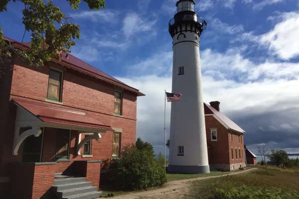
Keweenaw National Historical Park
National Historical Park
The stories of people and copper in the Keweenaw Peninsula have been intertwined for more than 7,000 years. Indigenous peoples made copper into tools and trade items. Investors and immigrants arrived...
Sandstone cliffs, beaches, waterfalls, sand dunes, inland lakes, deep forest, and wild shoreline beckon you to visit Pictured Rocks National Lakeshore. The power of Lake Superior shapes the park's coa...
15 mi from route
~38 min detour
$25
near mile 174.7
Station data from NREL Alternative Fuel Stations database.
Driving Electric?
About $53 in charging
· 1 stop
· 67% less CO2
Vehicle Type
kWh
Stops
DC Fast
Home Charge
Average EV
152
1
$53.19
$24.32
Efficient EV
126.7
1
$44.33
$20.26
EV Truck/SUV
202.6
2
$70.92
$32.42
Gas CO2
177 kg
EV CO2
59 kg (67% less)
Plan for 1 charging stop. A 30-minute DC fast charge mid-route should be enough to complete the trip comfortably.
DC fast charging avg $0.35/kWh. Home charging avg $0.16/kWh. US grid CO2: 0.39 kg/kWh.
Travel Intel
Current conditions at both ends of the drive.
Forecast as of Apr 15, 2026
Origin
Osceola, MI
Afternoon
in Osceola on Saturday
Local time
12:56 PM
EDT
Current temp
35°F
Unavailable
Live forecast
Destination
Lansing, MI
Afternoon
in Lansing on Saturday
Local time
12:56 PM
EDT
Current temp
47°F
Unavailable
Live forecast
56°F
Flat Rock, MI
167 mi in
Seasonal Notes
Summer travel usually means heavier construction, hotter rest stops, and busier weekend traffic around major cities.
Winter travel shortens daylight, so a route that looks manageable on paper can feel much longer after dark.
Holiday weekends tend to make both departure and arrival windows slower than the raw route time suggests.
For long drives, weather on day two can matter just as much as conditions at departure, so check the whole travel window rather than only the first day.
Time zone
Same local time
Origin and destination are on the same clock, so arrival timing is easier to judge at a glance.
Temperature spread
12 degrees warmer at arrival
A meaningful temperature swing is a good cue to rethink layers, water, and how soon you want to arrive.
Road read
9h 47m on the road
This is long enough that the arrival forecast matters almost as much as departure conditions. Recheck both ends before you roll.
Weather data from the National Weather Service. Conditions may change; check closer to your travel date.
Frequently Asked Questions
The drive from Osceola, MI to Lansing, MI covers 506.6 miles and takes about 9h 47m without stops. Add 15-30 minutes for a fuel or rest stop on longer drives.
The main roads are US 127, I 75, Townsend Drive. Expect a mix of highway and local road driving.
Consider an overnight stop or starting very early.
Yes. This route is usually more comfortable as a 2-day drive. A sensible stopping point is after roughly 253 miles on day one.
The midpoint is about 253.3 miles from Osceola, MI. Look for rest areas, gas stations, or food options near the halfway mark.
At current regular gas prices, expect to spend about $79.20 one way. This estimate uses 25.4 MPG — your actual cost will vary with your vehicle's fuel efficiency and current gas prices.
Start early — leave by 6-7 AM to arrive at a reasonable hour. This is a long drive — plan for a morning departure or consider splitting it into two days.
Plan about 2 meaningful breaks for fuel, food, or rest. Plan on a short reset every 3 to 4 hours to stay fresh behind the wheel.
This is a demanding drive. With 26 significant decision points across 506.6 miles, you will need to stay alert - especially through interchange areas and urban stretches. Consider splitting it into segments if you are not comfortable with fast highway navigation.
The main spots that need attention: at 10.3 miles (US 41 / Hancock Street): Lane positioning matters here; at 10.9 miles (US 41 / Front Street): Merge point - match speed before joining. Lane positioning matters here; at 110.9 miles (US 41; M 28 / Marquette Bypass): Roundabout - know your exit number before entering.
The route from Osceola, MI to Lansing, MI does not surface many named destination signs beyond the main corridor.
How this page is built
Compiled by the Trip.ovh planning team at COD Solutions Oy from open government datasets — OSRM over OpenStreetMap for geometry, EIA for fuel prices, USGS 3DEP for elevation, NREL for EV charging, and NPS for national parks. See our methodology for refresh cadence and limitations.