Trip from Saint Simons Island, GA to Johns Creek, GA

Drive Time

6h 22m

Distance

335.6 mi

540 km

Drive Score

8/10

Great drive

Same Day?

Yes, doable

Fuel Cost

$54

one way

EV Charging

Excellent

39 DC fast

Best Time to Leave

Save up to 38 min
4 AM
6h 10m ★
6 AM
6h 23m
8 AM
6h 48m
10 AM
6h 32m
12 PM
6h 29m
3 PM
6h 33m
5 PM
6h 46m
8 PM
6h 15m

Estimated drive times based on typical traffic patterns. Actual times may vary with weather, construction, and real-time conditions.

Downtown Johns Creek, GA, GA

Johns Creek, GA

Thomas K

Trip Overview

The drive from Saint Simons Island, GA to Johns Creek, GA covers 335.6 miles and takes about 6h 22m behind the wheel. This route is realistic as a one-day drive if you keep your stops efficient.

The route leans on Jim Gillis Historic Savannah Parkway, I 75, I 95 for much of the mileage, and the overall profile is highway-focused drive. The longest uninterrupted segment is about 155.9 miles on Jim Gillis Historic Savannah Parkway. At current regular gas prices, budget about $53.77 one way before food or hotel costs.

Trip Pace

Same-day drive is realistic

A same-day return is possible, but it will make for a full day on the road.

Break Rhythm

1 planned break

Plan on a short reset every 3 to 4 hours to stay fresh behind the wheel.

Midpoint

167.8 miles from Saint Simons Island, GA

A natural place for your longest stop of the day , about 3h 10m into the drive .

Drive Character

This is a 6h 22m highway drive covering 335.6 miles, with most of the trip on Jim Gillis Historic Savannah Parkway and I 75. The longest continuous stretch is about 155.9 miles on Jim Gillis Historic Savannah Parkway.

Most of the miles stay on highways, which makes pacing and fuel planning easier than turn-by-turn city driving.
There are about 33 navigation steps in the underlying route data, so the final approach matters more than the middle miles.
Jim Gillis Historic Savannah Parkway is the longest continuous segment at about 155.9 miles.

How Hard Is This Drive?

This is a straightforward highway drive that stays mostly on Jim Gillis Historic Savannah Parkway and I 75. This route has several spots where lane changes, forks, or exits need your full attention. The trickiest moment comes around 74.5 miles in.

Route Complexity 10/10

High effort - long or complex enough to need steady focus all day

This is a demanding drive. With 23 significant decision points across 335.6 miles, you will need to stay alert — especially through interchange areas and urban stretches. Consider splitting it into segments if you are not comfortable with fast highway navigation.

Where does it get tricky?

The main spots that need attention: at 74.5 miles: Exit ramp - move to the correct lane early. Lane positioning matters here; at 293.7 miles (I 675 / Terrell Starr Parkway): Highway fork - watch signs carefully. Lane positioning matters here. Multiple destination signs - pick the right one; at 303.8 miles: Highway fork - watch signs carefully. Lane positioning matters here. Multiple destination signs - pick the right one.

Critical Maneuvers

5 of 23 key points

These are the spots where you need to pay the most attention. Preview them before you drive.

7
74.5 mi into trip | ~1h 30m in

Take the exit toward I 16 West: Macon

Exit ramp - move to the correct lane early. Lane positioning matters here

Use the slight right lane. Exit 99B Toward I 16 West: Macon
9
293.7 mi into trip | ~5h 27m in | I 675 / Terrell Starr Parkway

Keep slight right at fork onto I 675 / Terrell Starr Parkway toward I 675 North: Augusta, Greenville

Highway fork - watch signs carefully. Lane positioning matters here. Multiple destination signs - pick the right one

Use the straight / slight right lanes. Exit 227 Toward I 675 North: Augusta, Greenville
8
303.8 mi into trip | ~5h 38m in

Keep slight right at fork toward I 285 East: Augusta, Greenville

Highway fork - watch signs carefully. Lane positioning matters here. Multiple destination signs - pick the right one

Use the slight left / slight right lanes. Toward I 285 East: Augusta, Greenville
8
324.8 mi into trip | ~6h 3m in

Keep slight right at fork toward GA 141 North: Peachtree Boulevard

Highway fork - watch signs carefully. Lane positioning matters here

Use the slight right lane. Toward GA 141 North: Peachtree Boulevard
8
328.6 mi into trip | ~6h 9m in | GA 141

Keep slight left at fork onto GA 141 toward GA 141 North: Cumming, Dahlonega

Highway fork - watch signs carefully. Lane positioning matters here. Multiple destination signs - pick the right one

Use the slight left / straight lanes. Toward GA 141 North: Cumming, Dahlonega

Towns Along This Route

Between Saint Simons Island, GA and Johns Creek, GA, road signs point toward Savannah and Greenville.

Savannah

74.7 mi in | ~1h 31m | via I 16

Greenville

293.7 mi in | ~5h 27m | via I 675

Main Roads

Road Distance Duration
Jim Gillis Historic Savannah Parkway 155.9 mi 2h 47m
I 75 62.1 mi 1h 7m
I 95 60.6 mi 1h 5m
Atlanta Bypass / The Perimeter 20.2 mi 23m
Terrell Starr Parkway 10.1 mi 11m
GA 141 6.2 mi 10m
Golden Isles Parkway 4.3 mi 6m
Peachtree Industrial Boulevard 3.6 mi 4m
Longest stretch: Jim Gillis Historic Savannah Parkway — 155.9 mi, about 2h 47m

Turn-by-Turn Driving Directions

Step-by-step road directions between Saint Simons Island, GA and Johns Creek, GA.

1

Start on 8th Street

138 ft · 11 sec · 8th Street
2

Turn left onto Bruce Drive

0.4 mi · 1 min · Bruce Drive
3

Turn right onto 1st Street

361 ft · 16 sec · 1st Street
4

Enter the roundabout and take exit 2 toward East Beach Causeway

62 ft · 2 sec · East Beach Causeway
5

Exit the roundabout onto East Beach Causeway

0.4 mi · 1 min · East Beach Causeway
6

Enter the roundabout and take exit 1 toward Demere Road

52 ft · 1 sec · Demere Road
7

Exit the roundabout onto Demere Road

1.0 mi · 1 min · Demere Road
8

Enter the roundabout and take exit 2 toward Demere Road

200 ft · 4 sec · Demere Road
9

Exit the roundabout onto Demere Road

1.3 mi · 2 min · Demere Road
10

Keep slight right

0.2 mi · 20 sec
11

Continue on F. J. Torras Causeway

2.1 mi · 3 min · F. J. Torras Causeway
12

Continue on Fernando Joseph Torras Causeway

2.0 mi · 3 min · Fernando Joseph Torras Causeway
13

Turn right onto Glynn Avenue

1.6 mi · 3 min · Glynn Avenue
14

Continue on Golden Isles Parkway

4.3 mi · 6 min · Golden Isles Parkway
15

Take the exit slight right toward I 95 North: I 95 North

0.6 mi · 1 min · I 95 North: I 95 North
16

Merge slight left

60 mi · 1 hr 4 min
17

Keep slight right

0.6 mi · 48 sec
18

Take the exit slight right toward I 16 West: Macon

0.2 mi · 51 sec · I 16 West: Macon
19

Merge slight left onto Jim Gillis Historic Savannah Parkway

156 mi · 2 hr 47 min · Jim Gillis Historic Savannah Parkway
20

Continue on Fall Line Freeway

0.5 mi · 40 sec · Fall Line Freeway
21

Keep slight right to continue on I 75 North: Atlanta

0.5 mi · 43 sec · I 75 North: Atlanta
22

Merge slight left

62 mi · 1 hr 7 min
23

Keep slight right to continue on Terrell Starr Parkway

10 mi · 11 min · Terrell Starr Parkway
24

Keep slight right to continue on I 285 East: Augusta, Greenville

0.6 mi · 1 min · I 285 East: Augusta, Greenville
25

Merge slight left onto Atlanta Bypass / The Perimeter

20 mi · 23 min · Atlanta Bypass / The Perimeter
26

Take the exit slight right toward GA 141: Peachtree Boulevard

0.2 mi · 33 sec · GA 141: Peachtree Boulevard
27

Keep slight right to continue on GA 141 North: Peachtree Boulevard

0.3 mi · 36 sec · GA 141 North: Peachtree Boulevard
28

Merge slight left onto Peachtree Industrial Boulevard

3.6 mi · 4 min · Peachtree Industrial Boulevard
29

Keep slight left to continue on GA 141 North: Cumming, Dahlonega

6.2 mi · 10 min · GA 141 North: Cumming, Dahlonega
30

Turn left onto Grove Point Road

0.2 mi · 56 sec · Grove Point Road
31

Turn left onto Groomsbridge Road

0.5 mi · 2 min · Groomsbridge Road
32

Turn right onto Morgan Hill Court

269 ft · 12 sec · Morgan Hill Court
33

Arrive at your destination

Trip Plan

Morning Departure

Start early — leave by 6-7 AM to arrive at a reasonable hour.

Evening Departure

This is a long drive — plan for a morning departure or consider splitting it into two days.

You can normally do this drive in one day.
Plan roughly 1 meaningful break for fuel, food, and rest.
The halfway point lands around 167.8 miles from Saint Simons Island, GA, or about 3h 10m into the drive.
The longest continuous stretch on this route runs about 155.9 miles.

This is a comfortable same-day trip.

Departure

Before you leave

Start with fuel, water, and navigation already sorted so the first hour feels easy.

First stop

Around 80 miles or 1h 36m in

Use this first pause for coffee, a restroom break, and a quick traffic check ahead.

Halfway reset

Around 167.8 miles or 3h 10m in

This is the best place for your longest stop, a real meal, and a full fuel check.

Final approach

Final hour starts around 5h 7m

Traffic, exits, and arrival timing usually matter more near Johns Creek, GA than in the middle of the route.

Before You Leave

+

Open the route before leaving Saint Simons Island, GA so your first major turns are already loaded.

+

Leave with enough water and a charging cable within reach, not packed away.

+

Check your fuel range against the first long segment, especially if you are starting outside city service areas.

Day 1

Settle into the route from Saint Simons Island, GA

This is one driving day of about 335.6 miles and 6h 22m.

Your first comfortable stop window is around 80 miles from Saint Simons Island, GA.
This route can stay practical as a one-day drive if traffic stays reasonable.
Plan about 1 real break rather than only quick fuel stops.
The longest stretch is on Jim Gillis Historic Savannah Parkway for about 155.9 miles.

Where to Stop

Rest stops, refuel points, and overnight suggestions along this route.

Halfway Point

Midpoint

About 167.8 mi from Saint Simons Island, GA · 3h 10m into the drive

Downtown Dadeville, AL, AL

Mid-route town

Meal stop

Dadeville, AL

168 mi into the route

Best for: Lunch, fuel, and a longer reset

This sits close to the middle of the route, so it works well for the longest stop of the day.

Pacing Suggestions

Savannah, GA

Fuel and coffee

A short stop after about 80 miles helps settle the day before fatigue starts building.

Lake City, FL

Meal break

The midpoint is around 167.8 miles from Saint Simons Island, GA, which is a good place for a longer meal and fuel stop.

Before the longest stretch

Fuel check

Top up before Jim Gillis Historic Savannah Parkway if your tank is already low. That segment runs about 155.9 miles.

Arriving in Johns Creek, GA

The final approach into Johns Creek, GA usually feels slower than the middle of the drive, so avoid planning your tightest schedule at the very end.

Try to arrive with enough fuel left to skip an immediate station stop unless you already know the area around Johns Creek, GA.

After long uninterrupted mileage, take five minutes before the last urban segment to reset and refocus on exits, merges, and city traffic.

These stop ideas are pacing suggestions — the exact town or exit can change with traffic, hotel plans, and fuel range.

National Parks Near This Route

Worth a detour if your schedule allows.

Ocmulgee Mounds National Historical Park

Ocmulgee Mounds National Historical Park

National Historical Park

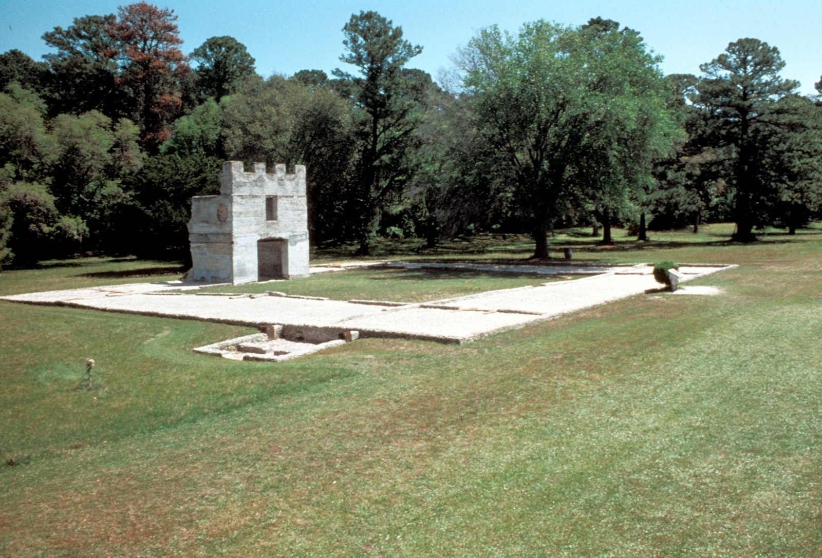
Welcome to Ocmulgee Mounds National Historical Park. This park is a prehistoric American Indian site, where many different American Indian cultures occupied this land for thousands of years. American...

3 mi from route ~7 min detour Free near mile 231.5
Caution: River Trail periodically closed under I-16
Park Closure: BOARDWALK CLOSED along the River Trail
View on nps.gov
Fort Frederica National Monument

Fort Frederica National Monument

National Monument

War was imminent as James Oglethorpe established Fort Frederica in 1736, to help protect the British colonies from the Spanish in Florida. Fort Frederica illustrates the story of the War of Jenkins Ea...

5 mi from route ~13 min detour Free
View on nps.gov
Chattahoochee River National Recreation Area

Chattahoochee River National Recreation Area

National Recreation Area

Today the river valley attracts us for so many reasons. Take a solitary walk to enjoy nature’s display, raft leisurely through the rocky shoals with friends, fish the misty waters as the sun comes up,...

6 mi from route ~14 min detour $5 near mile 335.6
View on nps.gov
Martin Luther King, Jr. National Historical Park

Martin Luther King, Jr. National Historical Park

National Historical Park

Welcome to Martin Luther King, Jr. National Historical Park & Preservation District where a young boy grows up in a time of segregation. He was moved by destiny to lead the modern civil rights movemen...

8 mi from route ~20 min detour Free near mile 312.5
View on nps.gov
Fort Pulaski National Monument

Fort Pulaski National Monument

National Monument

For much of the 19th century, masonry fortifications were the United States’ main defense against overseas enemies. However, during the Civil War, new technology proved its superiority over these fort...

20 mi from route ~51 min detour $10 near mile 69.4
View on nps.gov
Cumberland Island National Seashore

Cumberland Island National Seashore

National Seashore

St Marys is the gateway to Cumberland Island, Georgia's largest and southernmost barrier island. Here pristine maritime forests, undeveloped beaches and wide marshes whisper the stories of both man an...

21 mi from route ~52 min detour $15
View on nps.gov

Park data from the National Park Service API. Alerts update every 2 hours.

Fuel & Cost

Regular Gas

$53.77 one way

$107.55 round trip

$4.07/gal 25.4 MPG avg 118 kg CO2
Fuel Type $/gal One Way Round Trip
midgrade $4.43 $58.59 $117.18
premium $4.78 $63.21 $126.41
diesel $5.64 $74.65 $149.30

No toll roads detected on this route.

Estimated Trip Cost (one way, 1 person)

Fuel

$54

Meals

$25–$50

Total

$79–$104

Rough estimate based on US averages. Hotel $80–$140/night, meals $25–$50/day.

Estimated CO2 emission: 117.6 kg one way. Prices: EIA weekly data, 2026-04-06.

EV Charging Along Route

39 DC fast chargers · Coverage: excellent

Golden Isles Strike Zone - Tesla Supercharger

Brunswick, GA

Tesla

24 DCFC

IAP Port of Brunswick

Brunswick, GA

ENVIROSPARK

16 DCFC

Cracker Barrel - Tesla Supercharger

Brunswick, GA

Tesla

16 DCFC

Brunswick, GA Rechargery Relay - Shupe Wy

Brunswick, GA

IONNA

16 DCFC

TA, US-17, Richmond Hill, GA

Richmond Hill, GA

BP_PULSE

12 DCFC

Wendy's - Tesla Supercharger

Dublin, GA

Tesla

12 DCFC

Enmarket - Tesla Supercharger

Pooler, GA

Tesla

11 DCFC

Dairy Queen - Tesla Supercharger

Pooler, GA

Tesla

8 DCFC

ChargePoint Network: 16 Tesla: 8 RED_E: 5 ENVIROSPARK: 2 Electrify America: 2 IONNA: 1 BP_PULSE: 1 RIVIAN_ADVENTURE: 1 eVgo Network: 1 RACETRAC: 1 EV Connect: 1

Station data from NREL Alternative Fuel Stations database.

Driving Electric?

About $35 in charging · 1 stop · 67% less CO2

Vehicle Type kWh Stops DC Fast Home Charge
Average EV 100.7 1 $35.24 $16.11
Efficient EV 83.9 0 $29.37 $13.42
EV Truck/SUV 134.2 1 $46.98 $21.48

Gas CO2

117 kg

EV CO2

39 kg (67% less)

Plan for 1 charging stop. A 30-minute DC fast charge mid-route should be enough to complete the trip comfortably.

DC fast charging avg $0.35/kWh. Home charging avg $0.16/kWh. US grid CO2: 0.39 kg/kWh.

Travel Intel

Current conditions at both ends of the drive.

Forecast data refreshed 1 day ago

Origin

Saint Simons Island, GA

Late night in Saint Simons Island on Monday

Local time

5:27 AM

EDT

Current temp

81°F

Unavailable

Live forecast

Destination

Johns Creek, GA

Late night in Johns Creek on Monday

Local time

5:27 AM

EDT

Current temp

64°F

Unavailable

Live forecast

Seasonal Notes

Summer travel usually means heavier construction, hotter rest stops, and busier weekend traffic around major cities.

Winter travel shortens daylight, so a route that looks manageable on paper can feel much longer after dark.

Holiday weekends tend to make both departure and arrival windows slower than the raw route time suggests.

Time zone

Same local time

Origin and destination are on the same clock, so arrival timing is easier to judge at a glance.

Temperature spread

17 degrees cooler at arrival

A meaningful temperature swing is a good cue to rethink layers, water, and how soon you want to arrive.

Road read

6h 22m on the road

Start early — leave by 6-7 AM to arrive at a reasonable hour.

Weather data from the National Weather Service. Conditions may change; check closer to your travel date.

Frequently Asked Questions

The drive from Saint Simons Island, GA to Johns Creek, GA covers 335.6 miles and takes about 6h 22m without stops. Add 15-30 minutes for a fuel or rest stop on longer drives.
The main roads are Jim Gillis Historic Savannah Parkway, I 75, I 95. Most of the drive stays on highways, so watch for ramps and exits.
This is a comfortable same-day trip.
The midpoint is about 167.8 miles from Saint Simons Island, GA. Look for rest areas, gas stations, or food options near the halfway mark.
At current regular gas prices, expect to spend about $53.71 one way. This estimate uses 25.4 MPG — your actual cost will vary with your vehicle's fuel efficiency and current gas prices.
Start early — leave by 6-7 AM to arrive at a reasonable hour. This is a long drive — plan for a morning departure or consider splitting it into two days.
Plan about 1 meaningful break for fuel, food, or rest. Plan on a short reset every 3 to 4 hours to stay fresh behind the wheel.
This is a demanding drive. With 23 significant decision points across 335.6 miles, you will need to stay alert — especially through interchange areas and urban stretches. Consider splitting it into segments if you are not comfortable with fast highway navigation.
The main spots that need attention: at 74.5 miles: Exit ramp - move to the correct lane early. Lane positioning matters here; at 293.7 miles (I 675 / Terrell Starr Parkway): Highway fork - watch signs carefully. Lane positioning matters here. Multiple destination signs - pick the right one; at 303.8 miles: Highway fork - watch signs carefully. Lane positioning matters here. Multiple destination signs - pick the right one.
Between Saint Simons Island, GA and Johns Creek, GA, road signs point toward Savannah and Greenville.

Was this route helpful?

Thanks for your feedback!

Your tip has been submitted. Thanks!

/500

Explore More

Explore more options from Saint Simons Island, GA or browse trips ending in Johns Creek, GA.

Looking for more statewide routes? Browse GA road trips.

Explore maps for Saint Simons Island, GA or Johns Creek, GA on MapSof.net.