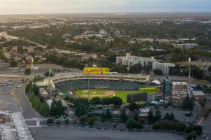
Trip from San Bernardino, CA to Bay Point, CA

Drive Time

7h 50m

Distance

414.6 mi

667 km

Drive Score

8/10

Great drive

Same Day?

Yes, doable

Fuel Cost

$96

one way

Trip Overview

The drive from San Bernardino, CA to Bay Point, CA covers 414.6 miles and takes about 7h 50m behind the wheel. This route is realistic as a one-day drive if you keep your stops efficient.

The route leans on I 215 North, San Bernardino Freeway, Barstow Freeway for much of the mileage, and the overall profile is turn-heavy local drive. At current regular gas prices, budget about $96.01 one way before food or hotel costs.

Trip Pace

Same-day drive is realistic

A same-day return is possible, but it will make for a full day on the road.

Break Rhythm

2 planned breaks

Plan on a short reset every 3 to 4 hours to stay fresh behind the wheel.

Midpoint

207.3 miles from San Bernardino, CA

A natural place for your longest stop of the day , about 3h 55m into the drive .

Drive Character

Expect a 7h 50m drive with frequent turns across 414.6 miles of local and secondary roads.

This route has more turning and local-road decision points than a simple highway run.
There are about 34 navigation steps in the underlying route data, so the final approach matters more than the middle miles.
I 215 North is one of the defining roads on this drive.

How Hard Is This Drive?

Expect a hands-on drive with frequent turns and local roads rather than long highway stretches. There are only a few real navigation decisions along the way.

Route Complexity 4/10

Easy - simple navigation with a manageable amount of wheel time

The route itself is not hard, but at 7h 50m, endurance matters. Plan breaks every 2-3 hours. The 0 decision points are all manageable with basic attention.

Where does it get tricky?

This route does not have any notably tricky sections. Most of the drive from San Bernardino, CA to Bay Point, CA is straightforward, with well-signed roads and simple exits.

Main Roads

Road Distance Duration
I 215 North Unavailable Refreshing
San Bernardino Freeway Unavailable Refreshing
Barstow Freeway Unavailable Refreshing
CA 210 West Unavailable Refreshing
Foothill Freeway Unavailable Refreshing
Golden State Freeway Unavailable Refreshing
Westside Freeway Unavailable Refreshing
William Elton Brown Freeway Unavailable Refreshing

Per-road distance and duration are being refreshed from OSRM for this route.

Longest stretch: I 215 North — detailed segment metrics are refreshing.

Turn-by-Turn Driving Directions

Step-by-step road directions between San Bernardino, CA and Bay Point, CA.

1

Start on West 5th Street

0.7 mi · 1 min · West 5th Street
2

Take the ramp right toward I 215 North: Barstow

0.3 mi · 45 sec · I 215 North: Barstow
3

Merge slight left onto San Bernardino Freeway

1.5 mi · 1 min · San Bernardino Freeway
4

Continue on Barstow Freeway

0.5 mi · 35 sec · Barstow Freeway
5

Take the exit slight right toward CA 210 West: Pasadena

1.0 mi · 2 min · CA 210 West: Pasadena
6

Merge slight left onto Foothill Freeway

21 mi · 24 min · Foothill Freeway
7

Keep slight right to continue on Foothill Freeway

1.2 mi · 1 min · Foothill Freeway
8

Keep slight right to continue on Foothill Freeway

2.4 mi · 2 min · Foothill Freeway
9

Keep slight right to continue on Foothill Freeway

1.4 mi · 1 min · Foothill Freeway
10

Keep slight right to continue on Foothill Freeway

1.8 mi · 2 min · Foothill Freeway
11

Keep slight right to continue on Foothill Freeway

20 mi · 23 min · Foothill Freeway
12

Keep slight right to continue on Foothill Freeway

26 mi · 29 min · Foothill Freeway
13

Keep slight right

0.1 mi · 9 sec
14

Merge slight right

1.0 mi · 1 min
15

Keep slight left

36 mi · 41 min
16

Keep slight left to continue on Golden State Freeway

22 mi · 25 min · Golden State Freeway
17

Keep slight right to continue on Westside Freeway

226 mi · 4 hr 1 min · Westside Freeway
18

Keep slight left to continue on William Elton Brown Freeway

14 mi · 14 min · William Elton Brown Freeway
19

Take the exit slight right

0.2 mi · 22 sec
20

Keep slight right to continue on Patterson Pass Road

289 ft · 7 sec · Patterson Pass Road
21

Turn straight onto Mountain House Parkway

0.7 mi · 1 min · Mountain House Parkway
22

Turn right onto International Parkway

0.8 mi · 1 min · International Parkway
23

Continue on Mountain House Parkway

2.8 mi · 5 min · Mountain House Parkway
24

At the end of the road, turn left onto Byron Road

1.8 mi · 2 min · Byron Road
25

Continue on Byron-Bethany Road

1.5 mi · 2 min · Byron-Bethany Road
26

Continue on Byron Highway

5.1 mi · 7 min · Byron Highway
27

Turn left onto Camino Diablo

1.6 mi · 3 min · Camino Diablo
28

Turn right onto Vasco Road

3.4 mi · 4 min · Vasco Road
29

Continue straight

19 mi · 22 min
30

Take the exit slight right toward Bay Point, San Marco Boulevard, Willow Pass Road

0.3 mi · 44 sec · Bay Point, San Marco Boulevard, Willow Pass Road
31

Turn right onto Willow Pass Road

0.3 mi · 35 sec · Willow Pass Road
32

Turn left onto Port Chicago Highway

0.2 mi · 38 sec · Port Chicago Highway
33

Turn left onto Riverside Drive

328 ft · 14 sec · Riverside Drive
34

Arrive at your destination

Trip Plan

Morning Departure

Start early — leave by 6-7 AM to arrive at a reasonable hour.

Evening Departure

This is a long drive — plan for a morning departure or consider splitting it into two days.

You can normally do this drive in one day.
Plan roughly 2 meaningful breaks for fuel, food, and rest.
The halfway point lands around 207.3 miles from San Bernardino, CA, or about 3h 55m into the drive.

This is a comfortable same-day trip.

Departure

Before you leave

Start with fuel, water, and navigation already sorted so the first hour feels easy.

First stop

Around 91 miles or 1h 43m in

Use this first pause for coffee, a restroom break, and a quick traffic check ahead.

Halfway reset

Around 207.3 miles or 3h 55m in

This is the best place for your longest stop, a real meal, and a full fuel check.

Final approach

Final hour starts around 6h 42m

Traffic, exits, and arrival timing usually matter more near Bay Point, CA than in the middle of the route.

Before You Leave

+

Open the route before leaving San Bernardino, CA so your first major turns are already loaded.

+

Leave with enough water and a charging cable within reach, not packed away.

+

Check your fuel range against the first long segment, especially if you are starting outside city service areas.

+

Pick one backup stop option before the midpoint in case traffic changes your pacing.

Day 1

Settle into the route from San Bernardino, CA

This is one driving day of about 414.6 miles and 7h 50m.

Your first comfortable stop window is around 91 miles from San Bernardino, CA.
This route can stay practical as a one-day drive if traffic stays reasonable.
Plan about 2 real breaks rather than only quick fuel stops.

Where to Stop

Rest stops, refuel points, and overnight suggestions along this route.

Halfway Point

Midpoint

About 207.3 mi from San Bernardino, CA · 3h 55m into the drive

Downtown Santa Clarita, CA, CA

Mid-route town

Meal stop

Santa Clarita, CA

207 mi into the route

Best for: Lunch, fuel, and a longer reset

This sits close to the middle of the route, so it works well for the longest stop of the day.

Pacing Suggestions

Los Angeles, CA

Fuel and coffee

A short stop after about 91 miles helps settle the day before fatigue starts building.

Santa Clarita, CA

Meal break

The midpoint is around 207.3 miles from San Bernardino, CA, which is a good place for a longer meal and fuel stop.

Arriving in Bay Point, CA

The final approach into Bay Point, CA usually feels slower than the middle of the drive, so avoid planning your tightest schedule at the very end.

Try to arrive with enough fuel left to skip an immediate station stop unless you already know the area around Bay Point, CA.

These stop ideas are pacing suggestions — the exact town or exit can change with traffic, hotel plans, and fuel range.

Fuel & Cost

Regular Gas

$96.01 one way

$192.02 round trip

$5.88/gal 25.4 MPG avg 145 kg CO2
Fuel Type $/gal One Way Round Trip
midgrade $6.07 $99.01 $198.03
premium $6.24 $101.90 $203.81
diesel $5.64 $92.11 $184.22

No toll roads detected on this route.

Estimated Trip Cost (one way, 1 person)

Fuel

$96

Meals

$25–$50

Total

$121–$146

Rough estimate based on US averages. Hotel $80–$140/night, meals $25–$50/day.

Estimated CO2 emission: 145.1 kg one way. Prices: EIA weekly data, 2026-04-06.

Driving Electric?

About $44 in charging · 1 stop · 66% less CO2

Vehicle Type kWh Stops DC Fast Home Charge
Average EV 124.4 1 $43.53 $19.90
Efficient EV 103.7 1 $36.28 $16.58
EV Truck/SUV 165.8 2 $58.04 $26.53

Gas CO2

145 kg

EV CO2

49 kg (66% less)

Plan for 1 charging stop. A 30-minute DC fast charge mid-route should be enough to complete the trip comfortably.

DC fast charging avg $0.35/kWh. Home charging avg $0.16/kWh. US grid CO2: 0.39 kg/kWh.

Travel Intel

Local time and weather at both ends of the drive

Current conditions at both ends of the drive. If you're planning ahead, check the forecast closer to your travel date.

Forecast data refreshed 2 days ago

Origin

San Bernardino, CA

Afternoon in San Bernardino on Saturday

Local time

3:32 PM

PDT

Current temp

52°F

Forecast unavailable right now

PDT Live forecast

Destination

Bay Point, CA

Afternoon in Bay Point on Saturday

Local time

3:32 PM

PDT

Current temp

--

Forecast unavailable right now

PDT

Along the Route

76°F

Santa Clarita, CA

207 mi in

Seasonal Notes

Summer travel usually means heavier construction, hotter rest stops, and busier weekend traffic around major cities.

Winter travel shortens daylight, so a route that looks manageable on paper can feel much longer after dark.

Holiday weekends tend to make both departure and arrival windows slower than the raw route time suggests.

Time zone

Same local time

Origin and destination are on the same clock, so arrival timing is easier to judge at a glance.

Road read

7h 50m on the road

Start early — leave by 6-7 AM to arrive at a reasonable hour.

Frequently Asked Questions

The drive from San Bernardino, CA to Bay Point, CA covers 414.6 miles and takes about 7h 50m without stops. Add 15-30 minutes for a fuel or rest stop on longer drives.
The main roads are I 215 North, San Bernardino Freeway, Barstow Freeway. Expect a mix of highway and local road driving.
This is a comfortable same-day trip.
The midpoint is about 207.3 miles from San Bernardino, CA. Look for rest areas, gas stations, or food options near the halfway mark.
At current regular gas prices, expect to spend about $96.01 one way. This estimate uses 25.4 MPG — your actual cost will vary with your vehicle's fuel efficiency and current gas prices.
Start early — leave by 6-7 AM to arrive at a reasonable hour. This is a long drive — plan for a morning departure or consider splitting it into two days.
Plan about 2 meaningful breaks for fuel, food, or rest. Plan on a short reset every 3 to 4 hours to stay fresh behind the wheel.
The route itself is not hard, but at 7h 50m, endurance matters. Plan breaks every 2-3 hours. The 0 decision points are all manageable with basic attention.
This route does not have any notably tricky sections. Most of the drive from San Bernardino, CA to Bay Point, CA is straightforward, with well-signed roads and simple exits.
The route from San Bernardino, CA to Bay Point, CA does not surface many named destination signs beyond the main corridor.

Was this route helpful?

Thanks for your feedback!

Your tip has been submitted. Thanks!

/500

Explore More

Return Trip

Bay Point, CA to San Bernardino, CA

Plan the drive back the other way.

420.4 mi 7h 1m

Explore more options from San Bernardino, CA or browse trips ending in Bay Point, CA.

Looking for more statewide routes? Browse CA road trips.

Explore maps for San Bernardino, CA or Bay Point, CA on MapSof.net.