Embark on a 307.1-mile journey from Savannah, GA, to Cedartown, GA, a drive that will take approximately 5 hours and 53 minutes. This route is primarily highway-focused, with 93% of the travel on interstates, making it a solid option for a single-day trip. You can expect the fuel costs to be around $48 for this excursion through Georgia. With only one recommended stop, this trip is designed for efficiency, allowing you to cover significant ground without extensive breaks.
Trip Pace
Same-day drive is realistic
A same-day return is possible, but it will make for a full day on the road.
Break Rhythm
1 planned break
Plan on a short reset every 3 to 4 hours to stay fresh behind the wheel.
Midpoint
153.5 miles from Savannah, GA
A natural place for your longest stop of the day
, about 2h 47m into the drive
.
Loading map...
Drive Character
This drive is predominantly a highway-focused experience, designed for covering distance. You'll spend most of your time on major roadways like Jim Gillis Historic Savannah Parkway and I-75. The highway share is a significant 93%, indicating long stretches of consistent driving. The longest uninterrupted segment spans 162.1 miles on the Jim Gillis Historic Savannah Parkway, offering a chance to settle in for a considerable period. Expect a steady pace throughout this journey.
Most of the miles stay on highways, which makes pacing and fuel planning easier than turn-by-turn city driving.
There are about 32 navigation steps in the underlying route data, so the final approach matters more than the middle miles.
Jim Gillis Historic Savannah Parkway is the longest continuous segment at about 162.1 miles.
How Hard Is This Drive?
This is a straightforward highway drive that stays mostly on Jim Gillis Historic Savannah Parkway and I 75. This route has several spots where lane changes, forks, or exits need your full attention. The trickiest moment comes around 3 miles in.
Route Complexity10/10
High effort - long or complex enough to need steady focus all day
This is a demanding drive. With 19 significant decision points across 307.1 miles, you will need to stay alert — especially through interchange areas and urban stretches. Consider splitting it into segments if you are not comfortable with fast highway navigation.
Where does it get tricky?
The main spots that need attention: at 3 miles: Exit ramp - move to the correct lane early. Lane positioning matters here. Multiple destination signs - pick the right one; at 3.2 miles: Highway fork - watch signs carefully. Lane positioning matters here; at 228.6 miles (I 75): Highway fork - watch signs carefully. Lane positioning matters here. Multiple destination signs - pick the right one.
Critical Maneuvers
5 of 19 key points
These are the spots where you need to pay the most attention. Preview them before you drive.
7
3 mi into trip|~5m in
Take the exit toward I 16, US 17 North: Macon, Savannah
Exit ramp - move to the correct lane early. Lane positioning matters here. Multiple destination signs - pick the right one
Use the slight right lane.
Toward I 16, US 17 North: Macon, Savannah
8
3.2 mi into trip|~5m in
Keep slight right at fork toward I 16 West: Macon
Highway fork - watch signs carefully. Lane positioning matters here
Use the slight left / slight right lanes.
Toward I 16 West: Macon
8
228.6 mi into trip|~4h 8m in|I 75
Keep slight left at fork onto I 75 toward I 75 North: Atlanta, Birmingham
Highway fork - watch signs carefully. Lane positioning matters here. Multiple destination signs - pick the right one
Use the straight / slight right lanes.
Toward I 75 North: Atlanta, Birmingham
8
247.3 mi into trip|~4h 31m in
Take the exit toward I 20 West, I 20 East: Birmingham, Augusta, Ralph David Abernathy Freeway
Exit ramp - move to the correct lane early. Lane positioning matters here. Multiple destination signs - pick the right one
Use the straight / slight right lanes.
Exit 247
Toward I 20 West, I 20 East: Birmingham, August...
8
260.6 mi into trip|~4h 48m in
Take the exit toward GA 6: Thornton Road, Austell
Exit ramp - move to the correct lane early. Lane positioning matters here. Multiple destination signs - pick the right one
Use the straight / slight right lanes.
Exit 44
Toward GA 6: Thornton Road, Austell
Towns Mentioned on Route Signs
Based on OSRM destination-sign hints, not a full list of every settlement the road passes.
Between Savannah, GA and Cedartown, GA, road signs point toward Birmingham, Augusta and Austell.
Birmingham
228.6 mi in|~4h 8m|via I 75
Augusta
247.3 mi in|~4h 31m
Austell
260.6 mi in|~4h 48m
Main Roads
Road
Distance
Duration
Jim Gillis Historic Savannah Parkway
162.1 mi
2h 54m
I 75
80.7 mi
1h 29m
Ralph David Abernathy Freeway
12.4 mi
15m
Rockmart Highway
10.7 mi
13m
Nathan Dean Parkway
10.2 mi
12m
C H James Parkway
7.4 mi
10m
Jimmy Campbell Parkway
5.9 mi
8m
Thornton Road
3.4 mi
5m
Longest stretch:
Jim Gillis Historic Savannah Parkway
— 162.1 mi, about 2h 54m
Turn-by-Turn Driving Directions
Step-by-step road directions between Savannah, GA and Cedartown, GA.
1
Start on this road
145 ft·13 sec·this road
2
Turn right onto North Fahm Street
72 ft·6 sec·North Fahm Street
3
Turn right onto West Bay Street
1.8 mi·2 min·West Bay Street
4
Turn left onto US 80; GA 25 Connector; GA 26
360 ft·7 sec·Collins Street
Use the straight / left lanes.
5
Continue on US 80; GA 25 Connector; GA 26
455 ft·9 sec·Augusta Avenue
6
Take the ramp onto US 80; GA 25 Connector; GA 26
0.2 mi·24 sec·US 80; GA 25 Connector; GA 26
Toward GA 21 South
7
Merge onto I 516; US 80; GA 21; GA 25; GA 26
0.8 mi·1 min·William F. Lynes Parkway
8
Take the exit
0.2 mi·19 sec
Toward I 16, US 17 North: Macon, SavannahUse the slight right lane.
9
Keep slight right at fork
0.2 mi·21 sec
Toward I 16 West: MaconUse the slight left / slight right lanes.
Toward I 75 North: AtlantaUse the straight / left lanes.
13
Merge onto I 75
62 mi·1 hr 7 min·I 75
Use the straight / slight right lanes.
14
Keep slight left at fork onto I 75
19 mi·22 min·I 75
Toward I 75 North: Atlanta, BirminghamUse the straight / slight right lanes.
15
Take the exit
0.2 mi·25 sec
Exit 247Toward I 20 West, I 20 East: Birmingham, Augusta, Ralph David Abernathy FreewayUse the straight / slight right lanes.
16
Keep slight left at fork
0.6 mi·1 min
Toward I 20 West: BirminghamUse the slight left lane.
17
Merge onto I 20
12 mi·15 min·Ralph David Abernathy Freeway
Use the straight / slight right lanes.
18
Take the exit
0.2 mi·27 sec
Exit 44Toward GA 6: Thornton Road, AustellUse the straight / slight right lanes.
19
Keep slight right at fork
175 ft·4 sec
Use the slight right lane.
20
Merge onto GA 6
3.4 mi·5 min·Thornton Road
Use the right lane.
21
Continue on US 278; GA 6
7.4 mi·10 min·C H James Parkway
Use the straight lane.
22
Continue on US 278; GA 6
1.0 mi·1 min·Wendy Bagwell Parkway
Use the left / straight lanes.
23
Continue on US 278; GA 6
3.3 mi·5 min·Jimmy Lee Smith Parkway
Use the straight / slight left / slight right lanes.
24
Continue on US 278; GA 6; GA 120
5.9 mi·8 min·Jimmy Campbell Parkway
Use the straight / slight left lanes.
25
Continue on US 278; GA 6
4.3 mi·4 min·Rockmart Highway
Use the left lane.
26
Continue on US 278; GA 6
10 mi·12 min·Nathan Dean Parkway
Use the straight / slight left lanes.
27
Continue on US 278; GA 6
2.8 mi·3 min·Cedartown Highway
Use the straight / slight left lanes.
28
Continue on US 278; GA 6
6.4 mi·8 min·Rockmart Highway
Use the left / straight lanes.
29
Continue on East Avenue
1.2 mi·2 min·East Avenue
30
At end of road, turn left onto South College Street
0.2 mi·28 sec·South College Street
31
Turn left onto West Avenue
238 ft·5 sec·West Avenue
32
Arrive at destination
West Avenue
Trip Plan
Given the 5-hour 53-minute duration, starting your drive in the morning is advisable to ensure you reach Cedartown with ample daylight. Plan for your single stop strategically, perhaps midway through your 307.1-mile journey, to manage your time effectively. With 93% of this trip on highways, keep an eye on your fuel gauge, especially during the 162.1-mile stretch on Jim Gillis Historic Savannah Parkway, as services might be less frequent compared to denser areas. The estimated fuel cost of $48 is a good budget point to consider.
Morning Departure
An early start around 7-8 AM gets you there with plenty of daylight left.
Evening Departure
A late afternoon start means arriving after dark. Morning is better.
You can normally do this drive in one day.
Plan roughly 1 meaningful break for fuel, food, and rest.
The halfway point lands around 153.5 miles from Savannah, GA, or about 2h 47m into the drive.
The longest continuous stretch on this route runs about 162.1 miles.
This is a comfortable same-day trip.
Departure
Before you leave
Start with fuel, water, and navigation already sorted so the first hour feels easy.
First stop
Around 80 miles or 1h 28m in
Use this first pause for coffee, a restroom break, and a quick traffic check ahead.
Halfway reset
Around 153.5 miles or 2h 47m in
This is the best place for your longest stop, a real meal, and a full fuel check.
Final approach
Final hour starts around 4h 37m
Traffic, exits, and arrival timing usually matter more near Cedartown, GA than in the middle of the route.
Before You Leave
+
Open the route before leaving Savannah, GA so your first major turns are already loaded.
+
Leave with enough water and a charging cable within reach, not packed away.
+
Check your fuel range against the first long segment, especially if you are starting outside city service areas.
Day 1
Settle into the route from Savannah, GA
This is one driving day of about 307.1 miles and 5h 53m.
Your first comfortable stop window is around 80 miles from Savannah, GA.
This route can stay practical as a one-day drive if traffic stays reasonable.
Plan about 1 real break rather than only quick fuel stops.
The longest stretch is on Jim Gillis Historic Savannah Parkway for about 162.1 miles.
Where to Stop
Rest stops, refuel points, and overnight suggestions along this route.
Halfway Point
Midpoint
About 153.5 mi from Savannah, GA
· 2h 47m into the drive
The midpoint is around 153.5 miles from Savannah, GA, which is a good place for a longer meal and fuel stop.
Before the longest stretch
Fuel check
Top up before Jim Gillis Historic Savannah Parkway if your tank is already low. That segment runs about 162.1 miles.
Arriving in Cedartown, GA
The final approach into Cedartown, GA usually feels slower than the middle of the drive, so avoid planning your tightest schedule at the very end.
Try to arrive with enough fuel left to skip an immediate station stop unless you already know the area around Cedartown, GA.
After long uninterrupted mileage, take five minutes before the last urban segment to reset and refocus on exits, merges, and city traffic.
These stop ideas are pacing suggestions — the exact town or exit can change with traffic, hotel plans, and fuel range.
National Parks Near This Route
Worth a detour if your schedule allows.
Martin Luther King, Jr. National Historical Park
National Historical Park
Welcome to Martin Luther King, Jr. National Historical Park & Preservation District where a young boy grows up in a time of segregation. He was moved by destiny to lead the modern civil rights movemen...
5 mi from route
~12 min detour
Free
near mile 243.6
Welcome to Ocmulgee Mounds National Historical Park. This park is a prehistoric American Indian site, where many different American Indian cultures occupied this land for thousands of years. American...
5 mi from route
~12 min detour
Free
near mile 158.8
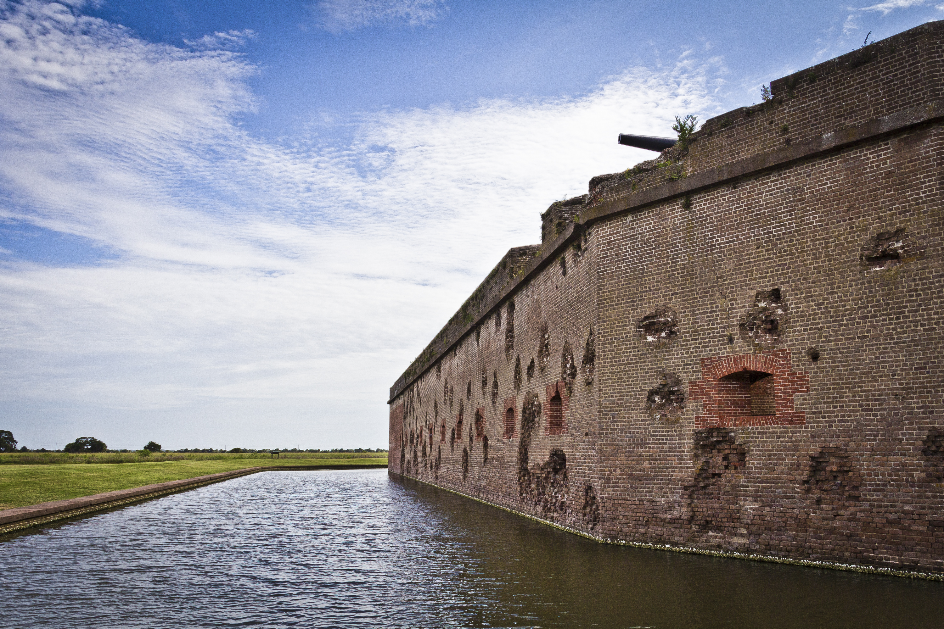
For much of the 19th century, masonry fortifications were the United States’ main defense against overseas enemies. However, during the Civil War, new technology proved its superiority over these fort...
Today the river valley attracts us for so many reasons. Take a solitary walk to enjoy nature’s display, raft leisurely through the rocky shoals with friends, fish the misty waters as the sun comes up,...
20 mi from route
~50 min detour
$5
near mile 254.1
Park data from the National Park Service API. Alerts update every 2 hours.
Fuel & Cost
Regular Gas
$48.02 one way
$96.05 round trip
$3.97/gal25.4 MPG avg107 kg CO2
Fuel Type
$/gal
One Way
Round Trip
midgrade
$4.34
$52.51
$105.02
premium
$4.70
$56.84
$113.68
diesel
$5.61
$67.80
$135.61
No toll roads detected on this route.
Estimated Trip Cost (one way, 1 person)
Fuel
$48
Meals
$25–$50
Total
$73–$98
Rough estimate based on US averages. Hotel $80–$140/night, meals $25–$50/day.
Estimated CO2 emission: 107.4 kg one way.
Prices: EIA weekly data, 2026-04-13.
Driving Electric?
About $32 in charging
· 1 stop
· 66% less CO2
Vehicle Type
kWh
Stops
DC Fast
Home Charge
Average EV
92.1
1
$32.25
$14.74
Efficient EV
76.8
0
$26.87
$12.28
EV Truck/SUV
122.8
1
$42.99
$19.65
Gas CO2
107 kg
EV CO2
36 kg (66% less)
Plan for 1 charging stop. A 30-minute DC fast charge mid-route should be enough to complete the trip comfortably.
DC fast charging avg $0.35/kWh. Home charging avg $0.16/kWh. US grid CO2: 0.39 kg/kWh.
Travel Intel
Current conditions at both ends of the drive.
Forecast data refreshed 5 days ago
Origin
Savannah, GA
Late night
in Savannah on Wednesday
Local time
12:51 AM
EDT
Current temp
65°F
Unavailable
Live forecast
Destination
Cedartown, GA
Late night
in Cedartown on Wednesday
Local time
12:51 AM
EDT
Current temp
89°F
Unavailable
Live forecast
Seasonal Notes
Summer travel usually means heavier construction, hotter rest stops, and busier weekend traffic around major cities.
Winter travel shortens daylight, so a route that looks manageable on paper can feel much longer after dark.
Holiday weekends tend to make both departure and arrival windows slower than the raw route time suggests.
Time zone
Same local time
Origin and destination are on the same clock, so arrival timing is easier to judge at a glance.
Temperature spread
24 degrees warmer at arrival
A meaningful temperature swing is a good cue to rethink layers, water, and how soon you want to arrive.
Road read
5h 53m on the road
An early start around 7-8 AM gets you there with plenty of daylight left.
Weather data from the National Weather Service. Conditions may change; check closer to your travel date.
Frequently Asked Questions
The drive from Savannah, GA to Cedartown, GA covers 307.1 miles and takes about 5h 53m without stops. Add 15-30 minutes for a fuel or rest stop on longer drives.
The main roads are Jim Gillis Historic Savannah Parkway, I 75, Ralph David Abernathy Freeway. Most of the drive stays on highways, so watch for ramps and exits.
This is a comfortable same-day trip.
The midpoint is about 153.5 miles from Savannah, GA. Look for rest areas, gas stations, or food options near the halfway mark.
At current regular gas prices, expect to spend about $48.02 one way. This estimate uses 25.4 MPG — your actual cost will vary with your vehicle's fuel efficiency and current gas prices.
An early start around 7-8 AM gets you there with plenty of daylight left. A late afternoon start means arriving after dark. Morning is better.
Plan about 1 meaningful break for fuel, food, or rest. Plan on a short reset every 3 to 4 hours to stay fresh behind the wheel.
This is a demanding drive. With 19 significant decision points across 307.1 miles, you will need to stay alert — especially through interchange areas and urban stretches. Consider splitting it into segments if you are not comfortable with fast highway navigation.
The main spots that need attention: at 3 miles: Exit ramp - move to the correct lane early. Lane positioning matters here. Multiple destination signs - pick the right one; at 3.2 miles: Highway fork - watch signs carefully. Lane positioning matters here; at 228.6 miles (I 75): Highway fork - watch signs carefully. Lane positioning matters here. Multiple destination signs - pick the right one.
Between Savannah, GA and Cedartown, GA, road signs point toward Birmingham, Augusta and Austell.