Trip from Scottsbluff, NE to Tecumseh, NE

Drive Time

8h 15m

Distance

452.4 mi

728 km

Drive Score

7/10

Good drive

Same Day?

2-day trip

Fuel Cost

$69

one way

EV Charging

Loading...

station data

Best Time to Leave

Save up to 23 min
4 AM
8h 8m ★
6 AM
8h 15m
8 AM
8h 31m
10 AM
8h 21m
12 PM
8h 19m
3 PM
8h 22m
5 PM
8h 30m
8 PM
8h 11m

Estimated drive times based on typical traffic patterns. Actual times may vary with weather, construction, and real-time conditions.

Downtown Scottsbluff, NE, NE

Scottsbluff, NE

Diana GP

Trip Overview

The drive from Scottsbluff, NE to Tecumseh, NE covers 452.4 miles and takes about 8h 15m behind the wheel. It usually feels better as a 2-day road trip than as one long push.

The route leans on I 80, US 26, East Highway 41 for much of the mileage, and the overall profile is highway-focused drive. The longest uninterrupted segment is about 269.8 miles on I 80. At current regular gas prices, budget about $68.71 one way before food or hotel costs.

Trip Pace

Best split across 2 days

Treat the return leg as its own travel day rather than an afterthought.

Break Rhythm

2 planned breaks

Plan on a short reset every 3 to 4 hours to stay fresh behind the wheel.

Midpoint

226.2 miles from Scottsbluff, NE

A natural place for your longest stop of the day , about 4h 15m into the drive .

Drive Character

This is a 8h 15m highway drive covering 452.4 miles, with most of the trip on I 80 and US 26. The longest continuous stretch is about 269.8 miles on I 80.

Most of the miles stay on highways, which makes pacing and fuel planning easier than turn-by-turn city driving.
There are about 30 navigation steps in the underlying route data, so the final approach matters more than the middle miles.
I 80 is the longest continuous segment at about 269.8 miles.

How Hard Is This Drive?

This is a straightforward highway drive that stays mostly on I 80 and US 26. There are only a few real navigation decisions along the way. The trickiest moment comes early in the drive near West 20th Street.

Route Complexity 4/10

Easy - simple navigation with a manageable amount of wheel time

The route itself is not hard, but at 8h 15m, endurance matters. Plan breaks every 2-3 hours. The 16 decision points are all manageable with basic attention.

Where does it get tricky?

The main spots that need attention: near the start (West 20th Street): Navigation decision point; at 8.9 miles (L-79E / Highway L79E): Lane positioning matters here; at 393.4 miles: Exit ramp - move to the correct lane early. Multiple destination signs - pick the right one.

Critical Maneuvers

5 of 16 key points

These are the spots where you need to pay the most attention. Preview them before you drive.

5
0 mi into trip | ~0m in | West 20th Street

Turn left onto West 20th Street

Navigation decision point

5
8.9 mi into trip | ~12m in | L-79E / Highway L79E

Turn right onto L-79E / Highway L79E

Lane positioning matters here

Use the right lane.
6
393.4 mi into trip | ~7h 4m in

Take the exit toward US 77 South, To NE 2: Beatrice, Nebraska City

Exit ramp - move to the correct lane early. Multiple destination signs - pick the right one

Exit 397 Toward US 77 South, To NE 2: Beatrice, Nebraska...
6
402.8 mi into trip | ~7h 16m in | US 77 / US Highway 77

Keep slight right at fork onto US 77 / US Highway 77

Highway fork - watch signs carefully. Lane positioning matters here

Use the straight / slight left lanes.
5
452.4 mi into trip | ~8h 14m in | Clay Street

Turn right onto Clay Street

Navigation decision point

Towns Along This Route

Between Scottsbluff, NE and Tecumseh, NE, road signs point toward To Ne 2: Beatrice and Nebraska City.

To Ne 2: Beatrice

393.4 mi in | ~7h 4m

Nebraska City

393.4 mi in | ~7h 4m

Main Roads

Road Distance Duration
I 80 269.8 mi 4h 33m
US 26 84 mi 1h 39m
East Highway 41 29 mi 33m
US Highway 26 12.5 mi 15m
Highway 92 11 mi 12m
US Highway 77 9.4 mi 10m
Highway 26 7.5 mi 9m
South 12th Street 6.8 mi 7m
Longest stretch: I 80 — 269.8 mi, about 4h 33m

Turn-by-Turn Driving Directions

Step-by-step road directions between Scottsbluff, NE and Tecumseh, NE.

1

Start on Avenue C

54 ft · 7 sec · Avenue C
2

Turn left onto West 20th Street

0.2 mi · 36 sec · West 20th Street
3

Continue on East 20th Street

1.2 mi · 3 min · East 20th Street
4

Turn right onto US 26; N-71; N-92

7.5 mi · 9 min · Highway 26
5

Turn right onto L-79E

2.1 mi · 2 min · Highway L79E
Use the right lane.
6

Turn left onto N-92

11 mi · 12 min · Highway 92
7

Continue on US 26; N-92

13 mi · 15 min · US Highway 26
8

Turn left onto US 26; US 385

1.0 mi · 1 min · Main Street
9

Continue on US 26

84 mi · 1 hr 39 min · US 26
10

Turn right onto North Spruce Street

2.7 mi · 4 min · North Spruce Street
11

Turn left onto US 26; US 30; N-61; I 80 Alt

305 ft · 7 sec · US 26; US 30; N-61; I 80 Alt
12

Turn right onto US 26; N-61

0.9 mi · 1 min · South Highway 26/61
13

Turn left

0.4 mi · 52 sec
Toward I 80 east
14

Merge onto I 80

270 mi · 4 hr 33 min · I 80
15

Take the exit

0.5 mi · 44 sec
Exit 397 Toward US 77 South, To NE 2: Beatrice, Nebraska City
16

Continue on US 77

4.7 mi · 5 min · Homestead Expressway
17

Continue on US 77

4.1 mi · 4 min · US Highway 77
18

Keep slight right at fork onto US 77

1.5 mi · 1 min · US Highway 77
Use the straight / slight left lanes.
19

Continue on US 77

6.8 mi · 7 min · South 12th Street
20

Continue on US 77

3.8 mi · 4 min · US Highway 77
21

Continue on US 77

4.0 mi · 4 min · Highway 77
22

Turn left onto N-41

29 mi · 33 min · East Highway 41
23

Turn right onto N-50

3.0 mi · 3 min · Highway 50
24

Continue on N-50

0.1 mi · 11 sec · North 13th Street
25

Turn straight onto N-50

0.6 mi · 57 sec · North 12th Street
26

Turn right onto Broadway Street

0.7 mi · 1 min · Broadway Street
27

Turn left onto South 3rd Street

493 ft · 23 sec · South 3rd Street
28

Turn right onto Clay Street

191 ft · 13 sec · Clay Street
29

Continue on Clay Street

134 ft · 12 sec · Clay Street
30

Arrive at destination

Clay Street

Trip Plan

Morning Departure

Start early — leave by 6-7 AM to arrive at a reasonable hour.

Evening Departure

This is a long drive — plan for a morning departure or consider splitting it into two days.

This drive is better paced as a 2-day trip.
Plan roughly 2 meaningful breaks for fuel, food, and rest.
The halfway point lands around 226.2 miles from Scottsbluff, NE, or about 4h 15m into the drive.
The longest continuous stretch on this route runs about 269.8 miles.

Consider an overnight stop or starting very early.

Departure

Before you leave

Start with fuel, water, and navigation already sorted so the first hour feels easy.

First stop

Around 100 miles or 2h 1m in

Use this first pause for coffee, a restroom break, and a quick traffic check ahead.

Halfway reset

Around 226.2 miles or 4h 15m in

This is the best place for your longest stop, a real meal, and a full fuel check.

Overnight split

Day 1 wrap after about 226.2 miles or 4h 15m

Stop before fatigue turns the last few hours into a grind. You want day two to start fresh, not just resumed.

Final approach

Final hour starts around 7h 3m

Traffic, exits, and arrival timing usually matter more near Tecumseh, NE than in the middle of the route.

Before You Leave

+

Open the route before leaving Scottsbluff, NE so your first major turns are already loaded.

+

Leave with enough water and a charging cable within reach, not packed away.

+

Check your fuel range against the first long segment, especially if you are starting outside city service areas.

+

Pick one backup stop option before the midpoint in case traffic changes your pacing.

+

Treat this as a 2-day road trip and book the overnight stop before the busiest arrival window.

Day 1

Settle into the route from Scottsbluff, NE

Aim for roughly 226 miles and 4.1 hours of wheel time on this day.

Day 2

Finish the approach into Tecumseh, NE

Aim for roughly 226 miles and 4.1 hours of wheel time on this day.

Your first comfortable stop window is around 100 miles from Scottsbluff, NE.
This route usually feels better as a 2-day drive than as one long push.
Plan about 2 real breaks rather than only quick fuel stops.
The longest stretch is on I 80 for about 269.8 miles.

Where to Stop

Rest stops, refuel points, and overnight suggestions along this route.

Halfway Point

Midpoint

About 226.2 mi from Scottsbluff, NE · 4h 15m into the drive

Downtown Cozad, NE, NE

Mid-route town

Overnight candidate

Cozad, NE

226 mi into the route

Best for: Hotel check-in, dinner, and a fresh start

This lines up well with a realistic day-end stop if you are breaking the drive into stages.

Find hotels in Cozad, NE

Overnight Options

Night 1

Cozad, NE

226 mi · about 4.1h in

A practical overnight split lands near Cozad, NE after about 226 miles or 4.1 hours of driving.

Find hotels

Pacing Suggestions

North Platte, NE

Fuel and coffee

A short stop after about 100 miles helps settle the day before fatigue starts building.

Cozad, NE

Meal break

The midpoint is around 226.2 miles from Scottsbluff, NE, which is a good place for a longer meal and fuel stop.

Overnight split

Hotel stop

For a steadier pace, wrap day one after about 226 miles or 4.1 hours on the road.

Arriving in Tecumseh, NE

The final approach into Tecumseh, NE usually feels slower than the middle of the drive, so avoid planning your tightest schedule at the very end.

Try to arrive with enough fuel left to skip an immediate station stop unless you already know the area around Tecumseh, NE.

On a multi-day trip, keep the last day a little lighter so you reach Tecumseh, NE with some flexibility left in the schedule.

After long uninterrupted mileage, take five minutes before the last urban segment to reset and refocus on exits, merges, and city traffic.

These stop ideas are pacing suggestions — the exact town or exit can change with traffic, hotel plans, and fuel range.

National Parks Near This Route

Worth a detour if your schedule allows.

Scotts Bluff National Monument

Scotts Bluff National Monument

National Monument

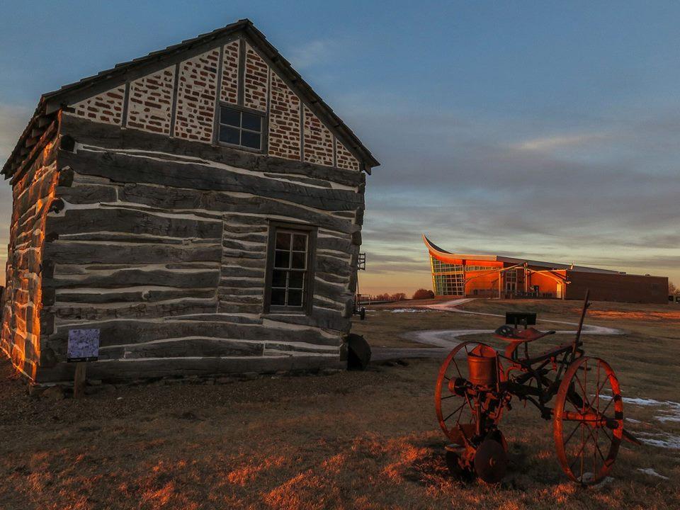
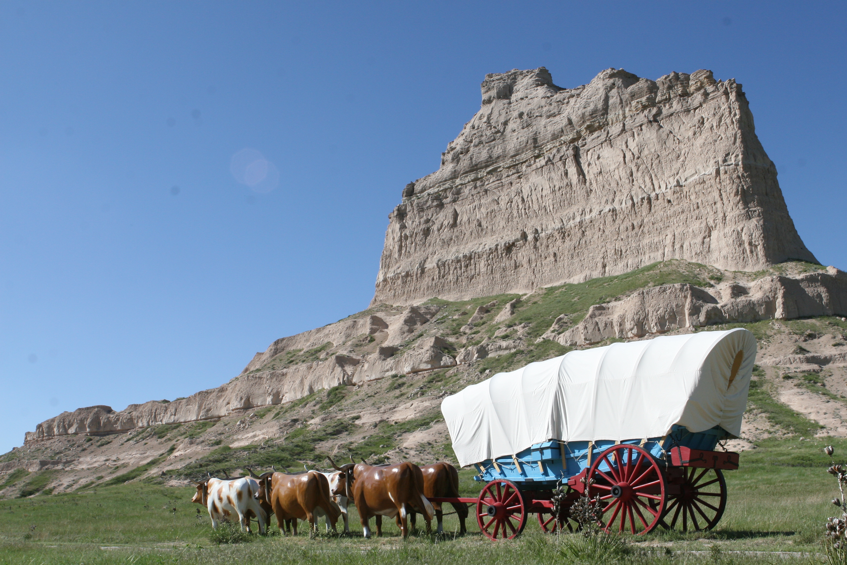
Towering 800 feet above the North Platte River, Scotts Bluff has served as a landmark for peoples from Native Americans to emigrants on the Oregon, California and Mormon Trails to modern travelers. Ri...

3 mi from route ~8 min detour Free
View on nps.gov
Homestead National Historical Park

Homestead National Historical Park

National Historical Park

The Homestead Act of 1862 transformed the world. Millions were invited to file claims including families, women, immigrants, and formerly enslaved people. Over 10 percent of the United States was home...

15 mi from route ~38 min detour Free near mile 421.2
View on nps.gov

Park data from the National Park Service API. Alerts update every 2 hours.

Fuel & Cost

Regular Gas

$68.71 one way

$137.43 round trip

$3.86/gal 25.4 MPG avg 158 kg CO2
Fuel Type $/gal One Way Round Trip
midgrade $4.25 $75.75 $151.50
premium $4.80 $85.40 $170.81
diesel $5.64 $100.51 $201.02

No toll roads detected on this route.

Estimated Trip Cost (one way, 1 person)

Fuel

$69

Hotel (1n)

$80–$140

Meals

$50–$100

Total

$199–$309

Rough estimate based on US averages. Hotel $80–$140/night, meals $25–$50/day.

Estimated CO2 emission: 158.3 kg one way. Prices: EIA weekly data, 2026-04-06.

Driving Electric?

About $48 in charging · 1 stop · 66% less CO2

Vehicle Type kWh Stops DC Fast Home Charge
Average EV 135.7 1 $47.50 $21.72
Efficient EV 113.1 1 $39.58 $18.10
EV Truck/SUV 181 2 $63.34 $28.95

Gas CO2

158 kg

EV CO2

53 kg (66% less)

Plan for 1 charging stop. A 30-minute DC fast charge mid-route should be enough to complete the trip comfortably.

DC fast charging avg $0.35/kWh. Home charging avg $0.16/kWh. US grid CO2: 0.39 kg/kWh.

Travel Intel

Current conditions at both ends of the drive.

Forecast data refreshed 3 days ago

Origin

Scottsbluff, NE

Late night in Scottsbluff on Monday

Local time

5:13 AM

MDT

Current temp

42°F

Unavailable

Live forecast

Destination

Tecumseh, NE

Morning in Tecumseh on Monday

Local time

6:13 AM

CDT

Current temp

49°F

Unavailable

Live forecast

Seasonal Notes

Summer travel usually means heavier construction, hotter rest stops, and busier weekend traffic around major cities.

Winter travel shortens daylight, so a route that looks manageable on paper can feel much longer after dark.

Holiday weekends tend to make both departure and arrival windows slower than the raw route time suggests.

For long drives, weather on day two can matter just as much as conditions at departure, so check the whole travel window rather than only the first day.

Time zone

1 hour later

The destination clock does not match departure time, so double-check hotel check-in windows and late arrival plans.

Temperature spread

7 degrees warmer at arrival

A meaningful temperature swing is a good cue to rethink layers, water, and how soon you want to arrive.

Road read

8h 15m on the road

This is long enough that the arrival forecast matters almost as much as departure conditions. Recheck both ends before you roll.

Weather data from the National Weather Service. Conditions may change; check closer to your travel date.

Frequently Asked Questions

The drive from Scottsbluff, NE to Tecumseh, NE covers 452.4 miles and takes about 8h 15m without stops. Add 15-30 minutes for a fuel or rest stop on longer drives.
The main roads are I 80, US 26, East Highway 41. Most of the drive stays on highways, so watch for ramps and exits.
Consider an overnight stop or starting very early.
Yes. This route is usually more comfortable as a 2-day drive. A sensible stopping point is after roughly 226 miles on day one.
The midpoint is about 226.2 miles from Scottsbluff, NE. Look for rest areas, gas stations, or food options near the halfway mark.
At current regular gas prices, expect to spend about $68.71 one way. This estimate uses 25.4 MPG — your actual cost will vary with your vehicle's fuel efficiency and current gas prices.
Start early — leave by 6-7 AM to arrive at a reasonable hour. This is a long drive — plan for a morning departure or consider splitting it into two days.
Plan about 2 meaningful breaks for fuel, food, or rest. Plan on a short reset every 3 to 4 hours to stay fresh behind the wheel.
The route itself is not hard, but at 8h 15m, endurance matters. Plan breaks every 2-3 hours. The 16 decision points are all manageable with basic attention.
The main spots that need attention: near the start (West 20th Street): Navigation decision point; at 8.9 miles (L-79E / Highway L79E): Lane positioning matters here; at 393.4 miles: Exit ramp - move to the correct lane early. Multiple destination signs - pick the right one.
Between Scottsbluff, NE and Tecumseh, NE, road signs point toward To Ne 2: Beatrice and Nebraska City.

Was this route helpful?

Thanks for your feedback!

Your tip has been submitted. Thanks!

/500

Explore More

More trips to Tecumseh, NE

Explore more options from Scottsbluff, NE or browse trips ending in Tecumseh, NE.

Looking for more statewide routes? Browse NE road trips.

Explore maps for Scottsbluff, NE or Tecumseh, NE on MapSof.net.