
Trip from Shawnee, OK to Lone Grove, OK

Compiled and reviewed by the Trip.ovh planning team at COD Solutions Oy · Last reviewed Apr 18, 2026 · Editorial standards

Drive Time

1h 57m

Distance

94.6 mi

152 km

Drive Score

9/10

Great drive

Same Day?

Yes, doable

Fuel Cost

$15

one way

EV Charging

Unknown

Best Time to Leave

Save up to 25 min
4 AM
1h 49m ★
6 AM
1h 57m
8 AM
2h 14m
10 AM
2h 3m
12 PM
2h 2m
3 PM
2h 4m
5 PM
2h 14m
8 PM
1h 52m

Estimated drive times based on typical traffic patterns. Actual times may vary with weather, construction, and real-time conditions.

Downtown Shawnee, OK, OK

Shawnee, OK

Wikimedia Commons

Downtown Lone Grove, OK, OK

Lone Grove, OK

syd.trgt

Trip Overview

The drive from Shawnee, OK to Lone Grove, OK covers 94.6 miles and takes about 1h 57m behind the wheel. This route is realistic as a one-day drive if you keep your stops efficient.

The route leans on US 177, World War I Veterans Memorial Highway, OK 7 for much of the mileage, and the overall profile is highway-focused drive. The longest uninterrupted segment is about 48.1 miles on US 177. At current regular gas prices, budget about $14.79 one way before food or hotel costs.

Trip Pace

Same-day drive is realistic

A same-day return is realistic if you keep stops short.

Midpoint

47.3 miles from Shawnee, OK

A natural place for your longest stop of the day , about 59m into the drive .

Who Is This Route For?

Weekend Trip

Doable as a same-day drive at 1h 57m. Total distance: 94.6 miles.

Family Friendly

Moderate complexity with 0 natural rest stops along the way.

Solo Traveler

1h 57m drive, comfortable solo distance.

First-Time Driver

Mostly highway driving (66%). Some complex stretches to watch for.

Drive Character

This is a 1h 57m highway drive covering 94.6 miles, with most of the trip on US 177 and World War I Veterans Memorial Highway. The longest continuous stretch is about 48.1 miles on US 177.

Most of the miles stay on highways, which makes pacing and fuel planning easier than turn-by-turn city driving.
There are about 24 navigation steps in the underlying route data, so the final approach matters more than the middle miles.
US 177 is the longest continuous segment at about 48.1 miles.

How Hard Is This Drive?

This is a straightforward highway drive that stays mostly on US 177 and World War I Veterans Memorial Highway. This route has several spots where lane changes, forks, or exits need your full attention. The trickiest moment comes around 26.5 miles in near US 177; OK 59.

Driving Effort 7/10

Demanding - plan breaks and stay ahead of the key maneuvers

Balances navigation complexity with total wheel time.

This drive requires moderate attention. Across 94.6 miles you will encounter 14 spots where lane choice or exit timing matters. Not difficult for experienced highway drivers, but worth previewing the tricky sections before you go.

Where does it get tricky?

The main spots that need attention: at 26.5 miles (US 177; OK 59): Lane positioning matters here; at 59 miles (OK 7): Lane positioning matters here; at 65.6 miles (US 77 / South D Street): Lane positioning matters here.

Critical Maneuvers

5 of 14 key points

These are the spots where you need to pay the most attention. Preview them before you drive.

5
26.5 mi into trip | ~34m in | US 177; OK 59

Turn right onto US 177; OK 59

Lane positioning matters here

Use the straight / right lanes.
5
59 mi into trip | ~1h 13m in | OK 7

Turn right onto OK 7

Lane positioning matters here

Use the straight / right lanes.
6
65.6 mi into trip | ~1h 22m in | US 77 / South D Street

Turn left onto US 77 / South D Street

Lane positioning matters here

Use the straight / left lanes.
8
88.8 mi into trip | ~1h 48m in

Take the exit toward US 70 West: Waurika, Lone Grove

Exit ramp - move to the correct lane early. Lane positioning matters here. Multiple destination signs - pick the right one

Use the straight / slight right lanes. Exit 31B Toward US 70 West: Waurika, Lone Grove
6
94.4 mi into trip | ~1h 56m in | Blackberry Street

Turn right onto Blackberry Street

Lane positioning matters here

Use the straight / right lanes.

Main Roads

Road Distance Duration
US 177 48.1 mi 57m
World War I Veterans Memorial Highway 19.3 mi 19m
OK 7 6.6 mi 9m
West Broadway Street 4.2 mi 5m
Chickasaw Turnpike 3.7 mi 4m
South Gordon Cooper Drive 3.4 mi 6m
OK 3W 2.7 mi 3m
US 77 2.6 mi 3m
Longest stretch: US 177 — 48.1 mi, about 57m

Turn-by-Turn Driving Directions

Step-by-step road directions between Shawnee, OK and Lone Grove, OK.

1

Start on West Main Street

139 ft · 7 sec · West Main Street
2

Turn right onto US 270 Business

0.5 mi · 1 min · South Beard Street
3

Continue on South Gordon Cooper Drive

3.4 mi · 6 min · South Gordon Cooper Drive
4

Take the ramp

0.2 mi · 24 sec
5

Merge onto US 177; US 270; OK 3W

0.2 mi · 15 sec · US 177; US 270; OK 3W
6

Continue on US 177; OK 3W

16 mi · 18 min · US 177; OK 3W
Use the straight / right lanes.
7

Continue on OK 3W; OK 59; US 177

2.7 mi · 3 min · OK 3W; OK 59; US 177
8

Continue on US 177; OK 59

3.2 mi · 4 min · US 177; OK 59
Use the straight / left lanes.
9

Turn right onto US 177; OK 59

28 mi · 34 min · US 177; OK 59
Use the straight / right lanes.
10

Take the ramp onto OK 7 Spur

0.3 mi · 44 sec · OK 7 Spur
11

Merge onto OK 7 Spur

3.7 mi · 4 min · Chickasaw Turnpike
12

Turn right onto OK 7

6.6 mi · 9 min · OK 7
Use the straight / right lanes.
13

Turn left onto US 77

1.1 mi · 1 min · South D Street
Use the straight / left lanes.
14

Continue on US 77

1.0 mi · 1 min · US 77
Use the straight / right lanes.
15

Continue on US 77

1.6 mi · 2 min · US 77
Use the straight / right lanes.
16

Take the ramp

0.3 mi · 34 sec
Use the right lane.
17

Merge onto I 35

19 mi · 19 min · World War I Veterans Memorial Highway
Use the straight / slight right lanes.
18

Take the exit

0.4 mi · 46 sec
Exit 31B Toward US 70 West: Waurika, Lone Grove Use the straight / slight right lanes.
19

Merge onto US 70

4.2 mi · 5 min · West Broadway Street
Use the straight / right lanes.
20

Continue on US 70

0.5 mi · 52 sec · US 70
Use the left / straight lanes.
21

Continue on US 70

0.4 mi · 59 sec · US 70
Use the straight / right lanes.
22

Turn right onto Blackberry Street

0.2 mi · 44 sec · Blackberry Street
Use the straight / right lanes.
23

Turn left onto Ash Street

36 ft · 1 sec · Ash Street
24

Arrive at destination

Ash Street

Trip Plan

Morning Departure

Leave by 9 AM and you'll arrive before lunch.

Evening Departure

Even a 4 PM departure gets you there before dark in summer.

You can normally do this drive in one day.
You may only need one short stretch break if traffic stays light.
The halfway point lands around 47.3 miles from Shawnee, OK, or about 59m into the drive.
The longest continuous stretch on this route runs about 48.1 miles.

This is a comfortable same-day trip.

Departure

Before you leave

Start with fuel, water, and navigation already sorted so the first hour feels easy.

First stop

Around 21 miles or 27m in

Use this first pause for coffee, a restroom break, and a quick traffic check ahead.

Halfway reset

Around 47.3 miles or 59m in

This is the best place for your longest stop, a real meal, and a full fuel check.

Final approach

Final hour starts around 1h 36m

Traffic, exits, and arrival timing usually matter more near Lone Grove, OK than in the middle of the route.

Before You Leave

+

Open the route before leaving Shawnee, OK so your first major turns are already loaded.

Day 1

Settle into the route from Shawnee, OK

This is one driving day of about 94.6 miles and 1h 57m.

Your first comfortable stop window is around 21 miles from Shawnee, OK.
This route can stay practical as a one-day drive if traffic stays reasonable.
The longest stretch is on US 177 for about 48.1 miles.

Where to Stop

Rest stops, refuel points, and overnight suggestions along this route.

Halfway Point

Midpoint

About 47.3 mi from Shawnee, OK · 59m into the drive

Downtown Davis, OK, OK

Mid-route town

Meal stop

Davis, OK

47 mi into the route

Best for: Lunch, fuel, and a longer reset

This sits close to the middle of the route, so it works well for the longest stop of the day.

Pacing Suggestions

Maud, OK

Fuel and coffee

A short stop after about 21 miles helps settle the day before fatigue starts building.

Wynnewood, OK

Meal break

The midpoint is around 47.3 miles from Shawnee, OK, which is a good place for a longer meal and fuel stop.

Arriving in Lone Grove, OK

The final approach into Lone Grove, OK usually feels slower than the middle of the drive, so avoid planning your tightest schedule at the very end.

These stop ideas are pacing suggestions — the exact town or exit can change with traffic, hotel plans, and fuel range.

National Parks Near This Route

Worth a detour if your schedule allows.

Chickasaw National Recreation Area

Chickasaw National Recreation Area

National Recreation Area

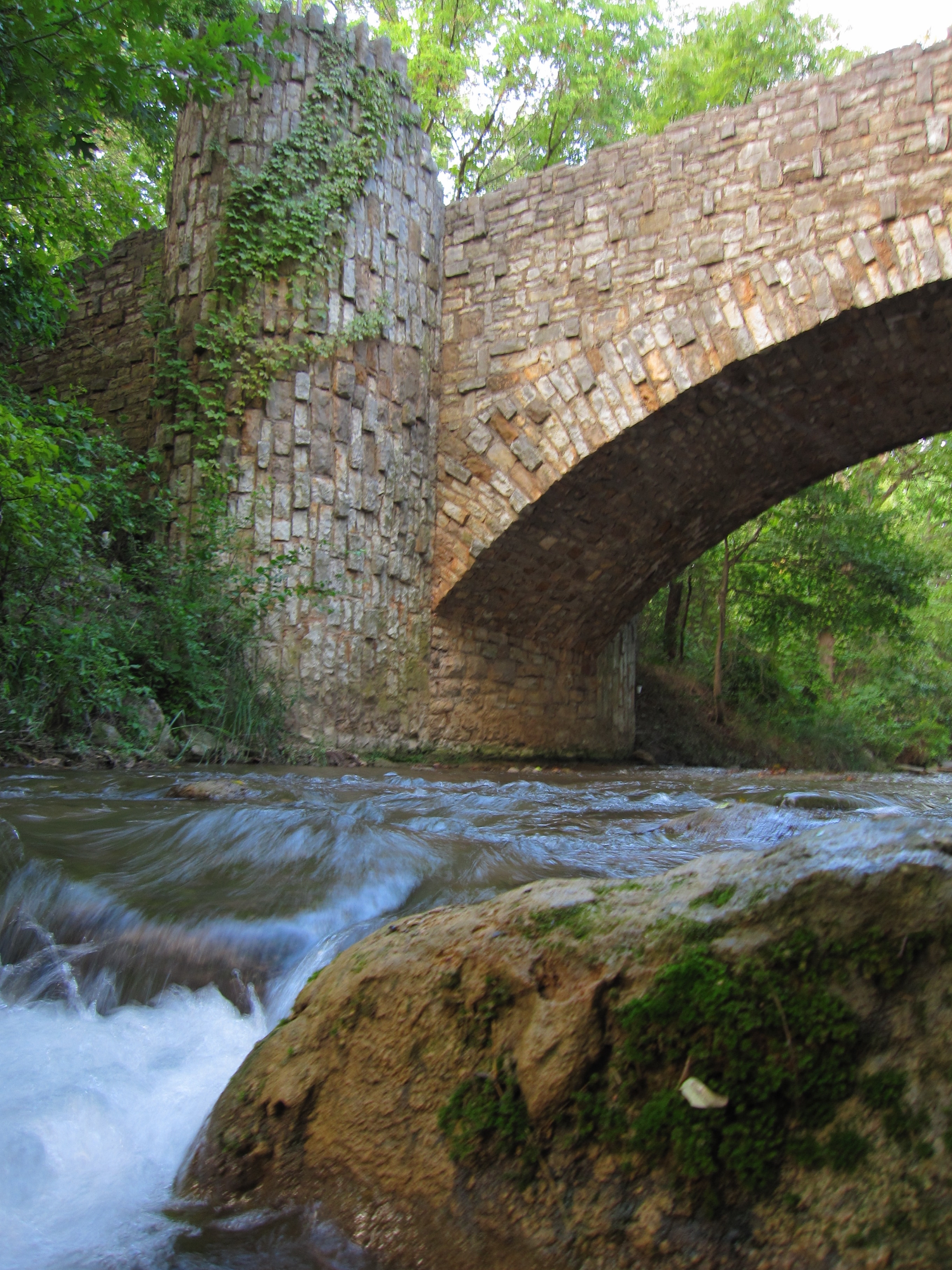
Springs, streams, lakes - whatever its form, water is the attraction at Chickasaw National Recreation Area.

3 mi from route ~9 min detour Free near mile 58.7
View on nps.gov

Park data from the National Park Service API. Alerts update every 2 hours.

Fuel & Cost

Regular Gas

$14.79 one way

$29.58 round trip

$3.97/gal 25.4 MPG avg 33 kg CO2
Fuel Type $/gal One Way Round Trip
midgrade $4.36 $16.24 $32.48
premium $4.89 $18.20 $36.41
diesel $5.61 $20.89 $41.77

Estimated Tolls: $0.26

Chickasaw Turnpike (3.7 mi) $0.26

Toll estimates based on average 2024-2025 rates. EZ-Pass/SunPass discounts may lower the actual cost.

Estimated Trip Cost (one way, 1 person)

Fuel

$15

Tolls

$0

Meals

$25–$50

Total

$40–$65

Rough estimate based on US averages. Hotel $80–$140/night, meals $25–$50/day.

Estimated CO2 emission: 33.1 kg one way. Prices: EIA weekly data, 2026-04-13.

Driving Electric?

About $10 in charging · 0 stops · 67% less CO2

Vehicle Type kWh Stops DC Fast Home Charge
Average EV 28.4 0 $9.93 $4.54
Efficient EV 23.7 0 $8.28 $3.78
EV Truck/SUV 37.8 0 $13.24 $6.05

Gas CO2

33 kg

EV CO2

11 kg (67% less)

This trip is well within single-charge range for most EVs. No charging stops needed if you start fully charged.

DC fast charging avg $0.35/kWh. Home charging avg $0.16/kWh. US grid CO2: 0.39 kg/kWh.

Travel Intel

Current conditions at both ends of the drive.

Forecast as of Apr 15, 2026

Origin

Shawnee, OK

Morning in Shawnee on Saturday

Local time

7:25 AM

CDT

Current temp

74°F

Unavailable

Live forecast

Destination

Lone Grove, OK

Morning in Lone Grove on Saturday

Local time

7:25 AM

CDT

Current temp

57°F

Unavailable

Live forecast

58°F

Davis, OK

47 mi in

Seasonal Notes

Summer travel usually means heavier construction, hotter rest stops, and busier weekend traffic around major cities.

Winter travel shortens daylight, so a route that looks manageable on paper can feel much longer after dark.

Holiday weekends tend to make both departure and arrival windows slower than the raw route time suggests.

Time zone

Same local time

Origin and destination are on the same clock, so arrival timing is easier to judge at a glance.

Temperature spread

17 degrees cooler at arrival

A meaningful temperature swing is a good cue to rethink layers, water, and how soon you want to arrive.

Road read

1h 57m on the road

Use the two city cards together: check the sky where you start, then compare it with the local time and temperature at arrival.

Weather data from the National Weather Service. Conditions may change; check closer to your travel date.

Frequently Asked Questions

The drive from Shawnee, OK to Lone Grove, OK covers 94.6 miles and takes about 1h 57m without stops. Add 15-30 minutes for a fuel or rest stop on longer drives.

The main roads are US 177, World War I Veterans Memorial Highway, OK 7. Most of the drive stays on highways, so watch for ramps and exits.

This is a comfortable same-day trip.

The midpoint is about 47.3 miles from Shawnee, OK. Look for rest areas, gas stations, or food options near the halfway mark.

At current regular gas prices, expect to spend about $14.79 one way. This estimate uses 25.4 MPG — your actual cost will vary with your vehicle's fuel efficiency and current gas prices.

Leave by 9 AM and you'll arrive before lunch. Even a 4 PM departure gets you there before dark in summer.

This drive requires moderate attention. Across 94.6 miles you will encounter 14 spots where lane choice or exit timing matters. Not difficult for experienced highway drivers, but worth previewing the tricky sections before you go.

The main spots that need attention: at 26.5 miles (US 177; OK 59): Lane positioning matters here; at 59 miles (OK 7): Lane positioning matters here; at 65.6 miles (US 77 / South D Street): Lane positioning matters here.

The route from Shawnee, OK to Lone Grove, OK does not surface many named destination signs beyond the main corridor.

Yes. Nearby national parks include Chickasaw National Recreation Area.

How this page is built

Compiled by the Trip.ovh planning team at COD Solutions Oy from open government datasets — OSRM over OpenStreetMap for geometry, EIA for fuel prices, and NPS for national parks. See our methodology for refresh cadence and limitations.

Was this helpful?

Thanks for your feedback!

Your tip has been submitted. Thanks!

/500

Explore More

Return Trip

Lone Grove, OK to Shawnee, OK

Plan the drive back the other way.

97 mi 2h 1m

More trips to Lone Grove, OK

Explore more options from Shawnee, OK or browse trips ending in Lone Grove, OK.

Looking for more statewide routes? Browse OK road trips.