
Trip from Tallulah, LA to Lafayette, LA

Compiled and reviewed by the Trip.ovh planning team at COD Solutions Oy · Last reviewed Apr 17, 2026 · Editorial standards

Drive Time

4h 22m

Distance

235.5 mi

379 km

Drive Score

9/10

Great drive

Same Day?

Yes, doable

Fuel Cost

$36

one way

EV Charging

Unknown

Best Time to Leave

Save up to 40 min
4 AM
4h 10m ★
6 AM
4h 23m
8 AM
4h 50m
10 AM
4h 32m
12 PM
4h 30m
3 PM
4h 34m
5 PM
4h 48m
8 PM
4h 15m

Estimated drive times based on typical traffic patterns. Actual times may vary with weather, construction, and real-time conditions.

Downtown Tallulah, LA, LA

Tallulah, LA

Israyosoy S.

Trip Overview

The drive from Tallulah, LA to Lafayette, LA covers 235.5 miles and takes about 4h 22m behind the wheel. This route is realistic as a one-day drive if you keep your stops efficient.

The route leans on Martin Luther King Jr Drive, Martin Luther King, Jr Highway, I 20 for much of the mileage, and the overall profile is turn-heavy local drive. The longest uninterrupted segment is about 89 miles on Martin Luther King Jr Drive. At current regular gas prices, budget about $35.57 one way before food or hotel costs.

Trip Pace

Same-day drive is realistic

A same-day return is possible, but it will make for a full day on the road.

Break Rhythm

1 planned break

Plan on a short reset every 3 to 4 hours to stay fresh behind the wheel.

Midpoint

117.8 miles from Tallulah, LA

A natural place for your longest stop of the day , about 2h 13m into the drive .

Who Is This Route For?

Weekend Trip

Doable as a same-day drive at 4h 22m. Total distance: 235.5 miles.

Family Friendly

Moderate complexity with 1 natural rest stops along the way.

Solo Traveler

4h 22m drive, comfortable solo distance.

First-Time Driver

Mostly highway driving (28%). Some complex stretches to watch for.

Scenic Drive

Turn-heavy local drive route profile with national parks nearby.

Drive Character

Expect a 4h 22m drive with frequent turns across 235.5 miles of local and secondary roads.

This route has more turning and local-road decision points than a simple highway run.
There are about 17 navigation steps in the underlying route data, so the final approach matters more than the middle miles.
Martin Luther King Jr Drive is the longest continuous segment at about 89 miles.

How Hard Is This Drive?

Expect a hands-on drive with frequent turns and local roads rather than long highway stretches. You will hit about 10 points where you need to pay attention to lane position or signs. The trickiest moment comes around 0.1 miles in near US 65 / North Chestnut Street.

Driving Effort 5/10

Moderate - straightforward overall, but long enough or busy enough to require pacing

Balances navigation complexity with total wheel time.

This drive requires moderate attention. Across 235.5 miles you will encounter 10 spots where lane choice or exit timing matters. Not difficult for experienced highway drivers, but worth previewing the tricky sections before you go.

Where does it get tricky?

The main spots that need attention: at 0.1 miles (US 65 / North Chestnut Street): Navigation decision point; at 53.8 miles: Exit ramp - move to the correct lane early; at 143.1 miles: Navigation decision point.

Critical Maneuvers

5 of 10 key points

These are the spots where you need to pay the most attention. Preview them before you drive.

4
0.1 mi into trip | ~0m in | US 65 / North Chestnut Street

Turn left onto US 65 / North Chestnut Street

Navigation decision point

4
53.8 mi into trip | ~58m in

Take the exit toward US 165 South: Columbia

Exit ramp - move to the correct lane early

Toward US 165 South: Columbia
4
143.1 mi into trip | ~2h 43m in

Turn left toward US 165 North: Monroe

Navigation decision point

Toward US 165 North: Monroe
6
147.5 mi into trip | ~2h 49m in | US 167

Keep slight left at fork onto US 167 toward I 49 South, US 167 South: Opelousas

Highway fork - watch signs carefully. Multiple destination signs - pick the right one

Toward I 49 South, US 167 South: Opelousas
4
234.9 mi into trip | ~4h 21m in | Jefferson Boulevard

Turn right onto Jefferson Boulevard

Navigation decision point

Main Roads

Road Distance Duration
Martin Luther King Jr Drive 89 mi 1h 43m
Martin Luther King, Jr Highway 76 mi 1h 17m
I 20 52.3 mi 56m
Veterans Memorial Expressway 8.8 mi 9m
Pineville Expressway 4.2 mi 5m
Northwest Evangeline Thruway 1.9 mi 3m
Bayou Drive 0.9 mi 1m
US 167 0.8 mi 1m
Longest stretch: Martin Luther King Jr Drive — 89 mi, about 1h 43m

Turn-by-Turn Driving Directions

Step-by-step road directions between Tallulah, LA and Lafayette, LA.

1

Start on US 80

334 ft · 13 sec · East Green Street
2

Turn left onto US 65

0.3 mi · 30 sec · North Chestnut Street
3

Turn slight right onto US 65

0.9 mi · 1 min · Bayou Drive
4

Take the ramp

0.2 mi · 24 sec
5

Merge onto I 20

52 mi · 56 min · I 20
6

Take the exit

0.2 mi · 31 sec
Toward US 165 South: Columbia
7

Merge onto US 165

89 mi · 1 hr 43 min · Martin Luther King Jr Drive
8

Turn left

0.3 mi · 35 sec
Toward US 165 North: Monroe
9

Merge onto US 167

4.2 mi · 5 min · Pineville Expressway
10

Keep slight left at fork onto US 167

0.8 mi · 1 min · US 167
Toward I 49 South, US 167 South: Opelousas
11

Merge onto I 49; US 167; US 71 BYP

76 mi · 1 hr 17 min · Martin Luther King, Jr Highway
12

Continue on I 49; US 167

8.8 mi · 9 min · Veterans Memorial Expressway
13

Continue on I 49; LA 182

1.9 mi · 3 min · Northwest Evangeline Thruway
14

Turn right onto Jefferson Boulevard

0.2 mi · 33 sec · Jefferson Boulevard
15

Continue on Rue Jefferson

0.3 mi · 51 sec · Rue Jefferson
16

Turn right onto Rue Vermilion Ouest

335 ft · 16 sec · Rue Vermilion Ouest
17

Arrive at destination

Rue Vermilion Ouest

Trip Plan

Morning Departure

An early start around 7-8 AM gets you there with plenty of daylight left.

Evening Departure

A late afternoon start means arriving after dark. Morning is better.

You can normally do this drive in one day.
Plan roughly 1 meaningful break for fuel, food, and rest.
The halfway point lands around 117.8 miles from Tallulah, LA, or about 2h 13m into the drive.
The longest continuous stretch on this route runs about 89 miles.

This is a comfortable same-day trip.

Departure

Before you leave

Start with fuel, water, and navigation already sorted so the first hour feels easy.

First stop

Around 52 miles or 56m in

Use this first pause for coffee, a restroom break, and a quick traffic check ahead.

Halfway reset

Around 117.8 miles or 2h 13m in

This is the best place for your longest stop, a real meal, and a full fuel check.

Final approach

Final hour starts around 3h 36m

Traffic, exits, and arrival timing usually matter more near Lafayette, LA than in the middle of the route.

Before You Leave

+

Open the route before leaving Tallulah, LA so your first major turns are already loaded.

+

Leave with enough water and a charging cable within reach, not packed away.

+

Check your fuel range against the first long segment, especially if you are starting outside city service areas.

Day 1

Settle into the route from Tallulah, LA

This is one driving day of about 235.5 miles and 4h 22m.

Your first comfortable stop window is around 52 miles from Tallulah, LA.
This route can stay practical as a one-day drive if traffic stays reasonable.
Plan about 1 real break rather than only quick fuel stops.
The longest stretch is on Martin Luther King Jr Drive for about 89 miles.

Where to Stop

Rest stops, refuel points, and overnight suggestions along this route.

Halfway Point

Midpoint

About 117.8 mi from Tallulah, LA · 2h 13m into the drive

suburb city of Alexandria, located in Rapides Parish, Louisiana

Mid-route town

Meal stop

Pineville, LA

118 mi into the route

Best for: Lunch, fuel, and a longer reset

This sits close to the middle of the route, so it works well for the longest stop of the day.

Popular next leg

Pineville, LA to Lafayette, LA

89.5 mi · 1h 35m

Pacing Suggestions

Monroe, LA

Fuel and coffee

A short stop after about 52 miles helps settle the day before fatigue starts building.

Pineville, LA

Meal break

The midpoint is around 117.8 miles from Tallulah, LA, which is a good place for a longer meal and fuel stop.

Before the longest stretch

Fuel check

Top up before Martin Luther King Jr Drive if your tank is already low. That segment runs about 89 miles.

Arriving in Lafayette, LA

The final approach into Lafayette, LA usually feels slower than the middle of the drive, so avoid planning your tightest schedule at the very end.

Try to arrive with enough fuel left to skip an immediate station stop unless you already know the area around Lafayette, LA.

These stop ideas are pacing suggestions — the exact town or exit can change with traffic, hotel plans, and fuel range.

National Parks Near This Route

Worth a detour if your schedule allows.

Poverty Point National Monument

Poverty Point National Monument

National Monument

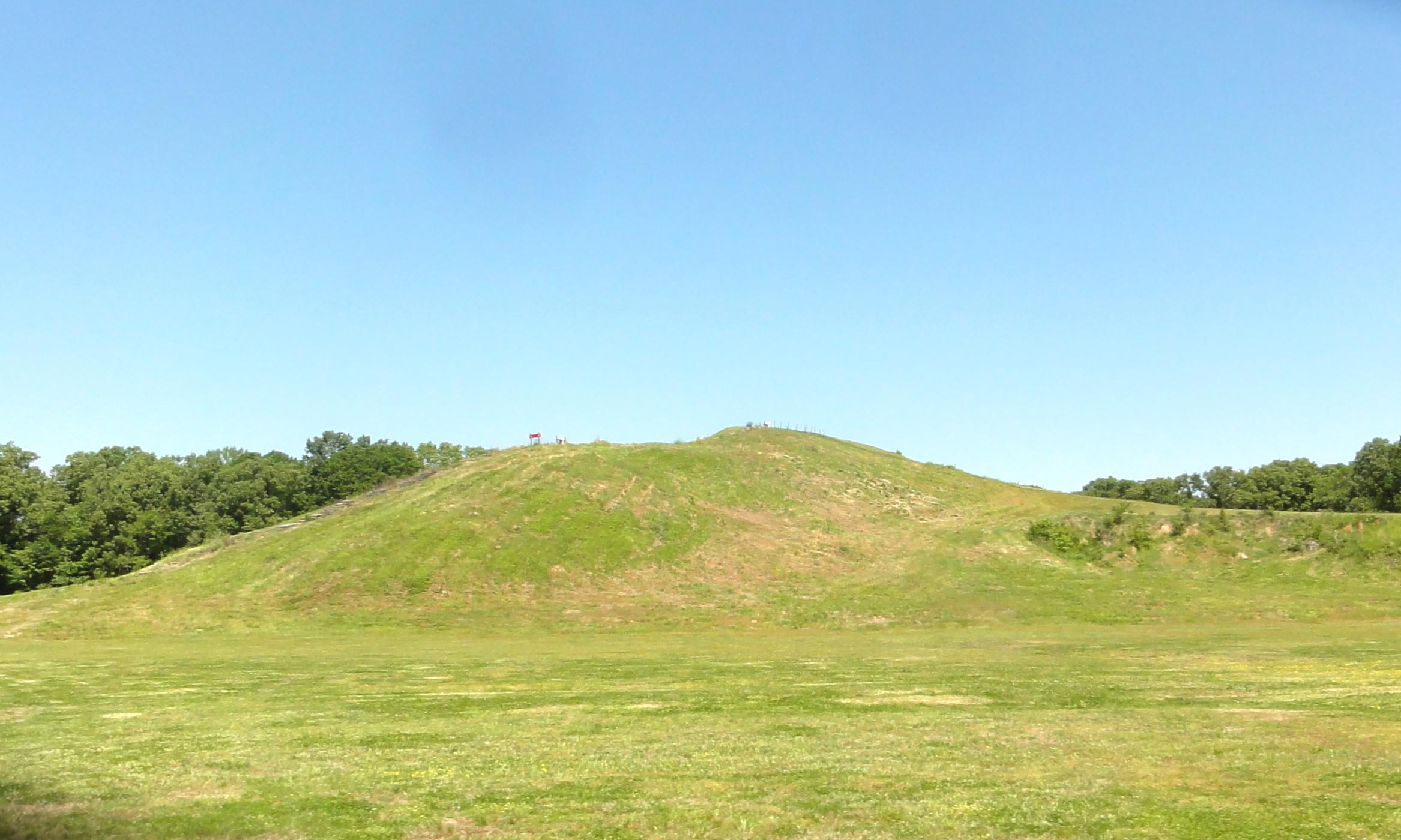
Now a nearly forgotten culture, Poverty Point at its peak 3,000 years ago was part of an enormous trading network that stretched for hundreds of miles across the continent. It was - and is - also an e...

14 mi from route ~36 min detour Free near mile 16.2
View on nps.gov

Park data from the National Park Service API. Alerts update every 2 hours.

Fuel & Cost

Regular Gas

$35.57 one way

$71.13 round trip

$3.84/gal 25.4 MPG avg 82 kg CO2
Fuel Type $/gal One Way Round Trip
midgrade $4.21 $39.04 $78.09
premium $4.56 $42.27 $84.54
diesel $5.61 $52.00 $103.99

Estimated Tolls: $0.13

Northwest Evangeline Thruway (1.9 mi) $0.13

Toll estimates based on average 2024-2025 rates. EZ-Pass/SunPass discounts may lower the actual cost.

Estimated Trip Cost (one way, 1 person)

Fuel

$36

Tolls

$0

Meals

$25–$50

Total

$61–$86

Rough estimate based on US averages. Hotel $80–$140/night, meals $25–$50/day.

Estimated CO2 emission: 82.4 kg one way. Prices: EIA weekly data, 2026-04-13.

Driving Electric?

About $25 in charging · 0 stops · 66% less CO2

Vehicle Type kWh Stops DC Fast Home Charge
Average EV 70.6 0 $24.73 $11.30
Efficient EV 58.9 0 $20.61 $9.42
EV Truck/SUV 94.2 1 $32.97 $15.07

Gas CO2

82 kg

EV CO2

28 kg (66% less)

Plan for 0 charging stops, roughly every 270 miles. Allow 25-40 minutes per stop at a DC fast charger.

DC fast charging avg $0.35/kWh. Home charging avg $0.16/kWh. US grid CO2: 0.39 kg/kWh.

Travel Intel

Current conditions at both ends of the drive.

Forecast as of Apr 13, 2026

Origin

Tallulah, LA

Morning in Tallulah on Friday

Local time

11:09 AM

CDT

Current temp

56°F

Unavailable

Live forecast

Destination

Lafayette, LA

Morning in Lafayette on Friday

Local time

11:09 AM

CDT

Current temp

83°F

Mostly Sunny

S 10 to 15 mph 4% chance Live forecast

Seasonal Notes

Summer travel usually means heavier construction, hotter rest stops, and busier weekend traffic around major cities.

Winter travel shortens daylight, so a route that looks manageable on paper can feel much longer after dark.

Holiday weekends tend to make both departure and arrival windows slower than the raw route time suggests.

Time zone

Same local time

Origin and destination are on the same clock, so arrival timing is easier to judge at a glance.

Temperature spread

27 degrees warmer at arrival

A meaningful temperature swing is a good cue to rethink layers, water, and how soon you want to arrive.

Road read

4h 22m on the road

An early start around 7-8 AM gets you there with plenty of daylight left.

Weather data from the National Weather Service. Conditions may change; check closer to your travel date.

Frequently Asked Questions

The drive from Tallulah, LA to Lafayette, LA covers 235.5 miles and takes about 4h 22m without stops. Add 15-30 minutes for a fuel or rest stop on longer drives.

The main roads are Martin Luther King Jr Drive, Martin Luther King, Jr Highway, I 20. Expect a mix of highway and local road driving.

This is a comfortable same-day trip.

The midpoint is about 117.8 miles from Tallulah, LA. Look for rest areas, gas stations, or food options near the halfway mark.

At current regular gas prices, expect to spend about $35.57 one way. This estimate uses 25.4 MPG — your actual cost will vary with your vehicle's fuel efficiency and current gas prices.

An early start around 7-8 AM gets you there with plenty of daylight left. A late afternoon start means arriving after dark. Morning is better.

Plan about 1 meaningful break for fuel, food, or rest. Plan on a short reset every 3 to 4 hours to stay fresh behind the wheel.

This drive requires moderate attention. Across 235.5 miles you will encounter 10 spots where lane choice or exit timing matters. Not difficult for experienced highway drivers, but worth previewing the tricky sections before you go.

The main spots that need attention: at 0.1 miles (US 65 / North Chestnut Street): Navigation decision point; at 53.8 miles: Exit ramp - move to the correct lane early; at 143.1 miles: Navigation decision point.

The route from Tallulah, LA to Lafayette, LA does not surface many named destination signs beyond the main corridor.

Yes. Nearby national parks include Poverty Point National Monument.

How this page is built

Compiled by the Trip.ovh planning team at COD Solutions Oy from open government datasets — OSRM over OpenStreetMap for geometry, EIA for fuel prices, and NPS for national parks. See our methodology for refresh cadence and limitations.

Was this helpful?

Thanks for your feedback!

Your tip has been submitted. Thanks!

/500

Explore More

Explore more options from Tallulah, LA or browse trips ending in Lafayette, LA.

Looking for more statewide routes? Browse LA road trips.