This nearly 500-mile journey from Tucson to Beaver Dam, Arizona, will take approximately 9 hours and 36 minutes of driving time, making it a solid two-day trip. You'll primarily navigate using the Wickenburg–Kingman Highway and the Las Vegas Freeway, with a portion of the Hoover Dam–Kingman Highway. Given the 25% highway share, expect a drive that's more about local roads than high-speed cruising. With an estimated fuel cost of $99 and two recommended stops, this route offers a chance to explore the Desert Southwest at a manageable pace. Splitting this drive over two days is highly recommended to avoid fatigue and truly enjoy the experience.
Trip Pace
Best split across 2 days
Treat the return leg as its own travel day rather than an afterthought.
Break Rhythm
2 planned breaks
Plan on a short reset every 3 to 4 hours to stay fresh behind the wheel.
Midpoint
247.5 miles from Tucson, AZ
A natural place for your longest stop of the day
, about 4h 52m into the drive
.
Loading map...
Drive Character
This route presents a 'turn-heavy local drive' profile, meaning you'll encounter numerous turns and changes in road type. While 25% of the drive is on highways, a significant portion will be on local roads. The longest uninterrupted stretch you'll experience is 106.7 miles on the Wickenburg–Kingman Highway. Be prepared for a dynamic driving experience that shifts between faster highway segments and more winding local routes as you progress through the Arizona landscape.
This route has more turning and local-road decision points than a simple highway run.
There are about 59 navigation steps in the underlying route data, so the final approach matters more than the middle miles.
Wickenburg–Kingman Highway is the longest continuous segment at about 106.7 miles.
How Hard Is This Drive?
Expect a hands-on drive with frequent turns and local roads rather than long highway stretches. This route has several spots where lane changes, forks, or exits need your full attention. The trickiest moment comes around 127.5 miles in.
Route Complexity10/10
High effort - long or complex enough to need steady focus all day
This is a demanding drive. With 34 significant decision points across 495.1 miles, you will need to stay alert — especially through interchange areas and urban stretches. Consider splitting it into segments if you are not comfortable with fast highway navigation.
Where does it get tricky?
The main spots that need attention: at 127.5 miles: Exit ramp - move to the correct lane early. Lane positioning matters here; at 137.1 miles: Exit ramp - move to the correct lane early. Lane positioning matters here; at 376.9 miles (US 93 BUS): Exit ramp - move to the correct lane early. Lane positioning matters here. Multiple destination signs - pick the right one.
Critical Maneuvers
5 of 34 key points
These are the spots where you need to pay the most attention. Preview them before you drive.
7
127.5 mi into trip|~2h 19m in
Take the exit toward AZ 101 Loop North
Exit ramp - move to the correct lane early. Lane positioning matters here
Use the straight / slight right lanes.
Exit 133B
Toward AZ 101 Loop North
7
137.1 mi into trip|~2h 31m in
Take the exit toward US 60
Exit ramp - move to the correct lane early. Lane positioning matters here
Use the slight right lane.
Exit 11
Toward US 60
8
376.9 mi into trip|~7h 21m in|US 93 BUS
Take the exit onto US 93 BUS toward US 93 BUS North, NV 172 East: Boulder City, Hoover Dam, Lake Mead
Exit ramp - move to the correct lane early. Lane positioning matters here. Multiple destination signs - pick the right one
Use the straight / slight right lanes.
Exit 2
Toward US 93 BUS North, NV 172 East: Boulder Ci...
8
377.1 mi into trip|~7h 22m in|US 93 BUS
Keep slight right at fork onto US 93 BUS toward US 93 BUS North: Boulder City
Highway fork - watch signs carefully. Lane positioning matters here
Use the right lane.
Exit 2
Toward US 93 BUS North: Boulder City
7
404.3 mi into trip|~7h 58m in
Take the exit toward NV 159: Charleston Boulevard
Exit ramp - move to the correct lane early. Lane positioning matters here
Use the slight right lane.
Exit 72
Toward NV 159: Charleston Boulevard
Towns Mentioned on Route Signs
Based on OSRM destination-sign hints, not a full list of every settlement the road passes.
Between Tucson, AZ and Beaver Dam, AZ, road signs point toward Las Vegas, Hoover Dam and Lake Mead.
Las Vegas
305.2 mi in|~5h 57m|via US 93
Hoover Dam
376.9 mi in|~7h 21m|via US 93 BUS
Lake Mead
376.9 mi in|~7h 21m|via US 93 BUS
Main Roads
Road
Distance
Duration
Wickenburg–Kingman Highway
106.7 mi
2h 9m
Las Vegas Freeway
73.3 mi
1h 13m
Hoover Dam–Kingman Highway
66.2 mi
1h 16m
Casa Grande-Tucson Highway
54.5 mi
55m
Phoenix-Casa Grande Highway
38.1 mi
38m
Grand Avenue
27.4 mi
37m
Purple Heart Trail
21.5 mi
21m
Purple Heart Highway
17.6 mi
20m
Longest stretch:
Wickenburg–Kingman Highway
— 106.7 mi, about 2h 9m
Turn-by-Turn Driving Directions
Step-by-step road directions between Tucson, AZ and Beaver Dam, AZ.
1
Start on North Country Club Road
1.0 mi·2 min·North Country Club Road
2
Turn left onto East Speedway Boulevard
3.3 mi·7 min·East Speedway Boulevard
3
Turn right onto North Freeway Road
415 ft·7 sec·North Freeway Road
4
Take the ramp
0.4 mi·47 sec
Toward I 10 West
5
Merge onto I 10
2.5 mi·2 min·North Freeway
Use the straight / slight right lanes.
6
Continue on I 10
3.7 mi·4 min·Casa Grande-Tucson Highway
Use the straight / slight right lanes.
7
Keep slight left at fork onto I 10
51 mi·51 min·Casa Grande-Tucson Highway
Use the straight / slight right lanes.
8
Continue on I 10
38 mi·38 min·Phoenix-Casa Grande Highway
Use the straight / slight right lanes.
9
Continue on I 10
12 mi·13 min·Maricopa Freeway
Use the straight / slight right lanes.
10
Keep slight left at fork onto I 10
2.0 mi·2 min·Papago Freeway
Use the slight left lane.
11
Keep slight left at fork onto I 10
2.7 mi·3 min·Papago Freeway
Use the straight / slight right lanes.
12
Continue on I 10
0.5 mi·36 sec·Dean Lindsey Memorial Tunnel
13
Continue on I 10
10 mi·12 min·Papago Freeway
Use the straight / slight right lanes.
14
Take the exit
0.9 mi·1 min
Exit 133BToward AZ 101 Loop NorthUse the straight / slight right lanes.
15
Continue on AZ 101 Loop
8.8 mi·10 min·Agua Fria Freeway
Use the straight / slight right lanes.
16
Take the exit
0.3 mi·36 sec
Exit 11Toward US 60Use the slight right lane.
17
Turn left onto US 60
20 mi·28 min·Grand Avenue
Use the left / right lanes.
18
Keep slight right at fork onto US 60
159 ft·3 sec·Phoenix–Wickenburg Highway
19
Continue on US 60
0.9 mi·1 min·Grand Avenue
20
Continue on US 60
0.2 mi·15 sec·Phoenix–Wickenburg Highway
21
Continue on US 60
0.1 mi·8 sec·Wickenburg–Phoenix Highway
22
Continue on US 60
6.3 mi·7 min·Grand Avenue
23
Continue on US 60
0.5 mi·31 sec·Phoenix-Wickenburg Highway
24
Continue on US 60
8.7 mi·10 min·Phoenix–Wickenburg Highway
25
Continue on US 60
1.5 mi·2 min·East Wickenburg Way
26
Enter roundabout onto US 93
2 ft·0 sec·Wickenburg–Kingman Highway
27
Continue on US 93
1.2 mi·2 min·Wickenburg–Kingman Highway
28
Keep slight right at fork onto US 93
0.5 mi·1 min·Wickenburg–Kingman Highway
29
Keep slight right at fork onto US 93
0.9 mi·1 min·Wickenburg–Kingman Highway
30
Keep slight right at fork onto US 93
0.9 mi·1 min·Wickenburg–Kingman Highway
31
Enter roundabout onto US 93
100 ft·4 sec·Wickenburg–Kingman Highway
32
Continue on US 93
1.2 mi·2 min·Wickenburg–Kingman Highway
33
Enter roundabout onto US 93
155 ft·6 sec·Wickenburg–Kingman Highway
34
Continue on US 93
0.6 mi·1 min·Wickenburg–Kingman Highway
35
Turn left onto US 93
112 ft·4 sec·Wickenburg–Kingman Highway
36
Keep slight right at fork onto US 93
101 mi·1 hr 58 min·Wickenburg–Kingman Highway
37
Continue on US 93
0.3 mi·23 sec·Wickenburg-Kingman Highway
38
Take the exit onto US 93
0.7 mi·1 min·US 93
Toward I 40 West
39
Merge onto I 40; US 93
22 mi·21 min·Purple Heart Trail
40
Take the exit onto US 93
0.3 mi·42 sec·US 93
Exit 48Toward US 93: Beale Street, Las Vegas
41
Turn slight right onto US 93
222 ft·7 sec·US 93
Exit 48Toward US 93: Beale Street, Las VegasUse the right lane.
42
Merge onto US 93
1.8 mi·2 min·West Beale Street
Use the right lane.
43
Continue on US 93
66 mi·1 hr 16 min·Hoover Dam–Kingman Highway
Use the right lane.
44
Continue on US 93
3.4 mi·4 min·Hoover Dam Bypass
45
Take the exit onto US 93 BUS
0.2 mi·20 sec·US 93 BUS
Exit 2Toward US 93 BUS North, NV 172 East: Boulder City, Hoover Dam, Lake MeadUse the straight / slight right lanes.
46
Keep slight right at fork onto US 93 BUS
6.0 mi·10 min·US 93 BUS
Exit 2Toward US 93 BUS North: Boulder CityUse the right lane.
47
Continue on US 93 BUS
3.6 mi·4 min·Boulder City Parkway
Use the straight / slight right lanes.
48
Continue on I 11; US 93; US 95
18 mi·20 min·Purple Heart Highway
Use the straight / slight right lanes.
49
Take the exit
0.3 mi·30 sec
Exit 72Toward NV 159: Charleston BoulevardUse the slight right lane.
50
Turn right onto NV 159
0.6 mi·1 min·East Charleston Boulevard
51
Turn left onto South Lamb Boulevard
6.8 mi·11 min·South Lamb Boulevard
Use the left lane.
52
Take the ramp
0.4 mi·50 sec
Toward I 15 North: Salt Lake City
53
Merge onto I 15; US 93
73 mi·1 hr 13 min·Las Vegas Freeway
Use the straight / slight right lanes.
54
Continue on I 15
8.1 mi·8 min·Veterans Memorial Highway
55
Take the exit
0.5 mi·53 sec
Exit 8Toward Beaver Dam, Littlefield
56
Turn left onto CR 91
0.6 mi·1 min·Highway 91
57
Turn right
332 ft·26 sec
58
At end of road, turn left
412 ft·30 sec
59
Arrive at destination
Trip Plan
To make the most of this 495.1-mile adventure, plan to split it over two days. Consider departing early on your first day to cover a good portion of the Wickenburg–Kingman Highway. With two recommended stops, you'll have opportunities to refuel and rest. Keep an eye on your fuel levels, especially during the longest stretch of 106.7 miles, as services might be spaced out. A practical tip for this route: familiarize yourself with the specific road numbers for the Wickenburg–Kingman Highway and the Hoover Dam–Kingman Highway before you depart, as GPS can sometimes be less reliable on these less-traveled segments.
Morning Departure
Start early — leave by 6-7 AM to arrive at a reasonable hour.
Evening Departure
This is a long drive — plan for a morning departure or consider splitting it into two days.
This drive is better paced as a 2-day trip.
Plan roughly 2 meaningful breaks for fuel, food, and rest.
The halfway point lands around 247.5 miles from Tucson, AZ, or about 4h 52m into the drive.
The longest continuous stretch on this route runs about 106.7 miles.
Consider an overnight stop or starting very early.
Departure
Before you leave
Start with fuel, water, and navigation already sorted so the first hour feels easy.
First stop
Around 109 miles or 1h 58m in
Use this first pause for coffee, a restroom break, and a quick traffic check ahead.
Halfway reset
Around 247.5 miles or 4h 52m in
This is the best place for your longest stop, a real meal, and a full fuel check.
Overnight split
Day 1 wrap after about 247.5 miles or 4h 52m
Stop before fatigue turns the last few hours into a grind. You want day two to start fresh, not just resumed.
Final approach
Final hour starts around 8h 34m
Traffic, exits, and arrival timing usually matter more near Beaver Dam, AZ than in the middle of the route.
Before You Leave
+
Open the route before leaving Tucson, AZ so your first major turns are already loaded.
+
Leave with enough water and a charging cable within reach, not packed away.
+
Check your fuel range against the first long segment, especially if you are starting outside city service areas.
+
Pick one backup stop option before the midpoint in case traffic changes your pacing.
+
Treat this as a 2-day road trip and book the overnight stop before the busiest arrival window.
Day 1
Settle into the route from Tucson, AZ
Aim for roughly 248 miles and 4.8 hours of wheel time on this day.
Day 2
Finish the approach into Beaver Dam, AZ
Aim for roughly 248 miles and 4.8 hours of wheel time on this day.
Your first comfortable stop window is around 109 miles from Tucson, AZ.
This route usually feels better as a 2-day drive than as one long push.
Plan about 2 real breaks rather than only quick fuel stops.
The longest stretch is on Wickenburg–Kingman Highway for about 106.7 miles.
Where to Stop
Rest stops, refuel points, and overnight suggestions along this route.
Halfway Point
Midpoint
About 247.5 mi from Tucson, AZ
· 4h 52m into the drive
The midpoint is around 247.5 miles from Tucson, AZ, which is a good place for a longer meal and fuel stop.
Overnight split
Hotel stop
For a steadier pace, wrap day one after about 248 miles or 4.8 hours on the road.
Arriving in Beaver Dam, AZ
The final approach into Beaver Dam, AZ usually feels slower than the middle of the drive, so avoid planning your tightest schedule at the very end.
Try to arrive with enough fuel left to skip an immediate station stop unless you already know the area around Beaver Dam, AZ.
On a multi-day trip, keep the last day a little lighter so you reach Beaver Dam, AZ with some flexibility left in the schedule.
After long uninterrupted mileage, take five minutes before the last urban segment to reset and refocus on exits, merges, and city traffic.
These stop ideas are pacing suggestions — the exact town or exit can change with traffic, hotel plans, and fuel range.
National Parks Near This Route
Worth a detour if your schedule allows.
Saguaro National Park
National Park
Tucson, Arizona is home to the nation's largest cacti. The giant saguaro is the universal symbol of the American west. These majestic plants, found only in a small portion of the United States, are pr...
10 mi from route
~25 min detour
$25
Park Closure: Red Hills Visitor Center (TMD) theater closed for repairs
An Ancestral Sonoran Desert People's farming community and "Great House" are preserved at Casa Grande Ruins. Whether a gathering place for people or simply a waypoint marker in an extensive system of...
11 mi from route
~28 min detour
Free
near mile 68.3
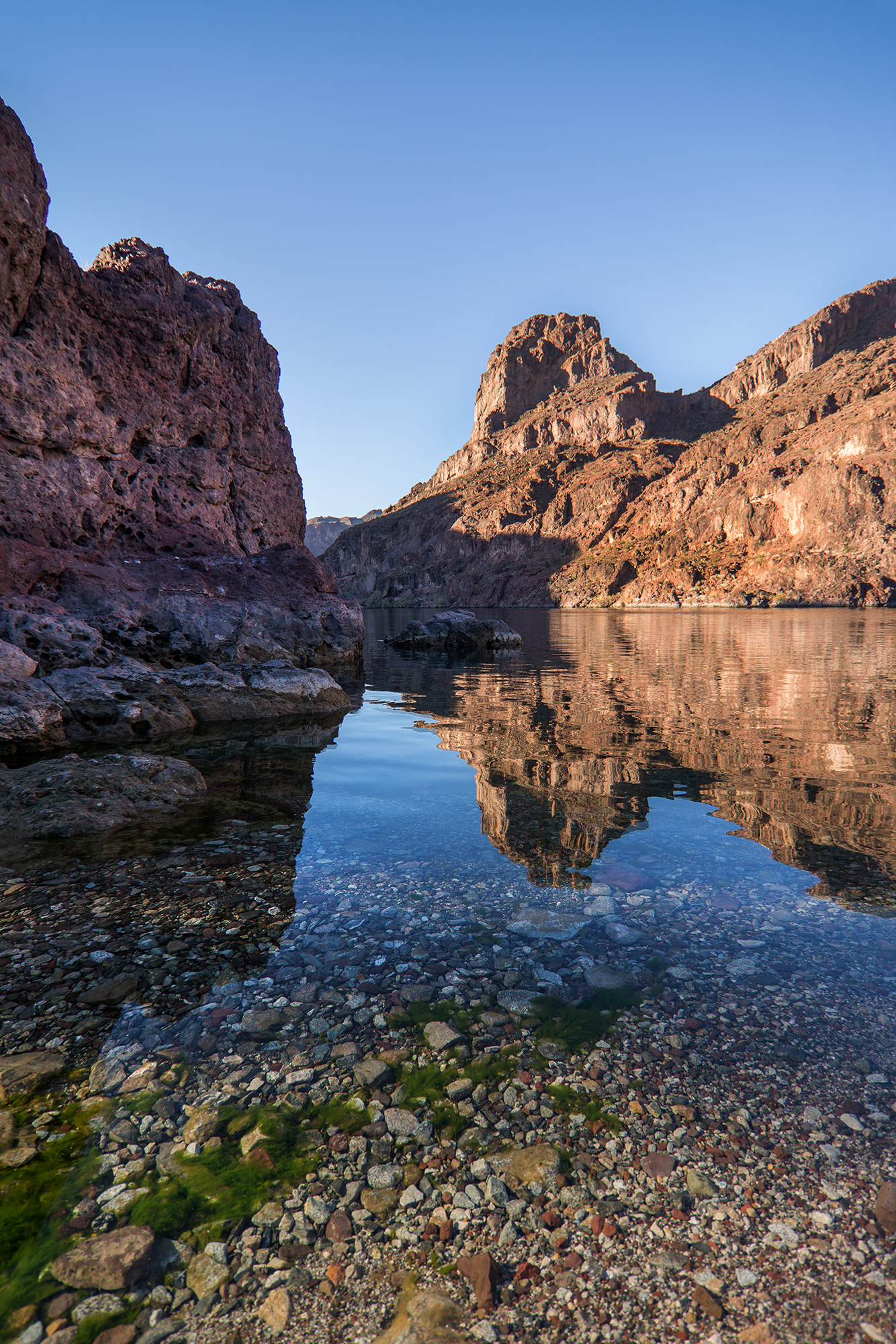
Experience outdoor thrills, striking landscapes, and brilliant blue waters. This year-round recreation area spreads across 1.5 million acres of mountains, canyons, valleys and two vast reservoirs. Vis...
15 mi from route
~38 min detour
$25
near mile 358.5
Park data from the National Park Service API. Alerts update every 2 hours.
Fuel & Cost
Regular Gas
$98.63 one way
$197.26 round trip
$5.06/gal25.4 MPG avg173 kg CO2
Fuel Type
$/gal
One Way
Round Trip
midgrade
$5.36
$104.38
$208.76
premium
$5.59
$108.98
$217.96
diesel
$5.61
$109.31
$218.62
No toll roads detected on this route.
Estimated Trip Cost (one way, 1 person)
Fuel
$99
Hotel (1n)
$80–$140
Meals
$50–$100
Total
$229–$339
Rough estimate based on US averages. Hotel $80–$140/night, meals $25–$50/day.
Estimated CO2 emission: 173.2 kg one way.
Prices: EIA weekly data, 2026-04-13.
Driving Electric?
About $52 in charging
· 1 stop
· 66% less CO2
Vehicle Type
kWh
Stops
DC Fast
Home Charge
Average EV
148.5
1
$51.99
$23.76
Efficient EV
123.8
1
$43.32
$19.80
EV Truck/SUV
198
2
$69.31
$31.69
Gas CO2
173 kg
EV CO2
58 kg (66% less)
Plan for 1 charging stop. A 30-minute DC fast charge mid-route should be enough to complete the trip comfortably.
DC fast charging avg $0.35/kWh. Home charging avg $0.16/kWh. US grid CO2: 0.39 kg/kWh.
Travel Intel
Current conditions at both ends of the drive.
Forecast data refreshed 5 days ago
Origin
Tucson, AZ
Night
in Tucson on Tuesday
Local time
10:32 PM
MST
Current temp
53°F
Unavailable
Live forecast
Destination
Beaver Dam, AZ
Night
in Beaver Dam on Tuesday
Local time
10:32 PM
MST
Current temp
51°F
Unavailable
Live forecast
Seasonal Notes
Summer travel usually means heavier construction, hotter rest stops, and busier weekend traffic around major cities.
Winter travel shortens daylight, so a route that looks manageable on paper can feel much longer after dark.
Holiday weekends tend to make both departure and arrival windows slower than the raw route time suggests.
For long drives, weather on day two can matter just as much as conditions at departure, so check the whole travel window rather than only the first day.
Time zone
Same local time
Origin and destination are on the same clock, so arrival timing is easier to judge at a glance.
Temperature spread
2 degrees cooler at arrival
A meaningful temperature swing is a good cue to rethink layers, water, and how soon you want to arrive.
Road read
9h 36m on the road
This is long enough that the arrival forecast matters almost as much as departure conditions. Recheck both ends before you roll.
Weather data from the National Weather Service. Conditions may change; check closer to your travel date.
Frequently Asked Questions
The drive from Tucson, AZ to Beaver Dam, AZ covers 495.1 miles and takes about 9h 36m without stops. Add 15-30 minutes for a fuel or rest stop on longer drives.
The main roads are Wickenburg–Kingman Highway, Las Vegas Freeway, Hoover Dam–Kingman Highway. Expect a mix of highway and local road driving.
Consider an overnight stop or starting very early.
Yes. This route is usually more comfortable as a 2-day drive. A sensible stopping point is after roughly 248 miles on day one.
The midpoint is about 247.5 miles from Tucson, AZ. Look for rest areas, gas stations, or food options near the halfway mark.
At current regular gas prices, expect to spend about $98.63 one way. This estimate uses 25.4 MPG — your actual cost will vary with your vehicle's fuel efficiency and current gas prices.
Start early — leave by 6-7 AM to arrive at a reasonable hour. This is a long drive — plan for a morning departure or consider splitting it into two days.
Plan about 2 meaningful breaks for fuel, food, or rest. Plan on a short reset every 3 to 4 hours to stay fresh behind the wheel.
This is a demanding drive. With 34 significant decision points across 495.1 miles, you will need to stay alert — especially through interchange areas and urban stretches. Consider splitting it into segments if you are not comfortable with fast highway navigation.
The main spots that need attention: at 127.5 miles: Exit ramp - move to the correct lane early. Lane positioning matters here; at 137.1 miles: Exit ramp - move to the correct lane early. Lane positioning matters here; at 376.9 miles (US 93 BUS): Exit ramp - move to the correct lane early. Lane positioning matters here. Multiple destination signs - pick the right one.
Between Tucson, AZ and Beaver Dam, AZ, road signs point toward Las Vegas, Hoover Dam and Lake Mead.