Utica, NY to Blooming Grove, NY is 187.2 miles and takes about 3h 48m via New York State Thruway, with a fuel budget near $31 and enough daylight to finish in a day. This trip stays within New York, traveling from the Northeast to the Northeast. Expect a route that involves a significant amount of highway driving, but also incorporates local roads as you near your destination. With just one recommended stop and a manageable duration, this is a straightforward drive suitable for a single day.
Trip Pace
Same-day drive is realistic
A same-day return is realistic if you keep stops short.
Break Rhythm
1 planned break
A short stop every 2 to 3 hours is enough for this drive.
Midpoint
93.6 miles from Utica, NY
A natural place for your longest stop of the day
, about 1h 49m into the drive
.
Utica is the heart of the Mohawk Valley and the seat of Oneida County in Central New York State. Utica offers the charm of small-city living balanced with the cultural and ethnic diversity of an international urban center. At the foot of the Adirondack Mountains, Utica is a truly scenic city that offers the pleasures of both a rural and urban setting.
Doable as a same-day drive at 3h 48m. Total distance: 187.2 miles.
Family Friendly
Moderate complexity with 1 natural rest stops along the way.
Solo Traveler
3h 48m drive, comfortable solo distance.
First-Time Driver
Mostly highway driving (1%). Some complex stretches to watch for.
Scenic Drive
Turn-heavy local drive route profile with national parks nearby.
Drive Character
This drive is primarily a highway journey, with the New York State Thruway making up a substantial portion of the route. You'll experience 100% highway driving for the longest stretch of 172.5 miles, offering a consistent pace. As you approach Blooming Grove, the profile shifts to a turn-heavy local drive, incorporating roads like Little Britain Road and Bull Road, which will require your attention. This transition from open highway to more intricate local roads is a key characteristic of this trip.
This route has more turning and local-road decision points than a simple highway run.
There are about 19 navigation steps in the underlying route data, so the final approach matters more than the middle miles.
New York State Thruway is the longest continuous segment at about 172.5 miles.
How Hard Is This Drive?
Expect a hands-on drive with frequent turns and local roads rather than long highway stretches. You will hit about 13 points where you need to pay attention to lane position or signs. The trickiest moment comes around 1.7 miles in.
Driving Effort5/10
Moderate - straightforward overall, but long enough or busy enough to require pacing
Balances navigation complexity with total wheel time.
This drive requires moderate attention. Across 187.2 miles you will encounter 13 spots where lane choice or exit timing matters. Not difficult for experienced highway drivers, but worth previewing the tricky sections before you go.
Where does it get tricky?
The main spots that need attention: at 1.7 miles: Highway fork - watch signs carefully; at 85.7 miles (New York State Thruway): Highway fork - watch signs carefully. Lane positioning matters here. Multiple destination signs - pick the right one; at 174.5 miles: Exit ramp - move to the correct lane early. Multiple destination signs - pick the right one.
Critical Maneuvers
5 of 13 key points
These are the spots where you need to pay the most attention. Preview them before you drive.
5
1.7 mi into trip|~3m in
Keep slight right at fork toward I 90 East
Highway fork - watch signs carefully
Toward I 90 East
8
85.7 mi into trip|~1h 40m in|New York State Thruway
Keep slight right at fork onto New York State Thruway toward I 87 South: New York, Boston
Highway fork - watch signs carefully. Lane positioning matters here. Multiple destination signs - pick the right one
Use the slight right lane.
Toward I 87 South: New York, Boston
6
174.5 mi into trip|~3h 23m in
Take the exit toward I 84, NY 17K, NY 300: Scranton, Newburgh, Stewart Airport
Exit ramp - move to the correct lane early. Multiple destination signs - pick the right one
Exit 17
Toward I 84, NY 17K, NY 300: Scranton, Newburgh...
7
175.3 mi into trip|~3h 24m in
Keep slight left at fork toward I 84 West, NY 300: Scranton, Newburgh
Highway fork - watch signs carefully. Multiple destination signs - pick the right one
Toward I 84 West, NY 300: Scranton, Newburgh
6
175.4 mi into trip|~3h 24m in
Keep slight right at fork toward NY 300: Newburgh
Highway fork - watch signs carefully
Toward NY 300: Newburgh
Towns Mentioned on Route Signs
Based on OSRM destination-sign hints, not a full list of every settlement the road passes.
Between Utica, NY and Blooming Grove, NY, road signs point toward Boston, Newburgh and Stewart Airport.
Boston
85.7 mi in|~1h 40m|via New York State Thruway
Newburgh
174.5 mi in|~3h 23m
Stewart Airport
174.5 mi in|~3h 23m
Main Roads
Road
Distance
Duration
New York State Thruway
172.5 mi
3h 19m
Little Britain Road
3.6 mi
5m
Bull Road
3.1 mi
7m
Union Avenue
2.2 mi
4m
Route 94
1.4 mi
2m
Genesee Street
1.3 mi
2m
East Main Street
0.7 mi
1m
North Street
0.5 mi
1m
Longest stretch:
New York State Thruway
— 172.5 mi, about 3h 19m
Turn-by-Turn Driving Directions
Step-by-step road directions between Utica, NY and Blooming Grove, NY.
1
Start on Washington Lane
63 ft·10 sec·Washington Lane
2
Turn left onto Genesee Street
1.3 mi·2 min·Genesee Street
3
Take the ramp
0.4 mi·49 sec
Toward I 90
4
Keep slight right at fork
0.3 mi·43 sec
Toward I 90 East
5
Merge onto I 90
84 mi·1 hr 36 min·New York State Thruway
6
Keep slight right at fork onto New York State Thruway
89 mi·1 hr 42 min·New York State Thruway
Toward I 87 South: New York, BostonUse the slight right lane.
7
Take the exit
0.7 mi·52 sec
Exit 17Toward I 84, NY 17K, NY 300: Scranton, Newburgh, Stewart Airport
8
Continue on this road
485 ft·11 sec·this road
9
Keep slight left at fork
400 ft·9 sec
Toward I 84 West, NY 300: Scranton, Newburgh
10
Keep slight right at fork
0.2 mi·30 sec
Toward NY 300: Newburgh
11
Turn right onto NY 300
2.2 mi·4 min·Union Avenue
12
At end of road, turn right onto NY 207
3.6 mi·5 min·Little Britain Road
13
Turn left onto Bull Road
3.1 mi·7 min·Bull Road
14
Turn straight onto Toleman Road
0.1 mi·16 sec·Toleman Road
15
Continue on North Street
0.5 mi·1 min·North Street
16
Turn right onto NY 94
0.7 mi·1 min·East Main Street
17
Continue on NY 94
1.4 mi·2 min·Route 94
18
Turn right onto Tuthill Road
0.2 mi·40 sec·Tuthill Road
19
Arrive at destination
Tuthill Road
Trip Plan
Given the 3-hour and 48-minute duration, leaving Utica in the morning should allow you to reach Blooming Grove with ample daylight. The longest stretch on the New York State Thruway is over 170 miles, so plan your fuel stops accordingly before embarking on that segment. While only one stop is suggested, don't hesitate to pull over if you need a break, especially during the turn-heavy local drive portion. Keep an eye out for the transition from the Thruway to local roads; this is where your navigation will become more critical.
Morning Departure
An early start around 7-8 AM gets you there with plenty of daylight left.
Evening Departure
A late afternoon start means arriving after dark. Morning is better.
You can normally do this drive in one day.
Plan roughly 1 meaningful break for fuel, food, and rest.
The halfway point lands around 93.6 miles from Utica, NY, or about 1h 49m into the drive.
The longest continuous stretch on this route runs about 172.5 miles.
This is a comfortable same-day trip.
Departure
Before you leave
Start with fuel, water, and navigation already sorted so the first hour feels easy.
First stop
Around 41 miles or 49m in
Use this first pause for coffee, a restroom break, and a quick traffic check ahead.
Halfway reset
Around 93.6 miles or 1h 49m in
This is the best place for your longest stop, a real meal, and a full fuel check.
Final approach
Final hour starts around 2h 59m
Traffic, exits, and arrival timing usually matter more near Blooming Grove, NY than in the middle of the route.
Before You Leave
+
Open the route before leaving Utica, NY so your first major turns are already loaded.
+
Leave with enough water and a charging cable within reach, not packed away.
+
Check your fuel range against the first long segment, especially if you are starting outside city service areas.
Day 1
Settle into the route from Utica, NY
This is one driving day of about 187.2 miles and 3h 48m.
Your first comfortable stop window is around 41 miles from Utica, NY.
This route can stay practical as a one-day drive if traffic stays reasonable.
Plan about 1 real break rather than only quick fuel stops.
The longest stretch is on New York State Thruway for about 172.5 miles.
Where to Stop
Rest stops, refuel points, and overnight suggestions along this route.
Halfway Point
Midpoint
About 93.6 mi from Utica, NY
· 1h 49m into the drive
The midpoint is around 93.6 miles from Utica, NY, which is a good place for a longer meal and fuel stop.
Before the longest stretch
Fuel check
Top up before New York State Thruway if your tank is already low. That segment runs about 172.5 miles.
Arriving in Blooming Grove, NY
The final approach into Blooming Grove, NY usually feels slower than the middle of the drive, so avoid planning your tightest schedule at the very end.
Try to arrive with enough fuel left to skip an immediate station stop unless you already know the area around Blooming Grove, NY.
After long uninterrupted mileage, take five minutes before the last urban segment to reset and refocus on exits, merges, and city traffic.
These stop ideas are pacing suggestions — the exact town or exit can change with traffic, hotel plans, and fuel range.
National Parks Near This Route
Worth a detour if your schedule allows.
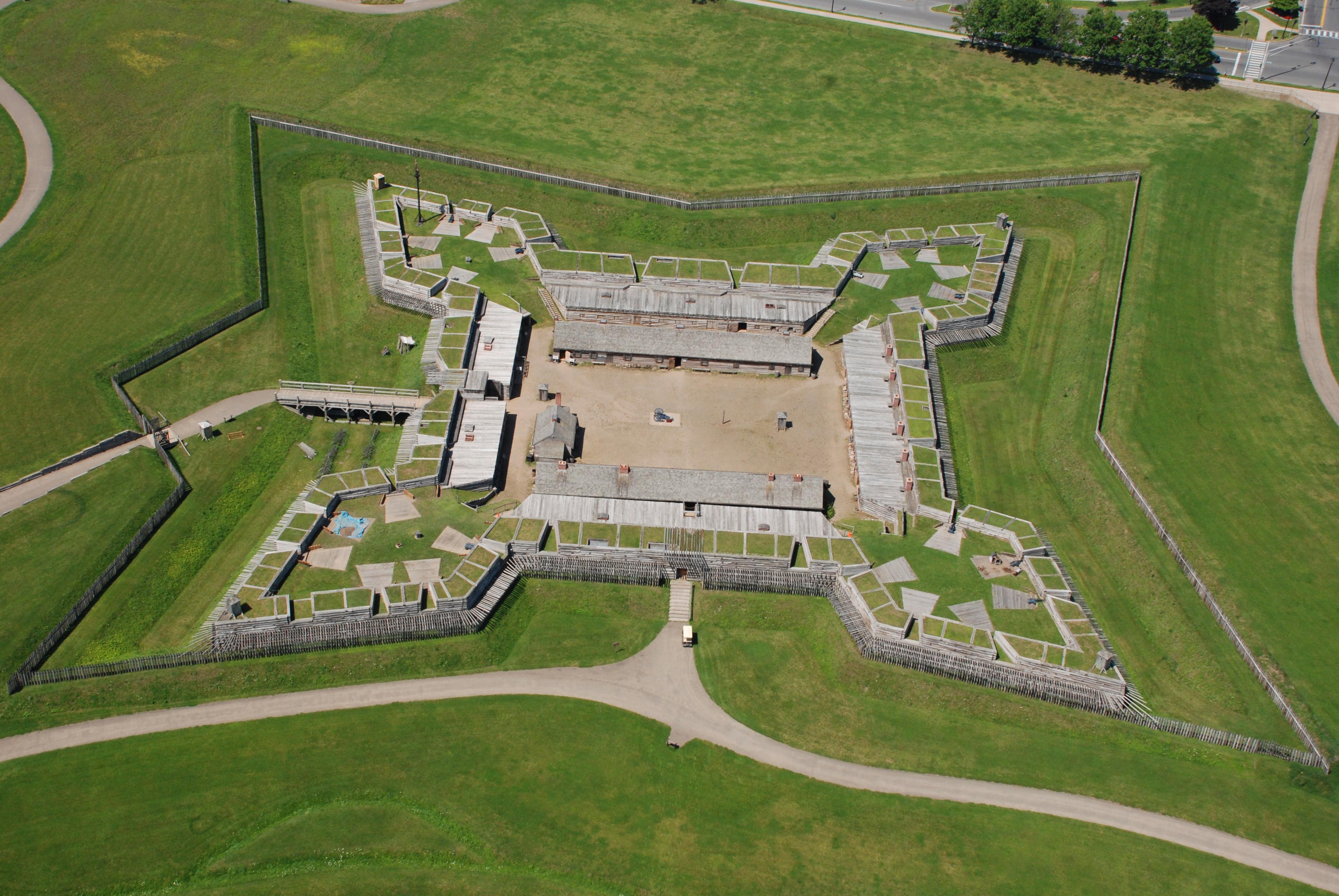
Fort Stanwix National Monument
National Monument
For centuries, the Oneida Carrying Place, a six-mile portage connecting the Mohawk River and Wood Creek, served as a vital link for those traveling by water from the ocean to the Great Lakes. When Eur...
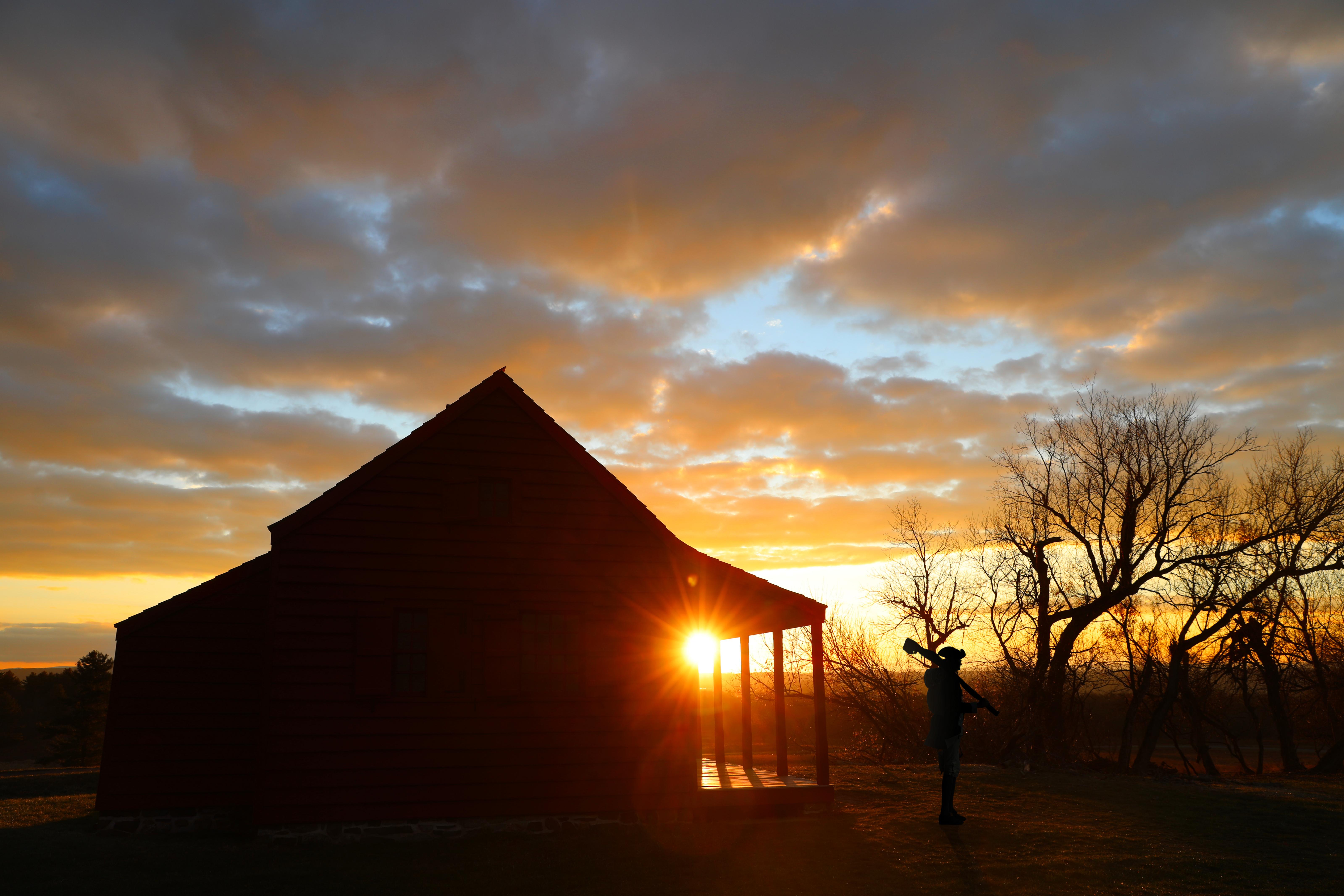
In 1777, a large British invasion force met an equally large American army here at Saratoga. After two intense battles, an eight-mile retreat, and a three-day siege, British General John Burgoyne surr...
Park data from the National Park Service API. Alerts update every 2 hours.
Fuel & Cost
Regular Gas
$30.81 one way
$61.63 round trip
$4.18/gal25.4 MPG avg66 kg CO2
Fuel Type
$/gal
One Way
Round Trip
midgrade
$4.52
$33.32
$66.64
premium
$4.92
$36.28
$72.57
diesel
$5.61
$41.33
$82.66
Estimated Tolls: $8.62
New York State Thruway
(172.5 mi)$8.62
Toll estimates based on average 2024-2025 rates. EZ-Pass/SunPass discounts may lower the actual cost.
Estimated Trip Cost (one way, 1 person)
Fuel
$31
Tolls
$9
Meals
$25–$50
Total
$64–$89
Rough estimate based on US averages. Hotel $80–$140/night, meals $25–$50/day.
Estimated CO2 emission: 65.5 kg one way.
Prices: EIA weekly data, 2026-04-13.
Driving Electric?
About $20 in charging
· 0 stops
· 66% less CO2
Vehicle Type
kWh
Stops
DC Fast
Home Charge
Average EV
56.2
0
$19.66
$8.99
Efficient EV
46.8
0
$16.38
$7.49
EV Truck/SUV
74.9
0
$26.21
$11.98
Gas CO2
65 kg
EV CO2
22 kg (66% less)
This trip is well within single-charge range for most EVs. No charging stops needed if you start fully charged.
DC fast charging avg $0.35/kWh. Home charging avg $0.16/kWh. US grid CO2: 0.39 kg/kWh.
Travel Intel
Current conditions at both ends of the drive.
Forecast as of Apr 15, 2026
Origin
Utica, NY
Evening
in Utica on Friday
Local time
6:59 PM
EDT
Current temp
41°F
Unavailable
Live forecast
Destination
Blooming Grove, NY
Evening
in Blooming Grove on Friday
Local time
6:59 PM
EDT
Current temp
59°F
Unavailable
Live forecast
Seasonal Notes
Summer travel usually means heavier construction, hotter rest stops, and busier weekend traffic around major cities.
Winter travel shortens daylight, so a route that looks manageable on paper can feel much longer after dark.
Holiday weekends tend to make both departure and arrival windows slower than the raw route time suggests.
Time zone
Same local time
Origin and destination are on the same clock, so arrival timing is easier to judge at a glance.
Temperature spread
18 degrees warmer at arrival
A meaningful temperature swing is a good cue to rethink layers, water, and how soon you want to arrive.
Road read
3h 48m on the road
Use the two city cards together: check the sky where you start, then compare it with the local time and temperature at arrival.
Weather data from the National Weather Service. Conditions may change; check closer to your travel date.
Frequently Asked Questions
The drive from Utica, NY to Blooming Grove, NY covers 187.2 miles and takes about 3h 48m without stops. Add 15-30 minutes for a fuel or rest stop on longer drives.
The main roads are New York State Thruway, Little Britain Road, Bull Road. Expect a mix of highway and local road driving.
This is a comfortable same-day trip.
The midpoint is about 93.6 miles from Utica, NY. Look for rest areas, gas stations, or food options near the halfway mark.
At current regular gas prices, expect to spend about $30.81 one way. This estimate uses 25.4 MPG — your actual cost will vary with your vehicle's fuel efficiency and current gas prices.
An early start around 7-8 AM gets you there with plenty of daylight left. A late afternoon start means arriving after dark. Morning is better.
Plan about 1 meaningful break for fuel, food, or rest. A short stop every 2 to 3 hours is enough for this drive.
This drive requires moderate attention. Across 187.2 miles you will encounter 13 spots where lane choice or exit timing matters. Not difficult for experienced highway drivers, but worth previewing the tricky sections before you go.
The main spots that need attention: at 1.7 miles: Highway fork - watch signs carefully; at 85.7 miles (New York State Thruway): Highway fork - watch signs carefully. Lane positioning matters here. Multiple destination signs - pick the right one; at 174.5 miles: Exit ramp - move to the correct lane early. Multiple destination signs - pick the right one.
Between Utica, NY and Blooming Grove, NY, road signs point toward Boston, Newburgh and Stewart Airport.
Yes. Nearby national parks include Fort Stanwix National Monument and Saratoga National Historical Park.
How this page is built
Compiled by the Trip.ovh planning team at COD Solutions Oy from open government datasets — OSRM over OpenStreetMap for geometry, EIA for fuel prices, and NPS for national parks. See our methodology for refresh cadence and limitations.