The drive from Chula Vista, CA to Isla Vista, CA covers 236.8 miles and takes about 4h 40m behind the wheel.
This route is realistic as a one-day drive if you keep your stops efficient.
The route leans on San Diego Freeway, Ventura Freeway, I 405 for much of the mileage,
and the overall profile is highway-focused drive.
The longest uninterrupted segment is about 63 miles on San Diego Freeway.
At current regular gas prices, budget about $54.43 one way before food or hotel costs.
Trip Pace
Same-day drive is realistic
A same-day return is possible, but it will make for a full day on the road.
Break Rhythm
1 planned break
Plan on a short reset every 3 to 4 hours to stay fresh behind the wheel.
Midpoint
118.4 miles from Chula Vista, CA
A natural place for your longest stop of the day
, about 2h 19m into the drive
.
Who Is This Route For?
Weekend Trip
Doable as a same-day drive at 4h 40m. Total distance: 236.8 miles.
Family Friendly
Moderate complexity with 1 natural rest stops along the way.
Solo Traveler
4h 40m drive, comfortable solo distance.
First-Time Driver
Mostly highway driving (82%). Some complex stretches to watch for.
Drive Character
This is a 4h 40m highway drive covering 236.8 miles, with most of the trip on San Diego Freeway and Ventura Freeway. The longest continuous stretch is about 63 miles on San Diego Freeway.
Most of the miles stay on highways, which makes pacing and fuel planning easier than turn-by-turn city driving.
There are about 28 navigation steps in the underlying route data, so the final approach matters more than the middle miles.
San Diego Freeway is the longest continuous segment at about 63 miles.
How Hard Is This Drive?
This is a straightforward highway drive that stays mostly on San Diego Freeway and Ventura Freeway. This route has several spots where lane changes, forks, or exits need your full attention. The trickiest moment comes around 1 miles in.
Driving Effort10/10
High effort - long or complex enough to need steady focus all day
Balances navigation complexity with total wheel time.
This is a demanding drive. With 23 significant decision points across 236.8 miles, you will need to stay alert - especially through interchange areas and urban stretches. Consider splitting it into segments if you are not comfortable with fast highway navigation.
Where does it get tricky?
The main spots that need attention: at 1 miles: Lane positioning matters here; at 1.5 miles: Exit ramp - move to the correct lane early. Lane positioning matters here; at 1.7 miles: Highway fork - watch signs carefully. Lane positioning matters here.
Critical Maneuvers
5 of 23 key points
These are the spots where you need to pay the most attention. Preview them before you drive.
7
1 mi into trip|~2m in
Take the ramp toward CA 54 East
Lane positioning matters here
Use the right lane.
Toward CA 54 East
8
1.5 mi into trip|~2m in
Take the exit toward I 805
Exit ramp - move to the correct lane early. Lane positioning matters here
Use the straight / slight right lanes.
Exit 2
Toward I 805
7
1.7 mi into trip|~3m in
Keep slight left at fork toward I 805 North
Highway fork - watch signs carefully. Lane positioning matters here
Use the straight / slight right lanes.
Toward I 805 North
7
75.5 mi into trip|~1h 30m in|CA 73 / San Joaquin Hills Transportation Corridor
Keep slight right at fork onto CA 73 / San Joaquin Hills Transportation Corridor toward CA 73 North: Long Beach
Highway fork - watch signs carefully. Lane positioning matters here
Use the straight / slight right lanes.
Toward CA 73 North: Long Beach
8
145.7 mi into trip|~2h 51m in
Take the exit toward US 101 North, US 101 South: Ventura, Los Angeles
Exit ramp - move to the correct lane early. Lane positioning matters here. Multiple destination signs - pick the right one
Use the slight right lane.
Exit 63B
Toward US 101 North, US 101 South: Ventura, Los...
Towns Mentioned on Route Signs
Based on OSRM destination-sign hints, not a full list of every settlement the road passes.
On the drive from Chula Vista, CA to Isla Vista, CA, road signs begin pointing toward Los Angeles along the way.
Los Angeles
145.7 mi in|~2h 51m
Main Roads
Road
Distance
Duration
San Diego Freeway
63 mi
1h 13m
Ventura Freeway
46.9 mi
54m
I 405
42.5 mi
49m
El Camino Real
22 mi
25m
Jacob Dekema Freeway
18.7 mi
21m
US 101
18.5 mi
21m
San Joaquin Hills Transportation Corridor
14.1 mi
16m
Corona Del Mar Freeway
4 mi
4m
Longest stretch:
San Diego Freeway
— 63 mi, about 1h 13m
Turn-by-Turn Driving Directions
Step-by-step road directions between Chula Vista, CA and Isla Vista, CA.
1
Start on F Street
52 ft·3 sec·F Street
2
Turn left onto 4th Avenue
0.9 mi·1 min·4th Avenue
Use the left lane.
3
Continue on Highland Avenue
478 ft·10 sec·Highland Avenue
4
Take the ramp
0.2 mi·24 sec
Toward CA 54 EastUse the right lane.
5
Merge onto CA 54
0.3 mi·19 sec·South Bay Freeway
6
Take the exit
0.2 mi·23 sec
Exit 2Toward I 805Use the straight / slight right lanes.
7
Keep slight left at fork
0.8 mi·1 min
Toward I 805 NorthUse the straight / slight right lanes.
The midpoint is around 118.4 miles from Chula Vista, CA, which is a good place for a longer meal and fuel stop.
Before the longest stretch
Fuel check
Top up before San Diego Freeway if your tank is already low. That segment runs about 63 miles.
Arriving in Isla Vista, CA
The final approach into Isla Vista, CA usually feels slower than the middle of the drive, so avoid planning your tightest schedule at the very end.
Try to arrive with enough fuel left to skip an immediate station stop unless you already know the area around Isla Vista, CA.
These stop ideas are pacing suggestions — the exact town or exit can change with traffic, hotel plans, and fuel range.
National Parks Near This Route
Worth a detour if your schedule allows.
Santa Monica Mountains National Recreation Area
National Recreation Area
The Santa Monica Mountains offer easy access to surprisingly wild places. Experience the famous beaches of Malibu or explore more than 500 miles of trails. The park abounds with historical and cultura...
4 mi from route
~9 min detour
Free
near mile 163.3
In 1542, Juan Rodriguez Cabrillo climbed out of his boat and onto shore, becoming the first European to set foot on what is now the West Coast of the United States. Cabrillo National Monument not only...
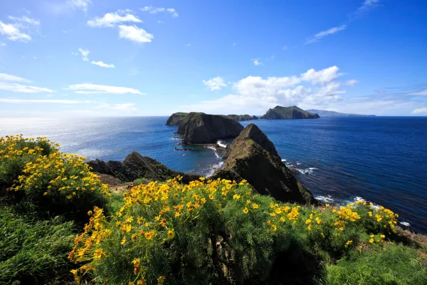
Channel Islands National Park encompasses five remarkable islands and their ocean environment, preserving and protecting a wealth of natural and cultural resources. Isolation over thousands of years h...
30 mi from route
~74 min detour
Free
near mile 236.8
Park data from the National Park Service API. Alerts update every 2 hours.
Fuel & Cost
Regular Gas
$54.43 one way
$108.85 round trip
$5.84/gal25.4 MPG avg83 kg CO2
Fuel Type
$/gal
One Way
Round Trip
midgrade
$6.02
$56.09
$112.17
premium
$6.18
$57.59
$115.17
diesel
$5.61
$52.28
$104.56
No toll roads detected on this route.
Estimated Trip Cost (one way, 1 person)
Fuel
$54
Meals
$25–$50
Total
$79–$104
Rough estimate based on US averages. Hotel $80–$140/night, meals $25–$50/day.
Estimated CO2 emission: 82.9 kg one way.
Prices: EIA weekly data, 2026-04-13.
Driving Electric?
About $25 in charging
· 0 stops
· 66% less CO2
Vehicle Type
kWh
Stops
DC Fast
Home Charge
Average EV
71
0
$24.86
$11.37
Efficient EV
59.2
0
$20.72
$9.47
EV Truck/SUV
94.7
1
$33.15
$15.16
Gas CO2
83 kg
EV CO2
28 kg (66% less)
Plan for 0 charging stops, roughly every 270 miles. Allow 25-40 minutes per stop at a DC fast charger.
DC fast charging avg $0.35/kWh. Home charging avg $0.16/kWh. US grid CO2: 0.39 kg/kWh.
Travel Intel
Current conditions at both ends of the drive.
Forecast as of Apr 15, 2026
Origin
Chula Vista, CA
Evening
in Chula Vista on Thursday
Local time
7:02 PM
PDT
Current temp
56°F
Unavailable
Live forecast
Destination
Isla Vista, CA
Evening
in Isla Vista on Thursday
Local time
7:02 PM
PDT
Current temp
75°F
Unavailable
Live forecast
Seasonal Notes
Summer travel usually means heavier construction, hotter rest stops, and busier weekend traffic around major cities.
Winter travel shortens daylight, so a route that looks manageable on paper can feel much longer after dark.
Holiday weekends tend to make both departure and arrival windows slower than the raw route time suggests.
Time zone
Same local time
Origin and destination are on the same clock, so arrival timing is easier to judge at a glance.
Temperature spread
19 degrees warmer at arrival
A meaningful temperature swing is a good cue to rethink layers, water, and how soon you want to arrive.
Road read
4h 40m on the road
An early start around 7-8 AM gets you there with plenty of daylight left.
Weather data from the National Weather Service. Conditions may change; check closer to your travel date.
Frequently Asked Questions
The drive from Chula Vista, CA to Isla Vista, CA covers 236.8 miles and takes about 4h 40m without stops. Add 15-30 minutes for a fuel or rest stop on longer drives.
The main roads are San Diego Freeway, Ventura Freeway, I 405. Most of the drive stays on highways, so watch for ramps and exits.
This is a comfortable same-day trip.
The midpoint is about 118.4 miles from Chula Vista, CA. Look for rest areas, gas stations, or food options near the halfway mark.
At current regular gas prices, expect to spend about $54.43 one way. This estimate uses 25.4 MPG — your actual cost will vary with your vehicle's fuel efficiency and current gas prices.
An early start around 7-8 AM gets you there with plenty of daylight left. A late afternoon start means arriving after dark. Morning is better.
Plan about 1 meaningful break for fuel, food, or rest. Plan on a short reset every 3 to 4 hours to stay fresh behind the wheel.
This is a demanding drive. With 23 significant decision points across 236.8 miles, you will need to stay alert - especially through interchange areas and urban stretches. Consider splitting it into segments if you are not comfortable with fast highway navigation.
The main spots that need attention: at 1 miles: Lane positioning matters here; at 1.5 miles: Exit ramp - move to the correct lane early. Lane positioning matters here; at 1.7 miles: Highway fork - watch signs carefully. Lane positioning matters here.
On the drive from Chula Vista, CA to Isla Vista, CA, road signs begin pointing toward Los Angeles along the way.
Yes. Nearby national parks include Santa Monica Mountains National Recreation Area, Cabrillo National Monument and Channel Islands National Park.