The drive from Concord, NC to Buxton, NC covers 360.2 miles and takes about 7h 51m behind the wheel.
This route is realistic as a one-day drive if you keep your stops efficient.
The route leans on US 64, NC 49, United States Highway 64 East for much of the mileage,
and the overall profile is highway-focused drive.
The longest uninterrupted segment is about 133.9 miles on US 64.
At current regular gas prices, budget about $56.33 one way before food or hotel costs.
Trip Pace
Same-day drive is realistic
A same-day return is possible, but it will make for a full day on the road.
Break Rhythm
2 planned breaks
Plan on a short reset every 3 to 4 hours to stay fresh behind the wheel.
Midpoint
180.1 miles from Concord, NC
A natural place for your longest stop of the day
, about 3h 52m into the drive
.
Who Is This Route For?
Weekend Trip
Doable as a same-day drive at 7h 51m. Total distance: 360.2 miles.
Family Friendly
Moderate complexity with 2 natural rest stops along the way.
Solo Traveler
7h 51m drive, plan rest stops for pacing.
Drive Character
This is a 7h 51m highway drive covering 360.2 miles, with most of the trip on US 64 and NC 49. The longest continuous stretch is about 133.9 miles on US 64.
Most of the miles stay on highways, which makes pacing and fuel planning easier than turn-by-turn city driving.
There are about 31 navigation steps in the underlying route data, so the final approach matters more than the middle miles.
US 64 is the longest continuous segment at about 133.9 miles.
How Hard Is This Drive?
This is a straightforward highway drive that stays mostly on US 64 and NC 49. This route has several spots where lane changes, forks, or exits need your full attention. The trickiest moment comes around 84.1 miles in near US 64.
Driving Effort8/10
Demanding - plan breaks and stay ahead of the key maneuvers
Balances navigation complexity with total wheel time.
This is a demanding drive. With 18 significant decision points across 360.2 miles, you will need to stay alert - especially through interchange areas and urban stretches. Consider splitting it into segments if you are not comfortable with fast highway navigation.
Where does it get tricky?
The main spots that need attention: at 84.1 miles (US 64): Highway fork - watch signs carefully. Lane positioning matters here; at 111 miles (US 64): Exit ramp - move to the correct lane early. Multiple destination signs - pick the right one; at 114.6 miles (US 64): Exit ramp - move to the correct lane early. Lane positioning matters here. Multiple destination signs - pick the right one.
Critical Maneuvers
5 of 18 key points
These are the spots where you need to pay the most attention. Preview them before you drive.
6
84.1 mi into trip|~2h in|US 64
Keep slight left at fork onto US 64
Highway fork - watch signs carefully. Lane positioning matters here
Use the straight lane.
6
111 mi into trip|~2h 35m in|US 64
Take the exit onto US 64 toward US 1 North, US 64 East: Raleigh
Exit ramp - move to the correct lane early. Multiple destination signs - pick the right one
Exit 404B
Toward US 1 North, US 64 East: Raleigh
8
114.6 mi into trip|~2h 40m in|US 64
Take the exit onto US 64 toward I 40 East, US 64 East: Benson, Rocky Mount
Exit ramp - move to the correct lane early. Lane positioning matters here. Multiple destination signs - pick the right one
Use the slight right lane.
Exit 1A
Toward I 40 East, US 64 East: Benson, Rocky Mou...
6
123 mi into trip|~2h 50m in|I 87; I 440; US 64
Keep slight left at fork onto I 87; I 440; US 64 toward I 87 North, I 440 East, US 64 East: Rocky Mount
Highway fork - watch signs carefully. Multiple destination signs - pick the right one
Toward I 87 North, I 440 East, US 64 East: Rock...
8
125.8 mi into trip|~2h 53m in|I 87; US 64
Keep slight right at fork onto I 87; US 64 toward I 87 North, US 64 East, US 264 East: Rocky Mount, Wilson, Greenville
Highway fork - watch signs carefully. Lane positioning matters here. Multiple destination signs - pick the right one
Use the slight right lane.
Toward I 87 North, US 64 East, US 264 East: Roc...
Towns Mentioned on Route Signs
Based on OSRM destination-sign hints, not a full list of every settlement the road passes.
Between Concord, NC and Buxton, NC, road signs point toward Rocky Mount, Wilson and Greenville.
Rocky Mount
114.6 mi in|~2h 40m|via US 64
Wilson
125.8 mi in|~2h 53m|via I 87; US 64
Greenville
125.8 mi in|~2h 53m|via I 87; US 64
Main Roads
Road
Distance
Duration
US 64
133.9 mi
2h 39m
NC 49
41.1 mi
54m
United States Highway 64 East
40.5 mi
49m
NC 12
24.6 mi
42m
Jordan Road
24.3 mi
35m
Cape Hatteras National Park Road
23.6 mi
33m
US 64 ALT
20.2 mi
28m
I 87
20 mi
21m
Longest stretch:
US 64
— 133.9 mi, about 2h 39m
Turn-by-Turn Driving Directions
Step-by-step road directions between Concord, NC and Buxton, NC.
1
Start on Spring Street Southwest
0.1 mi·21 sec·Spring Street Southwest
2
Turn left onto Corban Avenue Southwest
0.2 mi·24 sec·Corban Avenue Southwest
3
Continue on NC 73
3.9 mi·6 min·Corban Avenue Southeast
Use the right lane.
4
Continue on NC 73
3.8 mi·5 min·NC 73
Use the straight / right lanes.
5
Take the ramp
0.2 mi·35 sec
6
Merge onto NC 49
41 mi·53 min·NC 49
Use the straight lane.
7
Continue on NC 49
0.2 mi·38 sec·NC 49
8
Continue on US 64 BUS; NC 49
3.5 mi·6 min·West Dixie Drive
Use the straight / right lanes.
9
Continue on US 64 BUS; NC 49
7.1 mi·10 min·Richard K. Pugh Highway
Use the straight / right lanes.
10
Continue on US 64; NC 49
24 mi·35 min·Jordan Road
Use the straight / right lanes.
11
Keep slight left at fork onto US 64
27 mi·35 min·US 64
Use the straight lane.
12
Take the exit onto US 64
0.5 mi·1 min·US 64
Exit 404BToward US 1 North, US 64 East: Raleigh
13
Merge onto US 1; US 64
3.1 mi·3 min·Claude E. Pope Memorial Highway
14
Take the exit onto US 64
0.6 mi·1 min·US 64
Exit 1AToward I 40 East, US 64 East: Benson, Rocky MountUse the slight right lane.
15
Merge onto I 40; US 64
4.6 mi·5 min·Dan K Moore Freeway
16
Continue on I 40; US 64
3.2 mi·3 min·Thomas Bradshaw Freeway
Use the straight / slight right lanes.
17
Keep slight left at fork onto I 87; I 440; US 64
2.8 mi·3 min·I 87; I 440; US 64
Toward I 87 North, I 440 East, US 64 East: Rocky Mount
18
Keep slight right at fork onto I 87; US 64
17 mi·18 min·I 87; US 64
Toward I 87 North, US 64 East, US 264 East: Rocky Mount, Wilson, GreenvilleUse the slight right lane.
19
Keep slight left at fork onto US 64
80 mi·1 hr 26 min·US 64
20
Turn right onto US 64 ALT
20 mi·28 min·US 64 ALT
Use the straight lane.
21
Continue on US 64; NC 32
1.0 mi·1 min·United States Highway 64 East
22
Continue on US 64; NC 32
2.3 mi·3 min·U.S. Highway 64 East
23
Continue on US 64
40 mi·47 min·United States Highway 64 East
Use the straight lane.
24
Keep slight right at fork onto US 64
26 mi·35 min·US 64
25
Continue on US 64; SR 1540
0.2 mi·15 sec·South Virginia Dare Trail
26
Turn right onto NC 12
24 mi·33 min·Cape Hatteras National Park Road
27
Enter roundabout onto NC 12
71 ft·1 sec·NC 12
28
Continue on NC 12
25 mi·42 min·NC 12
Use the straight / right lanes.
29
Turn left
99 ft·8 sec
30
Turn right
12 ft·1 sec
31
Arrive at destination
Trip Plan
Morning Departure
Start early — leave by 6-7 AM to arrive at a reasonable hour.
Evening Departure
This is a long drive — plan for a morning departure or consider splitting it into two days.
You can normally do this drive in one day.
Plan roughly 2 meaningful breaks for fuel, food, and rest.
The halfway point lands around 180.1 miles from Concord, NC, or about 3h 52m into the drive.
The longest continuous stretch on this route runs about 133.9 miles.
This is a comfortable same-day trip.
Departure
Before you leave
Start with fuel, water, and navigation already sorted so the first hour feels easy.
First stop
Around 79 miles or 1h 52m in
Use this first pause for coffee, a restroom break, and a quick traffic check ahead.
Halfway reset
Around 180.1 miles or 3h 52m in
This is the best place for your longest stop, a real meal, and a full fuel check.
Final approach
Final hour starts around 6h 19m
Traffic, exits, and arrival timing usually matter more near Buxton, NC than in the middle of the route.
Before You Leave
+
Open the route before leaving Concord, NC so your first major turns are already loaded.
+
Leave with enough water and a charging cable within reach, not packed away.
+
Check your fuel range against the first long segment, especially if you are starting outside city service areas.
+
Pick one backup stop option before the midpoint in case traffic changes your pacing.
Day 1
Settle into the route from Concord, NC
This is one driving day of about 360.2 miles and 7h 51m.
Your first comfortable stop window is around 79 miles from Concord, NC.
This route can stay practical as a one-day drive if traffic stays reasonable.
Plan about 2 real breaks rather than only quick fuel stops.
The longest stretch is on US 64 for about 133.9 miles.
Where to Stop
Rest stops, refuel points, and overnight suggestions along this route.
Halfway Point
Midpoint
About 180.1 mi from Concord, NC
· 3h 52m into the drive
The midpoint is around 180.1 miles from Concord, NC, which is a good place for a longer meal and fuel stop.
Before the longest stretch
Fuel check
Top up before US 64 if your tank is already low. That segment runs about 133.9 miles.
Arriving in Buxton, NC
The final approach into Buxton, NC usually feels slower than the middle of the drive, so avoid planning your tightest schedule at the very end.
Try to arrive with enough fuel left to skip an immediate station stop unless you already know the area around Buxton, NC.
After long uninterrupted mileage, take five minutes before the last urban segment to reset and refocus on exits, merges, and city traffic.
These stop ideas are pacing suggestions — the exact town or exit can change with traffic, hotel plans, and fuel range.
National Parks Near This Route
Worth a detour if your schedule allows.
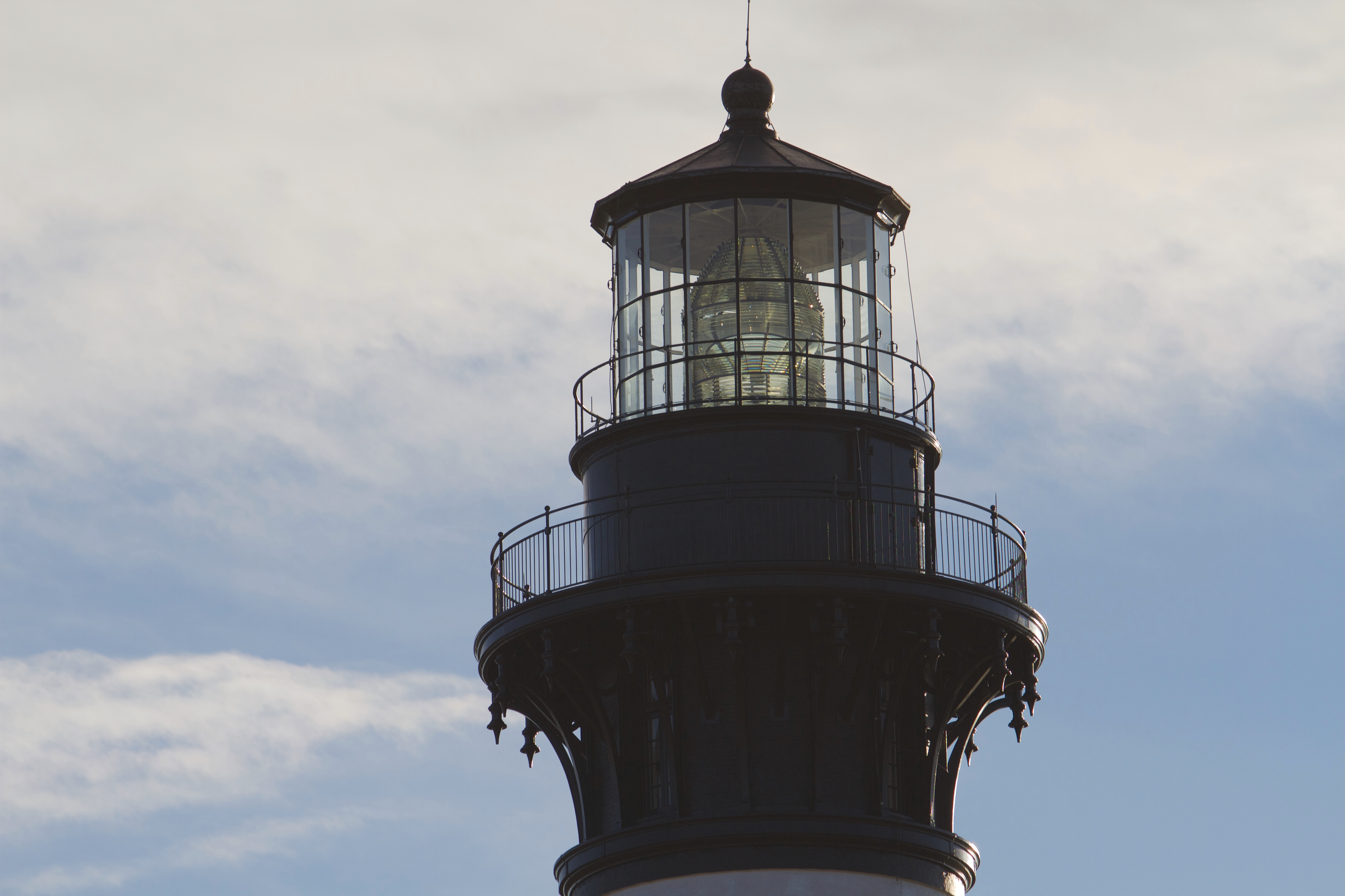
Cape Hatteras National Seashore
National Seashore
The sound of ocean waves, the starry night sky, or the calm of the salt marshes, you can experience it all. Shaped by the forces of water, wind, and storms these islands are ever changing. The plants,...
9 mi from route
~23 min detour
Free
near mile 347.8
Park Closure: Beach fires temporarily banned due to dry conditions and statewide burn ban
Park Closure: Beach safety closure in place from Buxton Village to near Ramp 43
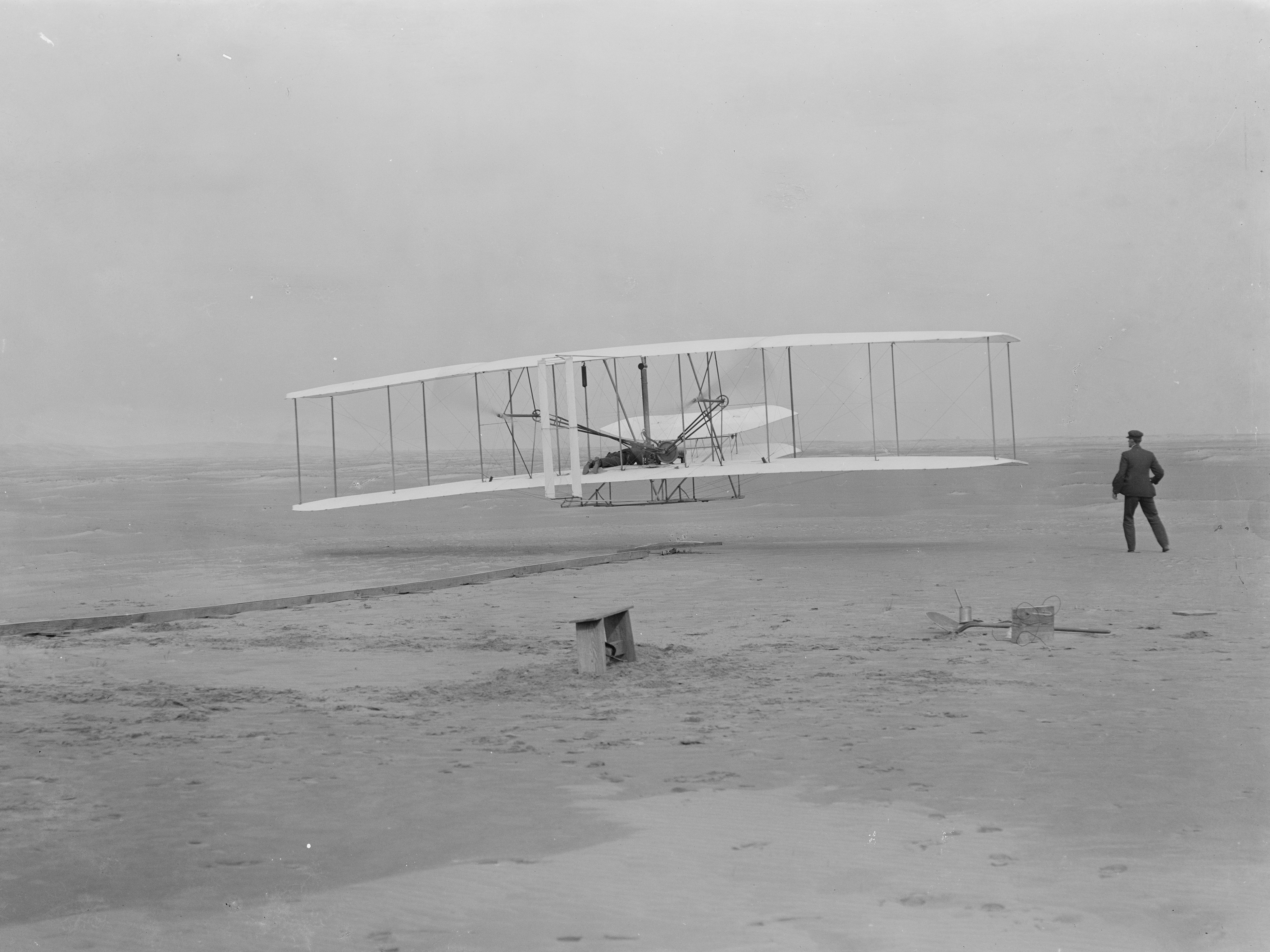
Wind, sand, and a dream of flight brought Wilbur and Orville Wright to Kitty Hawk, North Carolina where, after four years of scientific experimentation, they achieved the first successful airplane fli...
9 mi from route
~22 min detour
$10
near mile 310.5
Park data from the National Park Service API. Alerts update every 2 hours.
Fuel & Cost
Regular Gas
$56.33 one way
$112.65 round trip
$3.97/gal25.4 MPG avg126 kg CO2
Fuel Type
$/gal
One Way
Round Trip
midgrade
$4.34
$61.59
$123.18
premium
$4.70
$66.67
$133.33
diesel
$5.61
$79.53
$159.06
No toll roads detected on this route.
Estimated Trip Cost (one way, 1 person)
Fuel
$56
Meals
$25–$50
Total
$81–$106
Rough estimate based on US averages. Hotel $80–$140/night, meals $25–$50/day.
Estimated CO2 emission: 126 kg one way.
Prices: EIA weekly data, 2026-04-13.
Driving Electric?
About $38 in charging
· 1 stop
· 67% less CO2
Vehicle Type
kWh
Stops
DC Fast
Home Charge
Average EV
108.1
1
$37.82
$17.29
Efficient EV
90.1
1
$31.52
$14.41
EV Truck/SUV
144.1
1
$50.43
$23.05
Gas CO2
126 kg
EV CO2
42 kg (67% less)
Plan for 1 charging stop. A 30-minute DC fast charge mid-route should be enough to complete the trip comfortably.
DC fast charging avg $0.35/kWh. Home charging avg $0.16/kWh. US grid CO2: 0.39 kg/kWh.
Travel Intel
Current conditions at both ends of the drive.
Forecast as of Apr 15, 2026
Origin
Concord, NC
Afternoon
in Concord on Thursday
Local time
4:09 PM
EDT
Current temp
50°F
Unavailable
Live forecast
Destination
Buxton, NC
Afternoon
in Buxton on Thursday
Local time
4:09 PM
EDT
Current temp
64°F
Unavailable
Live forecast
Seasonal Notes
Summer travel usually means heavier construction, hotter rest stops, and busier weekend traffic around major cities.
Winter travel shortens daylight, so a route that looks manageable on paper can feel much longer after dark.
Holiday weekends tend to make both departure and arrival windows slower than the raw route time suggests.
Time zone
Same local time
Origin and destination are on the same clock, so arrival timing is easier to judge at a glance.
Temperature spread
14 degrees warmer at arrival
A meaningful temperature swing is a good cue to rethink layers, water, and how soon you want to arrive.
Road read
7h 51m on the road
Start early — leave by 6-7 AM to arrive at a reasonable hour.
Weather data from the National Weather Service. Conditions may change; check closer to your travel date.
Frequently Asked Questions
The drive from Concord, NC to Buxton, NC covers 360.2 miles and takes about 7h 51m without stops. Add 15-30 minutes for a fuel or rest stop on longer drives.
The main roads are US 64, NC 49, United States Highway 64 East. Most of the drive stays on highways, so watch for ramps and exits.
This is a comfortable same-day trip.
The midpoint is about 180.1 miles from Concord, NC. Look for rest areas, gas stations, or food options near the halfway mark.
At current regular gas prices, expect to spend about $56.33 one way. This estimate uses 25.4 MPG — your actual cost will vary with your vehicle's fuel efficiency and current gas prices.
Start early — leave by 6-7 AM to arrive at a reasonable hour. This is a long drive — plan for a morning departure or consider splitting it into two days.
Plan about 2 meaningful breaks for fuel, food, or rest. Plan on a short reset every 3 to 4 hours to stay fresh behind the wheel.
This is a demanding drive. With 18 significant decision points across 360.2 miles, you will need to stay alert - especially through interchange areas and urban stretches. Consider splitting it into segments if you are not comfortable with fast highway navigation.
The main spots that need attention: at 84.1 miles (US 64): Highway fork - watch signs carefully. Lane positioning matters here; at 111 miles (US 64): Exit ramp - move to the correct lane early. Multiple destination signs - pick the right one; at 114.6 miles (US 64): Exit ramp - move to the correct lane early. Lane positioning matters here. Multiple destination signs - pick the right one.
Between Concord, NC and Buxton, NC, road signs point toward Rocky Mount, Wilson and Greenville.
Yes. Nearby national parks include Cape Hatteras National Seashore and Wright Brothers National Memorial.