This 288.6-mile journey from Deming, New Mexico, to Grants, New Mexico, is designed for a single day of travel, taking approximately 5 hours and 28 minutes. The route primarily utilizes I-25 and I-40, with a portion on State Road 6, offering a highway-focused experience through the Desert Southwest. With an estimated fuel cost of $44, this drive is efficient for a day trip, though you'll want to be mindful of the longest stretch of 161.5 miles on I-25. Plan for one main stop along the way to break up the drive. This trip keeps you within the familiar landscapes of New Mexico.
Trip Pace
Same-day drive is realistic
A same-day return is possible, but it will make for a full day on the road.
Break Rhythm
1 planned break
Plan on a short reset every 3 to 4 hours to stay fresh behind the wheel.
Midpoint
144.3 miles from Deming, NM
A natural place for your longest stop of the day
, about 2h 50m into the drive
.
Who Is This Route For?
Weekend Trip
Doable as a same-day drive at 5h 28m. Total distance: 288.6 miles.
Family Friendly
Moderate complexity with 1 natural rest stops along the way.
Solo Traveler
5h 28m drive, comfortable solo distance.
First-Time Driver
Mostly highway driving (71%). Some complex stretches to watch for.
Drive Character
Expect a drive that is 71% highway, meaning you'll spend a good portion of your time on interstates. The longest uninterrupted stretch you'll encounter is 161.5 miles on I-25, so be prepared for extended periods of highway driving. While largely highway-focused, the inclusion of State Road 6 offers a slight variation in scenery and pace as you transition. This route is characterized by its efficiency and directness, allowing you to cover significant ground smoothly.
Most of the miles stay on highways, which makes pacing and fuel planning easier than turn-by-turn city driving.
There are about 24 navigation steps in the underlying route data, so the final approach matters more than the middle miles.
I 25 is the longest continuous segment at about 161.5 miles.
How Hard Is This Drive?
This is a straightforward highway drive that stays mostly on I 25 and I 40. You will hit about 13 points where you need to pay attention to lane position or signs. The trickiest moment comes early in the drive near NM 11 / North Gold Avenue.
Driving Effort5/10
Moderate - straightforward overall, but long enough or busy enough to require pacing
Balances navigation complexity with total wheel time.
This drive requires moderate attention. Across 288.6 miles you will encounter 13 spots where lane choice or exit timing matters. Not difficult for experienced highway drivers, but worth previewing the tricky sections before you go.
Where does it get tricky?
The main spots that need attention: near the start (NM 11 / North Gold Avenue): Navigation decision point; at 285.3 miles (I 40 Business): Exit ramp - move to the correct lane early. Multiple destination signs - pick the right one; at 285.5 miles (I 40 Business): Highway fork - watch signs carefully.
Critical Maneuvers
5 of 13 key points
These are the spots where you need to pay the most attention. Preview them before you drive.
4
0 mi into trip|~0m in|NM 11 / North Gold Avenue
Turn right onto NM 11 / North Gold Avenue
Navigation decision point
5
285.3 mi into trip|~5h 22m in|I 40 Business
Take the exit onto I 40 Business toward I 40, NM 547: Grants, Mount Taylor
Exit ramp - move to the correct lane early. Multiple destination signs - pick the right one
Toward I 40, NM 547: Grants, Mount Taylor
5
285.5 mi into trip|~5h 22m in|I 40 Business
Keep slight right at fork onto I 40 Business toward Grants
Highway fork - watch signs carefully
Toward Grants
6
288.5 mi into trip|~5h 27m in|San Jose Drive
At end of road, turn left onto San Jose Drive
Complex interchange - multiple decisions in a short stretch
5
288.5 mi into trip|~5h 28m in|San Jose Drive
Keep slight right at fork onto San Jose Drive
Highway fork - watch signs carefully
Main Roads
Road
Distance
Duration
I 25
161.5 mi
2h 41m
I 40
41 mi
41m
State Road 6
30.7 mi
39m
Hatch Highway
23.8 mi
36m
New Mexico State Road 26
23 mi
34m
I 40 Business
3 mi
4m
Main Street Northwest
1.4 mi
2m
North Gold Avenue
1.4 mi
2m
Longest stretch:
I 25
— 161.5 mi, about 2h 41m
Turn-by-Turn Driving Directions
Step-by-step road directions between Deming, NM and Grants, NM.
1
Start on I 10 Bus
43 ft·3 sec·East Pine Street
2
Turn right onto NM 11
1.4 mi·2 min·North Gold Avenue
3
Turn right onto NM 26
6.7 mi·11 min·Hatch Highway
4
Continue on NM 26
10.0 mi·14 min·New Mexico State Road 26
5
Continue on NM 26
17 mi·25 min·Hatch Highway
6
Continue on NM 26
12 mi·18 min·New Mexico State Road 26
7
Continue on NM 26
0.4 mi·39 sec·West Hall Street
8
Turn left onto West Canal Road
0.3 mi·25 sec·West Canal Road
9
Continue on NM 26
0.4 mi·34 sec·Franklin Street
10
Continue on NM 26
0.7 mi·1 min·New Mexico State Road 26
11
Take the ramp
0.2 mi·28 sec
12
Merge onto I 25
161 mi·2 hr 41 min·I 25
13
Take the exit
0.2 mi·33 sec
Toward NM 6: Los Lunas
14
Turn left onto NM 6
0.6 mi·1 min·Main Street Southwest
15
Continue on NM 6
1.4 mi·2 min·Main Street Northwest
16
Continue on NM 6
31 mi·39 min·State Road 6
17
Take the ramp
0.3 mi·37 sec
18
Merge onto I 40
41 mi·41 min·I 40
19
Take the exit onto I 40 Business
0.2 mi·20 sec·I 40 Business
Toward I 40, NM 547: Grants, Mount Taylor
20
Keep slight right at fork onto I 40 Business
2.8 mi·4 min·I 40 Business
Toward Grants
21
Turn left onto 5th Street
0.2 mi·33 sec·5th Street
22
At end of road, turn left onto San Jose Drive
397 ft·17 sec·San Jose Drive
23
Keep slight right at fork onto San Jose Drive
0.1 mi·27 sec·San Jose Drive
24
Arrive at destination
San Jose Drive
Trip Plan
To make the most of this 5-hour and 28-minute drive, consider an early morning departure from Deming to maximize daylight. With a longest stretch of 161.5 miles on I-25, plan your single stop strategically for fuel and a break around the halfway point. The $44 fuel cost is manageable, but always keep an eye on your gauge, especially before longer highway segments. Since this is a feasible day trip, you have the flexibility to adjust your timing based on traffic or personal preference. A useful tip is to download offline maps, as cell service can be intermittent in certain stretches of the New Mexico desert.
Morning Departure
An early start around 7-8 AM gets you there with plenty of daylight left.
Evening Departure
A late afternoon start means arriving after dark. Morning is better.
You can normally do this drive in one day.
Plan roughly 1 meaningful break for fuel, food, and rest.
The halfway point lands around 144.3 miles from Deming, NM, or about 2h 50m into the drive.
The longest continuous stretch on this route runs about 161.5 miles.
This is a comfortable same-day trip.
Departure
Before you leave
Start with fuel, water, and navigation already sorted so the first hour feels easy.
First stop
Around 63 miles or 1h 29m in
Use this first pause for coffee, a restroom break, and a quick traffic check ahead.
Halfway reset
Around 144.3 miles or 2h 50m in
This is the best place for your longest stop, a real meal, and a full fuel check.
Final approach
Final hour starts around 4h 31m
Traffic, exits, and arrival timing usually matter more near Grants, NM than in the middle of the route.
Before You Leave
+
Open the route before leaving Deming, NM so your first major turns are already loaded.
+
Leave with enough water and a charging cable within reach, not packed away.
+
Check your fuel range against the first long segment, especially if you are starting outside city service areas.
Day 1
Settle into the route from Deming, NM
This is one driving day of about 288.6 miles and 5h 28m.
Your first comfortable stop window is around 63 miles from Deming, NM.
This route can stay practical as a one-day drive if traffic stays reasonable.
Plan about 1 real break rather than only quick fuel stops.
The longest stretch is on I 25 for about 161.5 miles.
Where to Stop
Rest stops, refuel points, and overnight suggestions along this route.
Halfway Point
Midpoint
About 144.3 mi from Deming, NM
· 2h 50m into the drive
Place data sourced from public business listings. Hours and availability may vary.
National Parks Near This Route
Worth a detour if your schedule allows.
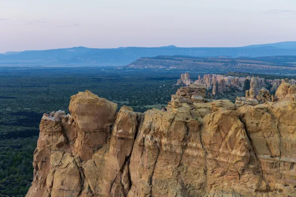
El Malpais National Monument
National Monument
The richly diverse volcanic landscape of El Malpais (el-mal-pie-EES) offers solitude, recreation, and adventure. Explore incredible geologic features such as young lava flows, cinder cones, lava tubes...
20 mi from route
~49 min detour
Free
near mile 278.7
Caution: NPS 300 Road Conditions
Park Closure: All lava tube caves closed November 1 through April 30
Petroglyph National Monument protects one of the largest petroglyph sites in North America, featuring designs and symbols carved onto volcanic rocks by Native Americans and Spanish settlers 400 to 700...
24 mi from route
~61 min detour
Free
near mile 219
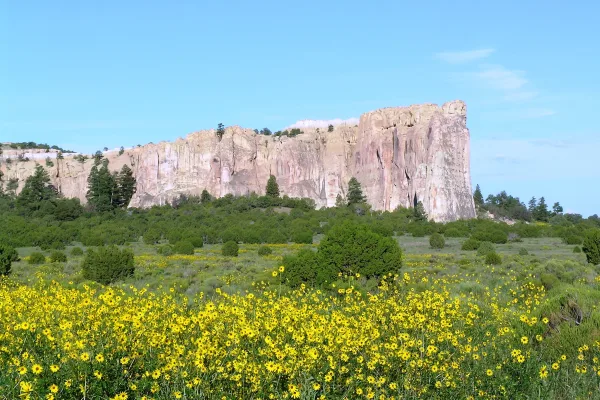
Imagine the refreshment of finding water after days of dusty travel. A reliable waterhole hidden at the base of a sandstone bluff made El Morro (the headland) a popular campsite for hundreds of years....
29 mi from route
~72 min detour
Free
near mile 288.6
Park data from the National Park Service API. Alerts update every 2 hours.
Fuel & Cost
Regular Gas
$43.59 one way
$87.17 round trip
$3.84/gal25.4 MPG avg101 kg CO2
Fuel Type
$/gal
One Way
Round Trip
midgrade
$4.21
$47.85
$95.69
premium
$4.56
$51.80
$103.60
diesel
$5.61
$63.72
$127.44
No toll roads detected on this route.
Estimated Trip Cost (one way, 1 person)
Fuel
$44
Meals
$25–$50
Total
$69–$94
Rough estimate based on US averages. Hotel $80–$140/night, meals $25–$50/day.
Estimated CO2 emission: 101 kg one way.
Prices: EIA weekly data, 2026-04-13.
Driving Electric?
About $30 in charging
· 1 stop
· 66% less CO2
Vehicle Type
kWh
Stops
DC Fast
Home Charge
Average EV
86.6
1
$30.30
$13.85
Efficient EV
72.2
0
$25.25
$11.54
EV Truck/SUV
115.4
1
$40.40
$18.47
Gas CO2
101 kg
EV CO2
34 kg (66% less)
Plan for 1 charging stop. A 30-minute DC fast charge mid-route should be enough to complete the trip comfortably.
DC fast charging avg $0.35/kWh. Home charging avg $0.16/kWh. US grid CO2: 0.39 kg/kWh.
Travel Intel
Current conditions at both ends of the drive.
Forecast as of Apr 15, 2026
Origin
Deming, NM
Late night
in Deming on Friday
Local time
1:14 AM
MDT
Current temp
83°F
Unavailable
Live forecast
Destination
Grants, NM
Late night
in Grants on Friday
Local time
1:14 AM
MDT
Current temp
74°F
Unavailable
Live forecast
83°F
Socorro, NM
144 mi in
Seasonal Notes
Summer travel usually means heavier construction, hotter rest stops, and busier weekend traffic around major cities.
Winter travel shortens daylight, so a route that looks manageable on paper can feel much longer after dark.
Holiday weekends tend to make both departure and arrival windows slower than the raw route time suggests.
Time zone
Same local time
Origin and destination are on the same clock, so arrival timing is easier to judge at a glance.
Temperature spread
9 degrees cooler at arrival
A meaningful temperature swing is a good cue to rethink layers, water, and how soon you want to arrive.
Road read
5h 28m on the road
An early start around 7-8 AM gets you there with plenty of daylight left.
Weather data from the National Weather Service. Conditions may change; check closer to your travel date.
Frequently Asked Questions
The drive from Deming, NM to Grants, NM covers 288.6 miles and takes about 5h 28m without stops. Add 15-30 minutes for a fuel or rest stop on longer drives.
The main roads are I 25, I 40, State Road 6. Most of the drive stays on highways, so watch for ramps and exits.
This is a comfortable same-day trip.
The midpoint is about 144.3 miles from Deming, NM. Look for rest areas, gas stations, or food options near the halfway mark.
At current regular gas prices, expect to spend about $43.59 one way. This estimate uses 25.4 MPG — your actual cost will vary with your vehicle's fuel efficiency and current gas prices.
An early start around 7-8 AM gets you there with plenty of daylight left. A late afternoon start means arriving after dark. Morning is better.
Plan about 1 meaningful break for fuel, food, or rest. Plan on a short reset every 3 to 4 hours to stay fresh behind the wheel.
This drive requires moderate attention. Across 288.6 miles you will encounter 13 spots where lane choice or exit timing matters. Not difficult for experienced highway drivers, but worth previewing the tricky sections before you go.
The main spots that need attention: near the start (NM 11 / North Gold Avenue): Navigation decision point; at 285.3 miles (I 40 Business): Exit ramp - move to the correct lane early. Multiple destination signs - pick the right one; at 285.5 miles (I 40 Business): Highway fork - watch signs carefully.
The route from Deming, NM to Grants, NM does not surface many named destination signs beyond the main corridor.
Data sources
The figures on this page are computed from open government and mapping datasets, not crowdsourced reviews. Distances and geometry come from
OSRM
over
OpenStreetMap.
Fuel cost uses
EIA
weekly regional averages.
National park proximity is from the
NPS API.
Full methodology, refresh cadence, and limitations are documented on the
methodology page.