
Trip from Fort Smith, AR to De Witt, AR

Last recalculated Apr 16, 2026

Drive Time

4h 31m

Distance

243.3 mi

392 km

Drive Score

8/10

Great drive

Same Day?

Yes, doable

Fuel Cost

$37

one way

EV Charging

Unknown

Best Time to Leave

Save up to 40 min
4 AM
4h 18m ★
6 AM
4h 32m
8 AM
4h 58m
10 AM
4h 41m
12 PM
4h 38m
3 PM
4h 42m
5 PM
4h 57m
8 PM
4h 24m

Estimated drive times based on typical traffic patterns. Actual times may vary with weather, construction, and real-time conditions.

Downtown De Witt, AR, AR

De Witt, AR

Andrea Piacquadio

Trip Overview

The drive from Fort Smith, AR to De Witt, AR covers 243.3 miles and takes about 4h 31m behind the wheel. This route is realistic as a one-day drive if you keep your stops efficient.

The route leans on US 71, I 40, McCoy Road for much of the mileage, and the overall profile is highway-focused drive. The longest uninterrupted segment is about 147.4 miles on US 71. At current regular gas prices, budget about $36.74 one way before food or hotel costs.

Trip Pace

Same-day drive is realistic

A same-day return is possible, but it will make for a full day on the road.

Break Rhythm

1 planned break

Plan on a short reset every 3 to 4 hours to stay fresh behind the wheel.

Midpoint

121.6 miles from Fort Smith, AR

A natural place for your longest stop of the day , about 2h 6m into the drive .

Who Is This Route For?

Weekend Trip

Doable as a same-day drive at 4h 31m. Total distance: 243.3 miles.

Family Friendly

Moderate complexity with 1 natural rest stops along the way.

Solo Traveler

4h 31m drive, comfortable solo distance.

First-Time Driver

Mostly highway driving (87%). Straightforward navigation.

Drive Character

This is a 4h 31m highway drive covering 243.3 miles, with most of the trip on US 71 and I 40. The longest continuous stretch is about 147.4 miles on US 71.

Most of the miles stay on highways, which makes pacing and fuel planning easier than turn-by-turn city driving.
There are about 15 navigation steps in the underlying route data, so the final approach matters more than the middle miles.
US 71 is the longest continuous segment at about 147.4 miles.

How Hard Is This Drive?

This is a straightforward highway drive that stays mostly on US 71 and I 40. There are only a few real navigation decisions along the way. The trickiest moment comes around 2 miles in.

Driving Effort 4/10

Easy - simple navigation with a manageable amount of wheel time

Balances navigation complexity with total wheel time.

This is a straightforward 4h 31m drive. You will face about 10 decision points, but nothing that requires special attention if you follow navigation.

Where does it get tricky?

The main spots that need attention: at 2 miles: Multiple destination signs - pick the right one; at 8 miles (US 71): Highway fork - watch signs carefully. Lane positioning matters here. Multiple destination signs - pick the right one; at 155.4 miles (I 40): Highway fork - watch signs carefully. Lane positioning matters here.

Critical Maneuvers

5 of 10 key points

These are the spots where you need to pay the most attention. Preview them before you drive.

5
2 mi into trip | ~3m in

Turn left toward I 540 North, US 71 North

Multiple destination signs - pick the right one

Toward I 540 North, US 71 North
8
8 mi into trip | ~11m in | US 71

Keep slight right at fork onto US 71 toward I 40 East: Little Rock, Memphis

Highway fork - watch signs carefully. Lane positioning matters here. Multiple destination signs - pick the right one

Use the straight / slight right lanes. Toward I 40 East: Little Rock, Memphis
7
155.4 mi into trip | ~2h 40m in | I 40

Keep slight right at fork onto I 40 toward Memphis

Highway fork - watch signs carefully. Lane positioning matters here

Use the straight lane. Toward Memphis
5
193.7 mi into trip | ~3h 19m in

Take the exit toward AR 11, US 63: Hazen, Des Arc

Exit ramp - move to the correct lane early. Multiple destination signs - pick the right one

Toward AR 11, US 63: Hazen, Des Arc
4
194 mi into trip | ~3h 20m in | US 63

Turn right onto US 63

Navigation decision point

Towns Mentioned on Route Signs

Based on OSRM destination-sign hints, not a full list of every settlement the road passes.

Between Fort Smith, AR and De Witt, AR, road signs point toward Memphis and Des Arc.

Memphis

155.4 mi in | ~2h 40m | via I 40

Des Arc

193.7 mi in | ~3h 19m

Main Roads

Road Distance Duration
US 71 147.4 mi 2h 29m
I 40 38.4 mi 39m
McCoy Road 27.4 mi 38m
US 63 19.3 mi 28m
I 540 5.7 mi 6m
Grand Avenue 2 mi 3m
Pond Road 0.9 mi 1m
East South Front 0.8 mi 1m
Longest stretch: US 71 — 147.4 mi, about 2h 29m

Turn-by-Turn Driving Directions

Step-by-step road directions between Fort Smith, AR and De Witt, AR.

1

Start on Grand Avenue

2.0 mi · 3 min · Grand Avenue
2

Turn left

0.3 mi · 40 sec
Toward I 540 North, US 71 North
3

Merge onto I 540; US 71

5.7 mi · 6 min · I 540; US 71
4

Keep slight right at fork onto US 71

147 mi · 2 hr 29 min · US 71
Toward I 40 East: Little Rock, Memphis Use the straight / slight right lanes.
5

Keep slight right at fork onto I 40

38 mi · 39 min · I 40
Toward Memphis Use the straight lane.
6

Take the exit

0.3 mi · 37 sec
Toward AR 11, US 63: Hazen, Des Arc
7

Turn right onto US 63

2.6 mi · 3 min · US 63
8

Turn left onto US 63; US 70

0.8 mi · 1 min · East South Front
9

Turn slight right

0.1 mi · 24 sec
10

Turn straight onto US 63

17 mi · 24 min · US 63
11

Turn left onto US 165

0.9 mi · 1 min · Pond Road
12

Continue on US 165

27 mi · 38 min · McCoy Road
13

Turn left onto AR 152

0.7 mi · 1 min · West 2nd Street
14

Turn right onto AR 1B

115 ft · 3 sec · South Jefferson Street
15

Arrive at destination

AR 1B

Trip Plan

Morning Departure

An early start around 7-8 AM gets you there with plenty of daylight left.

Evening Departure

A late afternoon start means arriving after dark. Morning is better.

You can normally do this drive in one day.
Plan roughly 1 meaningful break for fuel, food, and rest.
The halfway point lands around 121.6 miles from Fort Smith, AR, or about 2h 6m into the drive.
The longest continuous stretch on this route runs about 147.4 miles.

This is a comfortable same-day trip.

Departure

Before you leave

Start with fuel, water, and navigation already sorted so the first hour feels easy.

First stop

Around 54 miles or 57m in

Use this first pause for coffee, a restroom break, and a quick traffic check ahead.

Halfway reset

Around 121.6 miles or 2h 6m in

This is the best place for your longest stop, a real meal, and a full fuel check.

Final approach

Final hour starts around 3h 28m

Traffic, exits, and arrival timing usually matter more near De Witt, AR than in the middle of the route.

Before You Leave

+

Open the route before leaving Fort Smith, AR so your first major turns are already loaded.

+

Leave with enough water and a charging cable within reach, not packed away.

+

Check your fuel range against the first long segment, especially if you are starting outside city service areas.

Day 1

Settle into the route from Fort Smith, AR

This is one driving day of about 243.3 miles and 4h 31m.

Your first comfortable stop window is around 54 miles from Fort Smith, AR.
This route can stay practical as a one-day drive if traffic stays reasonable.
Plan about 1 real break rather than only quick fuel stops.
The longest stretch is on US 71 for about 147.4 miles.

Where to Stop

Rest stops, refuel points, and overnight suggestions along this route.

Halfway Point

Midpoint

About 121.6 mi from Fort Smith, AR · 2h 6m into the drive

Downtown Conway, AR, AR

Mid-route town

Meal stop

Conway, AR

122 mi into the route

Best for: Lunch, fuel, and a longer reset

This sits close to the middle of the route, so it works well for the longest stop of the day.

Popular next leg

Conway, AR to De Witt, AR

117 mi · 2h 23m

Pacing Suggestions

Delaware, AR

Fuel and coffee

A short stop after about 54 miles helps settle the day before fatigue starts building.

Conway, AR

Meal break

The midpoint is around 121.6 miles from Fort Smith, AR, which is a good place for a longer meal and fuel stop.

Before the longest stretch

Fuel check

Top up before US 71 if your tank is already low. That segment runs about 147.4 miles.

Arriving in De Witt, AR

The final approach into De Witt, AR usually feels slower than the middle of the drive, so avoid planning your tightest schedule at the very end.

Try to arrive with enough fuel left to skip an immediate station stop unless you already know the area around De Witt, AR.

After long uninterrupted mileage, take five minutes before the last urban segment to reset and refocus on exits, merges, and city traffic.

These stop ideas are pacing suggestions — the exact town or exit can change with traffic, hotel plans, and fuel range.

National Parks Near This Route

Worth a detour if your schedule allows.

Arkansas Post National Memorial

Arkansas Post National Memorial

National Memorial

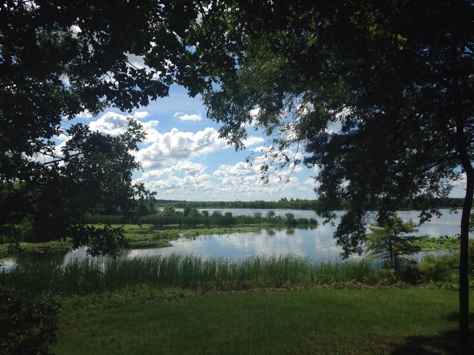
Located at the confluence of two rivers, Arkansas Post has served as a gathering place for many cultures throughout human history - it represents cultural cooperation, conflict, synthesis, and diversi...

20 mi from route ~50 min detour Free near mile 243.3
View on nps.gov

Park data from the National Park Service API. Alerts update every 2 hours.

Fuel & Cost

Regular Gas

$36.74 one way

$73.49 round trip

$3.84/gal 25.4 MPG avg 85 kg CO2
Fuel Type $/gal One Way Round Trip
midgrade $4.21 $40.34 $80.67
premium $4.56 $43.67 $87.34
diesel $5.61 $53.72 $107.44

No toll roads detected on this route.

Estimated Trip Cost (one way, 1 person)

Fuel

$37

Meals

$25–$50

Total

$62–$87

Rough estimate based on US averages. Hotel $80–$140/night, meals $25–$50/day.

Estimated CO2 emission: 85.1 kg one way. Prices: EIA weekly data, 2026-04-13.

Driving Electric?

About $26 in charging · 0 stops · 67% less CO2

Vehicle Type kWh Stops DC Fast Home Charge
Average EV 73 0 $25.55 $11.68
Efficient EV 60.8 0 $21.29 $9.73
EV Truck/SUV 97.3 1 $34.06 $15.57

Gas CO2

85 kg

EV CO2

28 kg (67% less)

Plan for 0 charging stops, roughly every 270 miles. Allow 25-40 minutes per stop at a DC fast charger.

DC fast charging avg $0.35/kWh. Home charging avg $0.16/kWh. US grid CO2: 0.39 kg/kWh.

Travel Intel

Current conditions at both ends of the drive.

Forecast as of Apr 15, 2026

Origin

Fort Smith, AR

Morning in Fort Smith on Thursday

Local time

11:58 AM

CDT

Current temp

76°F

Unavailable

Live forecast

Destination

De Witt, AR

Morning in De Witt on Thursday

Local time

11:58 AM

CDT

Current temp

77°F

Unavailable

Live forecast

Seasonal Notes

Summer travel usually means heavier construction, hotter rest stops, and busier weekend traffic around major cities.

Winter travel shortens daylight, so a route that looks manageable on paper can feel much longer after dark.

Holiday weekends tend to make both departure and arrival windows slower than the raw route time suggests.

Time zone

Same local time

Origin and destination are on the same clock, so arrival timing is easier to judge at a glance.

Temperature spread

1 degrees warmer at arrival

A meaningful temperature swing is a good cue to rethink layers, water, and how soon you want to arrive.

Road read

4h 31m on the road

An early start around 7-8 AM gets you there with plenty of daylight left.

Weather data from the National Weather Service. Conditions may change; check closer to your travel date.

Frequently Asked Questions

The drive from Fort Smith, AR to De Witt, AR covers 243.3 miles and takes about 4h 31m without stops. Add 15-30 minutes for a fuel or rest stop on longer drives.
The main roads are US 71, I 40, McCoy Road. Most of the drive stays on highways, so watch for ramps and exits.
This is a comfortable same-day trip.
The midpoint is about 121.6 miles from Fort Smith, AR. Look for rest areas, gas stations, or food options near the halfway mark.
At current regular gas prices, expect to spend about $36.74 one way. This estimate uses 25.4 MPG — your actual cost will vary with your vehicle's fuel efficiency and current gas prices.
An early start around 7-8 AM gets you there with plenty of daylight left. A late afternoon start means arriving after dark. Morning is better.
Plan about 1 meaningful break for fuel, food, or rest. Plan on a short reset every 3 to 4 hours to stay fresh behind the wheel.
This is a straightforward 4h 31m drive. You will face about 10 decision points, but nothing that requires special attention if you follow navigation.
The main spots that need attention: at 2 miles: Multiple destination signs - pick the right one; at 8 miles (US 71): Highway fork - watch signs carefully. Lane positioning matters here. Multiple destination signs - pick the right one; at 155.4 miles (I 40): Highway fork - watch signs carefully. Lane positioning matters here.
Between Fort Smith, AR and De Witt, AR, road signs point toward Memphis and Des Arc.

Was this helpful?

Thanks for your feedback!

Your tip has been submitted. Thanks!

/500

Explore More

Explore more options from Fort Smith, AR or browse trips ending in De Witt, AR.

Looking for more statewide routes? Browse AR road trips.

Explore maps for Fort Smith, AR or De Witt, AR on MapSof.net.