The drive from Isla Vista, CA to Fresno, CA covers 235.5 miles and takes about 4h 49m behind the wheel.
This route is realistic as a one-day drive if you keep your stops efficient.
The route leans on El Camino Real, CA 41, CA 46 for much of the mileage,
and the overall profile is mixed drive.
The longest uninterrupted segment is about 111.6 miles on El Camino Real.
At current regular gas prices, budget about $54.13 one way before food or hotel costs.
Trip Pace
Same-day drive is realistic
A same-day return is possible, but it will make for a full day on the road.
Break Rhythm
1 planned break
Plan on a short reset every 3 to 4 hours to stay fresh behind the wheel.
Midpoint
117.7 miles from Isla Vista, CA
A natural place for your longest stop of the day
, about 2h 19m into the drive
.
Fresno is in the San Joaquin Valley of California. Many visitors find themselves stopping in Fresno on the way to Yosemite National Park, Sequoia and Kings Canyon National Parks, or other destinations in the Sierras.
Top landmarks
•Holy Trinity Church, Fresno — church building in Fresno, United States of America
•Fresno station — train station in Fresno, California
•Kearney Park — park in Fresno County, California, United States of America
Doable as a same-day drive at 4h 49m. Total distance: 235.5 miles.
Family Friendly
Moderate complexity with 1 natural rest stops along the way.
Solo Traveler
4h 49m drive, comfortable solo distance.
Scenic Drive
Mixed drive route profile with national parks nearby.
Drive Character
The drive from Isla Vista, CA to Fresno, CA covers 235.5 miles and takes about 4h 49m, using a mix of highways and local roads.
Expect a mix of faster highway mileage and slower local approaches near the beginning or end.
There are about 22 navigation steps in the underlying route data, so the final approach matters more than the middle miles.
El Camino Real is the longest continuous segment at about 111.6 miles.
How Hard Is This Drive?
This route mixes highway mileage with some local-road sections near the start or finish. This route has several spots where lane changes, forks, or exits need your full attention. The trickiest moment comes early in the drive.
Driving Effort7/10
Demanding - plan breaks and stay ahead of the key maneuvers
Balances navigation complexity with total wheel time.
This is a demanding drive. With 15 significant decision points across 235.5 miles, you will need to stay alert - especially through interchange areas and urban stretches. Consider splitting it into segments if you are not comfortable with fast highway navigation.
Where does it get tricky?
The main spots that need attention: near the start: Navigation decision point; at 0.1 miles (Abrego Road): Navigation decision point; at 0.2 miles (Camino del Sur): Navigation decision point.
Critical Maneuvers
5 of 15 key points
These are the spots where you need to pay the most attention. Preview them before you drive.
5
0 mi into trip|~0m in
Turn left
Navigation decision point
5
0.1 mi into trip|~0m in|Abrego Road
Turn left onto Abrego Road
Navigation decision point
5
0.2 mi into trip|~1m in|Camino del Sur
Turn right onto Camino del Sur
Navigation decision point
6
151.8 mi into trip|~2h 59m in|CA 41
Keep slight right at fork onto CA 41
Highway fork - watch signs carefully. Lane positioning matters here
Use the straight lane.
7
234.7 mi into trip|~4h 47m in
Take the exit toward Tulare Street
Exit ramp - move to the correct lane early. Lane positioning matters here
Use the straight / slight right lanes.
Exit 127
Toward Tulare Street
Towns Mentioned on Route Signs
Based on OSRM destination-sign hints, not a full list of every settlement the road passes.
On the drive from Isla Vista, CA to Fresno, CA, road signs begin pointing toward Bakersfield along the way.
Bakersfield
125.7 mi in|~2h 29m
Main Roads
Road
Distance
Duration
El Camino Real
111.6 mi
2h 9m
CA 41
84.2 mi
1h 49m
CA 46
24.4 mi
28m
Cabrillo Highway
11.9 mi
13m
Storke Road
1.2 mi
2m
El Colegio Road
0.4 mi
1m
North First Street
0.3 mi
<1m
Camino del Sur
0.2 mi
<1m
Longest stretch:
El Camino Real
— 111.6 mi, about 2h 9m
Turn-by-Turn Driving Directions
Step-by-step road directions between Isla Vista, CA and Fresno, CA.
1
Start on this road
90 ft·11 sec·this road
2
Turn left
259 ft·24 sec
3
Turn left onto Abrego Road
0.1 mi·29 sec·Abrego Road
4
Turn right onto Camino del Sur
0.2 mi·54 sec·Camino del Sur
5
Turn left onto El Colegio Road
0.4 mi·52 sec·El Colegio Road
6
Keep slight right at fork onto El Colegio Road
287 ft·7 sec·El Colegio Road
7
Turn straight onto Storke Road
1.2 mi·2 min·Storke Road
Use the straight lane.
8
Take the ramp
0.3 mi·32 sec
Toward US 101 North
9
Merge onto US 101
83 mi·1 hr 36 min·El Camino Real
Use the straight / slight right lanes.
10
Continue on US 101
12 mi·13 min·Cabrillo Highway
11
Continue on US 101
29 mi·32 min·El Camino Real
Use the straight lane.
12
Take the exit
0.2 mi·28 sec
Toward CA 46 East: Fresno, Bakersfield
13
Turn right onto CA 46
24 mi·28 min·CA 46
14
Merge onto CA 41; CA 46
1.4 mi·1 min·CA 41; CA 46
15
Turn slight right
490 ft·6 sec
16
Keep slight right at fork onto CA 41
83 mi·1 hr 48 min·CA 41
Use the straight lane.
17
Take the exit
0.3 mi·41 sec
Exit 127Toward Tulare StreetUse the straight / slight right lanes.
18
Turn right onto East Tulare Avenue
0.2 mi·25 sec·East Tulare Avenue
19
Turn left onto North 1st Street
390 ft·15 sec·North 1st Street
Use the left lane.
20
Continue on North First Street
0.3 mi·32 sec·North First Street
21
Turn right onto East Washington Avenue
28 ft·1 sec·East Washington Avenue
22
Arrive at destination
East Washington Avenue
Trip Plan
Morning Departure
An early start around 7-8 AM gets you there with plenty of daylight left.
Evening Departure
A late afternoon start means arriving after dark. Morning is better.
You can normally do this drive in one day.
Plan roughly 1 meaningful break for fuel, food, and rest.
The halfway point lands around 117.7 miles from Isla Vista, CA, or about 2h 19m into the drive.
The longest continuous stretch on this route runs about 111.6 miles.
This is a comfortable same-day trip.
Departure
Before you leave
Start with fuel, water, and navigation already sorted so the first hour feels easy.
First stop
Around 52 miles or 1h 3m in
Use this first pause for coffee, a restroom break, and a quick traffic check ahead.
Halfway reset
Around 117.7 miles or 2h 19m in
This is the best place for your longest stop, a real meal, and a full fuel check.
Final approach
Final hour starts around 3h 53m
Traffic, exits, and arrival timing usually matter more near Fresno, CA than in the middle of the route.
Before You Leave
+
Open the route before leaving Isla Vista, CA so your first major turns are already loaded.
+
Leave with enough water and a charging cable within reach, not packed away.
+
Check your fuel range against the first long segment, especially if you are starting outside city service areas.
Day 1
Settle into the route from Isla Vista, CA
This is one driving day of about 235.5 miles and 4h 49m.
Your first comfortable stop window is around 52 miles from Isla Vista, CA.
This route can stay practical as a one-day drive if traffic stays reasonable.
Plan about 1 real break rather than only quick fuel stops.
The longest stretch is on El Camino Real for about 111.6 miles.
Where to Stop
Rest stops, refuel points, and overnight suggestions along this route.
Halfway Point
Midpoint
About 117.7 mi from Isla Vista, CA
· 2h 19m into the drive
Place data sourced from public business listings. Hours and availability may vary.
National Parks Near This Route
Worth a detour if your schedule allows.
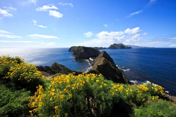
Channel Islands National Park
National Park
Channel Islands National Park encompasses five remarkable islands and their ocean environment, preserving and protecting a wealth of natural and cultural resources. Isolation over thousands of years h...
30 mi from route
~74 min detour
Free
Park Closure: Temporary Closure on Santa Rosa Island
Station data from NREL Alternative Fuel Stations database.
Driving Electric?
About $25 in charging
· 0 stops
· 66% less CO2
Vehicle Type
kWh
Stops
DC Fast
Home Charge
Average EV
70.6
0
$24.73
$11.30
Efficient EV
58.9
0
$20.61
$9.42
EV Truck/SUV
94.2
1
$32.97
$15.07
Gas CO2
82 kg
EV CO2
28 kg (66% less)
Plan for 0 charging stops, roughly every 270 miles. Allow 25-40 minutes per stop at a DC fast charger.
DC fast charging avg $0.35/kWh. Home charging avg $0.16/kWh. US grid CO2: 0.39 kg/kWh.
Travel Intel
Current conditions at both ends of the drive.
Forecast as of Jun 21, 2022
Origin
Isla Vista, CA
Late night
in Isla Vista on Saturday
Local time
3:58 AM
PDT
Current temp
75°F
Unavailable
Live forecast
Destination
Fresno, CA
Late night
in Fresno on Saturday
Local time
3:58 AM
PDT
Current temp
51°F
Unavailable
Live forecast
Seasonal Notes
Summer travel usually means heavier construction, hotter rest stops, and busier weekend traffic around major cities.
Winter travel shortens daylight, so a route that looks manageable on paper can feel much longer after dark.
Holiday weekends tend to make both departure and arrival windows slower than the raw route time suggests.
Time zone
Same local time
Origin and destination are on the same clock, so arrival timing is easier to judge at a glance.
Temperature spread
24 degrees cooler at arrival
A meaningful temperature swing is a good cue to rethink layers, water, and how soon you want to arrive.
Road read
4h 49m on the road
An early start around 7-8 AM gets you there with plenty of daylight left.
Weather data from the National Weather Service. Conditions may change; check closer to your travel date.
Frequently Asked Questions
The drive from Isla Vista, CA to Fresno, CA covers 235.5 miles and takes about 4h 49m without stops. Add 15-30 minutes for a fuel or rest stop on longer drives.
The main roads are El Camino Real, CA 41, CA 46. Expect a mix of highway and local road driving.
This is a comfortable same-day trip.
The midpoint is about 117.7 miles from Isla Vista, CA. Look for rest areas, gas stations, or food options near the halfway mark.
At current regular gas prices, expect to spend about $54.13 one way. This estimate uses 25.4 MPG — your actual cost will vary with your vehicle's fuel efficiency and current gas prices.
An early start around 7-8 AM gets you there with plenty of daylight left. A late afternoon start means arriving after dark. Morning is better.
Plan about 1 meaningful break for fuel, food, or rest. Plan on a short reset every 3 to 4 hours to stay fresh behind the wheel.
This is a demanding drive. With 15 significant decision points across 235.5 miles, you will need to stay alert - especially through interchange areas and urban stretches. Consider splitting it into segments if you are not comfortable with fast highway navigation.
The main spots that need attention: near the start: Navigation decision point; at 0.1 miles (Abrego Road): Navigation decision point; at 0.2 miles (Camino del Sur): Navigation decision point.
On the drive from Isla Vista, CA to Fresno, CA, road signs begin pointing toward Bakersfield along the way.
How this page is built
Compiled by the Trip.ovh planning team at COD Solutions Oy from open government datasets — OSRM over OpenStreetMap for geometry, EIA for fuel prices, NREL for EV charging, and NPS for national parks. See our methodology for refresh cadence and limitations.