This 303.4-mile drive from Miami to Odessa, Florida, is designed for a single day, taking approximately 5 hours and 39 minutes. You'll primarily be on I-75 and Florida's Turnpike, with a brief stint on State Road 54. With a fuel cost estimated at $48, this highway-focused route offers a straightforward journey through Florida. Given its duration and the continuous nature of the drive, it's perfectly manageable as a one-day trip without needing an overnight stop. This route is a practical choice for getting across the state efficiently.
Trip Pace
Same-day drive is realistic
A same-day return is possible, but it will make for a full day on the road.
Break Rhythm
1 planned break
Plan on a short reset every 3 to 4 hours to stay fresh behind the wheel.
Midpoint
151.7 miles from Miami, FL
A natural place for your longest stop of the day
, about 2h 50m into the drive
.
Loading map...
Drive Character
Expect a largely highway-focused experience, with 94% of the drive taking place on major roadways. The bulk of your travel, a continuous 254.9 miles, will be on I-75. This means you'll encounter consistent speeds and limited need for navigation adjustments for much of the journey. While the profile is predominantly highway, be prepared for the transition onto State Road 54 as you near your destination. The character of the drive is one of steady progress, with the emphasis on reaching your destination efficiently.
Most of the miles stay on highways, which makes pacing and fuel planning easier than turn-by-turn city driving.
There are about 19 navigation steps in the underlying route data, so the final approach matters more than the middle miles.
I 75 is the longest continuous segment at about 254.9 miles.
How Hard Is This Drive?
This is a straightforward highway drive that stays mostly on I 75 and State Road 54. This route has several spots where lane changes, forks, or exits need your full attention. The trickiest moment comes around 0.2 miles in.
Route Complexity10/10
High effort - long or complex enough to need steady focus all day
This is a demanding drive. With 16 significant decision points across 303.4 miles, you will need to stay alert — especially through interchange areas and urban stretches. Consider splitting it into segments if you are not comfortable with fast highway navigation.
Where does it get tricky?
The main spots that need attention: at 0.2 miles: Highway fork - watch signs carefully. Lane positioning matters here; at 10.5 miles: Exit ramp - move to the correct lane early. Lane positioning matters here; at 22.2 miles: Exit ramp - move to the correct lane early. Lane positioning matters here. Multiple destination signs - pick the right one.
Critical Maneuvers
5 of 16 key points
These are the spots where you need to pay the most attention. Preview them before you drive.
7
0.2 mi into trip|~0m in
Keep slight right at fork toward I 95 North
Highway fork - watch signs carefully. Lane positioning matters here
Use the slight right lane.
Toward I 95 North
7
10.5 mi into trip|~14m in
Take the exit toward SR 826 West: Florida's Turnpike Toll
Exit ramp - move to the correct lane early. Lane positioning matters here
Use the slight left lane.
Exit 12A
Toward SR 826 West: Florida's Turnpike Toll
8
22.2 mi into trip|~28m in
Take the exit toward I 595, SR 84, US 441
Exit ramp - move to the correct lane early. Lane positioning matters here. Multiple destination signs - pick the right one
Use the straight / slight right lanes.
Exit 54
Toward I 595, SR 84, US 441
8
22.7 mi into trip|~29m in
Keep slight left at fork toward SR 84 West, I 595 West
Highway fork - watch signs carefully. Lane positioning matters here. Multiple destination signs - pick the right one
Use the slight left / slight right lanes.
Toward SR 84 West, I 595 West
8
287.5 mi into trip|~5h 16m in
Take the exit toward FL 56: Land O Lakes, Tarpon Springs
Exit ramp - move to the correct lane early. Lane positioning matters here. Multiple destination signs - pick the right one
Use the straight / slight right lanes.
Exit 275
Toward FL 56: Land O Lakes, Tarpon Springs
Towns Mentioned on Route Signs
Based on OSRM destination-sign hints, not a full list of every settlement the road passes.
On the drive from Miami, FL to Odessa, FL, road signs begin pointing toward Tarpon Springs along the way.
Tarpon Springs
287.5 mi in|~5h 16m
Main Roads
Road
Distance
Duration
I 75
254.9 mi
4h 34m
State Road 54
12.7 mi
18m
Florida's Turnpike
10.5 mi
12m
I 95
9.8 mi
12m
Port Everglades Expressway
9.1 mi
10m
State Road 56
1 mi
1m
North Miami Avenue
<0.1 mi
<1m
Longest stretch:
I 75
— 254.9 mi, about 4h 34m
Turn-by-Turn Driving Directions
Step-by-step road directions between Miami, FL and Odessa, FL.
1
Start on North Miami Avenue
499 ft·16 sec·North Miami Avenue
Use the straight lane.
2
Take the ramp
472 ft·11 sec
Toward I 95Use the slight right lane.
3
Keep slight right at fork
0.5 mi·1 min
Toward I 95 NorthUse the slight right lane.
4
Merge onto I 95
2.1 mi·2 min·I 95
Use the straight / slight right lanes.
5
Keep slight right at fork onto I 95
7.8 mi·9 min·I 95
Use the straight / slight right lanes.
6
Take the exit
0.8 mi·1 min
Exit 12AToward SR 826 West: Florida's Turnpike TollUse the slight left lane.
7
Keep slight left at fork
0.4 mi·54 sec
Toward Florida's Turnpike
8
Merge onto Florida's Turnpike
10 mi·12 min·Florida's Turnpike
Use the straight / slight right lanes.
9
Take the exit
0.5 mi·1 min
Exit 54Toward I 595, SR 84, US 441Use the straight / slight right lanes.
10
Keep slight left at fork
0.6 mi·1 min
Toward SR 84 West, I 595 WestUse the slight left / slight right lanes.
11
Keep slight left at fork
0.1 mi·17 sec
Toward I 595 WestUse the slight left / slight right lanes.
12
Merge onto I 595
9.1 mi·10 min·Port Everglades Expressway
Use the straight / slight right lanes.
13
Merge onto I 75
255 mi·4 hr 34 min·I 75
Use the straight / slight right lanes.
14
Take the exit
2.2 mi·3 min
Exit 275Toward FL 56: Land O Lakes, Tarpon SpringsUse the straight / slight right lanes.
15
Keep slight left at fork
0.1 mi·17 sec
Toward FL 56 WestUse the slight left lane.
16
Turn left onto FL 56
1.0 mi·1 min·State Road 56
Use the left lane.
17
Continue on FL 54
13 mi·18 min·State Road 54
Use the left / straight lanes.
18
Continue on FL 54
246 ft·9 sec·State Road 54
19
Arrive at destination
FL 54
Trip Plan
To make the most of this 5-hour, 39-minute drive, consider an early morning departure from Miami to avoid potential traffic congestion. With only one suggested stop, you have flexibility in pacing yourself. The longest stretch without a significant road change is over 250 miles on I-75, so ensure you're comfortable with extended periods of highway driving. Keep an eye on your fuel levels, especially as you get closer to Odessa, and plan your refueling accordingly within the estimated $48 budget. This route is best tackled head-on as a single-day excursion.
Morning Departure
An early start around 7-8 AM gets you there with plenty of daylight left.
Evening Departure
A late afternoon start means arriving after dark. Morning is better.
You can normally do this drive in one day.
Plan roughly 1 meaningful break for fuel, food, and rest.
The halfway point lands around 151.7 miles from Miami, FL, or about 2h 50m into the drive.
The longest continuous stretch on this route runs about 254.9 miles.
This is a comfortable same-day trip.
Departure
Before you leave
Start with fuel, water, and navigation already sorted so the first hour feels easy.
First stop
Around 80 miles or 1h 33m in
Use this first pause for coffee, a restroom break, and a quick traffic check ahead.
Halfway reset
Around 151.7 miles or 2h 50m in
This is the best place for your longest stop, a real meal, and a full fuel check.
Final approach
Final hour starts around 4h 34m
Traffic, exits, and arrival timing usually matter more near Odessa, FL than in the middle of the route.
Before You Leave
+
Open the route before leaving Miami, FL so your first major turns are already loaded.
+
Leave with enough water and a charging cable within reach, not packed away.
+
Check your fuel range against the first long segment, especially if you are starting outside city service areas.
Day 1
Settle into the route from Miami, FL
This is one driving day of about 303.4 miles and 5h 39m.
Your first comfortable stop window is around 80 miles from Miami, FL.
This route can stay practical as a one-day drive if traffic stays reasonable.
Plan about 1 real break rather than only quick fuel stops.
The longest stretch is on I 75 for about 254.9 miles.
Where to Stop
Rest stops, refuel points, and overnight suggestions along this route.
Halfway Point
Midpoint
About 151.7 mi from Miami, FL
· 2h 50m into the drive
The midpoint is around 151.7 miles from Miami, FL, which is a good place for a longer meal and fuel stop.
Before the longest stretch
Fuel check
Top up before I 75 if your tank is already low. That segment runs about 254.9 miles.
Arriving in Odessa, FL
The final approach into Odessa, FL usually feels slower than the middle of the drive, so avoid planning your tightest schedule at the very end.
Try to arrive with enough fuel left to skip an immediate station stop unless you already know the area around Odessa, FL.
After long uninterrupted mileage, take five minutes before the last urban segment to reset and refocus on exits, merges, and city traffic.
These stop ideas are pacing suggestions — the exact town or exit can change with traffic, hotel plans, and fuel range.
National Parks Near This Route
Worth a detour if your schedule allows.
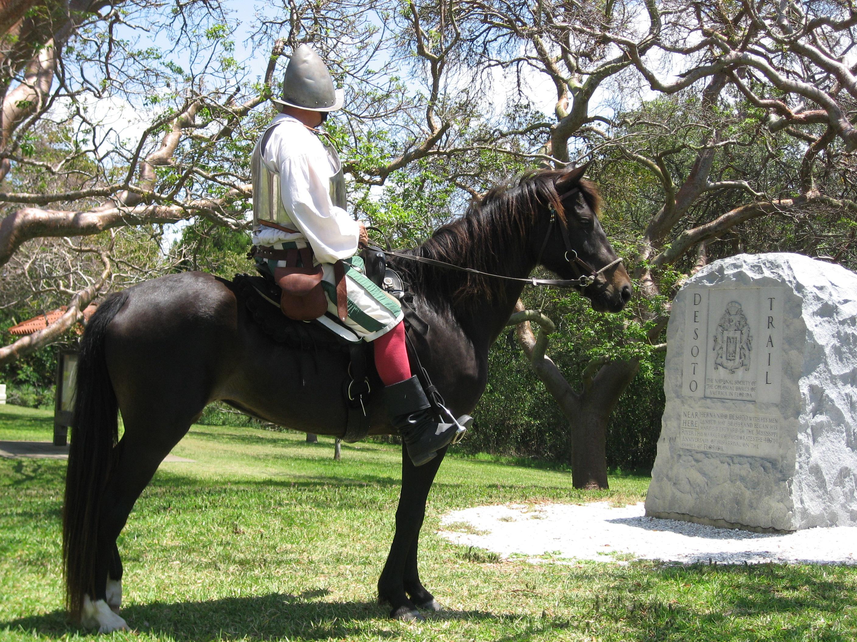
De Soto National Memorial
National Memorial
In May 1539, Conquistador Hernando de Soto’s army of soldiers, hired mercenaries, craftsmen, and clergy made landfall in Tampa Bay. They were met with fierce resistance of indigenous people protecting...
8 mi from route
~21 min detour
Free
near mile 240.6
Within sight of Miami, yet worlds away, Biscayne protects a rare combination of aquamarine waters, emerald islands, and fish-bejeweled coral reefs. Evidence of 10,000 years of human history is here to...
Park data from the National Park Service API. Alerts update every 2 hours.
Fuel & Cost
Regular Gas
$48.29 one way
$96.59 round trip
$4.04/gal25.4 MPG avg106 kg CO2
Fuel Type
$/gal
One Way
Round Trip
midgrade
$4.40
$52.53
$105.07
premium
$4.72
$56.42
$112.83
diesel
$5.61
$66.99
$133.97
Estimated Tolls: $0.73
Florida's Turnpike
(10.5 mi)$0.73
Toll estimates based on average 2024-2025 rates. EZ-Pass/SunPass discounts may lower the actual cost.
Estimated Trip Cost (one way, 1 person)
Fuel
$48
Tolls
$1
Meals
$25–$50
Total
$74–$99
Rough estimate based on US averages. Hotel $80–$140/night, meals $25–$50/day.
Estimated CO2 emission: 106.2 kg one way.
Prices: EIA weekly data, 2026-04-13.
Driving Electric?
About $32 in charging
· 1 stop
· 67% less CO2
Vehicle Type
kWh
Stops
DC Fast
Home Charge
Average EV
91
1
$31.86
$14.56
Efficient EV
75.9
0
$26.55
$12.14
EV Truck/SUV
121.4
1
$42.48
$19.42
Gas CO2
106 kg
EV CO2
35 kg (67% less)
Plan for 1 charging stop. A 30-minute DC fast charge mid-route should be enough to complete the trip comfortably.
DC fast charging avg $0.35/kWh. Home charging avg $0.16/kWh. US grid CO2: 0.39 kg/kWh.
Travel Intel
Current conditions at both ends of the drive.
Forecast data refreshed 9 hours ago
Origin
Miami, FL
Late night
in Miami on Wednesday
Local time
5:02 AM
EDT
Current temp
78°F
Mostly Sunny
E 15 mph0% chanceLive forecast
Rip Current Statement
Rip Current Statement issued April 14 at 4:28PM EDT until April 16 at 8:00PM EDT by NWS Miami FL
Rip Current Statement
Rip Current Statement issued April 14 at 12:29PM EDT until April 15 at 2:00AM EDT by NWS Tallahassee FL
Destination
Odessa, FL
Late night
in Odessa on Wednesday
Local time
5:02 AM
EDT
Current temp
67°F
Unavailable
Live forecast
Seasonal Notes
Summer travel usually means heavier construction, hotter rest stops, and busier weekend traffic around major cities.
Winter travel shortens daylight, so a route that looks manageable on paper can feel much longer after dark.
Holiday weekends tend to make both departure and arrival windows slower than the raw route time suggests.
Time zone
Same local time
Origin and destination are on the same clock, so arrival timing is easier to judge at a glance.
Temperature spread
11 degrees cooler at arrival
A meaningful temperature swing is a good cue to rethink layers, water, and how soon you want to arrive.
Road read
5h 39m on the road
An early start around 7-8 AM gets you there with plenty of daylight left.
Weather data from the National Weather Service. Conditions may change; check closer to your travel date.
Frequently Asked Questions
The drive from Miami, FL to Odessa, FL covers 303.4 miles and takes about 5h 39m without stops. Add 15-30 minutes for a fuel or rest stop on longer drives.
The main roads are I 75, State Road 54, Florida's Turnpike. Most of the drive stays on highways, so watch for ramps and exits.
This is a comfortable same-day trip.
The midpoint is about 151.7 miles from Miami, FL. Look for rest areas, gas stations, or food options near the halfway mark.
At current regular gas prices, expect to spend about $48.29 one way. This estimate uses 25.4 MPG — your actual cost will vary with your vehicle's fuel efficiency and current gas prices.
An early start around 7-8 AM gets you there with plenty of daylight left. A late afternoon start means arriving after dark. Morning is better.
Plan about 1 meaningful break for fuel, food, or rest. Plan on a short reset every 3 to 4 hours to stay fresh behind the wheel.
This is a demanding drive. With 16 significant decision points across 303.4 miles, you will need to stay alert — especially through interchange areas and urban stretches. Consider splitting it into segments if you are not comfortable with fast highway navigation.
The main spots that need attention: at 0.2 miles: Highway fork - watch signs carefully. Lane positioning matters here; at 10.5 miles: Exit ramp - move to the correct lane early. Lane positioning matters here; at 22.2 miles: Exit ramp - move to the correct lane early. Lane positioning matters here. Multiple destination signs - pick the right one.
On the drive from Miami, FL to Odessa, FL, road signs begin pointing toward Tarpon Springs along the way.