The drive from Questa, NM to Hobbs, NM covers 389.2 miles and takes about 8h 25m behind the wheel.
It usually feels better as a 2-day road trip than as one long push.
The route leans on South Avenue D, New Mexico Highway 518, US 84 for much of the mileage,
and the overall profile is mixed drive.
The longest uninterrupted segment is about 82.5 miles on South Avenue D.
At current regular gas prices, budget about $58.78 one way before food or hotel costs.
Trip Pace
Best split across 2 days
Treat the return leg as its own travel day rather than an afterthought.
Break Rhythm
2 planned breaks
Plan on a short reset every 3 to 4 hours to stay fresh behind the wheel.
Midpoint
194.6 miles from Questa, NM
A natural place for your longest stop of the day
, about 4h 28m into the drive
.
Who Is This Route For?
Solo Traveler
8h 25m drive, plan rest stops for pacing.
Scenic Drive
Mixed drive route profile with national parks nearby.
Drive Character
The drive from Questa, NM to Hobbs, NM covers 389.2 miles and takes about 8h 25m, using a mix of highways and local roads.
Expect a mix of faster highway mileage and slower local approaches near the beginning or end.
There are about 37 navigation steps in the underlying route data, so the final approach matters more than the middle miles.
South Avenue D is the longest continuous segment at about 82.5 miles.
How Hard Is This Drive?
This route mixes highway mileage with some local-road sections near the start or finish. This route has several spots where lane changes, forks, or exits need your full attention. The trickiest moment comes early in the drive near NM 522 / Main Street.
Driving Effort7/10
Demanding - plan breaks and stay ahead of the key maneuvers
Balances navigation complexity with total wheel time.
This is a demanding drive. With 18 significant decision points across 389.2 miles, you will need to stay alert - especially through interchange areas and urban stretches. Consider splitting it into segments if you are not comfortable with fast highway navigation.
Where does it get tricky?
The main spots that need attention: near the start (NM 522 / Main Street): Navigation decision point; at 24.4 miles (NM 68 / Paseo del Pueblo Sur): Lane positioning matters here; at 27.8 miles (NM 518 / New Mexico Highway 518): Lane positioning matters here.
Critical Maneuvers
5 of 18 key points
These are the spots where you need to pay the most attention. Preview them before you drive.
4
0 mi into trip|~0m in|NM 522 / Main Street
At end of road, turn left onto NM 522 / Main Street
Navigation decision point
5
24.4 mi into trip|~38m in|NM 68 / Paseo del Pueblo Sur
Turn right onto NM 68 / Paseo del Pueblo Sur
Lane positioning matters here
Use the left lane.
5
27.8 mi into trip|~44m in|NM 518 / New Mexico Highway 518
Turn left onto NM 518 / New Mexico Highway 518
Lane positioning matters here
Use the left lane.
4
101.9 mi into trip|~2h 44m in|NM 104 / East University
Turn left onto NM 104 / East University
Navigation decision point
5
149.8 mi into trip|~3h 39m in|US 84
Take the exit onto US 84
Exit ramp - move to the correct lane early
Main Roads
Road
Distance
Duration
South Avenue D
82.5 mi
1h 34m
New Mexico Highway 518
53.4 mi
1h 24m
US 84
41.9 mi
47m
South US Highway 84
41.1 mi
46m
US Highway 60
35.6 mi
41m
Main Street
20.1 mi
29m
I 40
19.9 mi
19m
NM 267
17.6 mi
25m
Longest stretch:
South Avenue D
— 82.5 mi, about 1h 34m
Turn-by-Turn Driving Directions
Step-by-step road directions between Questa, NM and Hobbs, NM.
1
Start on NM 38
243 ft·13 sec·NM 38
2
At end of road, turn left onto NM 522
20 mi·29 min·Main Street
3
Continue on Paseo del Pueblo Norte
3.3 mi·6 min·Paseo del Pueblo Norte
Use the left / straight / right lanes.
4
Turn right onto Camino de la Placita
0.9 mi·1 min·Camino de la Placita
5
Turn right onto NM 68
3.4 mi·6 min·Paseo del Pueblo Sur
Use the left lane.
6
Turn left onto NM 518
195 ft·3 sec·New Mexico Highway 518
Use the left lane.
7
Continue on NM 518
16 mi·27 min·High Road to Taos
8
Continue on NM 518
53 mi·1 hr 24 min·New Mexico Highway 518
9
Continue on NM 518
3.6 mi·5 min·7th Street
10
Turn left onto Mills Avenue
0.7 mi·1 min·Mills Avenue
11
Turn right onto I 25 Bus
0.7 mi·1 min·Grand Avenue
12
Turn left onto NM 104
0.2 mi·20 sec·East University
13
Take the ramp
0.3 mi·40 sec
14
Merge onto I 25
5.6 mi·5 min·I 25
15
Take the exit
0.2 mi·31 sec
16
Turn left onto US 84
42 mi·47 min·US 84
17
Take the exit onto US 84
0.3 mi·35 sec·US 84
18
Merge onto I 40
20 mi·19 min·I 40
19
Take the exit
0.2 mi·30 sec
Toward US 84 South: Fort Summer
20
Turn right onto US 84
264 ft·3 sec·Historic Route 66
21
Continue on US 84
41 mi·46 min·South US Highway 84
22
Continue on US 84
0.6 mi·45 sec·North 4th Street
23
Continue on US 60; US 84
1.3 mi·1 min·East Sumner Avenue
24
Continue on US 60; US 84
36 mi·41 min·US Highway 60
25
Turn right onto NM 267
14 mi·19 min·10th Street
26
Keep slight left at fork onto NM 267
18 mi·25 min·NM 267
27
Turn right onto North Avenue I
1.0 mi·2 min·North Avenue I
28
Turn left onto West 18th Street
0.5 mi·1 min·West 18th Street
29
Turn right onto NM 206
82 mi·1 hr 34 min·South Avenue D
30
Keep slight right at fork
0.3 mi·41 sec
31
Continue on US 82
0.8 mi·52 sec·Plains Highway
32
Continue on US 82
1.2 mi·1 min·Tatum Highway
33
Continue on US 82
1.0 mi·1 min·North Main Street
34
Continue on US 82
2.6 mi·4 min·South Main Avenue
35
Continue on NM 18
17 mi·20 min·North Lovington Highway
36
Continue on North Turner Street
1.8 mi·3 min·North Turner Street
37
Arrive at destination
North Turner Street
Trip Plan
Morning Departure
Start early — leave by 6-7 AM to arrive at a reasonable hour.
Evening Departure
This is a long drive — plan for a morning departure or consider splitting it into two days.
This drive is better paced as a 2-day trip.
Plan roughly 2 meaningful breaks for fuel, food, and rest.
The halfway point lands around 194.6 miles from Questa, NM, or about 4h 28m into the drive.
The longest continuous stretch on this route runs about 82.5 miles.
Consider an overnight stop or starting very early.
Departure
Before you leave
Start with fuel, water, and navigation already sorted so the first hour feels easy.
First stop
Around 86 miles or 2h 19m in
Use this first pause for coffee, a restroom break, and a quick traffic check ahead.
Halfway reset
Around 194.6 miles or 4h 28m in
This is the best place for your longest stop, a real meal, and a full fuel check.
Overnight split
Day 1 wrap after about 194.6 miles or 4h 28m
Stop before fatigue turns the last few hours into a grind. You want day two to start fresh, not just resumed.
Final approach
Final hour starts around 7h 13m
Traffic, exits, and arrival timing usually matter more near Hobbs, NM than in the middle of the route.
Before You Leave
+
Open the route before leaving Questa, NM so your first major turns are already loaded.
+
Leave with enough water and a charging cable within reach, not packed away.
+
Check your fuel range against the first long segment, especially if you are starting outside city service areas.
+
Pick one backup stop option before the midpoint in case traffic changes your pacing.
+
Treat this as a 2-day road trip and book the overnight stop before the busiest arrival window.
Day 1
Settle into the route from Questa, NM
Aim for roughly 195 miles and 4.2 hours of wheel time on this day.
Day 2
Finish the approach into Hobbs, NM
Aim for roughly 195 miles and 4.2 hours of wheel time on this day.
Your first comfortable stop window is around 86 miles from Questa, NM.
This route usually feels better as a 2-day drive than as one long push.
Plan about 2 real breaks rather than only quick fuel stops.
The longest stretch is on South Avenue D for about 82.5 miles.
Where to Stop
Rest stops, refuel points, and overnight suggestions along this route.
Halfway Point
Midpoint
About 194.6 mi from Questa, NM
· 4h 28m into the drive
Place data sourced from public business listings. Hours and availability may vary.
National Parks Near This Route
Worth a detour if your schedule allows.
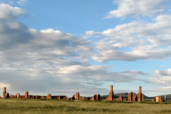
Fort Union National Monument
National Monument
Exposed to the wind, within a sweeping valley of short grass prairie, and along the eroded Santa Fe Trail, lie the adobe walled ruins of the largest 19th century military fort in the region. From 1851...
14 mi from route
~34 min detour
Free
near mile 80.5
Pecos is a natural and cultural crossroads through which hunters, gatherers, traders, missionaries, immigrants, soldiers, ranchers, and other travelers passed and lived. Follow in their footsteps and...
25 mi from route
~63 min detour
Free
near mile 107.4
Station data from NREL Alternative Fuel Stations database.
Driving Electric?
About $41 in charging
· 1 stop
· 66% less CO2
Vehicle Type
kWh
Stops
DC Fast
Home Charge
Average EV
116.8
1
$40.87
$18.68
Efficient EV
97.3
1
$34.06
$15.57
EV Truck/SUV
155.7
1
$54.49
$24.91
Gas CO2
136 kg
EV CO2
46 kg (66% less)
Plan for 1 charging stop. A 30-minute DC fast charge mid-route should be enough to complete the trip comfortably.
DC fast charging avg $0.35/kWh. Home charging avg $0.16/kWh. US grid CO2: 0.39 kg/kWh.
Travel Intel
Current conditions at both ends of the drive.
Forecast as of Apr 15, 2026
Origin
Questa, NM
Late night
in Questa on Friday
Local time
5:13 AM
MDT
Current temp
37°F
Unavailable
Live forecast
Destination
Hobbs, NM
Late night
in Hobbs on Friday
Local time
5:13 AM
MDT
Current temp
82°F
Unavailable
Live forecast
73°F
Las Vegas, NM
195 mi in
Seasonal Notes
Summer travel usually means heavier construction, hotter rest stops, and busier weekend traffic around major cities.
Winter travel shortens daylight, so a route that looks manageable on paper can feel much longer after dark.
Holiday weekends tend to make both departure and arrival windows slower than the raw route time suggests.
For long drives, weather on day two can matter just as much as conditions at departure, so check the whole travel window rather than only the first day.
Time zone
Same local time
Origin and destination are on the same clock, so arrival timing is easier to judge at a glance.
Temperature spread
45 degrees warmer at arrival
A meaningful temperature swing is a good cue to rethink layers, water, and how soon you want to arrive.
Road read
8h 25m on the road
This is long enough that the arrival forecast matters almost as much as departure conditions. Recheck both ends before you roll.
Weather data from the National Weather Service. Conditions may change; check closer to your travel date.
Frequently Asked Questions
The drive from Questa, NM to Hobbs, NM covers 389.2 miles and takes about 8h 25m without stops. Add 15-30 minutes for a fuel or rest stop on longer drives.
The main roads are South Avenue D, New Mexico Highway 518, US 84. Expect a mix of highway and local road driving.
Consider an overnight stop or starting very early.
Yes. This route is usually more comfortable as a 2-day drive. A sensible stopping point is after roughly 195 miles on day one.
The midpoint is about 194.6 miles from Questa, NM. Look for rest areas, gas stations, or food options near the halfway mark.
At current regular gas prices, expect to spend about $58.78 one way. This estimate uses 25.4 MPG — your actual cost will vary with your vehicle's fuel efficiency and current gas prices.
Start early — leave by 6-7 AM to arrive at a reasonable hour. This is a long drive — plan for a morning departure or consider splitting it into two days.
Plan about 2 meaningful breaks for fuel, food, or rest. Plan on a short reset every 3 to 4 hours to stay fresh behind the wheel.
This is a demanding drive. With 18 significant decision points across 389.2 miles, you will need to stay alert - especially through interchange areas and urban stretches. Consider splitting it into segments if you are not comfortable with fast highway navigation.
The main spots that need attention: near the start (NM 522 / Main Street): Navigation decision point; at 24.4 miles (NM 68 / Paseo del Pueblo Sur): Lane positioning matters here; at 27.8 miles (NM 518 / New Mexico Highway 518): Lane positioning matters here.
The route from Questa, NM to Hobbs, NM does not surface many named destination signs beyond the main corridor.
How this page is built
Compiled and maintained by the Trip.ovh planning team at COD Solutions Oy (Helsinki). Each route is built from authoritative open government and mapping datasets rather than crowdsourced reviews. Distances and geometry come from
OSRM
over
OpenStreetMap.
Fuel cost uses
EIA
weekly regional averages.
EV charging comes from the
NREL Alternative Fuels
dataset.
National park proximity is from the
NPS API.
Pages are published only after passing our data-quality checks; our
methodology page
documents refresh cadence, editorial standards, and known limitations.