The drive from San Diego, CA to Chester, CA covers 656 miles and takes about 12h 34m behind the wheel.
It usually feels better as a 2-day road trip than as one long push.
The route leans on Westside Freeway, San Diego Freeway, Deer Creek Highway for much of the mileage,
and the overall profile is long-distance drive.
The longest uninterrupted segment is about 304.9 miles on Westside Freeway.
At current regular gas prices, budget about $150.78 one way before food or hotel costs.
Trip Pace
Best split across 2 days
Treat the return leg as its own travel day rather than an afterthought.
Break Rhythm
3 planned breaks
Plan on a short reset every 3 to 4 hours to stay fresh behind the wheel.
Midpoint
328 miles from San Diego, CA
A natural place for your longest stop of the day
, about 6h 12m into the drive
.
Drive Character
At 656 miles and 12h 34m of driving, this is a route where fuel stops, weather, and timing matter more than any single turn. The main roads are Westside Freeway and San Diego Freeway.
Most of the miles stay on highways, which makes pacing and fuel planning easier than turn-by-turn city driving.
There are about 41 navigation steps in the underlying route data, so the final approach matters more than the middle miles.
Westside Freeway is the longest continuous segment at about 304.9 miles.
How Hard Is This Drive?
This is a straightforward highway drive that stays mostly on Westside Freeway and San Diego Freeway. This route has several spots where lane changes, forks, or exits need your full attention. The trickiest moment comes around 76.1 miles in near I 5 Truck.
Driving Effort8/10
Demanding - plan breaks and stay ahead of the key maneuvers
Balances navigation complexity with total wheel time.
This is a demanding drive. With 36 significant decision points across 656 miles, you will need to stay alert - especially through interchange areas and urban stretches. Consider splitting it into segments if you are not comfortable with fast highway navigation.
Where does it get tricky?
The main spots that need attention: at 76.1 miles (I 5 Truck): Highway fork - watch signs carefully. Lane positioning matters here; at 83.7 miles: Exit ramp - move to the correct lane early. Lane positioning matters here; at 144.7 miles (I 5 Truck): Highway fork - watch signs carefully. Lane positioning matters here. Multiple destination signs - pick the right one.
Critical Maneuvers
5 of 36 key points
These are the spots where you need to pay the most attention. Preview them before you drive.
7
76.1 mi into trip|~1h 29m in|I 5 Truck
Keep slight right at fork onto I 5 Truck toward Bake Parkway
Highway fork - watch signs carefully. Lane positioning matters here
Use the straight / slight right lanes.
Toward Bake Parkway
7
83.7 mi into trip|~1h 38m in
Take the exit toward Jamboree Road
Exit ramp - move to the correct lane early. Lane positioning matters here
Use the slight right lane.
Exit 100
Toward Jamboree Road
9
144.7 mi into trip|~2h 52m in|I 5 Truck
Keep slight right at fork onto I 5 Truck toward I 5 Truck North, CA 14 Truck
Highway fork - watch signs carefully. Lane positioning matters here. Multiple destination signs - pick the right one
Use the straight / slight right lanes.
Exit 161A
Toward I 5 Truck North, CA 14 Truck
8
509.6 mi into trip|~9h 30m in|CA 99 / Golden State Highway
Keep slight right at fork onto CA 99 / Golden State Highway toward CA 99 North, CA 70: Yuba City, Marysville
Highway fork - watch signs carefully. Lane positioning matters here. Multiple destination signs - pick the right one
Use the straight / slight right lanes.
Toward CA 99 North, CA 70: Yuba City, Marysvill...
8
522 mi into trip|~9h 44m in|CA 70
Keep slight right at fork onto CA 70 toward CA 70 North: Marysville, Oroville
Highway fork - watch signs carefully. Lane positioning matters here. Multiple destination signs - pick the right one
Use the straight / slight right lanes.
Toward CA 70 North: Marysville, Oroville
Towns Mentioned on Route Signs
Based on OSRM destination-sign hints, not a full list of every settlement the road passes.
Between San Diego, CA and Chester, CA, road signs point toward Marysville and Oroville.
Marysville
509.6 mi in|~9h 30m|via CA 99
Oroville
522 mi in|~9h 44m|via CA 70
Main Roads
Road
Distance
Duration
Westside Freeway
304.9 mi
5h 29m
San Diego Freeway
75.2 mi
1h 27m
Deer Creek Highway
52.3 mi
1h 9m
CA 70
52 mi
1h
Golden State Freeway
50 mi
57m
I 5 Truck
45.3 mi
52m
Santa Ana Freeway
30.4 mi
35m
State Highway 36 East
12.6 mi
17m
Longest stretch:
Westside Freeway
— 304.9 mi, about 5h 29m
Turn-by-Turn Driving Directions
Step-by-step road directions between San Diego, CA and Chester, CA.
1
Start on Front Street
26 ft·6 sec·Front Street
2
Turn left onto West Broadway
290 ft·12 sec·West Broadway
3
Turn left onto 1st Avenue
0.6 mi·1 min·1st Avenue
Use the left lane.
4
Take the ramp
0.2 mi·24 sec
Toward I 5 North: Los AngelesUse the left / straight lanes.
5
Merge onto I 5
13 mi·15 min·San Diego Freeway
Use the straight / slight right lanes.
6
Keep slight left at fork onto I 5
36 mi·43 min·San Diego Freeway
Use the straight / slight right lanes.
7
Keep slight right at fork onto I 5
18 mi·20 min·San Diego Freeway
Use the straight / slight right lanes.
8
Keep slight left at fork onto I 5
7.4 mi·8 min·San Diego Freeway
Use the straight / slight right lanes.
9
Keep slight right at fork onto I 5 Truck
1.6 mi·1 min·I 5 Truck
Toward Bake ParkwayUse the straight / slight right lanes.
10
Keep slight right at fork onto I 5 Truck
6.0 mi·6 min·I 5 Truck
Use the slight right lane.
11
Take the exit
0.2 mi·16 sec
Exit 100Toward Jamboree RoadUse the slight right lane.
12
Continue on this road
527 ft·11 sec·this road
13
Turn right onto Jamboree Road
0.1 mi·18 sec·Jamboree Road
Use the left / right lanes.
14
Turn left onto El Camino Real
2.2 mi·4 min·El Camino Real
Use the left lane.
15
Turn left onto Newport Avenue
357 ft·13 sec·Newport Avenue
Use the left lane.
16
Take the ramp
0.2 mi·16 sec
Toward I 5 North: Los Angeles
17
Merge onto I 5
1.3 mi·1 min·Santa Ana Freeway
Use the straight / slight right lanes.
18
Keep slight right at fork onto I 5
1.7 mi·1 min·Santa Ana Freeway
19
Keep slight right at fork onto I 5
9.4 mi·10 min·Santa Ana Freeway
Use the slight right lane.
20
Keep slight right at fork onto I 5
18 mi·20 min·Santa Ana Freeway
Use the straight / slight right lanes.
21
Keep slight right at fork onto I 5
25 mi·29 min·Golden State Freeway
Use the straight / slight right lanes.
22
Keep slight left at fork onto I 5
2.2 mi·2 min·Golden State Freeway
Use the straight / slight right lanes.
23
Keep slight right at fork onto I 5 Truck
1.5 mi·1 min·I 5 Truck
Exit 161AToward I 5 Truck North, CA 14 TruckUse the straight / slight right lanes.
24
Keep slight left at fork onto I 5 Truck
36 mi·41 min·I 5 Truck
Use the straight / slight right lanes.
25
Keep slight left at fork onto I 5
22 mi·25 min·Golden State Freeway
Use the straight / slight right lanes.
26
Keep slight right at fork onto I 5
226 mi·4 hr 1 min·Westside Freeway
Toward I 5 NorthUse the straight / slight right lanes.
27
Keep slight right at fork onto I 5
26 mi·27 min·Westside Freeway
28
Keep left at fork onto I 5
54 mi·59 min·Westside Freeway
Use the straight / slight right lanes.
29
Keep slight right at fork onto CA 99
7.5 mi·8 min·Golden State Highway
Toward CA 99 North, CA 70: Yuba City, MarysvilleUse the straight / slight right lanes.
30
Continue on CA 99
5.0 mi·5 min·Bernie Richter Memorial Highway
31
Keep slight right at fork onto CA 70
22 mi·25 min·CA 70
Toward CA 70 North: Marysville, OrovilleUse the straight / slight right lanes.
32
Turn right onto 5th Street
0.2 mi·38 sec·5th Street
33
Turn left onto B Street
1.5 mi·3 min·B Street
Use the straight / right lanes.
34
Continue on CA 70
30 mi·35 min·CA 70
Use the left lane.
35
Keep slight left at fork onto CA 149
5.7 mi·6 min·CA 149
Use the straight lane.
36
Merge onto CA 99
9.5 mi·11 min·CA 99
Use the straight lane.
37
Take the exit
0.2 mi·15 sec
Toward CA 32: Orland, Chester
38
Turn right onto CA 32
52 mi·1 hr 9 min·Deer Creek Highway
Use the right lane.
39
At end of road, turn right onto CA 36; CA 89
13 mi·17 min·State Highway 36 East
40
Turn right onto Aspen Street
27 ft·1 sec·Aspen Street
41
Arrive at destination
Aspen Street
Trip Plan
Morning Departure
Start early — leave by 6-7 AM to arrive at a reasonable hour.
Evening Departure
This is a long drive — plan for a morning departure or consider splitting it into two days.
This drive is better paced as a 2-day trip.
Plan roughly 3 meaningful breaks for fuel, food, and rest.
The halfway point lands around 328 miles from San Diego, CA, or about 6h 12m into the drive.
The longest continuous stretch on this route runs about 304.9 miles.
Consider an overnight stop or starting very early.
Departure
Before you leave
Start with fuel, water, and navigation already sorted so the first hour feels easy.
First stop
Around 144 miles or 2h 51m in
Use this first pause for coffee, a restroom break, and a quick traffic check ahead.
Halfway reset
Around 328 miles or 6h 12m in
This is the best place for your longest stop, a real meal, and a full fuel check.
Overnight split
Day 1 wrap after about 328 miles or 6h 12m
Stop before fatigue turns the last few hours into a grind. You want day two to start fresh, not just resumed.
Final approach
Final hour starts around 11h 13m
Traffic, exits, and arrival timing usually matter more near Chester, CA than in the middle of the route.
Before You Leave
+
Open the route before leaving San Diego, CA so your first major turns are already loaded.
+
Leave with enough water and a charging cable within reach, not packed away.
+
Check your fuel range against the first long segment, especially if you are starting outside city service areas.
+
Pick one backup stop option before the midpoint in case traffic changes your pacing.
+
Treat this as a 2-day road trip and book the overnight stop before the busiest arrival window.
Day 1
Settle into the route from San Diego, CA
Aim for roughly 328 miles and 6.3 hours of wheel time on this day.
Day 2
Finish the approach into Chester, CA
Aim for roughly 328 miles and 6.3 hours of wheel time on this day.
Your first comfortable stop window is around 144 miles from San Diego, CA.
This route usually feels better as a 2-day drive than as one long push.
Plan about 3 real breaks rather than only quick fuel stops.
The longest stretch is on Westside Freeway for about 304.9 miles.
Where to Stop
Rest stops, refuel points, and overnight suggestions along this route.
Halfway Point
Midpoint
About 328 mi from San Diego, CA
· 6h 12m into the drive
Place data sourced from public business listings. Hours and availability may vary.
National Parks Near This Route
Worth a detour if your schedule allows.
Cabrillo National Monument
National Monument
In 1542, Juan Rodriguez Cabrillo climbed out of his boat and onto shore, becoming the first European to set foot on what is now the West Coast of the United States. Cabrillo National Monument not only...
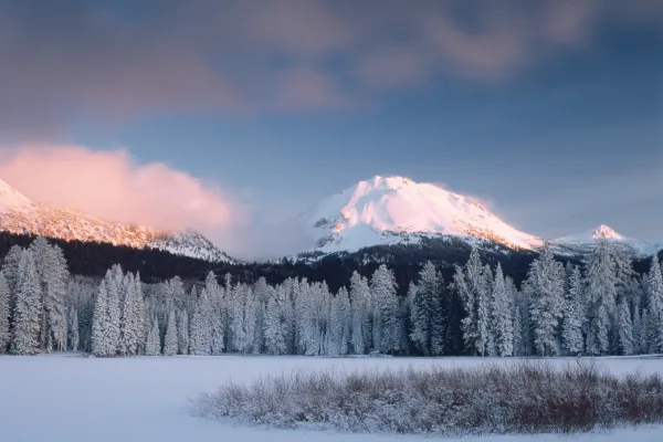
Lassen Volcanic National Park is home to steaming fumaroles, meadows freckled with wildflowers, clear mountain lakes, and numerous volcanoes. Jagged peaks tell the story of its eruptive past while hot...
The Santa Monica Mountains offer easy access to surprisingly wild places. Experience the famous beaches of Malibu or explore more than 500 miles of trails. The park abounds with historical and cultura...
24 mi from route
~60 min detour
Free
near mile 135.7
Yes, we can! Widely recognized as the most important Latino leader in the United States during the twentieth century, Cesar Chavez led farm workers and supporters in the establishment of the country's...
27 mi from route
~68 min detour
Free
near mile 203.6
Station data from NREL Alternative Fuel Stations database.
Driving Electric?
About $69 in charging
· 2 stops
· 67% less CO2
Vehicle Type
kWh
Stops
DC Fast
Home Charge
Average EV
196.8
2
$68.88
$31.49
Efficient EV
164
1
$57.40
$26.24
EV Truck/SUV
262.4
3
$91.84
$41.98
Gas CO2
230 kg
EV CO2
77 kg (67% less)
Plan for 2 charging stops, roughly every 270 miles. Allow 25-40 minutes per stop at a DC fast charger.
DC fast charging avg $0.35/kWh. Home charging avg $0.16/kWh. US grid CO2: 0.39 kg/kWh.
Travel Intel
Current conditions at both ends of the drive.
Forecast as of Apr 15, 2026
Origin
San Diego, CA
Afternoon
in San Diego on Thursday
Local time
4:34 PM
PDT
Current temp
56°F
Unavailable
Live forecast
Destination
Chester, CA
Afternoon
in Chester on Thursday
Local time
4:34 PM
PDT
Current temp
31°F
Unavailable
Live forecast
Seasonal Notes
Summer travel usually means heavier construction, hotter rest stops, and busier weekend traffic around major cities.
Winter travel shortens daylight, so a route that looks manageable on paper can feel much longer after dark.
Holiday weekends tend to make both departure and arrival windows slower than the raw route time suggests.
For long drives, weather on day two can matter just as much as conditions at departure, so check the whole travel window rather than only the first day.
Time zone
Same local time
Origin and destination are on the same clock, so arrival timing is easier to judge at a glance.
Temperature spread
25 degrees cooler at arrival
A meaningful temperature swing is a good cue to rethink layers, water, and how soon you want to arrive.
Road read
12h 34m on the road
This is long enough that the arrival forecast matters almost as much as departure conditions. Recheck both ends before you roll.
Weather data from the National Weather Service. Conditions may change; check closer to your travel date.
Frequently Asked Questions
The drive from San Diego, CA to Chester, CA covers 656 miles and takes about 12h 34m without stops. Add 15-30 minutes for a fuel or rest stop on longer drives.
The main roads are Westside Freeway, San Diego Freeway, Deer Creek Highway. Expect a mix of highway and local road driving.
Consider an overnight stop or starting very early.
Yes. This route is usually more comfortable as a 2-day drive. A sensible stopping point is after roughly 328 miles on day one.
The midpoint is about 328 miles from San Diego, CA. Look for rest areas, gas stations, or food options near the halfway mark.
At current regular gas prices, expect to spend about $150.78 one way. This estimate uses 25.4 MPG — your actual cost will vary with your vehicle's fuel efficiency and current gas prices.
Start early — leave by 6-7 AM to arrive at a reasonable hour. This is a long drive — plan for a morning departure or consider splitting it into two days.
Plan about 3 meaningful breaks for fuel, food, or rest. Plan on a short reset every 3 to 4 hours to stay fresh behind the wheel.
This is a demanding drive. With 36 significant decision points across 656 miles, you will need to stay alert - especially through interchange areas and urban stretches. Consider splitting it into segments if you are not comfortable with fast highway navigation.
The main spots that need attention: at 76.1 miles (I 5 Truck): Highway fork - watch signs carefully. Lane positioning matters here; at 83.7 miles: Exit ramp - move to the correct lane early. Lane positioning matters here; at 144.7 miles (I 5 Truck): Highway fork - watch signs carefully. Lane positioning matters here. Multiple destination signs - pick the right one.
Between San Diego, CA and Chester, CA, road signs point toward Marysville and Oroville.